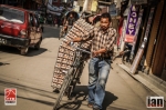
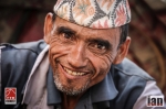
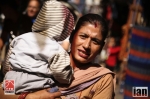
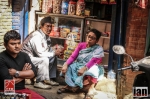
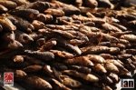
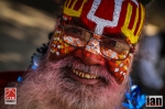
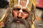
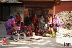
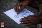
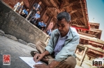
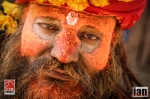
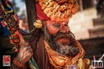
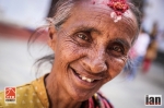
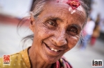
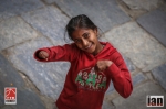
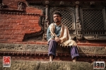
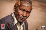
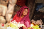
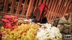
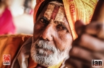
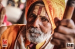
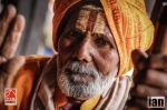
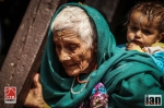
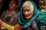
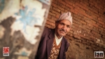
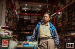
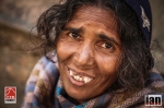
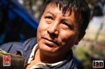
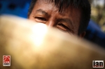
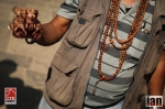
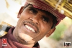
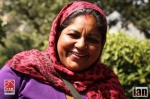
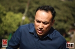
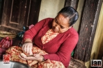
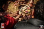
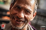
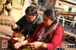
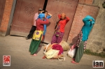
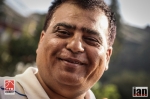
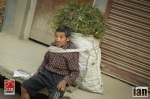
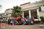
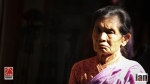
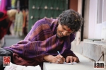
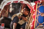
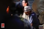
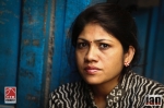
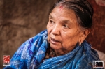
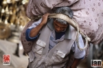
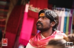
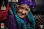
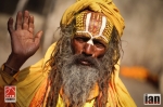
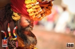
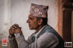
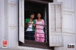
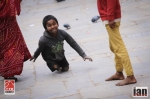
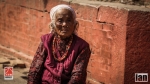
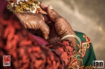
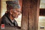
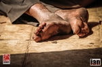
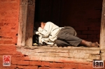
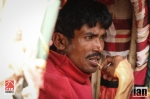
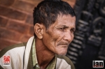
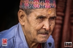
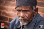
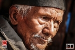
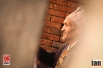
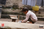
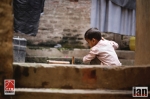
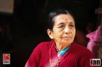
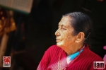
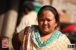
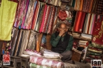
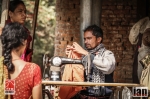
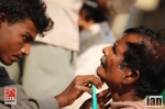
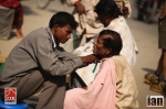
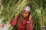
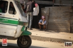
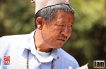
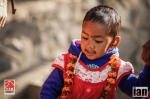
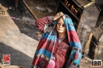
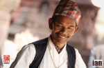
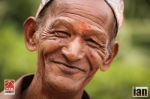
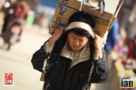
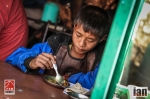
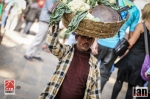
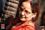
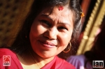
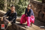
An incredible day exploring the sights, sounds, colours and meeting the people of Kathmandu. What an incredible place.
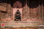
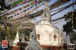
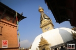
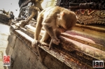
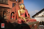
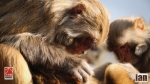
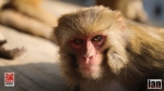
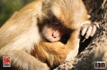
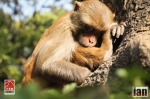
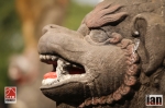
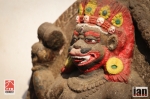
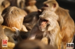
Located at the top of a hill, our day started with a visit to Swayambhunath (affectionately known as the Monkey Temple).
Swayambhunath (Devanagari: स्वयम्भूनाथ स्तुप; sometimes romanized Swoyambhunath) is an ancient religious complex atop a hill in the Kathmandu Valley, west of Kathmandu city. The Tibetan name for the site means ‘Sublime Trees’ (Wylie:Phags.pa Shing.kun), for the many varieties of trees found on the hill. However, Shing.kun may be a corruption of the local Nepal Bhasa name for the complex, Singgu, meaning ‘self-sprung’. For the Buddhist Newars in whose mythological history and origin myth as well as day-to-day religious practice, Swayambhunath occupies a central position, it is probably the most sacred among Buddhist pilgrimage sites. For Tibetans and followers of Tibetan Buddhism, it is second only to Boudhanath.
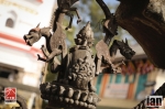
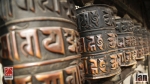
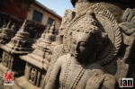
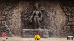
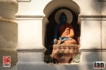
The Swayambhunath complex consists of a stupa, a variety of shrines and temples, some dating back to the Licchavi period. A Tibetan monastery, museum and library are more recent additions. The stupa has Buddha’s eyes and eyebrows painted on. Between them, the number one (in Devanagari script) is painted in the fashion of a nose. There are also shops, restaurants and hostels. The site has two access points: a long stairway with 365 steps, leading directly to the main platform of the temple, which is from the top of the hill to the east; and a car road around the hill from the south leading to the southwest entrance. The first sight on reaching the top of the stairway is the Vajra. Tsultrim Allione describes the experience:
We were breathless and sweating as we stumbled up the last steep steps and practically fell upon the biggest vajra (thunder-bolt scepter) that I have ever seen. Behind this vajra was the vast, round, white dome of the stupa, like a full solid skirt, at the top of which were two giant Buddha eyes wisely looking out over the peaceful valley which was just beginning to come alive.[2]
Much of Swayambhunath’s iconography comes from the Vajrayana tradition of Newar Buddhism. However, the complex is also an important site for Buddhists of many schools, and is also revered by Hindus.
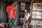
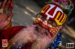
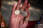
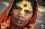
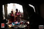
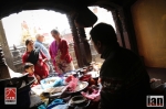
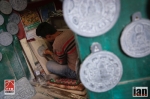
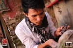
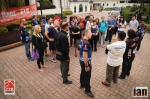
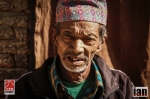
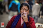
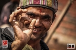
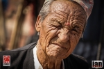
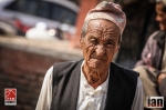
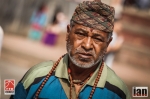
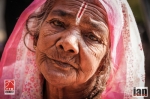
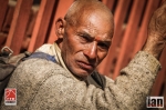
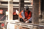
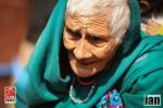
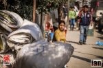
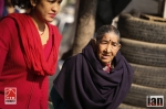
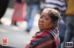
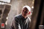
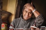
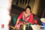
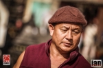
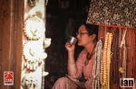
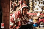
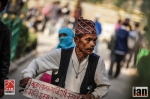
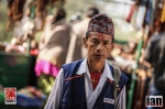
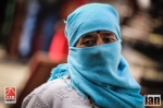
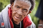
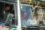
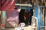
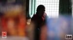
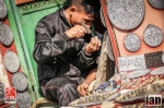
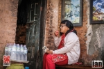
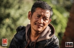
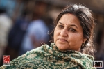
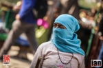
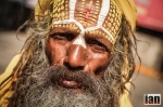
From Swayambhunath we took a short bus ride and then walked around the vibrant streets of Kathmandu. It’s a cacophany of noise mixed with people, cars and colour. The people are warm, welcoming, happy and friendly despite obvious poverty that is on display no matter where you look.
Kathmandu (Nepali: काठमाडौं [kɑʈʰmɑɳɖu]; Nepal Bhasa: येँ देय्) is the capital and largest municipality of Nepal. It is the only city of Nepal with the administrative status of Mahanagarpalika (Metropolitan City), as compared to Up-Mahanagarpalika (Sub-Metropolitan City) or Nagarpalika (Municipality). Kathmandu is the core of Nepal’s largest urban agglomeration located in the Kathmandu valley consisting of Lalitpur, Kirtipur, Madhyapur Thimi, Bhaktapur and a number of smaller communities. Kathmandu is also known informally as “KTM” or the “tri-city”. According to the 2011 census, Kathmandu has a population of close to 1 million people. The municipal area is 50.67 square kilometres (19.56 sq mi) and has a population density of 3000per km² and 17000 per km square in city.
The city stands at an elevation of approximately 1,400 metres (4,600 ft) in the bowl-shaped Kathmandu Valley of central Nepal.[6] It is surrounded by four major mountains: Shivapuri, Phulchoki, Nagarjun, and Chandragiri. Kathmandu Valley is part of three districts (Kathmandu, Lalitpur, and Bhaktapur), has the highest population density in the country, and is home to about a twelfth of Nepal’s population.
Historically, the Kathmandu Valley and adjoining areas were known as Nepal Mandala. Until the 15th century, Bhaktapur was its capital when two other capitals, Kathmandu and Lalitpur, were established. During the Rana and Shah eras, British historians called the valley itself “Nepal Proper”. Today, Kathmandu is not only the capital of the Federal Democratic Republic of Nepal, but also the headquarters of the Bagmati Zone and the Central Development Region of Nepal.
Kathmandu is the gateway to tourism in Nepal. It is also the hub of the country’s economy. It has the most advanced infrastructure of any urban area in Nepal, and its economy is focused on tourism, which accounted for 3.8% of Nepal’s GDP in 1995–96. Tourism in Kathmandu declined thereafter during a period of political unrest, but since then has improved. In 2013, Kathmandu was ranked third among the top 10 travel destinations on the rise in the world by TripAdvisor, and ranked first in Asia.
The city has a rich history, spanning nearly 2000 years, as inferred from inscriptions found in the valley. Religious and cultural festivities form a major part of the lives of people residing in Kathmandu. Most of Kathmandu’s people follow Hinduism and many others follow Buddhism. There are people of other religious beliefs as well, giving Kathmandu a cosmopolitan culture. Nepali is the most commonly spoken language in the city. English is understood by Kathmandu’s educated residents. Content ©wikipedia
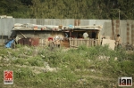
Tomorrow, Tuesday 12th is an early start as we all leave Kathmandu and head to Jiri for an overnight camp and then the race starts Wednesday.
Stage 1 – Preview
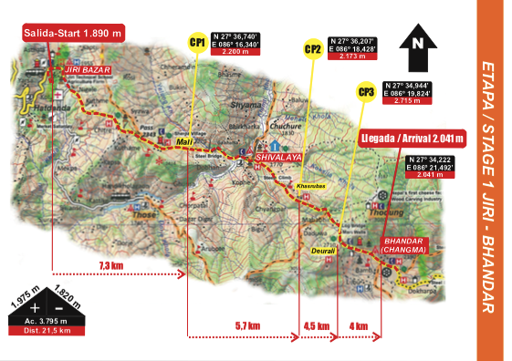
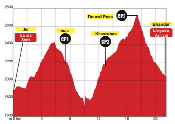
Km 0. Departure from campsite with initial direction 150o. Follow main pathway that crosses Bhandar. At the end of the village, cross the wooden covered bridge, turn left immediately and followmainpathwayparalleltotheriver (maintaineddescenttillKm3,7).
Km 1,04. Take footpath on the right and go down crossing several times the main pathway. Km 3,7 (1.523 m). Turn right crossing the bridge (maintained ascent till Km 9,8).
Km 9,8. Arrival to the pass that leads to the Golla village (Gompa). Take the footpath on the left that leads to the village exit and to the CP2.
Km 10 CP2 . Come out following the path on the right. Terrain combining flat sections and slight ups and downs till Km 12.
Km 12. Take the detour on the left and follow the marked path. Maintained climbing inside the forest till Km 13,5 where we reach a hill with flags. Follow marked pathway inside the forest.
Km 16,9 (3625 m.). Find a clearing and enter again the forest with direction 170o. Follow marked pathway.
Km17. Anewclearing. Initialdirection150otillenteragaintheforest.
Km17,5(3.772m.).Comeout oftheforest.Followmarkedpathandturnleftafterfewmeters to start climb to the Pike Peak (4.065 m). Follow marked path. We will identify the summit because of the prayer flags.
Km 19,5 CP3. Reach the Pike Peak summit. Go down the marked path till a Many Wall (3.989 m). Take marked path on the left. Go down along a technical zone. CAUTION!.
Km 21,5. (3.950 m). Clearing. Turn left and go on till pass with Mani Wall (3.500 m). Km 23,7 (3.783 m). Pass by a group of 3 chorten and follow pathway. Km26,5(3.265m).Turnleft crossingtheriver.Followmarks.Km 28. Taktur.
STAGE ARRIVAL.
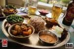
KATHMANDU IMAGES: