Home of the Giants 2024 has just come to a conclusion. And what a week it has been.
This trip came about through personal adventure in the Jotunheimen mountains of Norway and the desire to share and showcase this magical playground.
What is Home of the Giants?
A multi-day adventure, 6-days in total, through a magical and challenging landscape. Unlike a race, this journey was created as a finely balanced exclusive trip for up to just 12 participants. A challenge at a more relaxed pace, taking in an amazing route whilst moving light in a semi self-sufficient mode using DNT cabins for overnight accommodation.
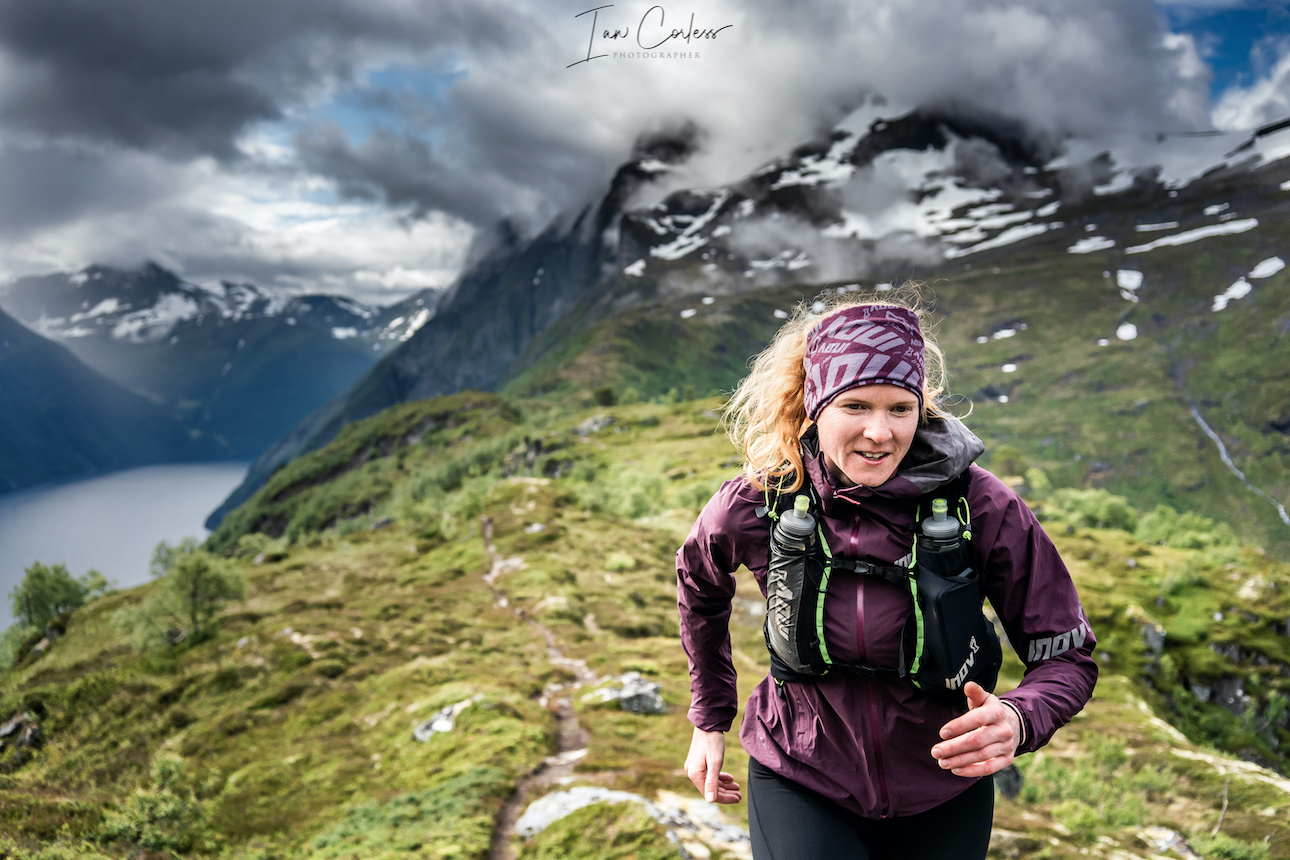
Based around the concept of stage races, Home of the Giants is about moving lighter and therefore faster with a minimum amount of equipment without compromising safety. All we needed could be carried in a small pack weighing approximately 3kg (plus liquid).
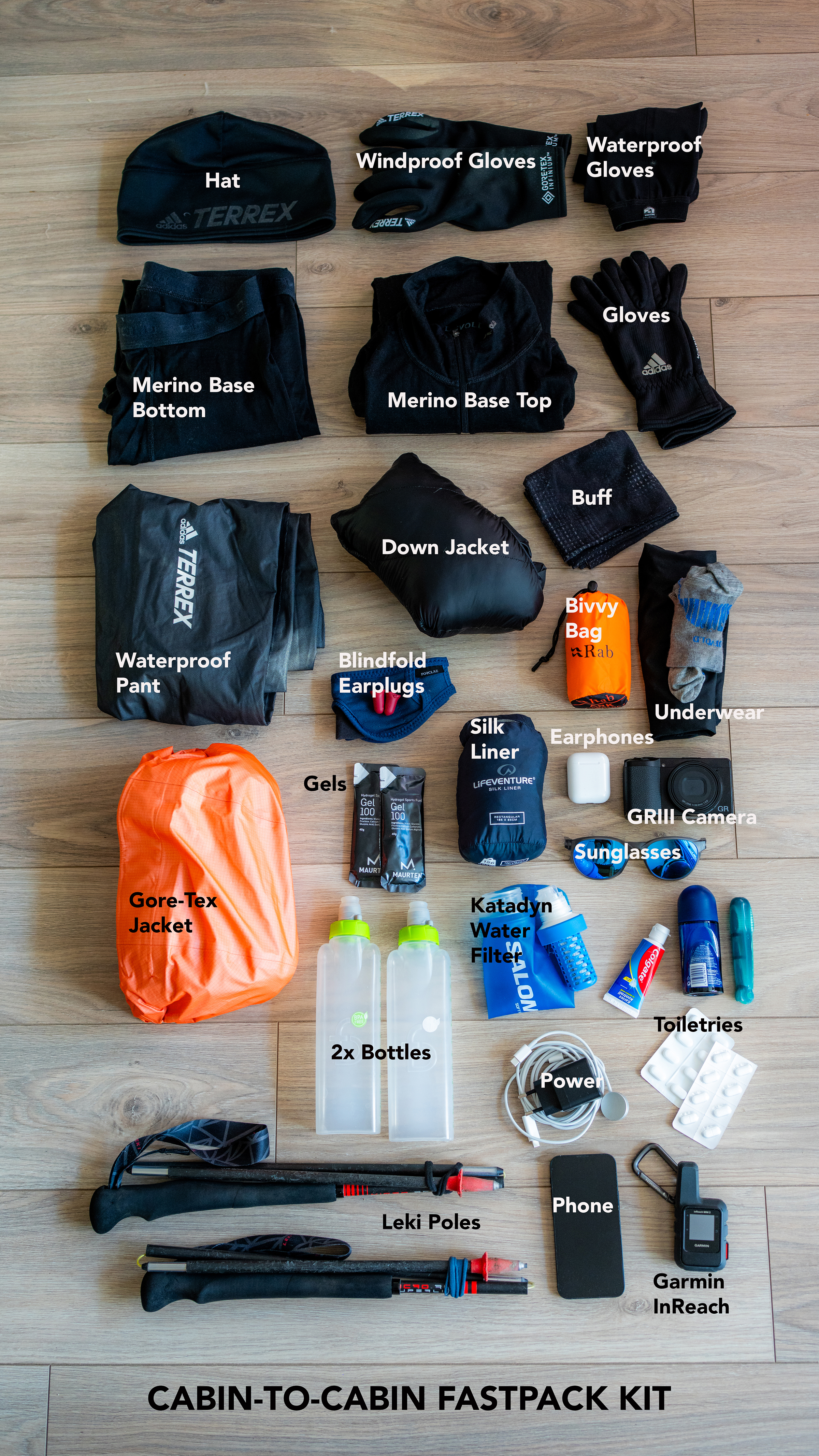
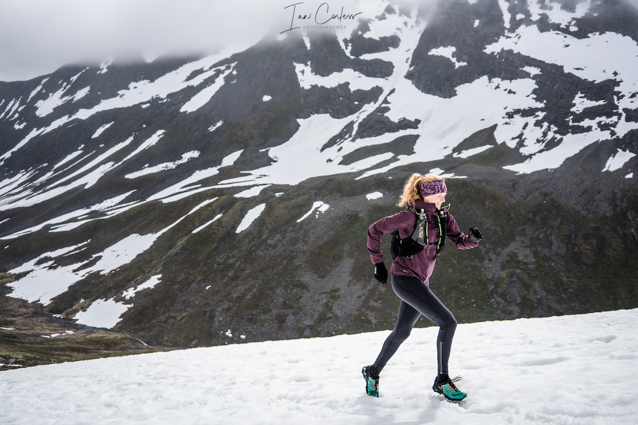
It is important to emphasize that Norway can have spring, summer and winter in one day. Never underestimate the challenge of the environment. It is all well and good being light IF you can move fast. You also need to consider the ‘what if’ scenario and should you become slow or a worst case scenario, injured and waiting help/ rescue. At a minimum you MUST have merino top and bottom, warm insulating layer (down or PrimaLoft) waterproof jacket and pants, hat, gloves and a bivy bag. I also strongly recommend a product such as Garmin InReach. Much of Jotunheimen has no phone connection, an InReach with emergency SOS button, for me, should be mandatory.
You can see an example of my pack below and the details are as follows:
- Camelbak Octane Pack 600g
- adidas hat 32g
- adidas gloves Infinitum 52g
- Hestra waterproof gloves 53g
- adidas gloves 41g
- Devold merino base top 193g
- Devold merino base bottom 166g
- Buff 43g
- Haglofs down jacket 163g
- adidas waterproof pant 125g
- adidas Gore-Tex jacket 272g
- Rab bivvy bag 110g
- Underwear 98g
- Gels 81g (for emergency)
- Silk liner 126g
- Blindfold/ earplugs 22g
- Earphones 44g
- Ricoh GRIII camera 251g (a luxury)
- Sunglasses 18g
- Bottles x2 90g
- Katadyn water filter 52g
- Toiletries 196g
- Power supply 138g
- Phone 136g
- Garmin InReach 108g
- Leki poles 250g
3379g
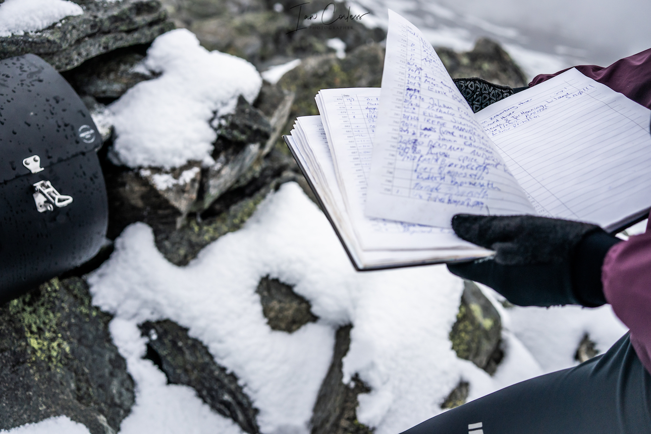
Staying at DNT staffed cabins provides the best of both worlds, they provide a bed for the night, dinner, breakfast, a packed lunch and they have additional facilities such as relaxation areas, showers and a bar. It’s the ultimate way to travel light in the mountains. Beds are in dorms or private rooms that depending on the cabin can be solo, double, triple, quadruple or five plus. Most DNT’s have a rule that irrespective of if you arrive and there are no beds, you will not be turned away, so, rest assured, a safe haven is always available.
OUR JOURNEY
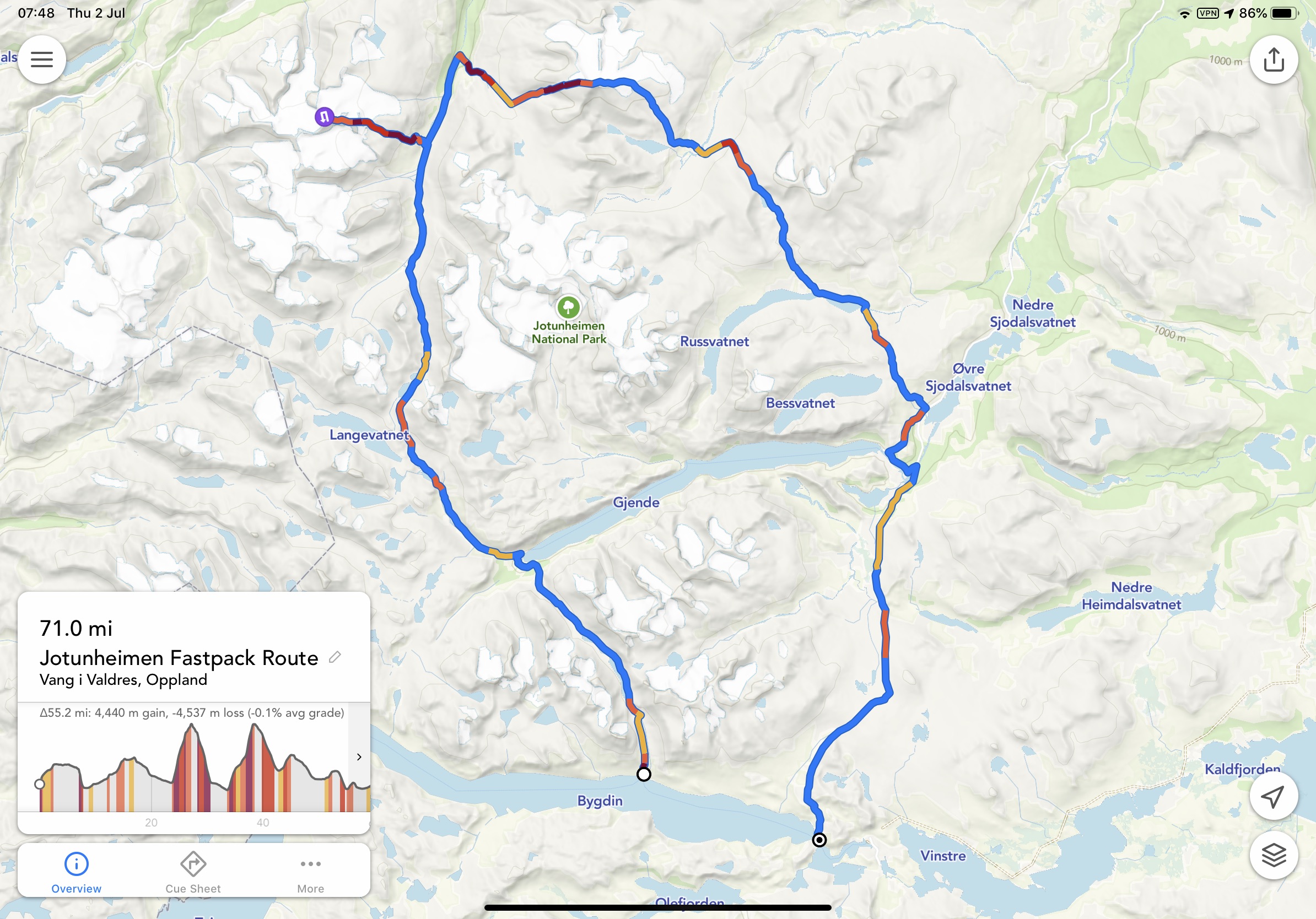
Day 1 – Oslo to Bygdin
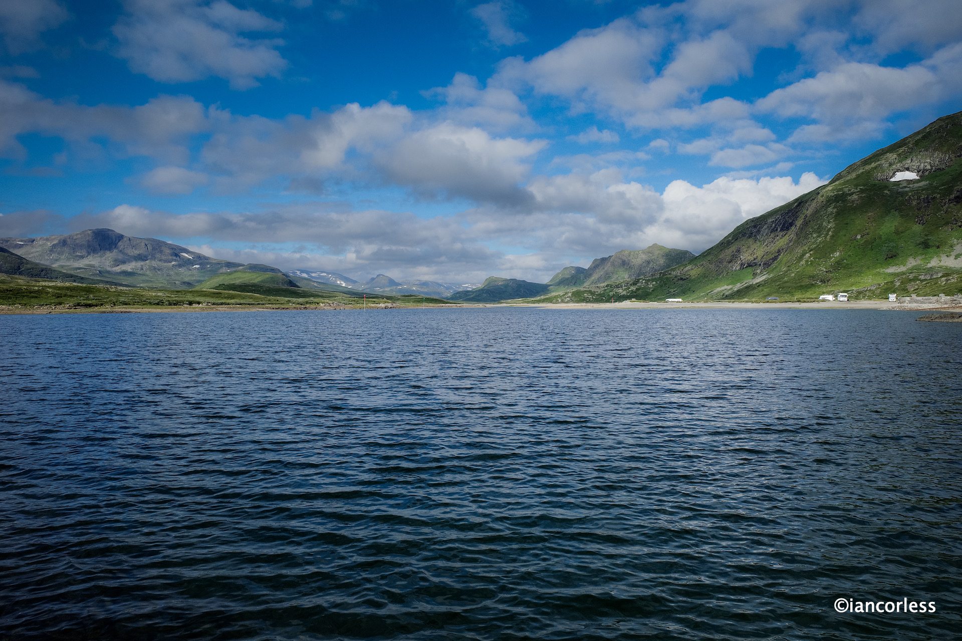
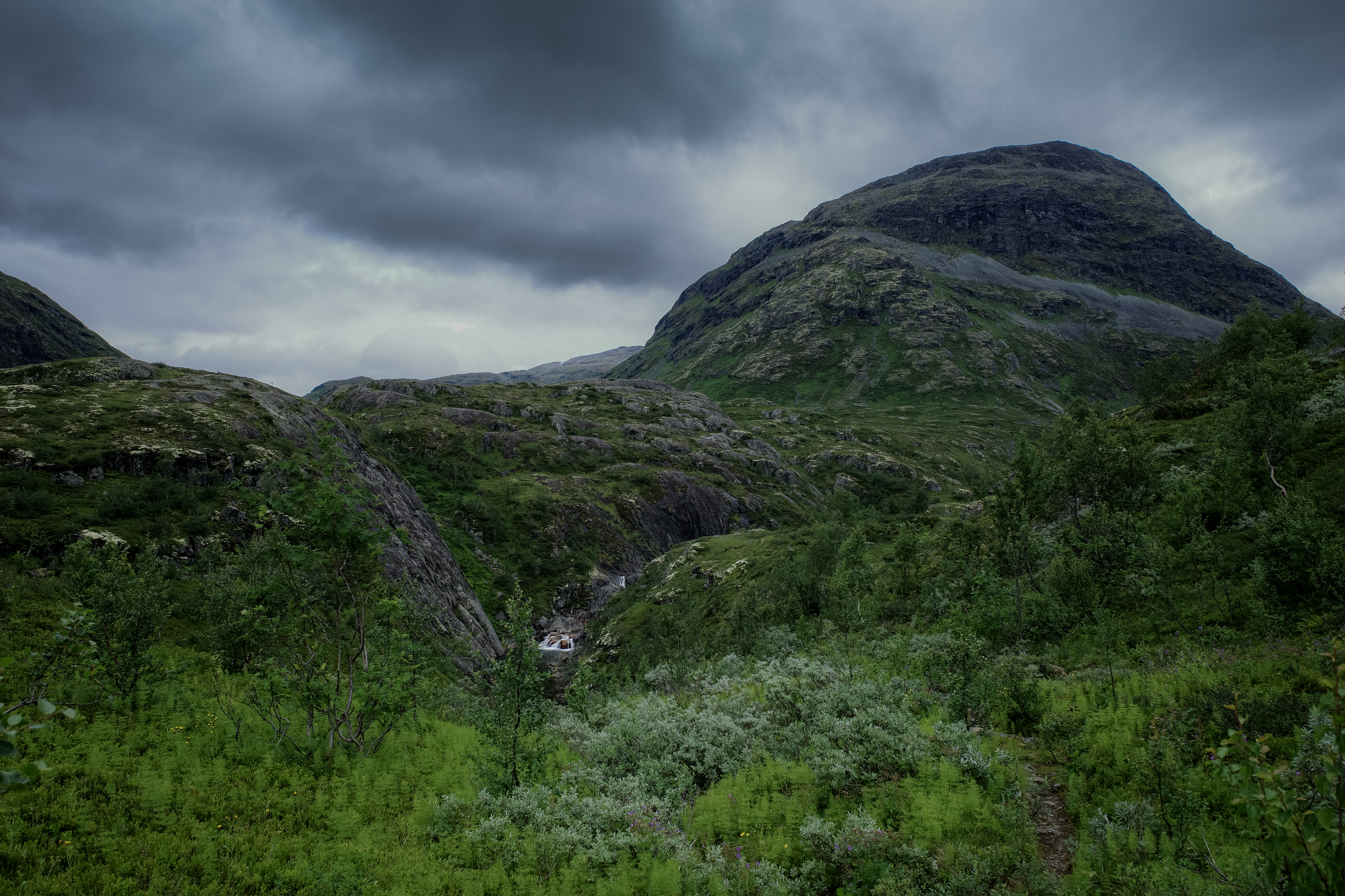
We departed Oslo bus terminal at 0830 Monday for a direct trip to Bygdin Fjellhotel. The journey taking 4-hours with a 15-minute break ideal for a midday arrival. The weather was grim with torrential rain for most of the way. It was an ominous start and constant glancing at weather apps confirmed that our week ahead would have mixed weather. It’s Norway after all!
Arrival at Bygdin was seamless and after a break at 1500 we departed in the rain to take in the summit of Synshorn (1464m) which is a great introduction to Norwegian mountain terrain. The plan was initially to just summit and return, a 75-minute journey at a steady pace. However, the weather, although still wet, was not cold and after long travel, we all decided to continue for a back-up and planned 12km route. We followed the ridge north to Heimre Fagerdalshøe (1510 m above sea level) with a great view over Bygdin to Falketind. We then continued in the direction of Synsbekk and connected to the ’T’ marked trail that would bring us back to Bygdisheim and the lake for a short gravel road section back to the hotel.
It was a great intro to the week and then we could enjoy the benefits of Bygdin Fjellhotel – a warm shower, sauna and a lovely traditional Norwegian dinner.
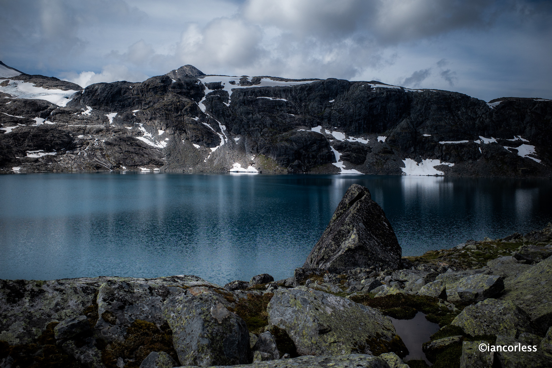
Day 2 – Bygdin – Eisbugarden – Skogadalbøen
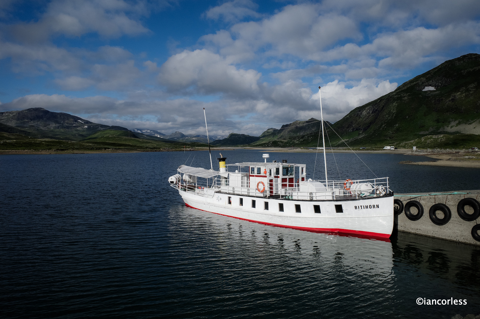
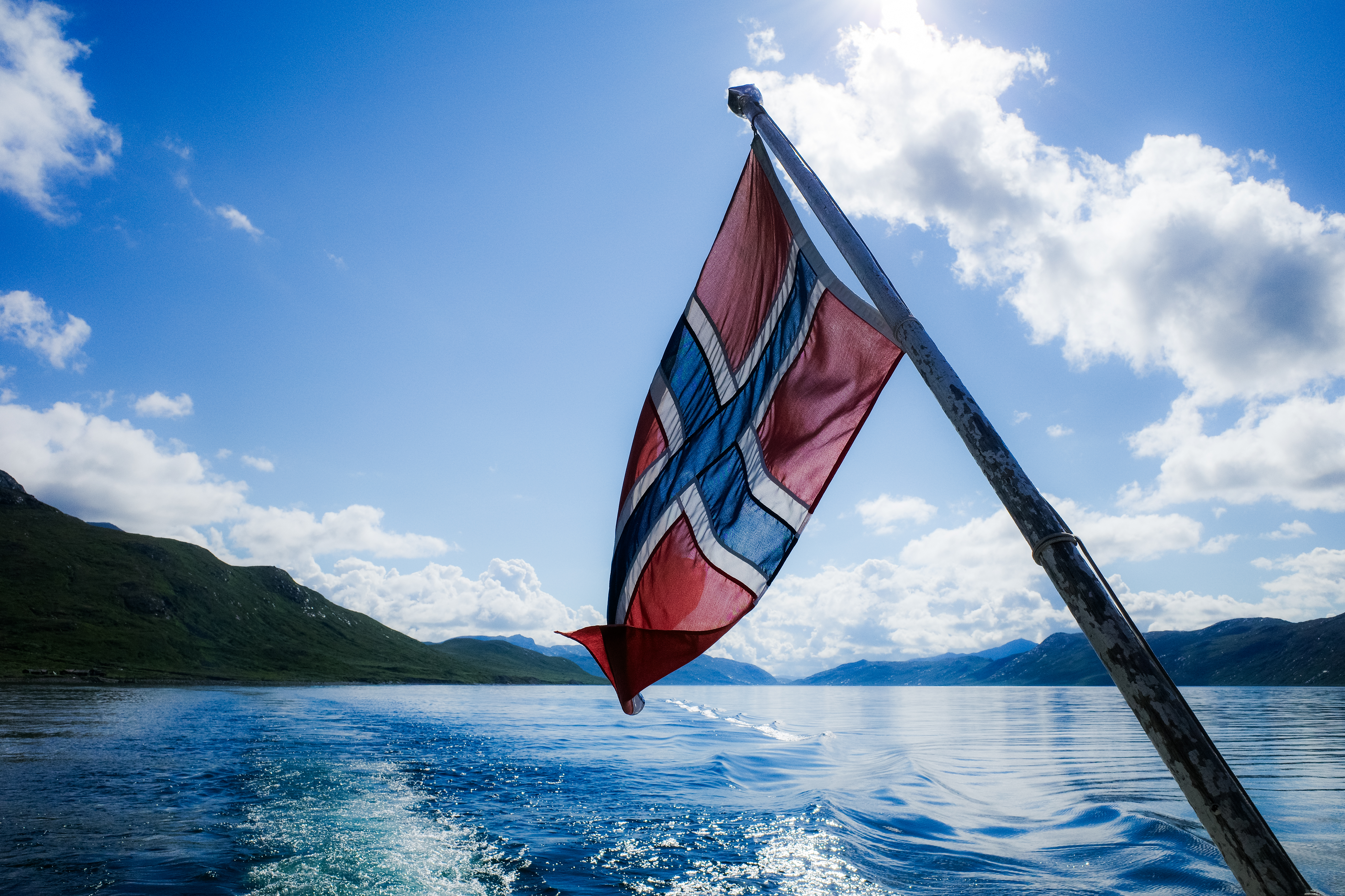
It was a casual start to the day with a hearty breakfast and then meeting the M/B Bitihorn boat at 0900 for a transfer the length of Bygdin lake (stopping at Torfinnsbu) and then continuing to Eidsbugarden.
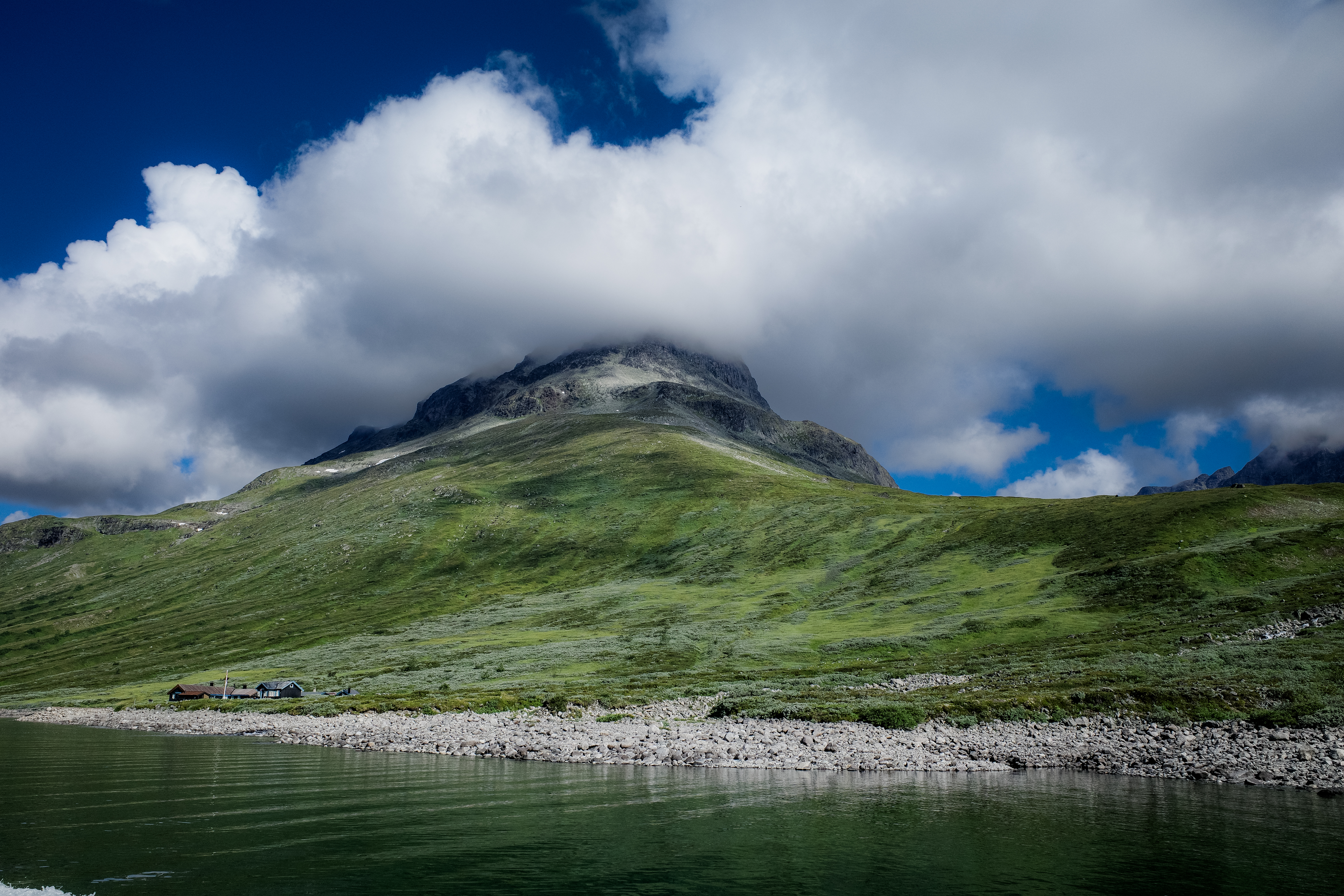
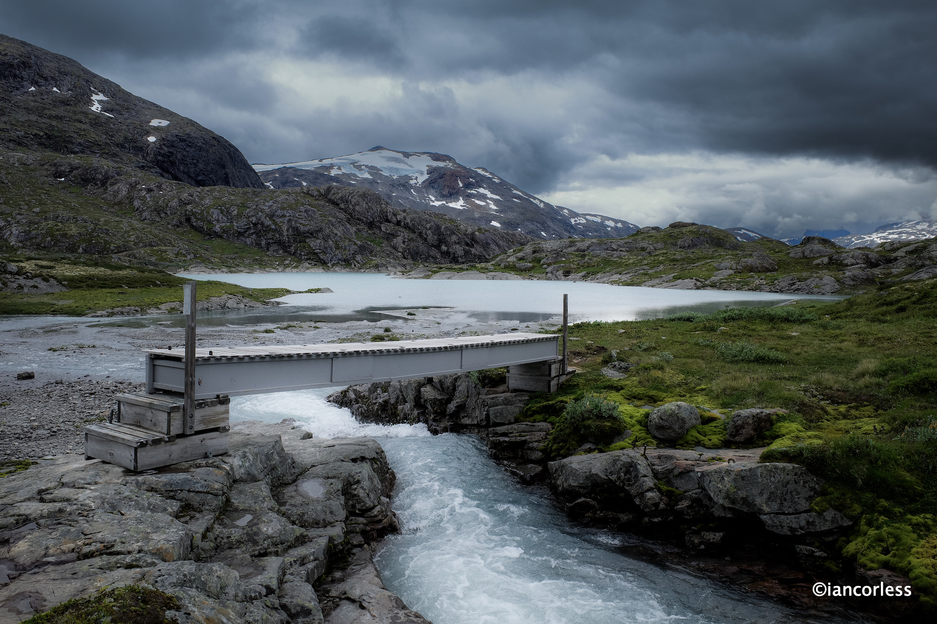
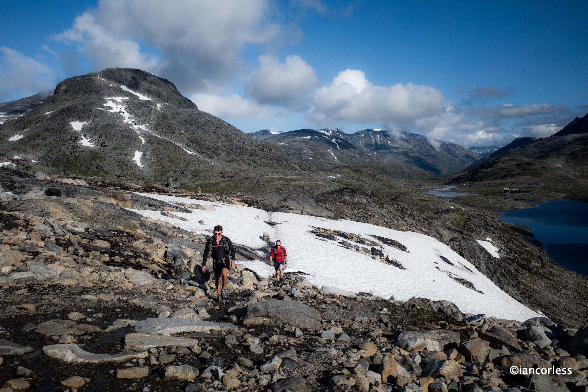
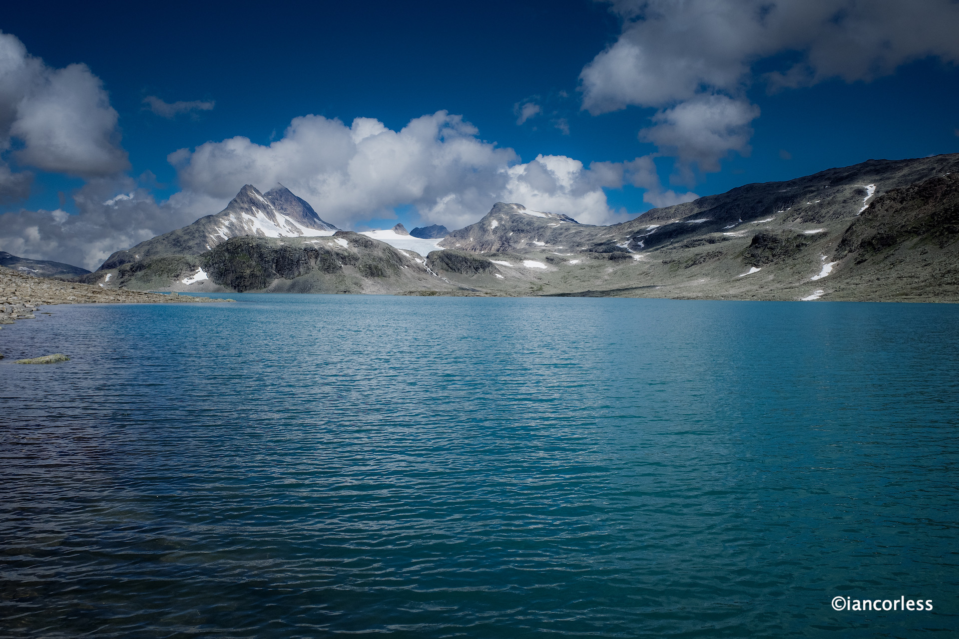
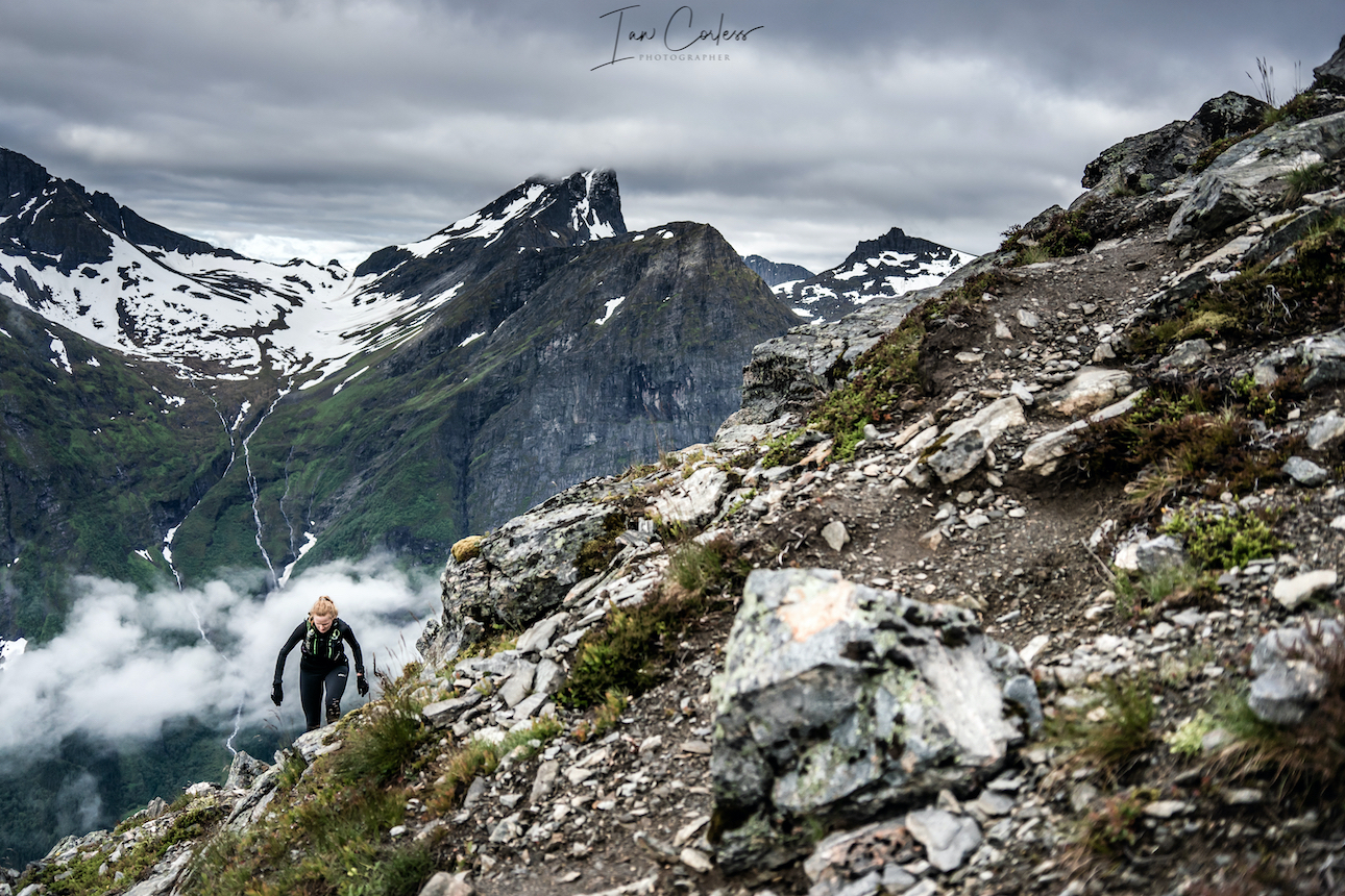
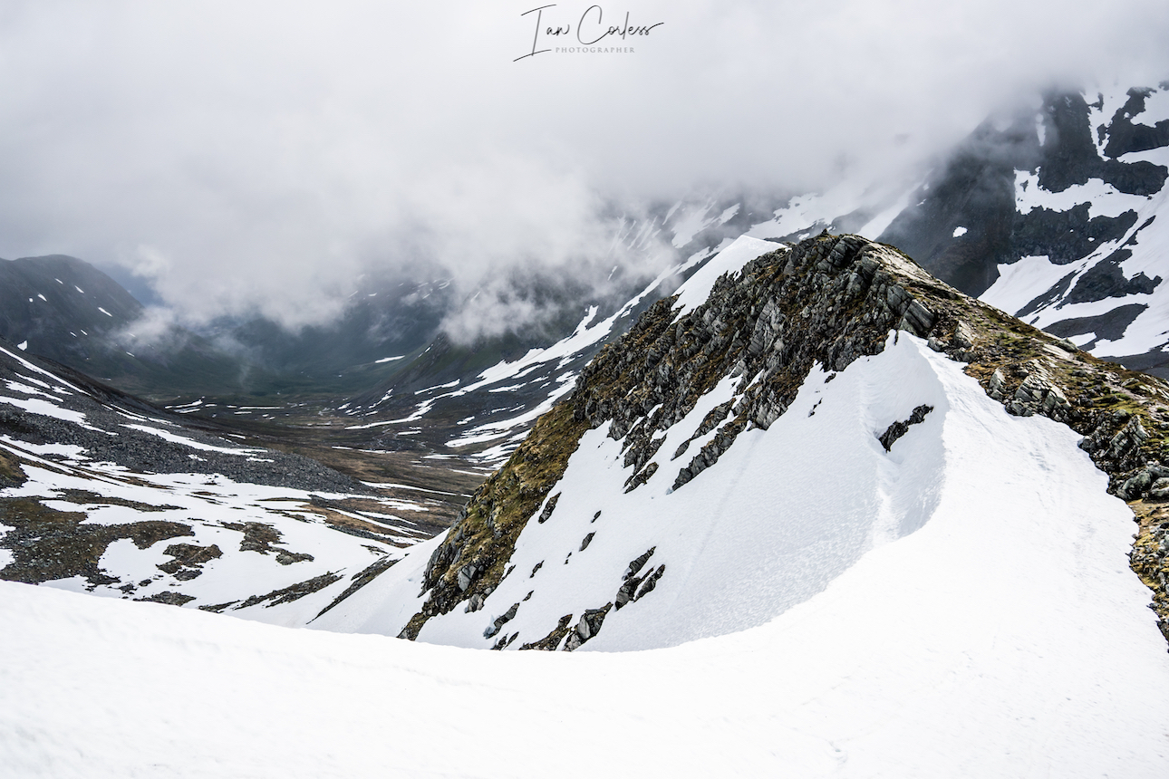
By 1100 we were ready for our first full day, Eidsbugarden to the remote Skogadalbøen DNT cabin. The route is considered very demanding due to the nature of the terrain. It’s very important when looking at routes in Norway that you never focus too much on the distance but more the time it will take to cover the distance. Depending on the time of year, this route can have a great deal of snow, so, be careful and do research in advance. For us, we had several snow fields to cross and all were in good condition.
Our weather was glorious, blue skies, white fluffy clouds and amazing views.
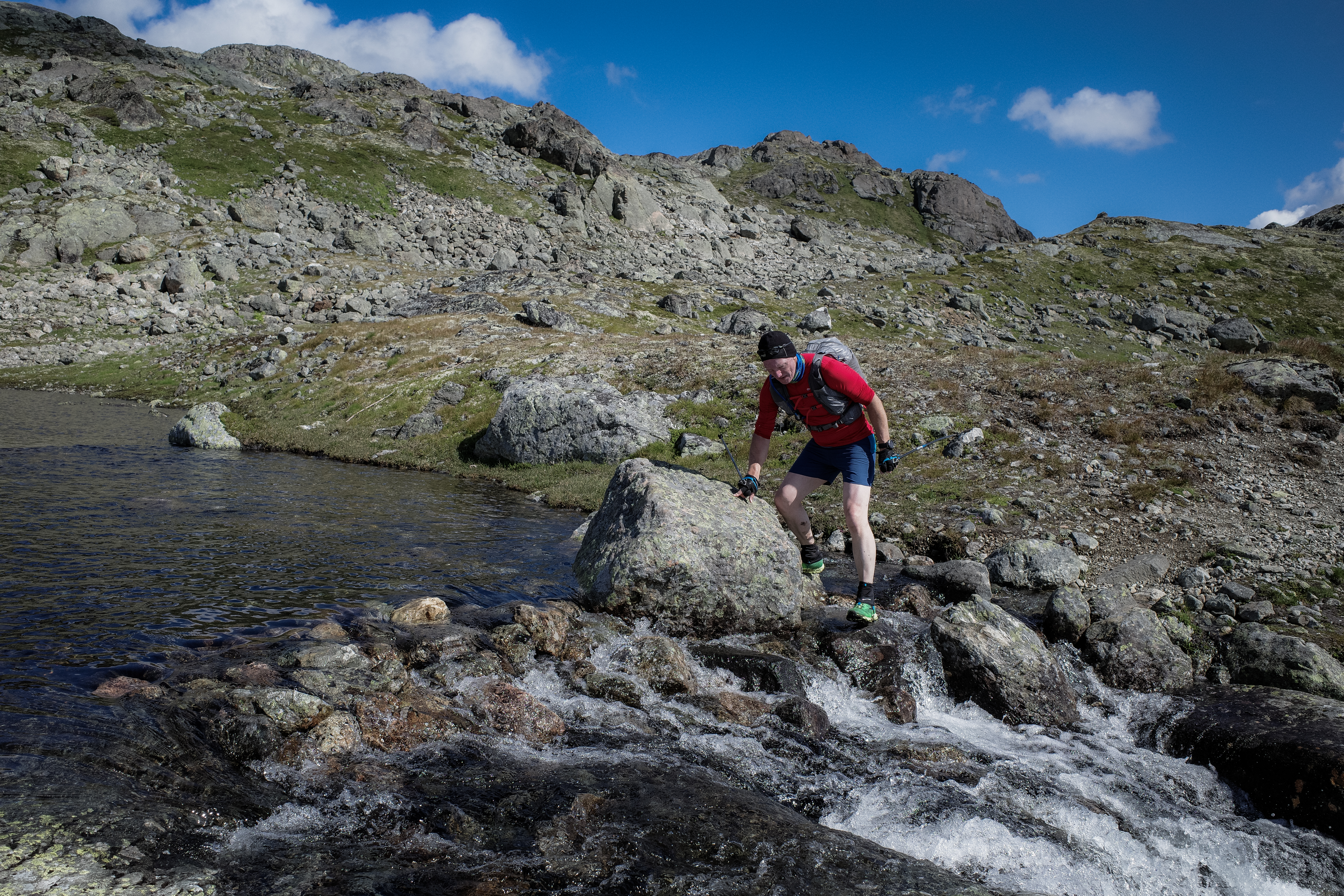
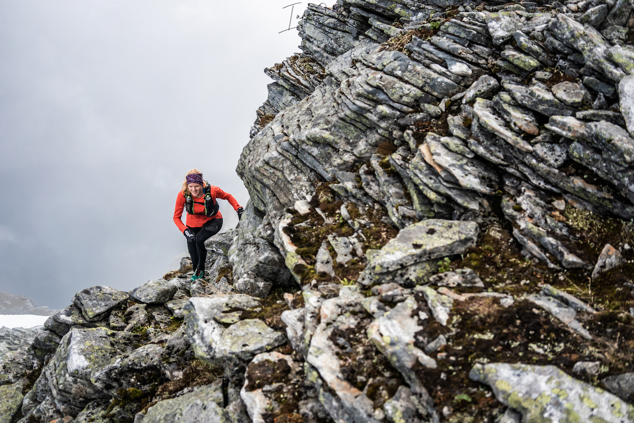
A short road section and a right turn and we were already climbing through saturated and boggy ground to Sløtafjellet. Then the rocks and boulders started.
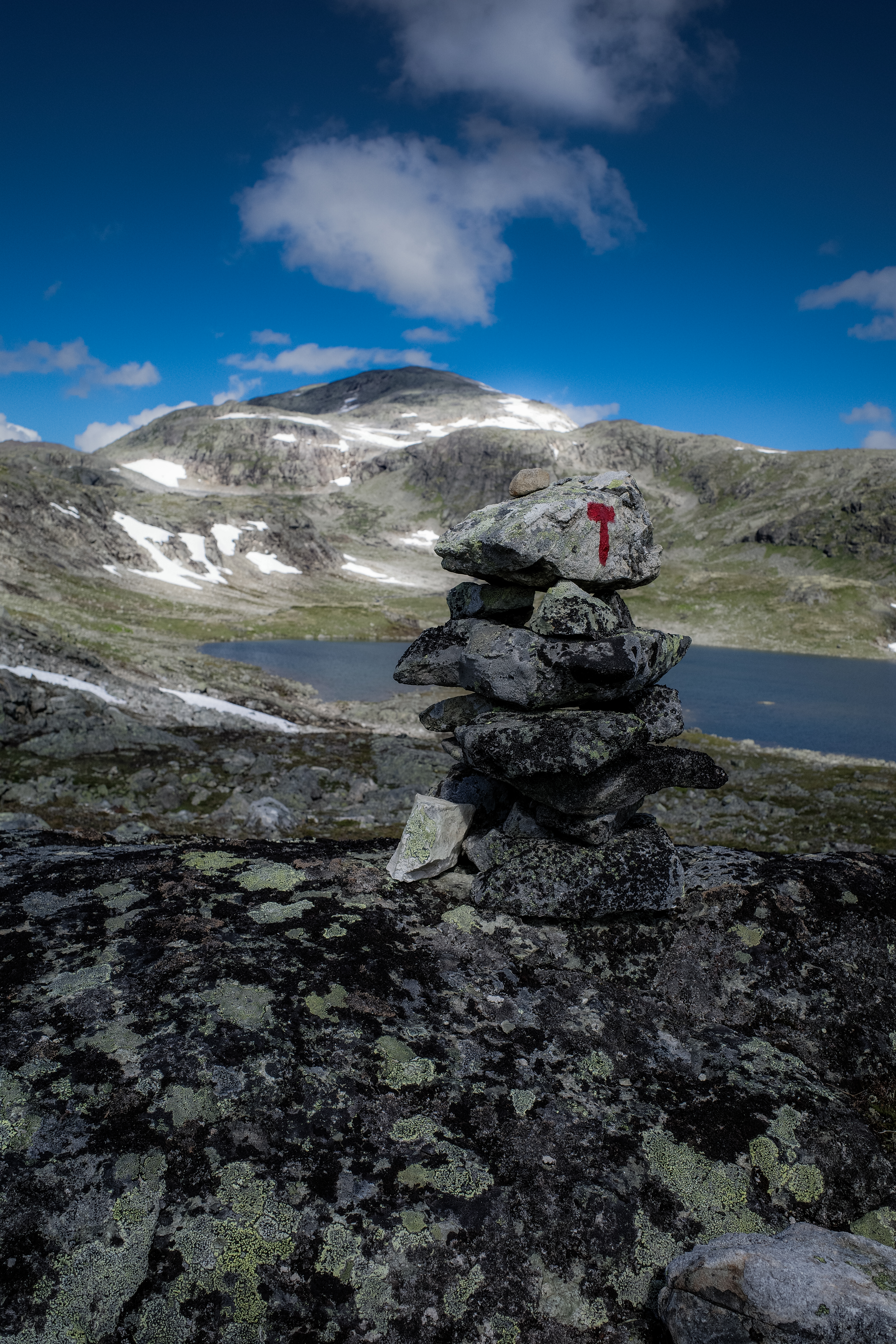
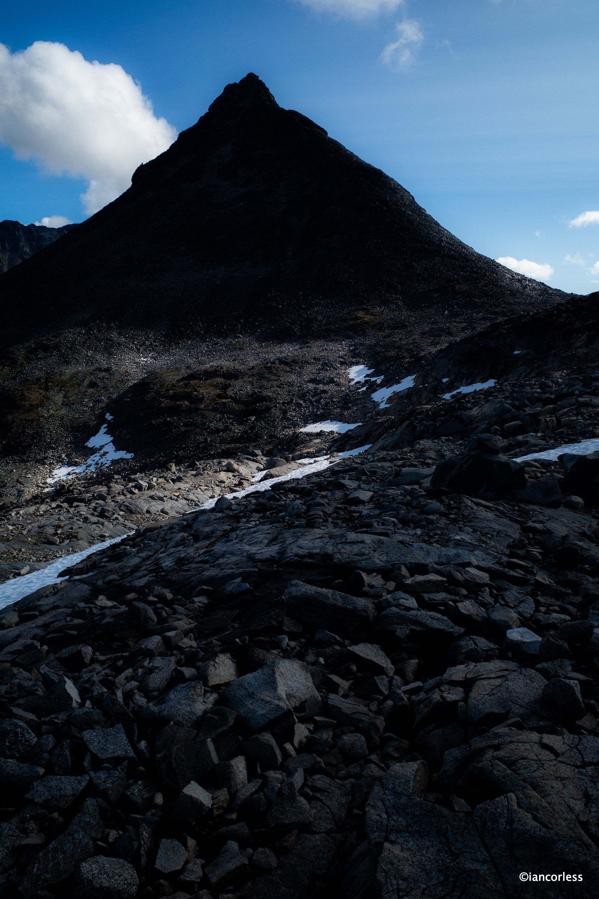
This route has a ‘reputation’ for the rocky terrain and hence the difficulty rating. It’s hard to move fast! The route climbs up passing lakes and at all times you are surrounded by stunning snow-covered peaks – magical.
Arriving at Kvitevatnet lake you keep to the left and at the end climb up towards Uradalsvatnet lake, againkeepin to the left.
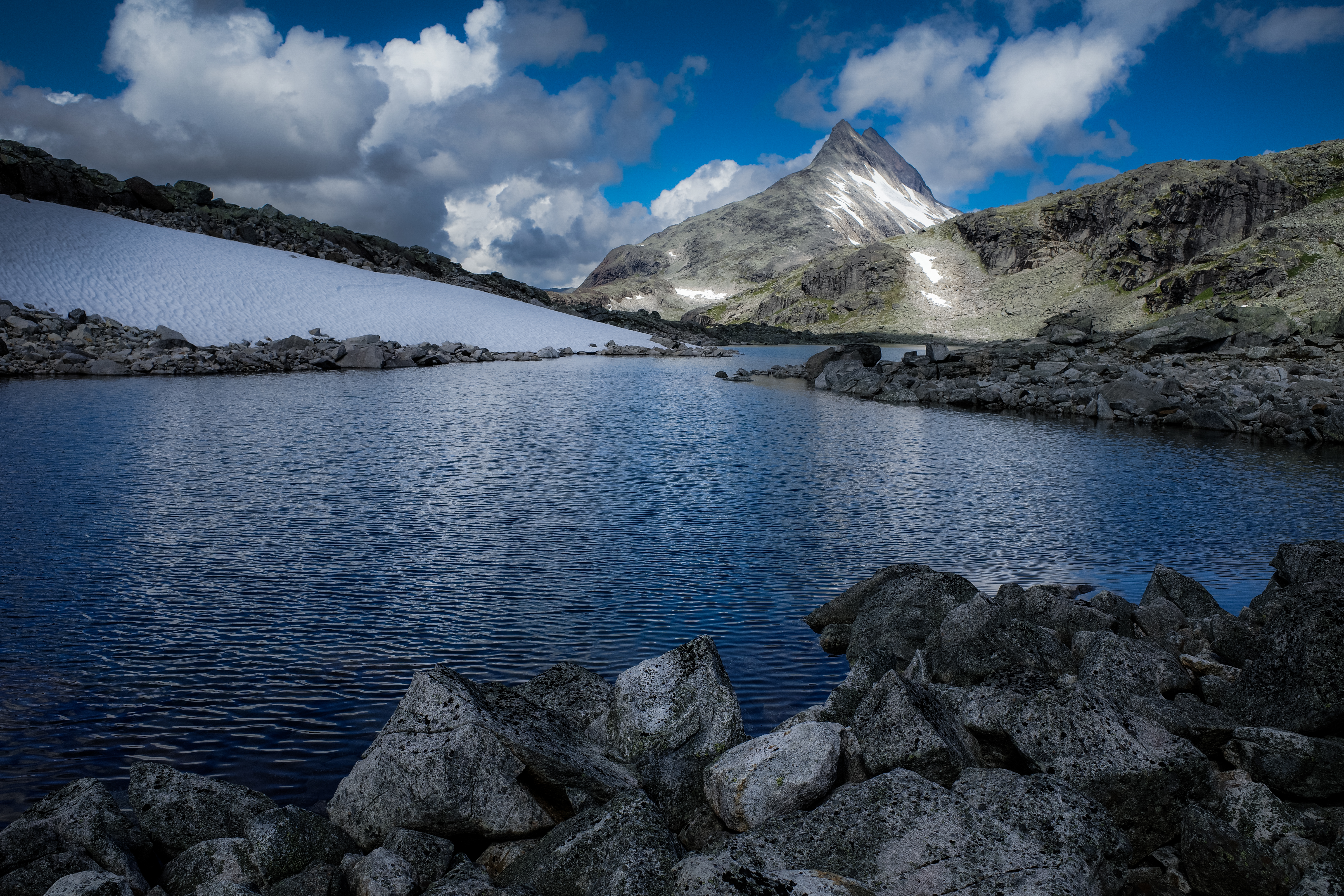
Passing through Uradalen the route eventually reaches its high point and then the descent starts through more ‘runnable’ terrain towards Skogadalsbøen.
Of course, there is a kick in the tail with more rocks and very closed in and dense single-track with lots of mud. We covered 24.5km, 670m+ in 4h 55m. Geoff and Baz were pretty tired at the end, and I think it’s fair to say that Baz had seen and experienced enough rocks and boulders to last a lifetime. My reply was always, 1this is Norway, this is Jotunheimen!’
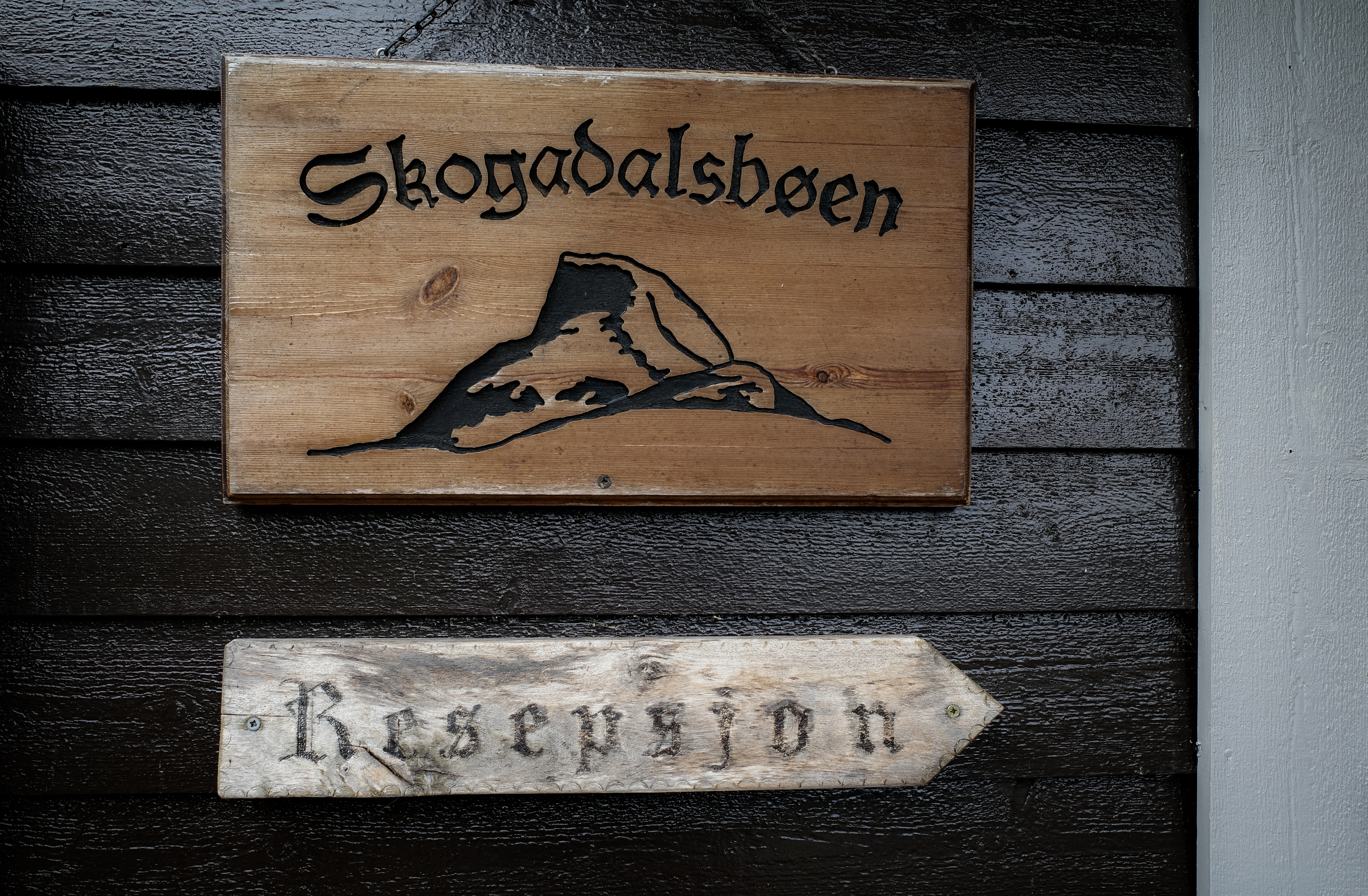
My girlfriend, Abelone, had initially planned to join Home of the Giants. Our intention, two groups of 4/5-people. However, in the buildup to the event we had 6-people cancel – not ideal. These cancellations caused many logistical problems and of course, there was never any risk of cancelling, but it did mean that Abelone was not needed to guide a group. However, she was on holiday with her son Håkon (10) and after summiting Fannaråki they joined us at Skogadalbøen DNT.
As usual, we had an amazing three course dinner, a lovely evening of banter and then a good night’s sleep.
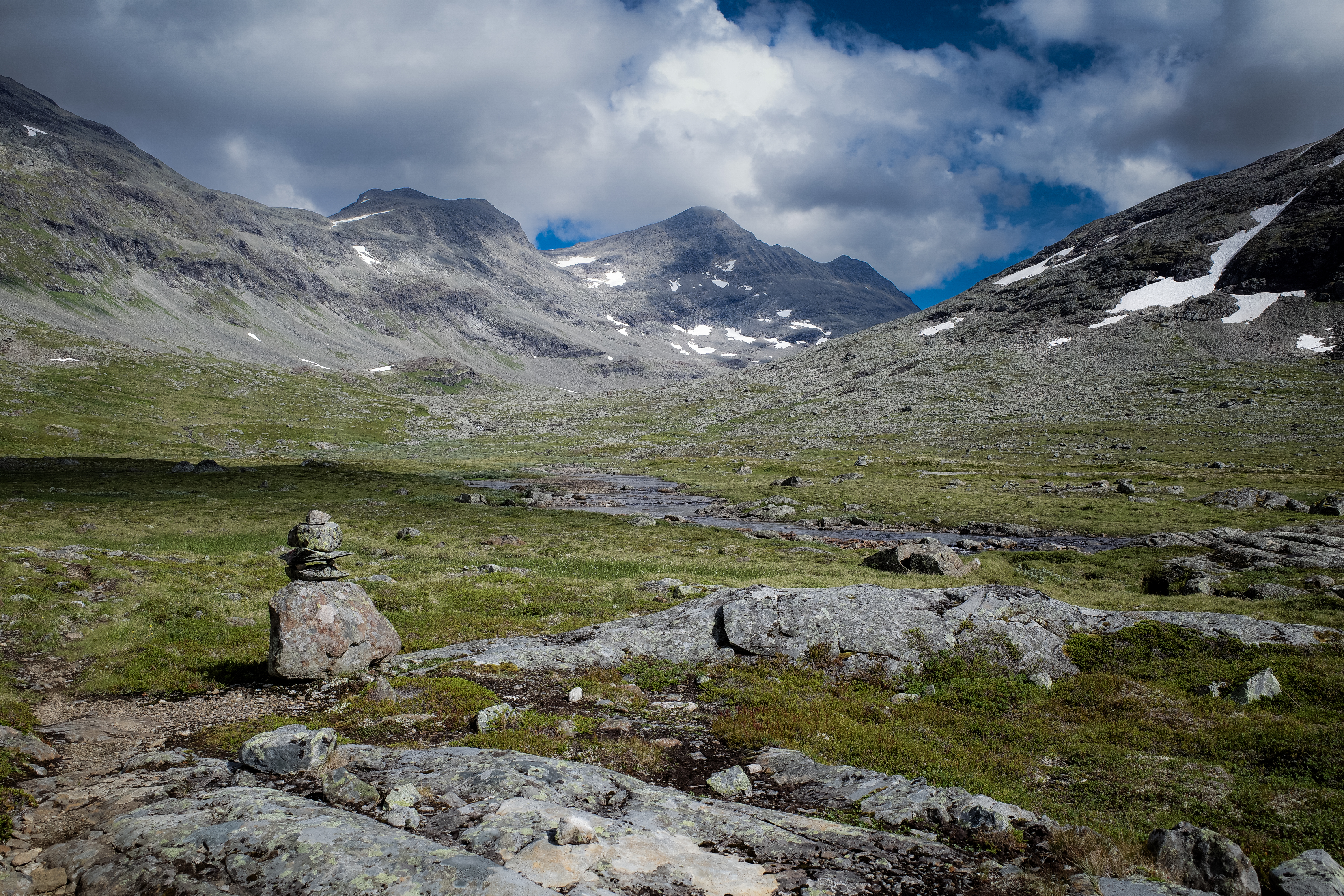
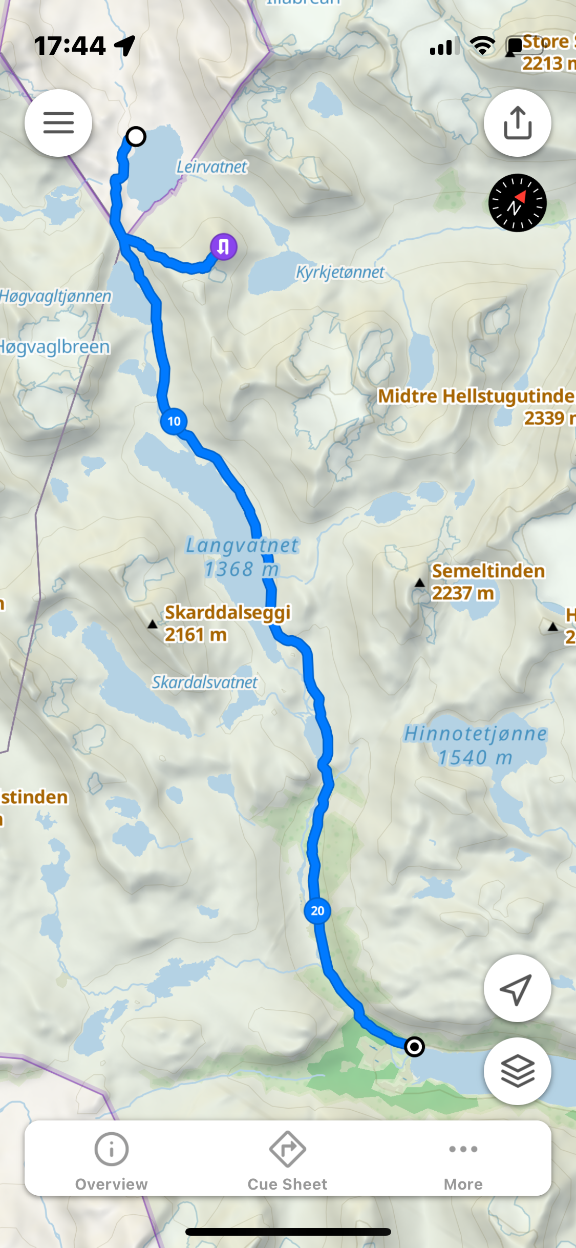
Day 3 – Skogadalbøen to Leirvassbu
Skogadalbøen to Leirvassbu is in comparison to the previous day, an easy route. Even though UT.NO describe it as a ‘very demanding summer route.’ Håkon had decided he enjoyed the group dynamic so much he wanted to also do the 19km route. He and Abelone got underway and some 30-minutes later we started.
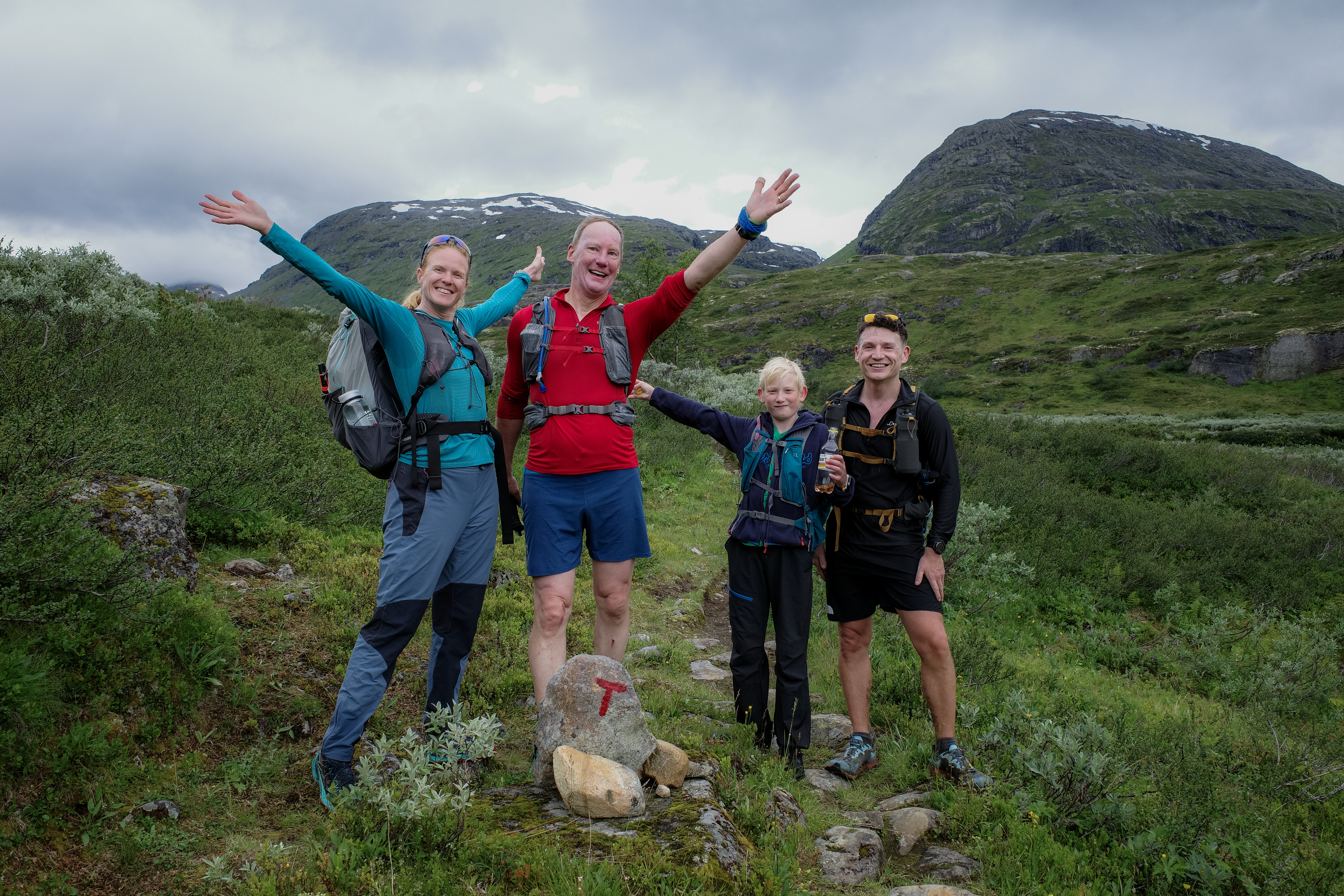
Passing them early in the trail we had a group photo and pushed on. Today was a running day, albeit steady and relaxed. Geoff and Baz had big smiles; I think they almost considered it a rest day after what had been experienced the day before.
The ground constantly wet and boggy, the weather was overcast and cloudy with occasional light drizzle.
Passing through Storutladlen and onwards to Gravdalen it was a great feeling day. The views and landscape ever changing. After passing Gravdalsdammen, we soon joined an undulating gravel road that took us to Leirvassbu DNT.
On the approach, Kyrkja (2032m) was to our right, shrouded in mist and clag. Today was not the day to attempt the summit. After 19.68km, 811m of vert we finished in 3h 34m. Abelone and Håkon arrived a couple of hours later, Håkon sprinting ahead with a smile. What a joy to see. Geoff and Baz were blown away by Håkon’s speed, enthusiasm and commitment.
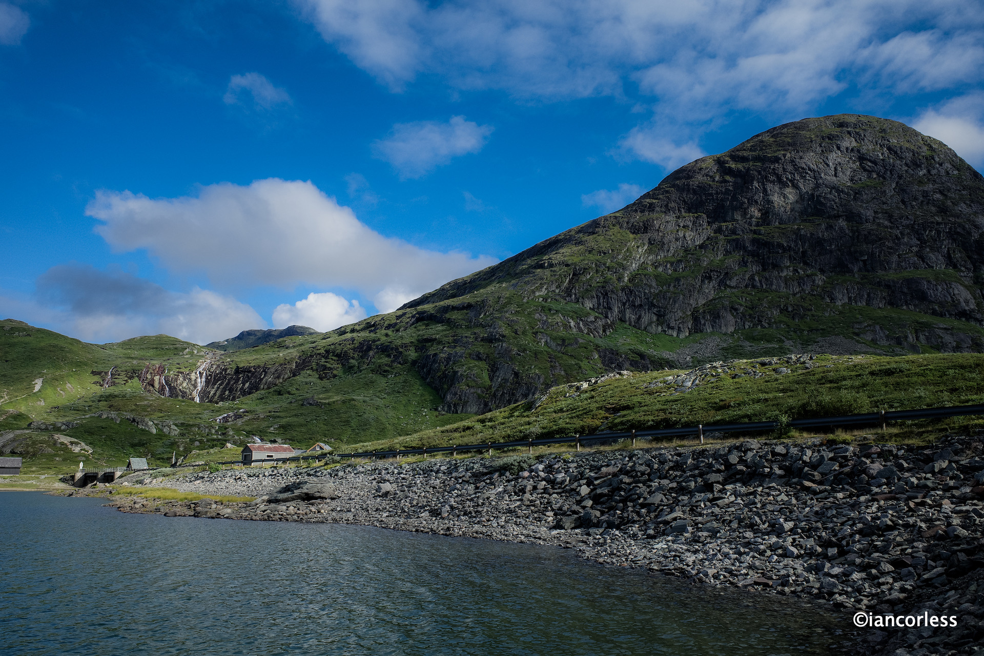
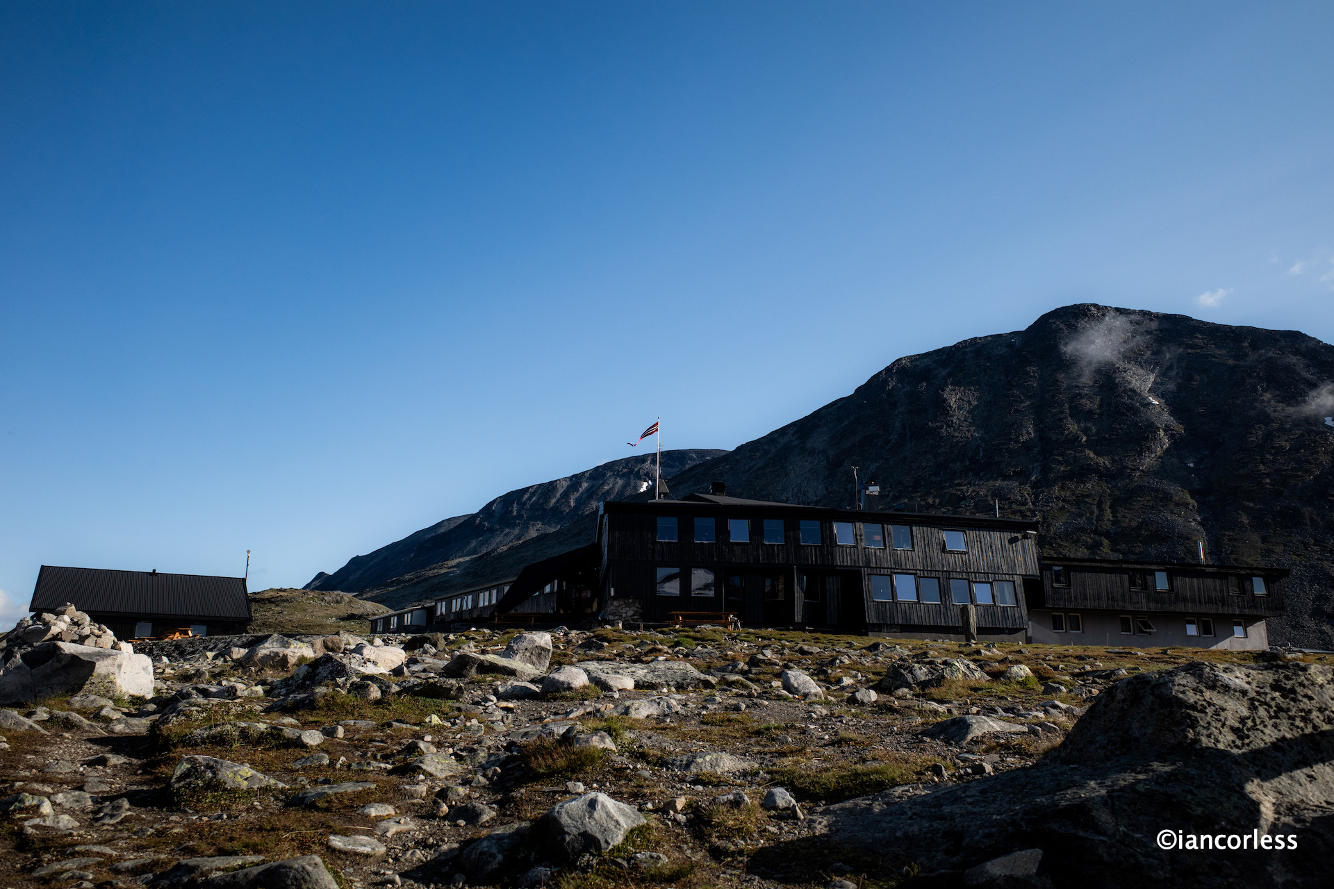
Early finish and we could then rest, relax, enjoy the Leirvassbu DNT and prepare for the following day. Leirvassbu DNT is a large and modern cabin with no dorms, a large bar area and an excellent restaurant. A stunning location surrounded by mountains, a great place for staying more than one night as there is lots to explore. It has road access, so, it can be accessed by private car or bus, worth knowing just in case you need a contingency escape option.
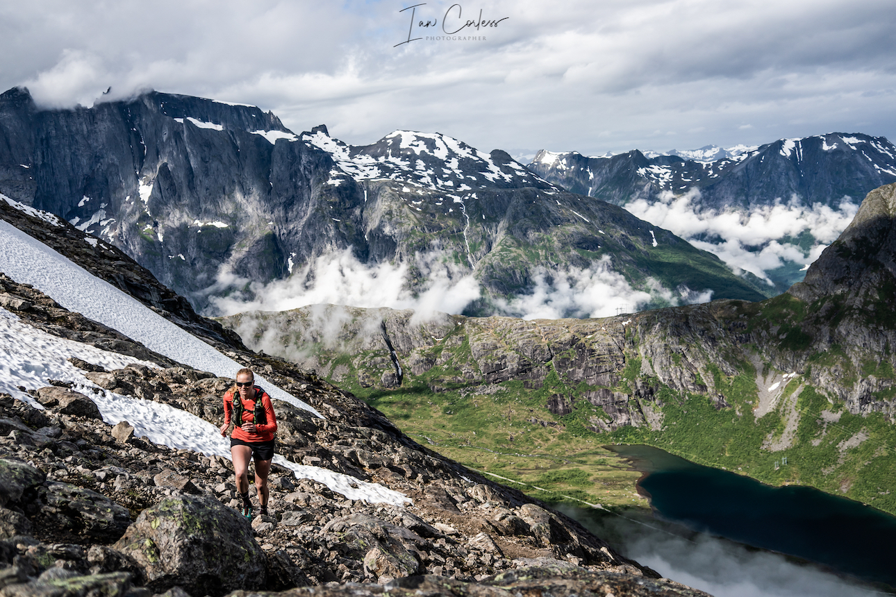
The weather forecast for the following was good and it was therefore decided we would summit Kyrkja first and then continue to Gjendebu. Abelone and Håkon would miss the summit go straight to Gjendebu and therefore miss out on the 2 to 3h detour.
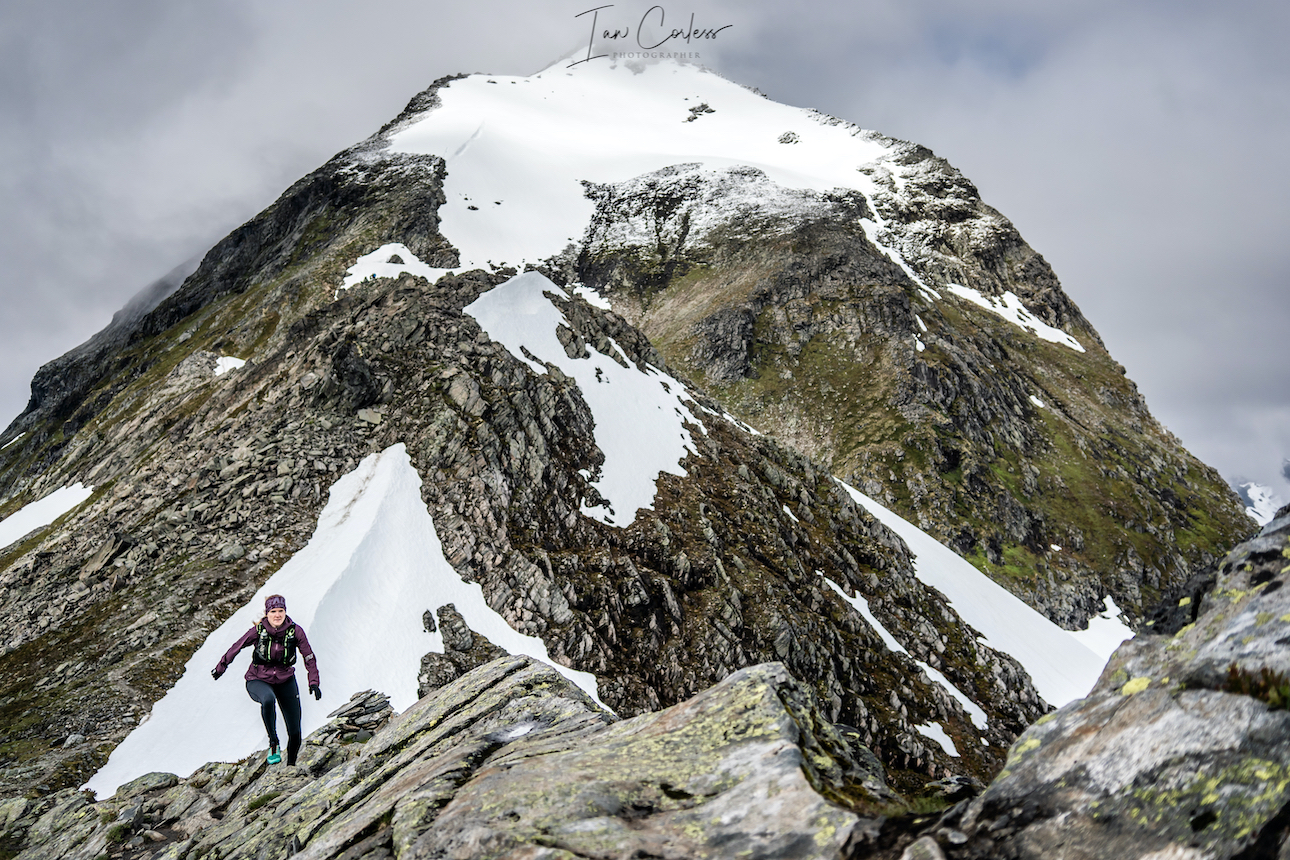
Day 4 – Leirvassbu to Gjendebu via Kyrkja
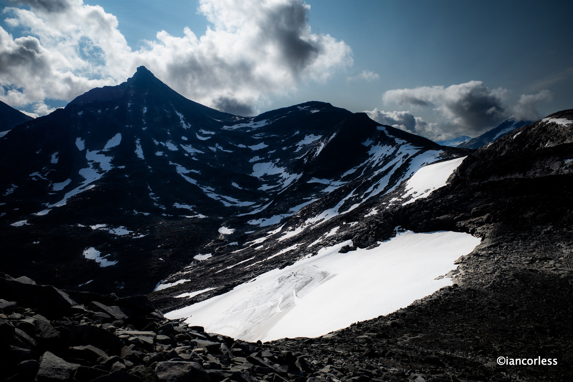
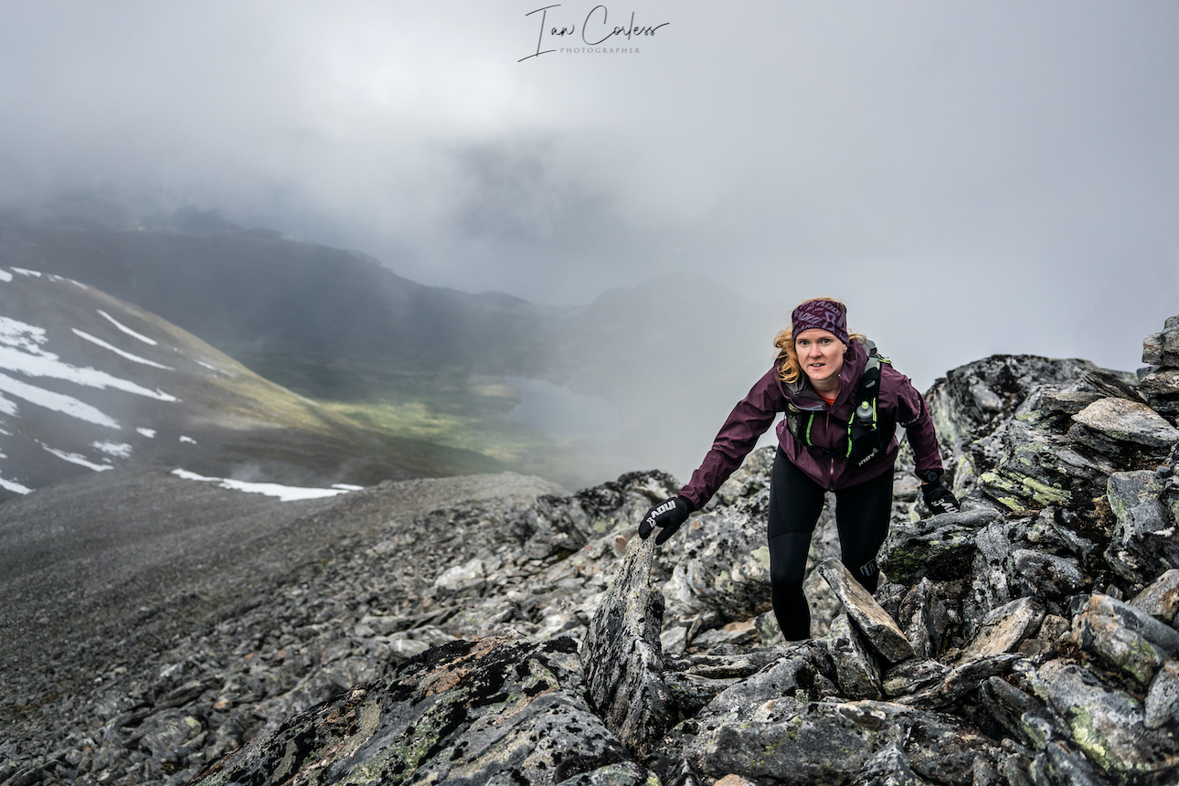
The weather gods did not disappoint. It was a stunning day and a perfect morning to climb Kyrkja.
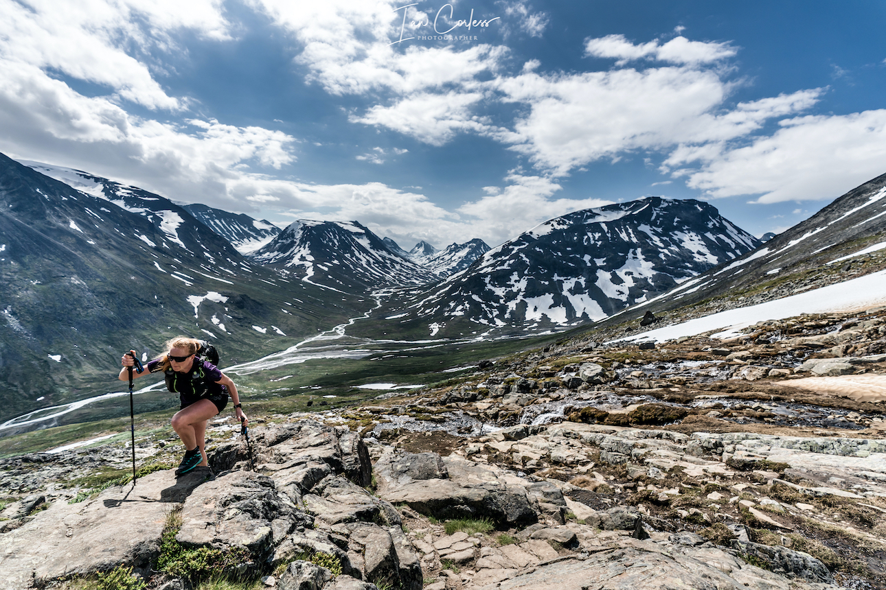
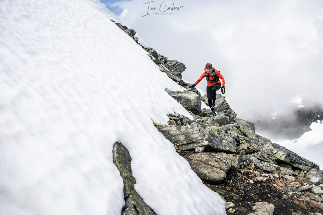
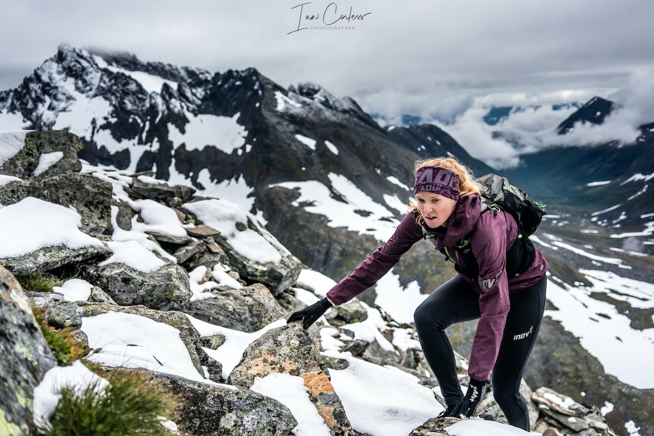
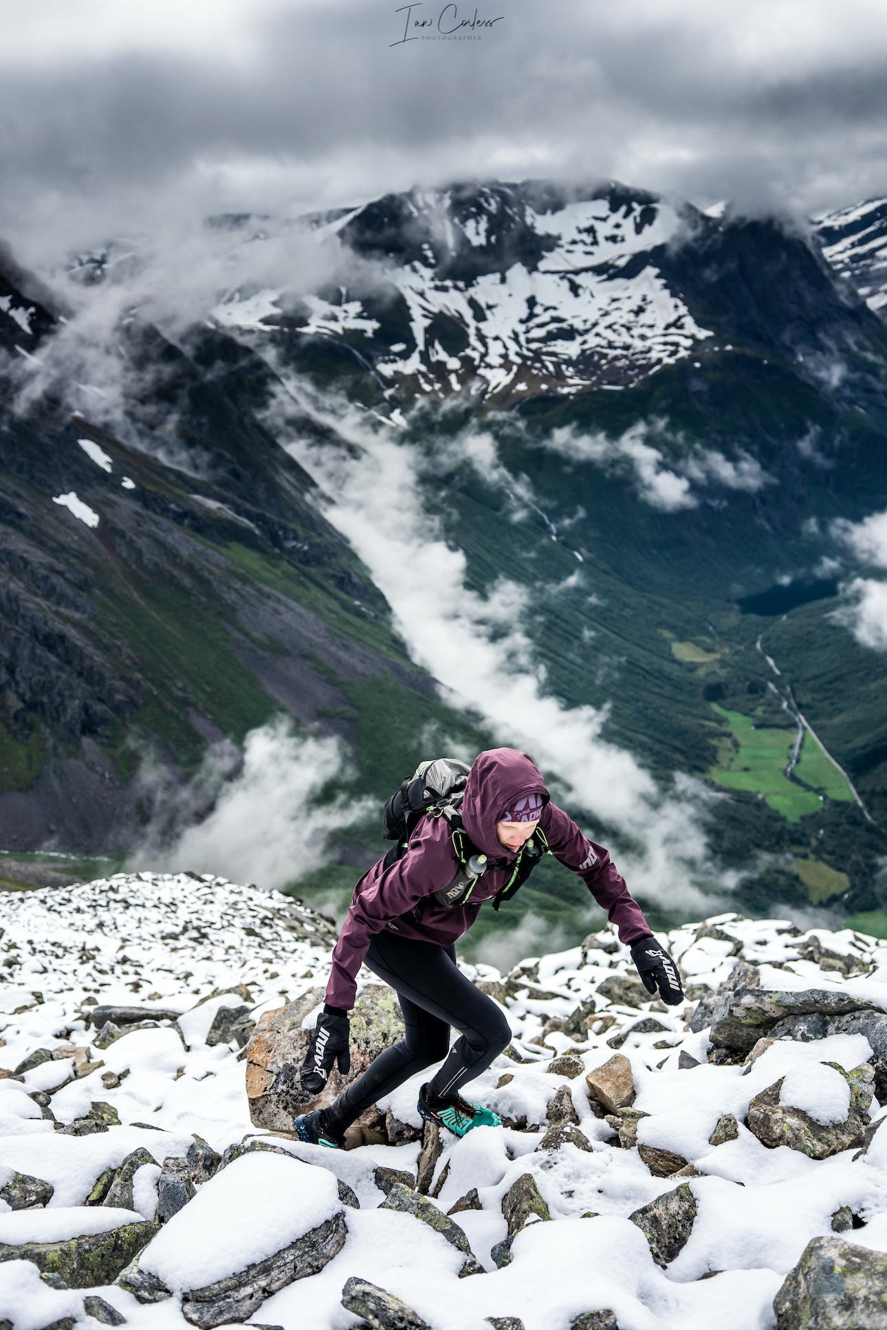
Abelone and Håkon left just before us they made their way to Gjendebu, we soon caught them, passed and then we started the climb to the summit. The early slopes mix trail, rock and snow crossing with boulders everywhere.
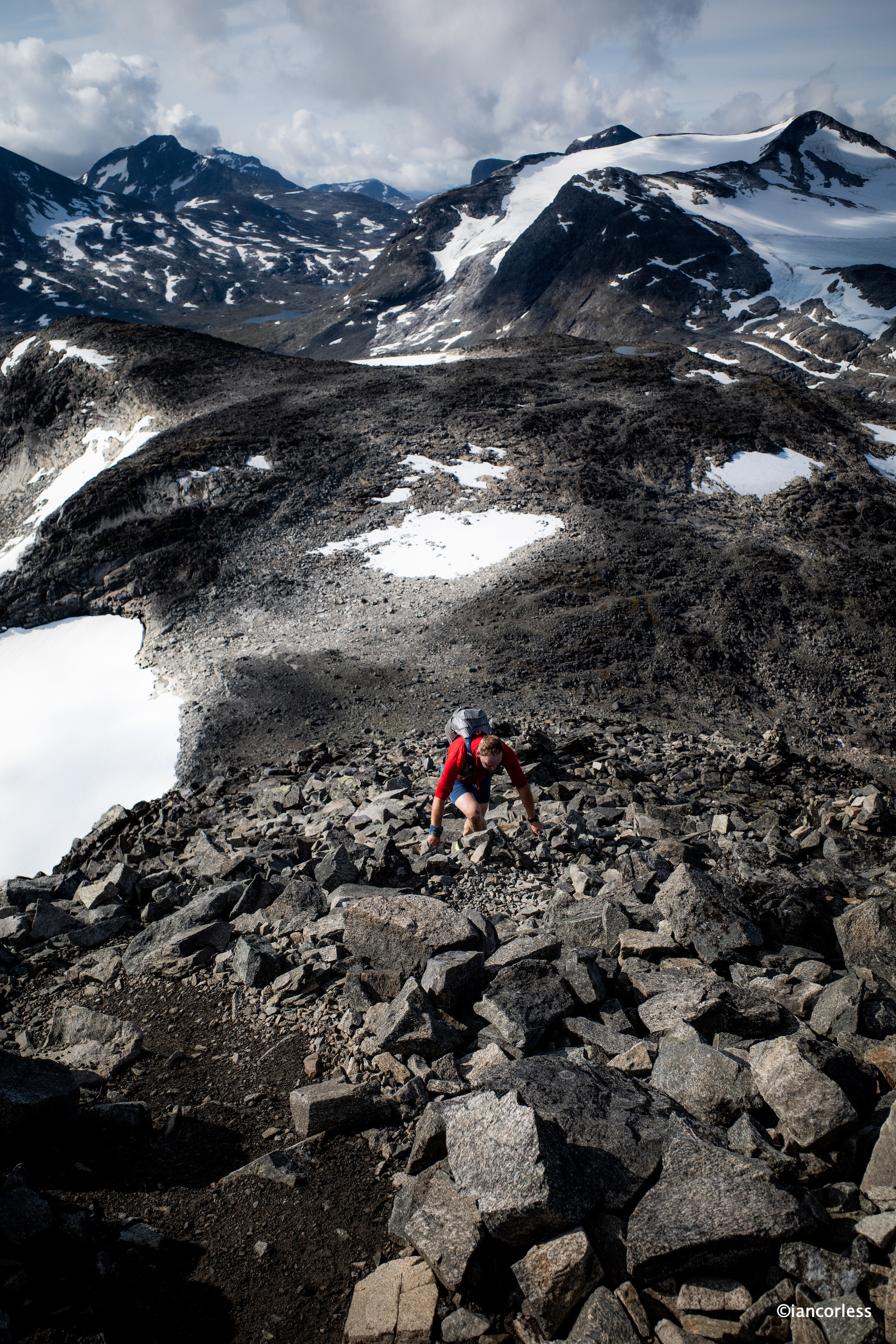
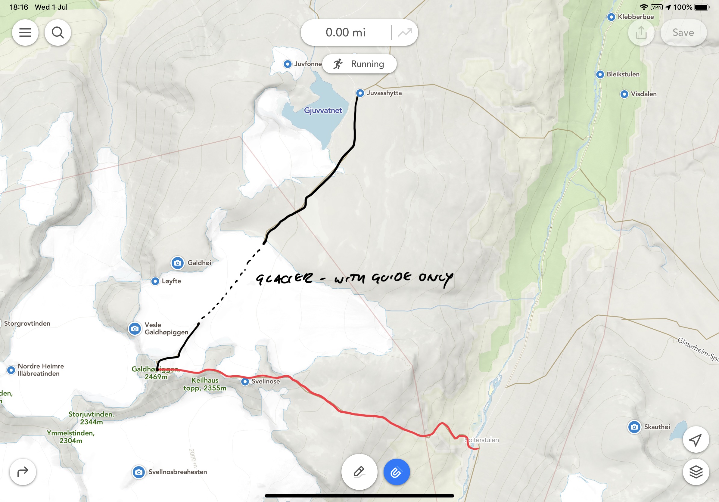
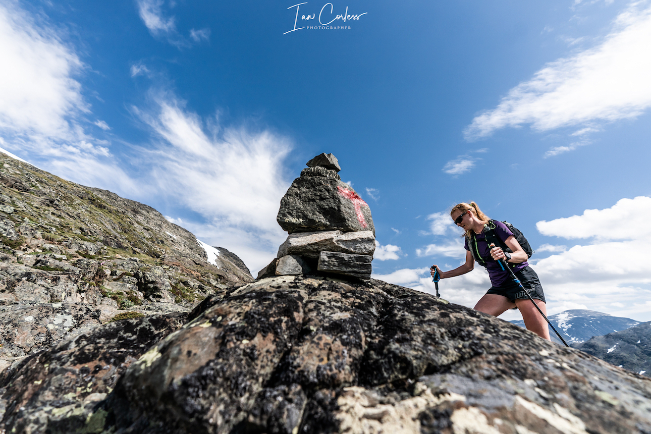
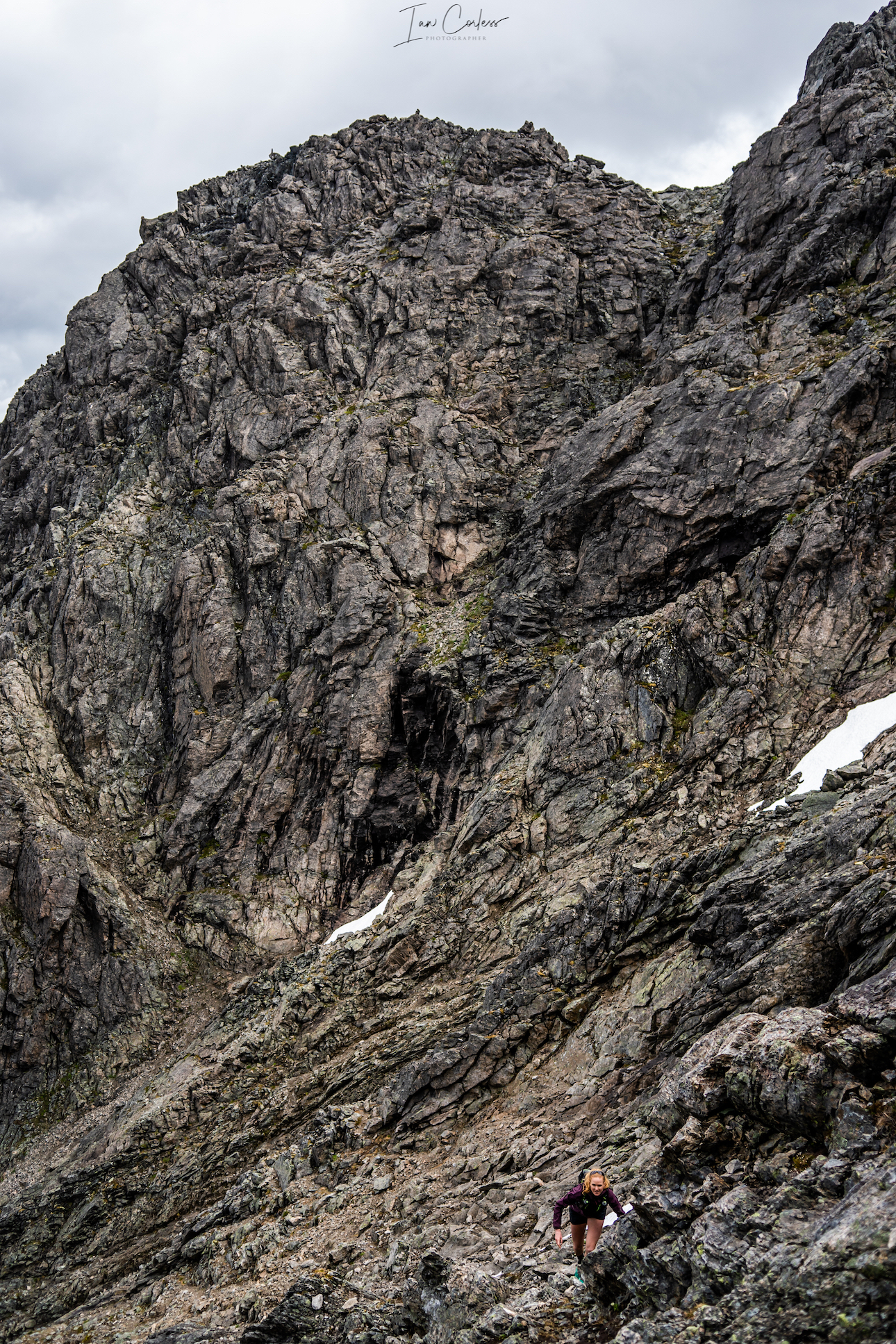
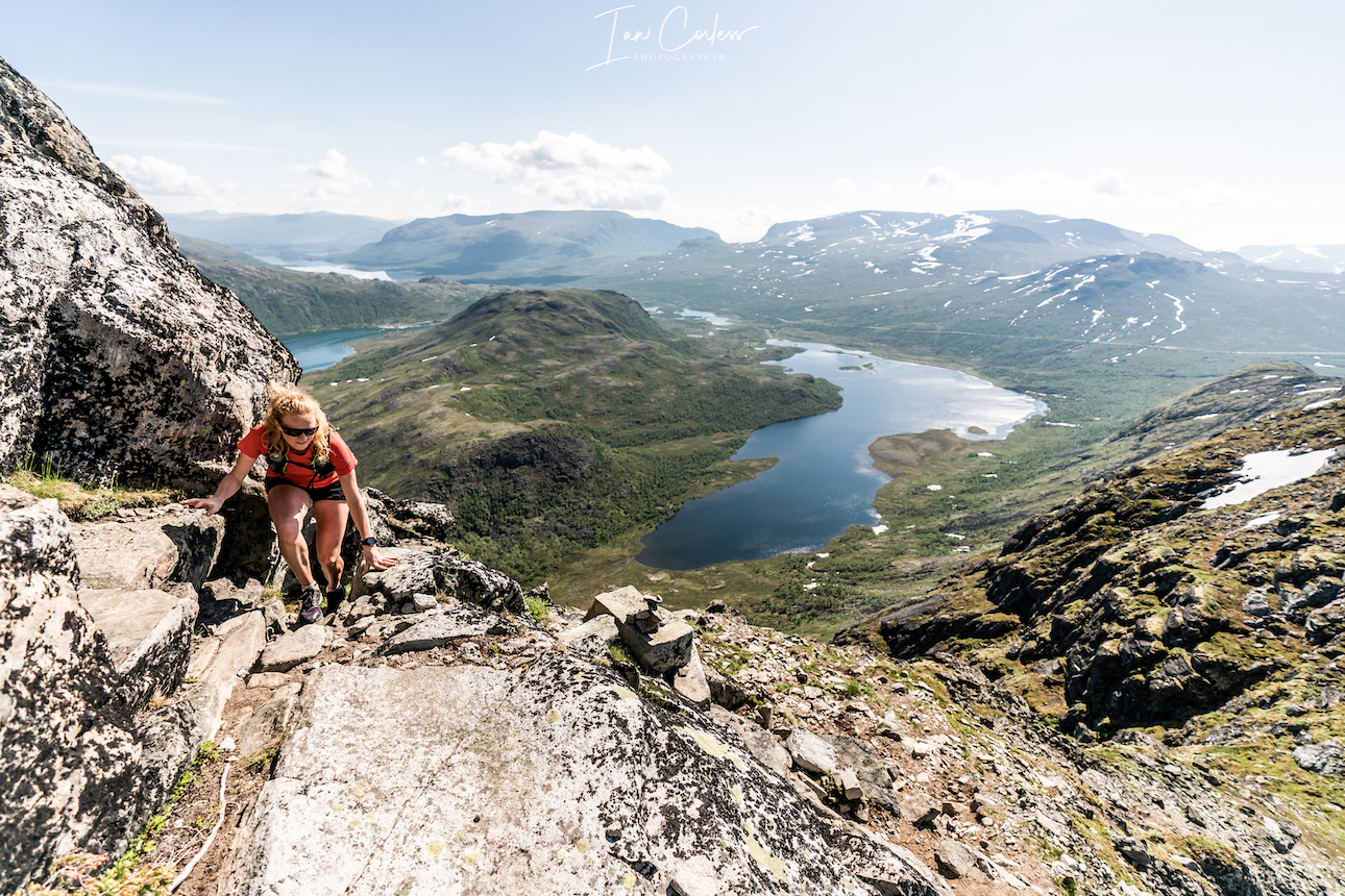
Once at the base of Kyrkja, the climb really starts and it’s a hands-on scramble to the summit. Cairns are placed regularly and at times the route is obvious. Other times, the route is vaguer.
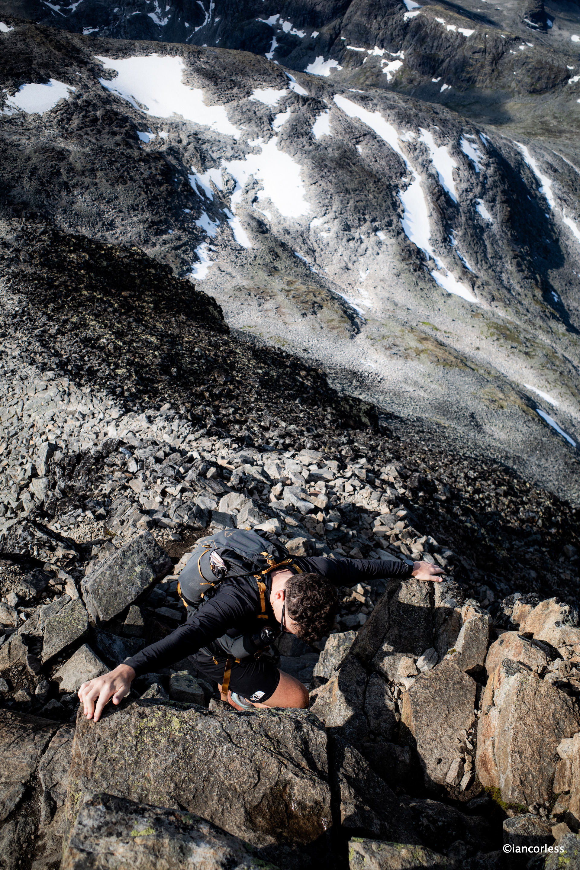
There are several sections with more exposure when sound had-holds, and secure foot-placing is essential. It’s not a difficult scramble but as with all these things, going at a calm and steady pace reaps rewards.
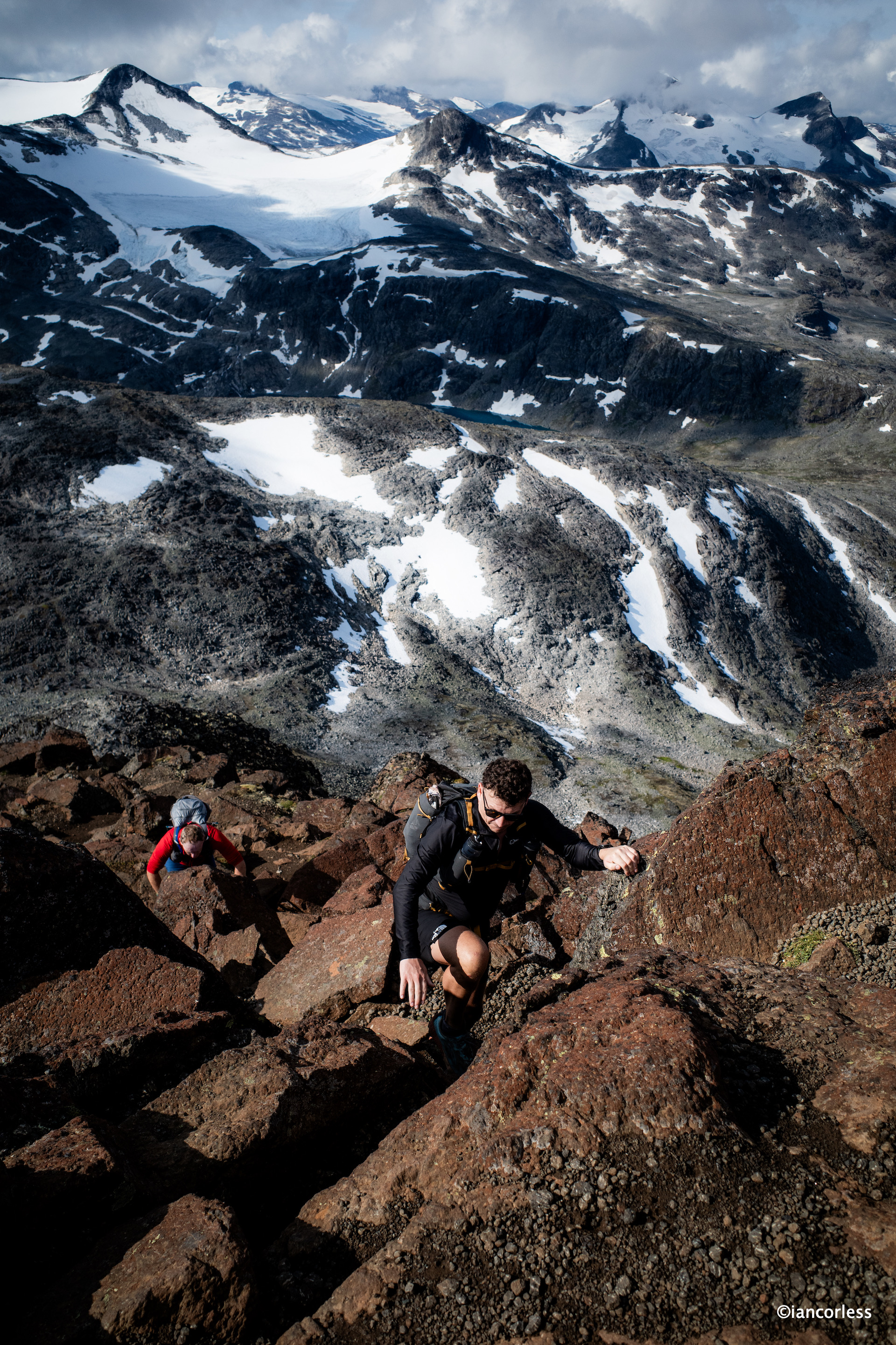
Geoff certainly felt pushed here. He is not too happy at heights, but he pushed on, listened to to best route options and before he knew it, he was with Baz at the summit.
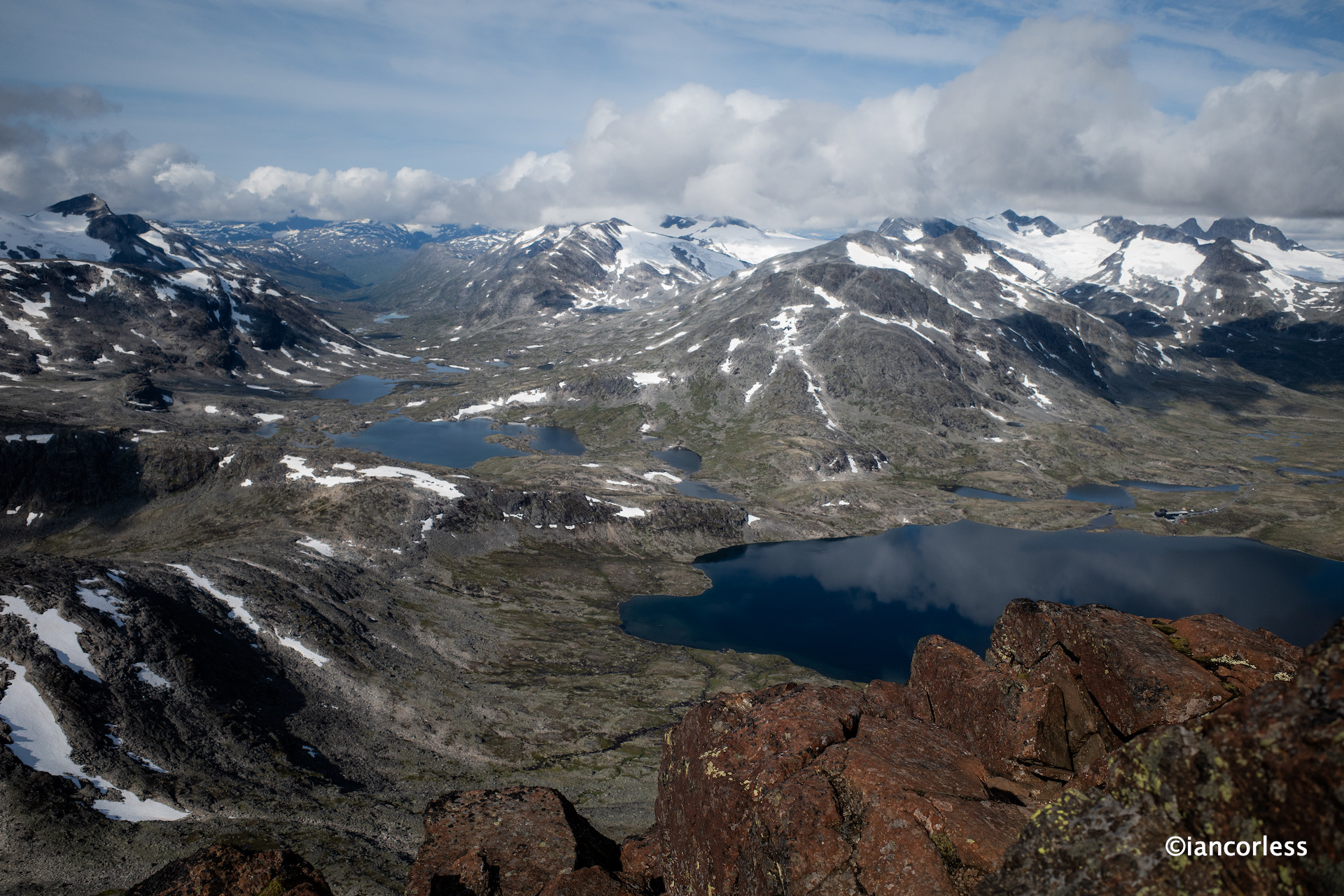
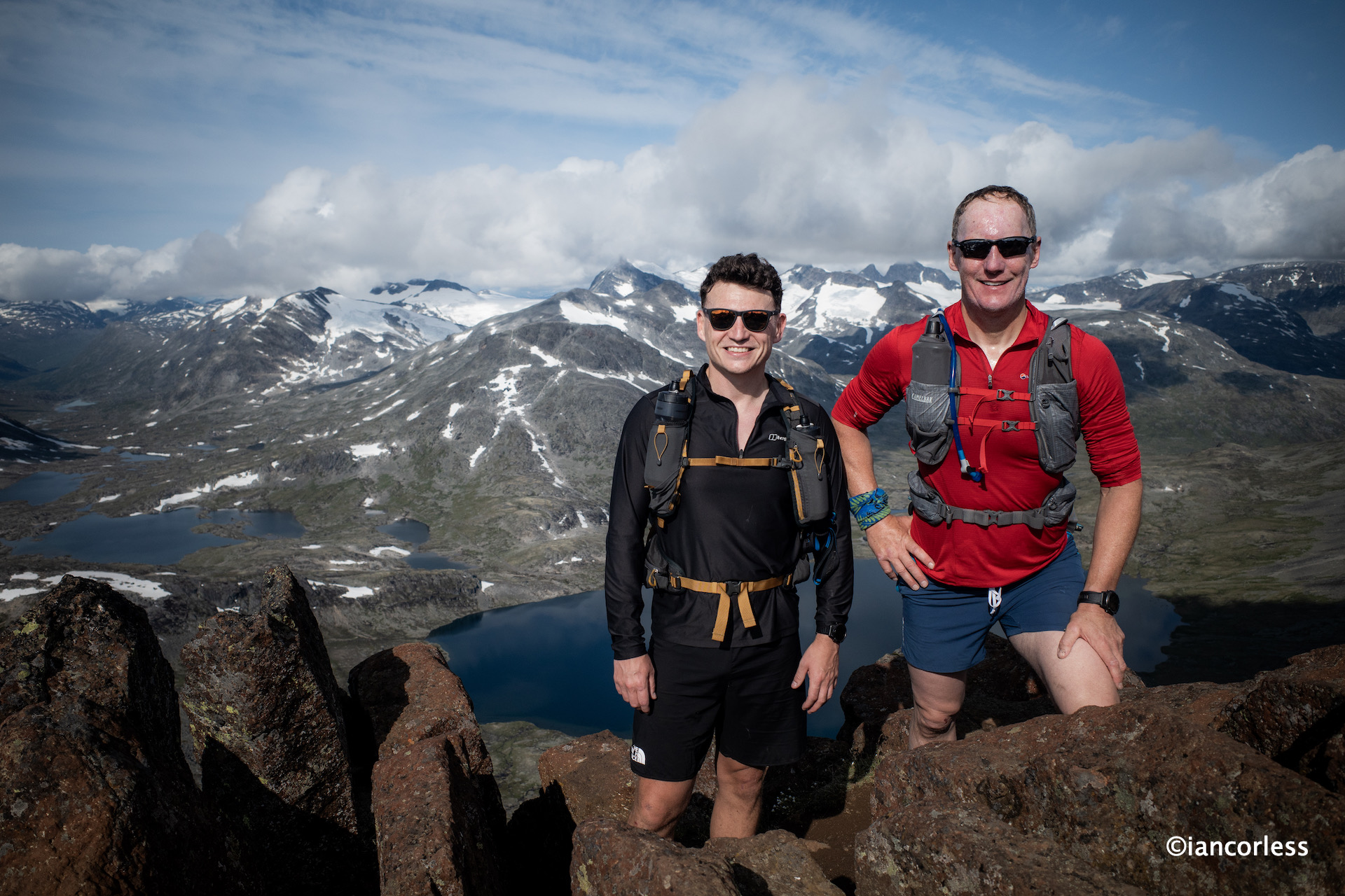
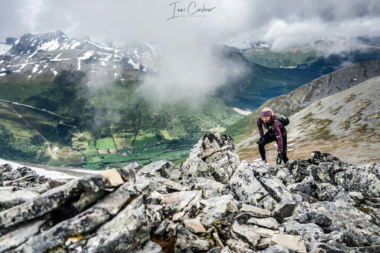
The 360 views here are quite magnificent. What goes up must come down and depending on your ability, head for heights and skill level, the downward route can be harder than the climb.

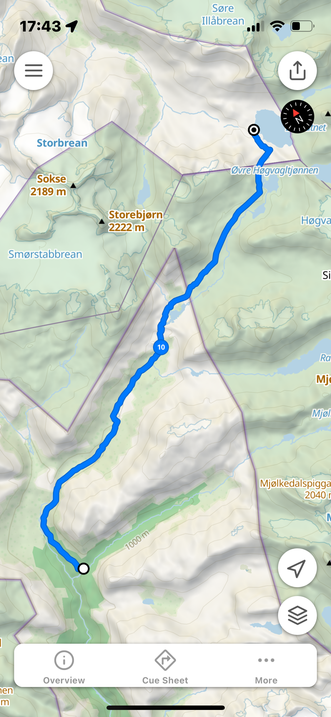
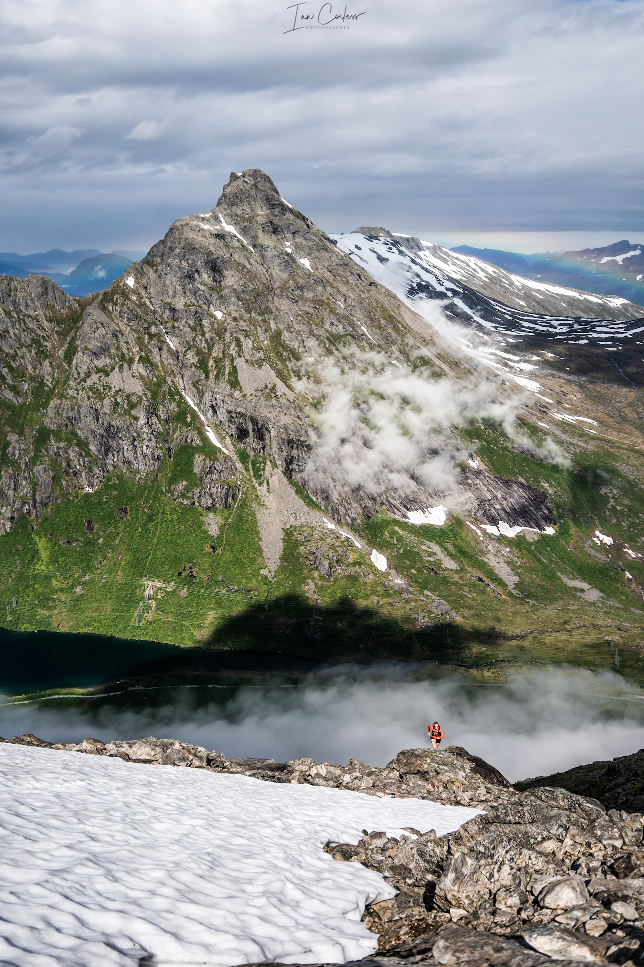
All three of us were soon at the bottom and re-tracing back on the trail to Leirvassbu and then at Høgvaglen we turned left and started to follow the red Ts on the route to Gjendebu.
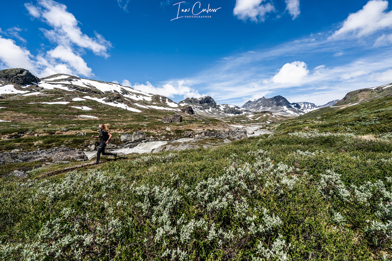
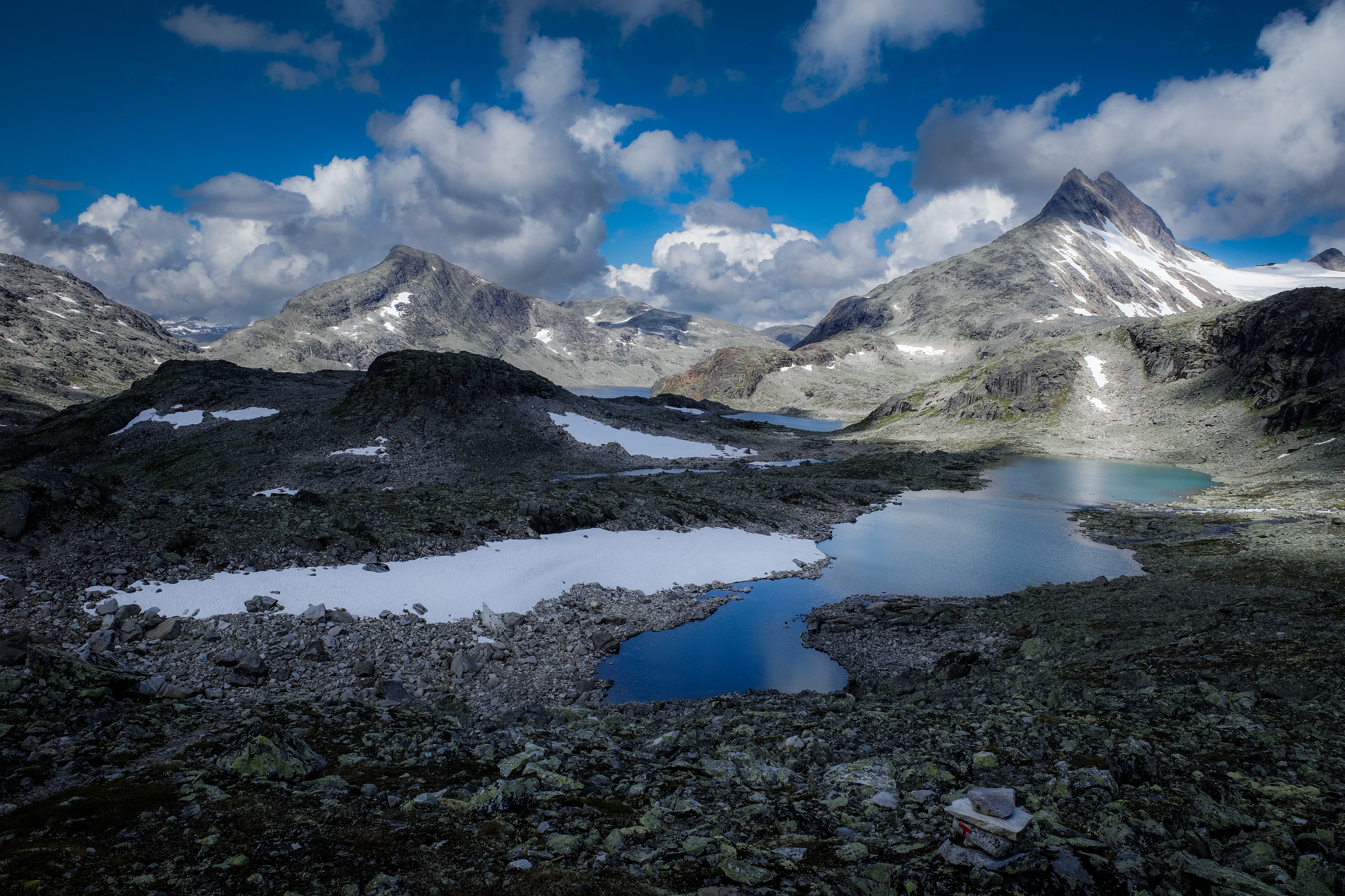
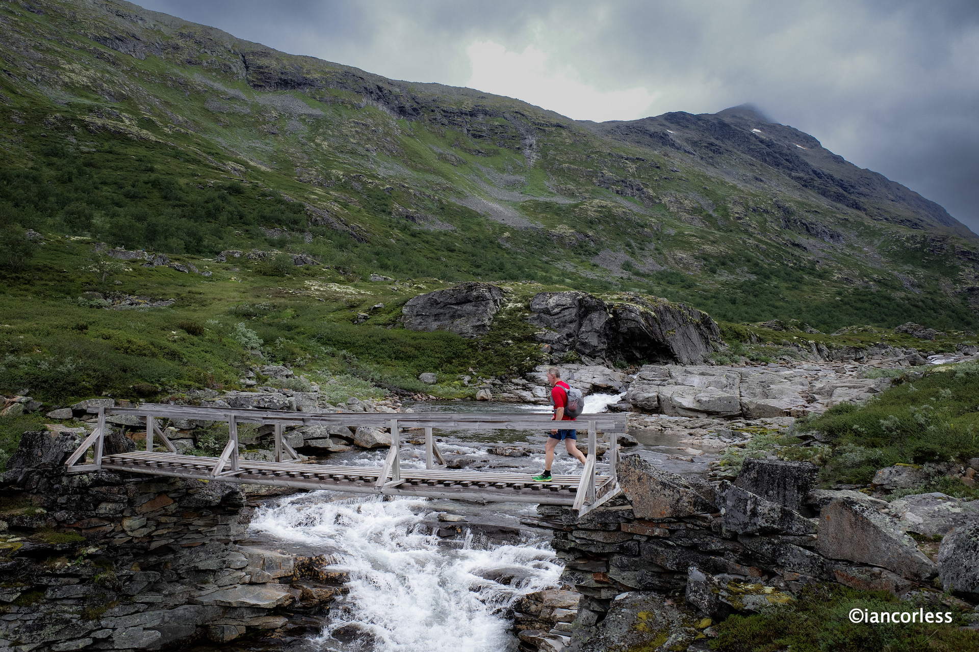
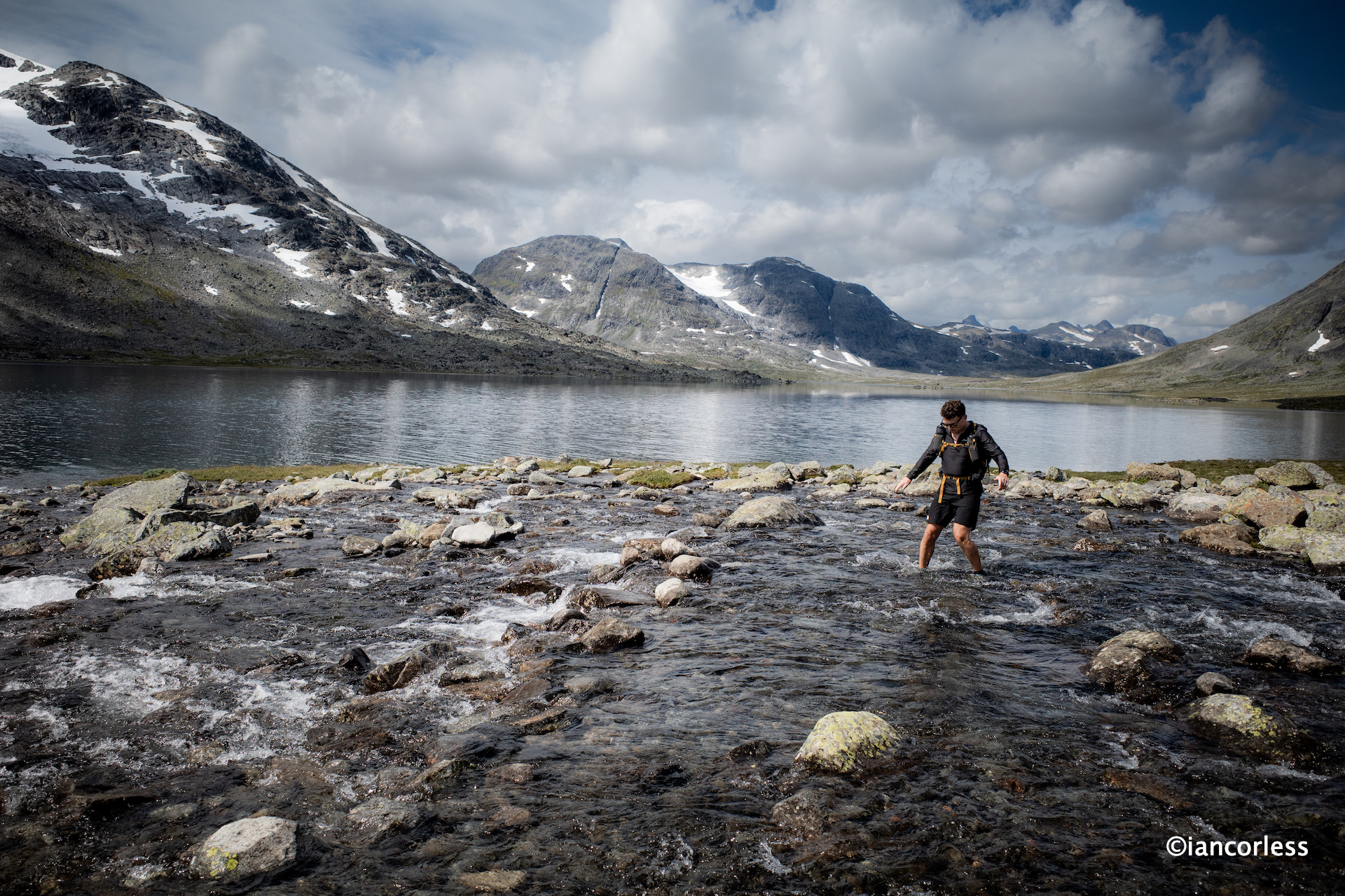
The route now is more runnable mixing rocky terrain, water crossing, fjell, single-track and of course mud.
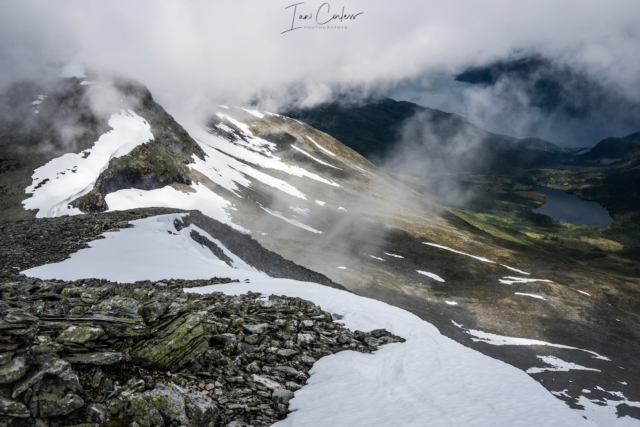
Passing three key lakes, Øvre Høgvagltjønnen, Nedre Høgvagltjønnen and Langvatnet we were soon descending next to Hellerfossen waterfall and then passing through Storåddalen.

The trails now were saturated and muddy and considerably greener than what we had experienced earlier in the day. There was also plenty of cows.
Before we knew it, we were running into Gjendebu after a stunning day of 25.69km, 741m of vert and 4h 42m on the clock. Baz and Geoff jumped in the lake, I got the beer in.
Sitting in the sun, I wondered where Abelone and Håkon where? I had absolutely expected them to be here before us BUT there had been a chance that we may, have caught them in the last km or so… Apparently, Håkon was on a mission to beat us, and he ran the final 3km! What an effort by him, incredible. We had expected them to take 6-hours, and they had taken 5, bravo!
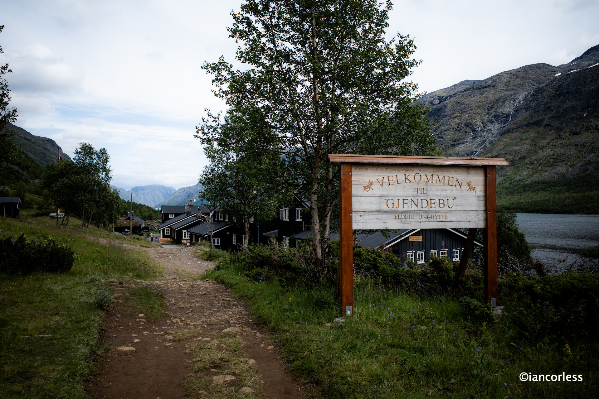
Gjendebu is a wonderful DNT and the oldest. It’s wonderfully traditional and recently refurbished. Comfort level is high, service superb and food excellent.
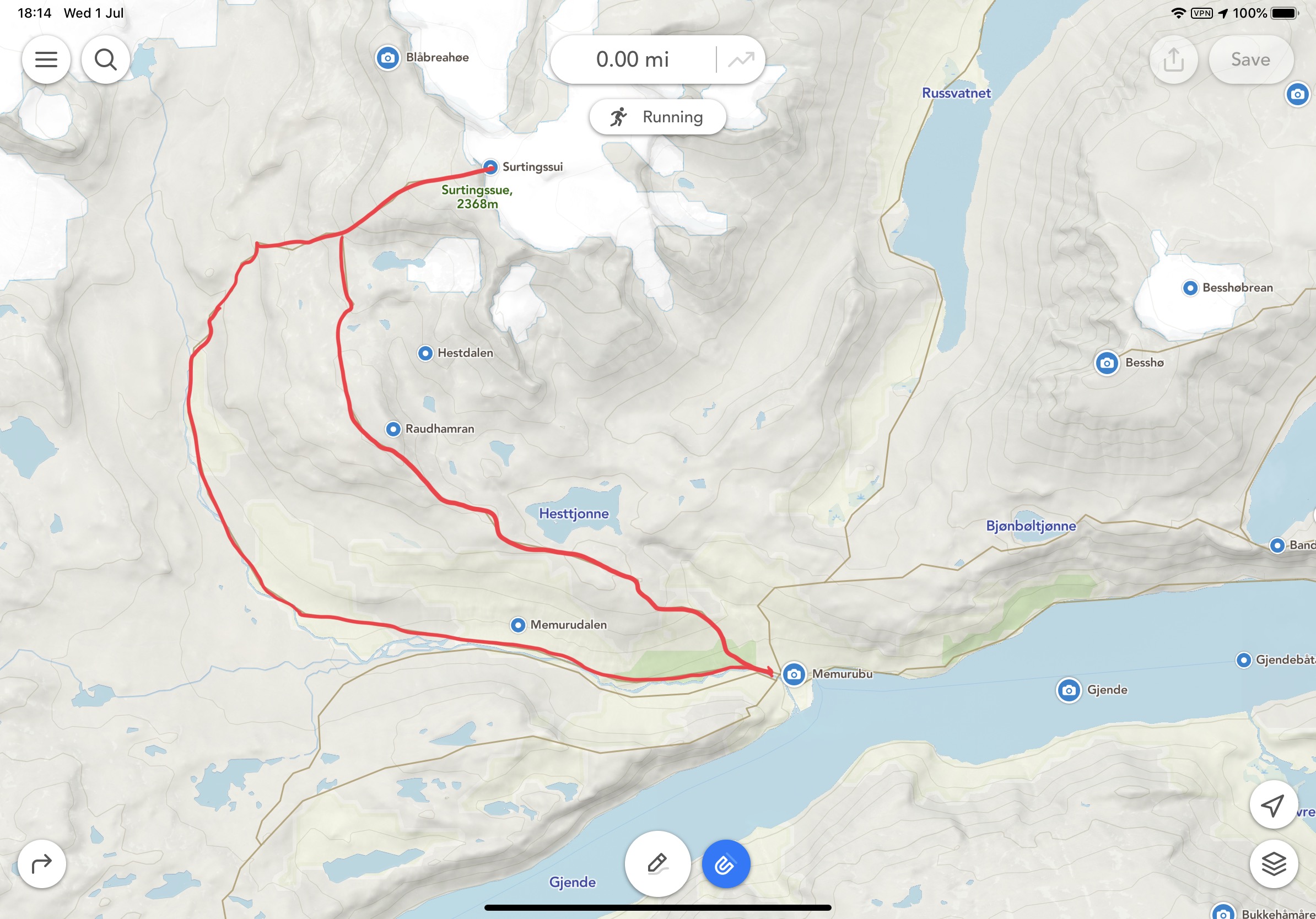
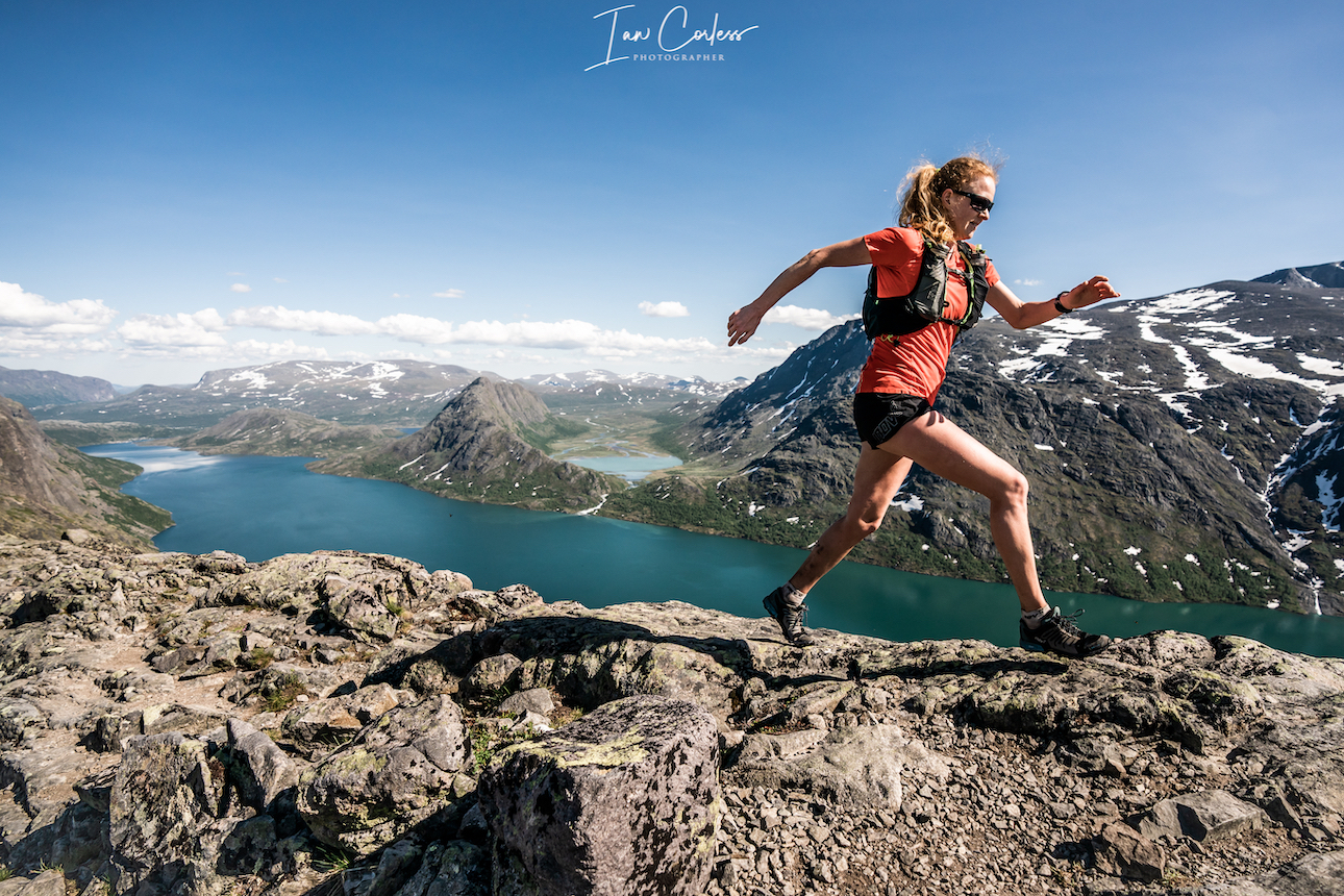
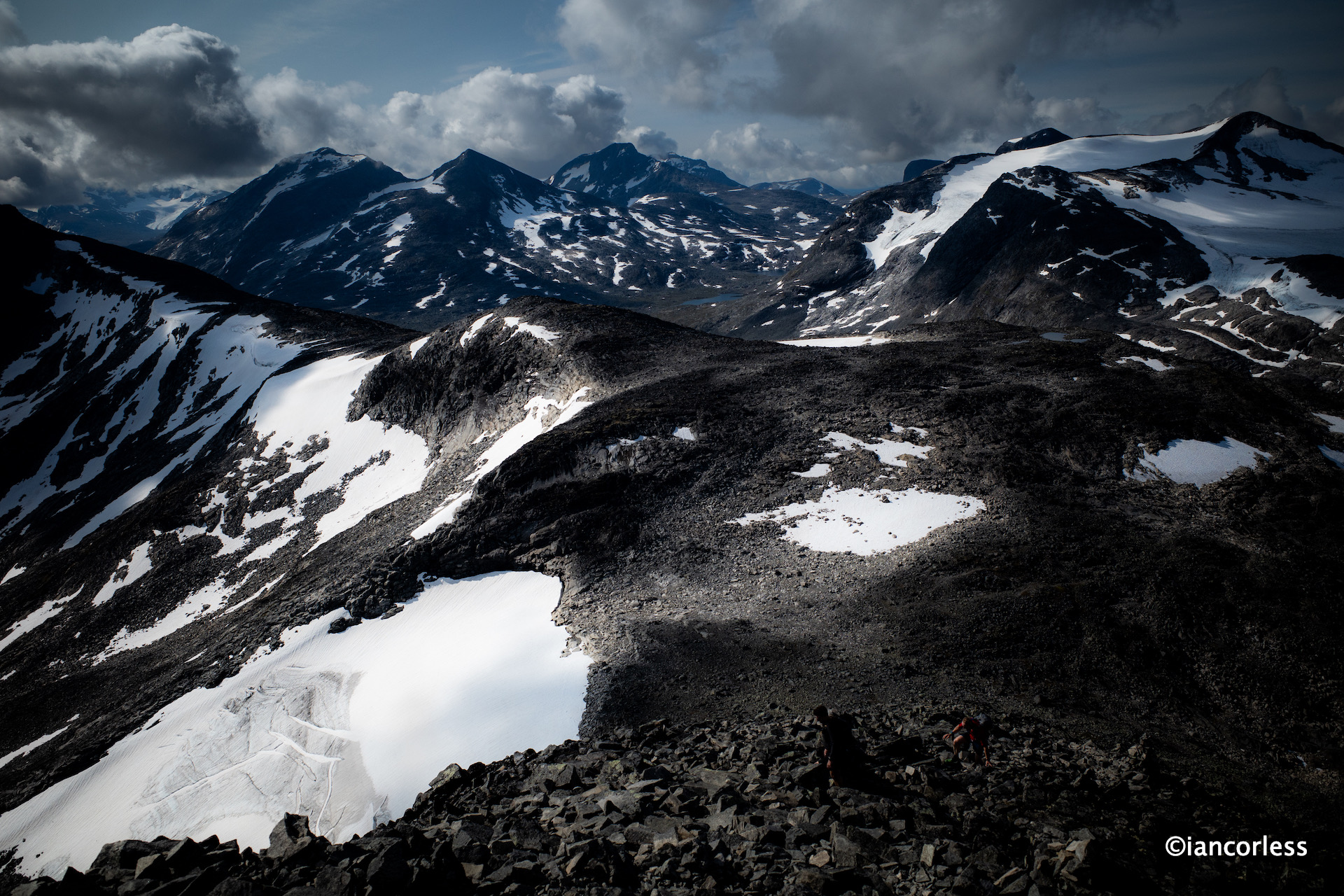
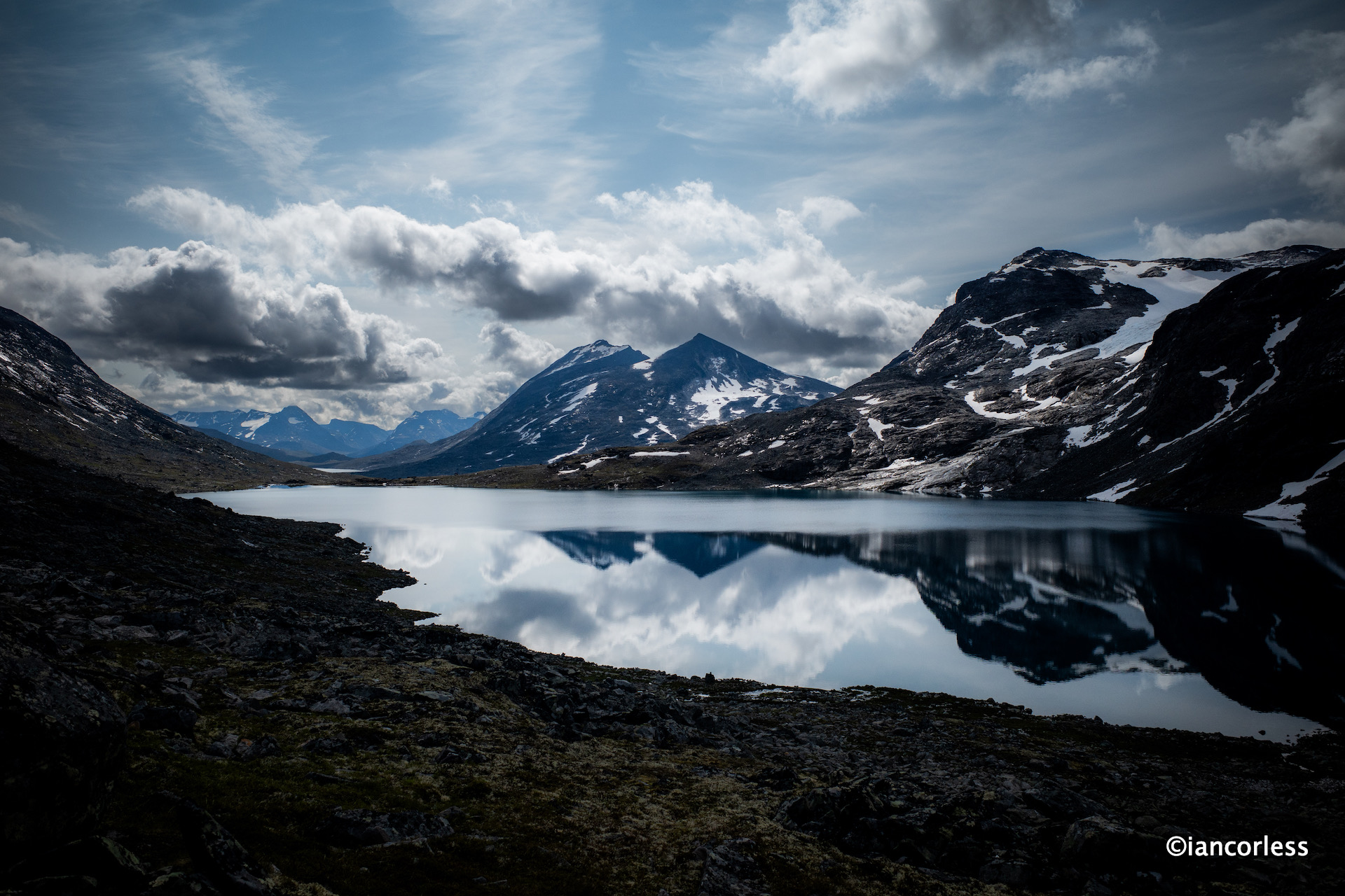
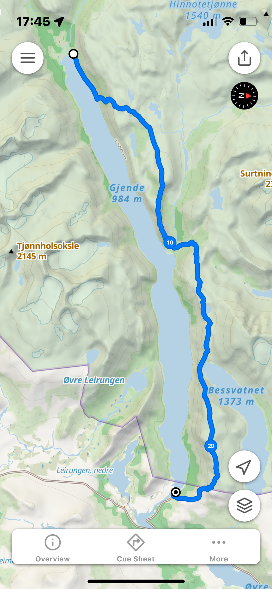
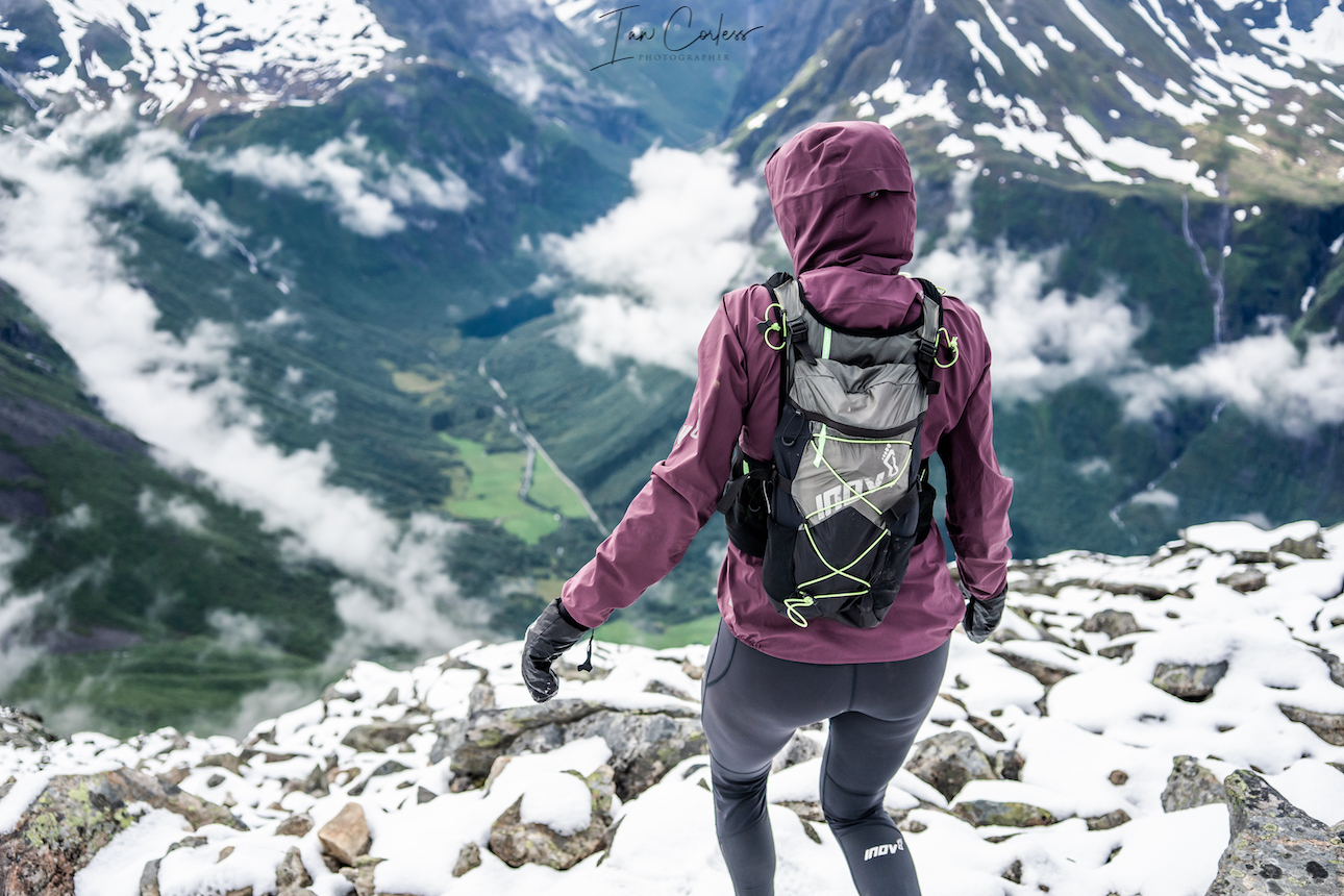
Day 5 – Gjendebu to Gjendesheim via Bukkelægret, Memurubu and Besseggen

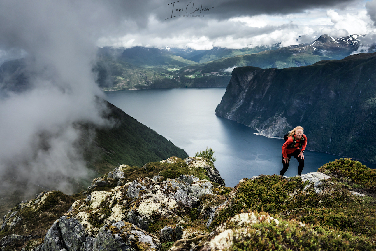
Leg 1 Gjendebu to Memurubu
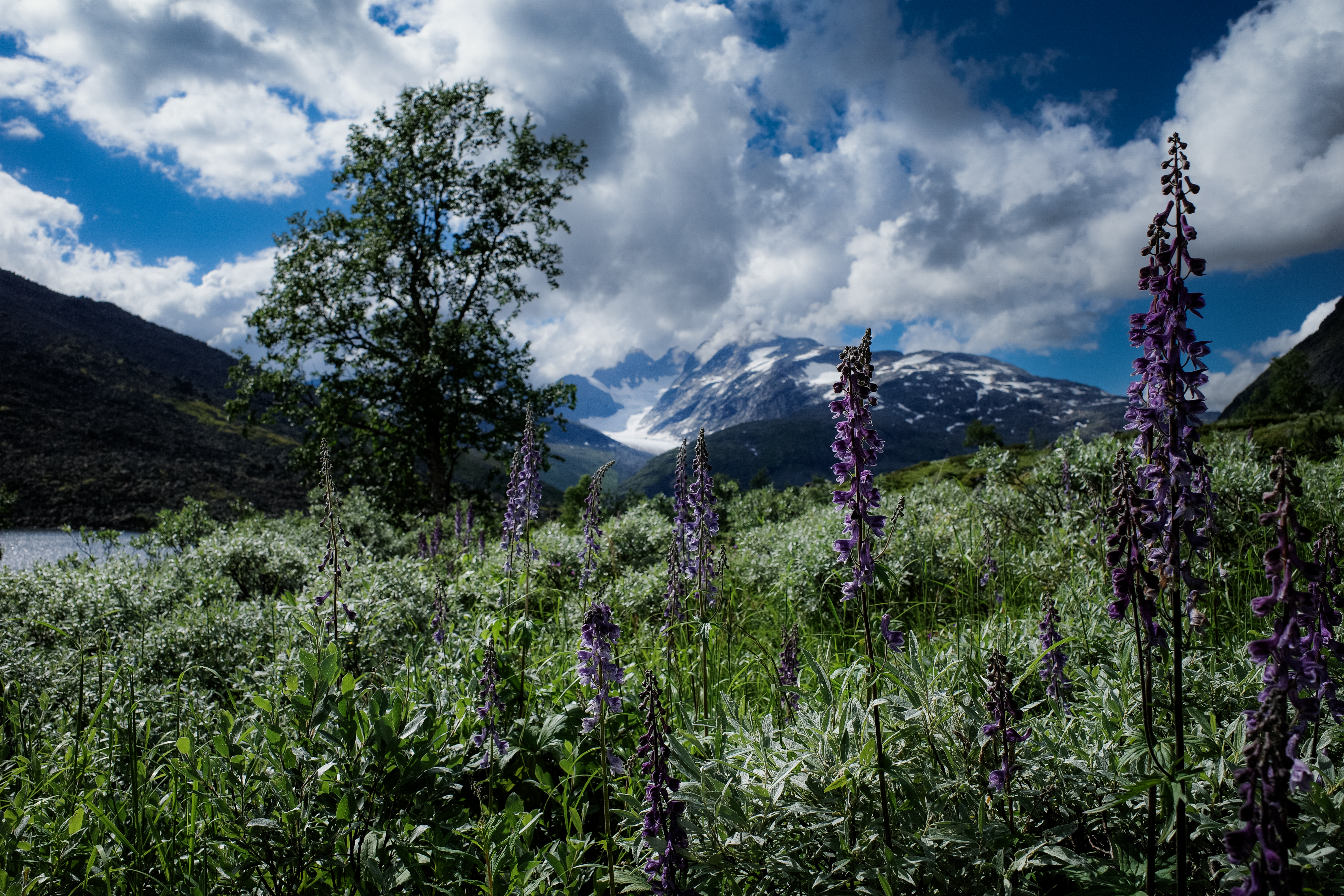
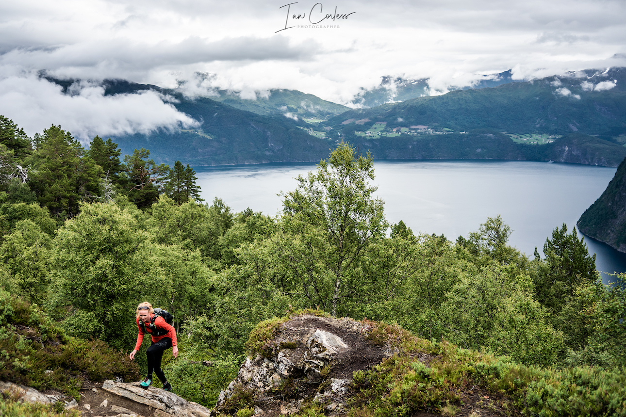
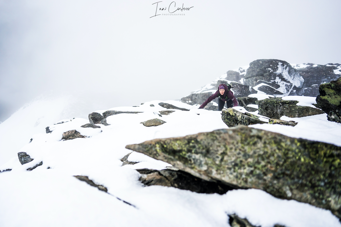
I took no photos for this day, the weather was too bad, so, enjoy the image above of a considerably better day with Abelone.
Our longest day ahead and the weather forecast was rain all day. We were committed with our route BUT as always, sense and forward thinking was key. Our route was a two-day route, Gjendebu to Memurubu one day and then Memurubu to Gjendesheim day two. To do the whole lot in one day does require a fast and light approach.
The first leg is 11km and at Memurubu we had the option to pick up the boat to our finish, should conditions deteriorate.
The early km’s follow a single-track rocky and muddy trail next to Gjende lake. After 4km you turn left and then steeply climb. This section, Bukkelægret, is renowned as being difficult, especially in bad weather due to the gradient, slippery rock and the multiple chain sections. UT.NO say, ‘Chains and railings in exposed places. NB: Do not go outside the marked path! It is the only possible decrease. It is better to walk in the opposite direction if you are afraid of heights or choose the longer route around Storådalen.’
The route up was fine and although the rain was constant, we were all warm and enjoying the climb.
Once at the top I made a silly navigation error. I turned right following a trail that leads towards Kjuklingen. Within less than a km I knew I was wrong. I stopped, took a moment and then Baz, Geoff and I backtracked. While running I looked to the right and could see the trail up the other side of the mountain and eventually, we picked back up the red T’s and we were back on track. A frustrating mistake but these things happen!
Travelling northeast into Lågtunga, between Grunnevatnet and Sjugurdtinntjønne and down over Sjugurdtinden. We had a stunning moment when we were confronted by a large male Reindeer. We dropped to a walk and approached slowly. At the time I expressed how unusual it was to see one alone. But, as we crested the summit, a herd of maybe 20-30 reindeer were visible, what a sight!
The final descent to Memurubu is steep, rocky and slippery – care is needed, especially in torrential rain.
At Memurubu we entered the cabin and took an ‘aid station’ break of warm coffee and buns. I changed base-layer to a dry merino top and prepared for the next section.
We had had rain all day so far, but it had been pleasant in type 2 kind of way. Baz and Geoff decided to wear tights, I stayed in shorts. The option to pull out and take the ferry was not really an option, we were committed to the task.
Leg 2 Memurubu to Gjendesheim
The climb out of Gjendebu is steep and I soon removed my jacket, there was a hint of better weather coming and I loudly said, ‘it is clearing up!’ Famous last words…
The jacket soon came back on, and the rain increased. I was now on my second set of gloves, good old Raynauds in the hands brutal in bad weather.
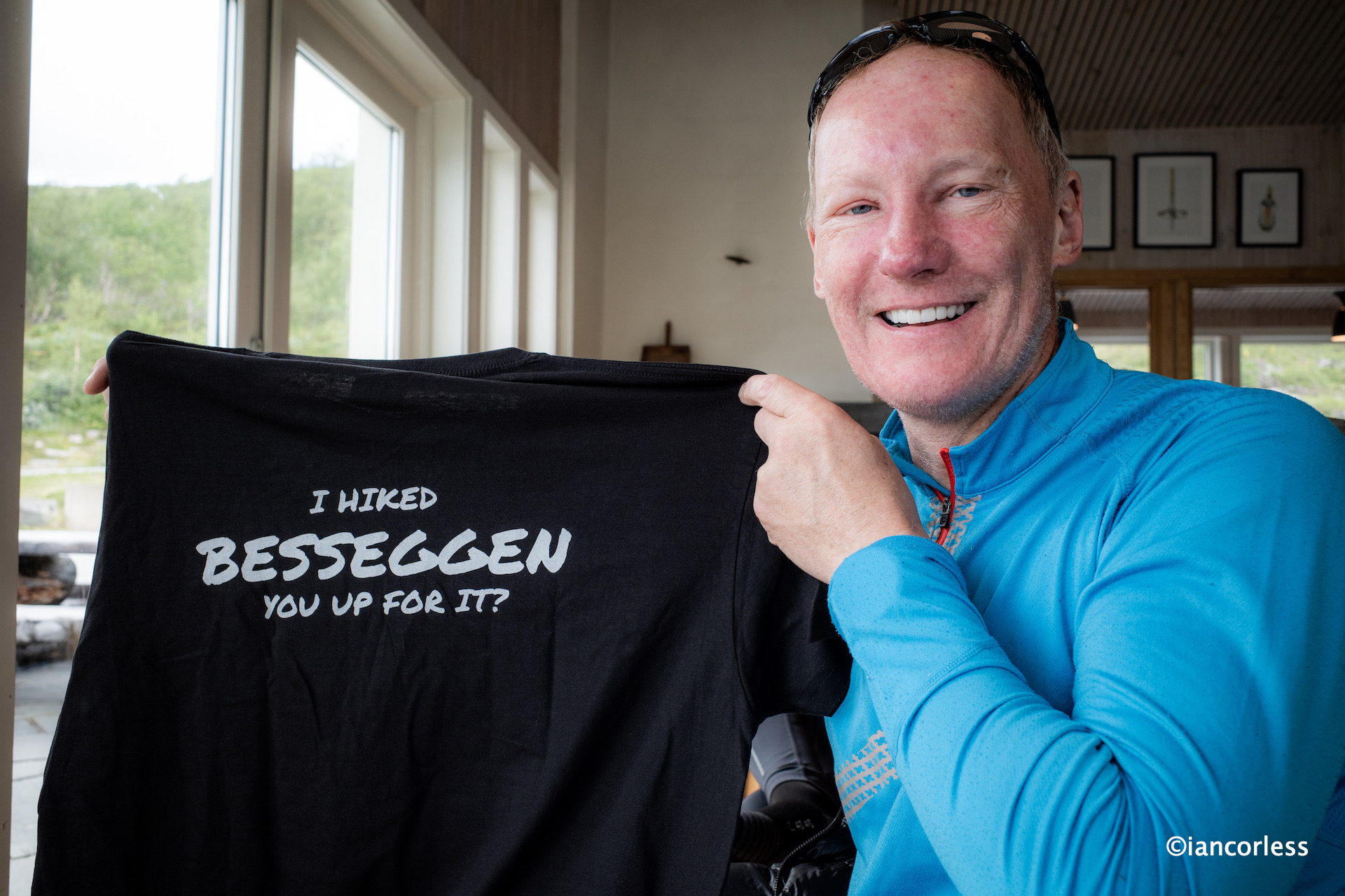
This route is one of the most popular in Norway. Many take the early boat to Memurubu from Gjendesheim and then return via Besseggen, an average time taking 7-hours. On a good day there are many, many people. Today, hardly anyone.
The terrain is hilly and rocky as we headed to the foot of Besshøe and then on to Bjørnbøltjønne, the highest point on the route before heading down to the southern end of Bessvatnet.
Now we were at Besseggen, the steep climb ahead of us and Geoff loudly saying, ‘Are we going up there…!’
I reassured him it was not as bad as it looked. However, the steep rock face has an extra challenge in the rain. We stared the climb and soon came across a group of teenagers frozen on the mountain unable to proceed. They were questioning the decision to come this way, and they asked Geoff what time the last boat was at Memurubu! Unfortunately, they would not make the last boat if they backtracked, however, the cabin would look after them.
Ahead I heard screaming and crying. It got louder as I climbed only to find a mother trying to climb with a young girl who was beyond terrified. I offered help but it was refused. ‘We will be fine; she is just very anxious and scared.’ No shit I thought to myself. As I climbed up, I saw her husband and another child. They had back-up help but I stopped multiple times to make sure that I was not leaving a potentially disastrous situation.
Geoff and Baz were making good headway, every 5 to 10m I would stop and make sure their line was good.
The 350 meter climb up to the top cairn on Veslfjellet 1743m soon passed and now the weather was wild.
Wind was raging in from the right, the rain was torrential and the visibility poor.
We regrouped and I clearly expressed that we NEEDED to move. It was no stopping and all running now down the, at times, steep and rocky descent to Gjendesheim.
This was without doubt the hardest hour of the whole week and clearly demonstrated how Norway, as beautiful as it is, can turn wild and violent.
Soon we were on the final stone steps that lead to the DNT and lake Gjende.
We were absolutely soaked and exhilarated with the day. It was true Norwegian mountain day, and we had completed the whole 26.1km with 1800m vertical in 6h 30m on what was a very tough and slow day.
All three of showered for a good 15-minutes. A cold beer followed quickly and before we knew it, we had another wonderful 3-course meal with Reindeer as the main course.
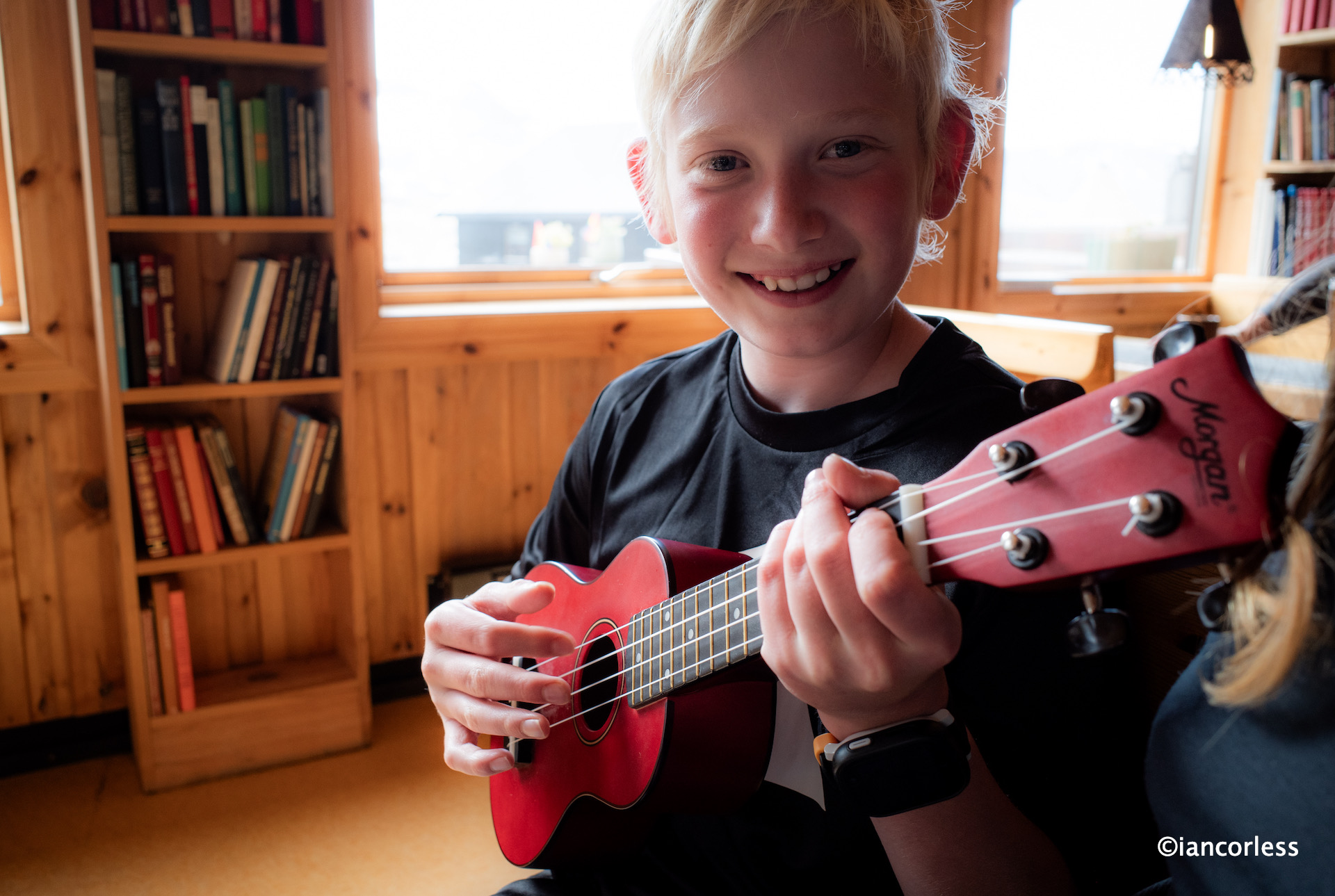
The evening was chilled and relaxed. We had a short concert of traditional music, and we discussed the completed adventure.
My offer for a following morning run was very quickly turned down.
A good sleep and the following day we departed at 1400 for a direct bus to Oslo and onward travel.
What a stunning week!
Thoughts and Summary
For me, there is no better way to travel through the mountains of Norway than by cabin-to-cabin. What the DNT offer is a five-star service and it really is a privilege to have this available. A shower, a bed, hot meals and a drying room for apparel and shoes is stunning.
Few people travel fast and light, they prefer to move at a slower pace with loads of equipment and take long stops and plenty of sight-seeing.
However, fast and light allows for a faster pace, the option to cover more distance and ultimately, more relaxation times in the cabins.
You do need to be experienced and prepared to move in this way.
In sunny and beautiful weather, fast and light is easy. In bad weather you need to be prepared, constantly making judgement calls and adjusting speed so as to ensure you are safe. Our final day a prime example.
We were well prepared and all three of us had the right and correct equipment for the planned adventure. The option to change a base layer at Memurubu for me was spot on, as was the decision for Baz and Geoff to move out of shorts and into tights. Despite the torrential rain, wind and colder temperatures, all three of us still had emergency layers of insulated jacket, waterproof pants and a bivvy bag available in our packs.
We all brought poles and on day 1 we used them a great deal, less so after. Geoff broke a pole on day 1 which was frustrating. However, when finished, Geoff said he would not bring poles next time. I understand his thought process, but, the additional weight of just over 200g is an excellent security blanket if moving slower or picking up an injury. Just learn how to use pols before.
Due to the nature of the DNT layout, sometimes we were not in the main building, and we all wished we had brought some very light flip-flops. I am now searching the internet for the lightest and most practical.
Good shoes are essential and normally I would never say YOU MUST get these shoes, but VJ Sport shoes and the amazing Butyl outsole are the only run shoes that can be relied on for Norwegian rock, especially when wet. Geoff and I wore VJ, me in the MAXx2 and Geoff in the Ultra. Gaz wore Altra and he had no grip – it compromised his enjoyment.
Norwegians have a saying, there is no bad weather, just bad equipment. It’s very true. We had mixed weather for our trip and in all honesty, it made the trip better. I never took my camera out on the last day as the weather was so bad, but I absolutely loved the challenge of making that route in bad conditions. Just a shame Geoff and Baz did not get to see those iconic Besseggen views down the lake and the surrounding area.
Finally, if you are interested in joining us in July 2025 for a similar journey, please get in touch. We will have 8-places available.
Follow on:
Instagram – @iancorlessphotography
Twitter – @talkultra
facebook.com/iancorlessphotography
Web – www.iancorless.com
Web – www.iancorlessphotography.com
Image sales –www.iancorless.photoshelter.com


 Wild camp close to Vengjedalssetra, we suggest you go near Venjesdalsvatnet lake, there are some great camp spots at the top closer to Romsdalshornet and you have access to water.
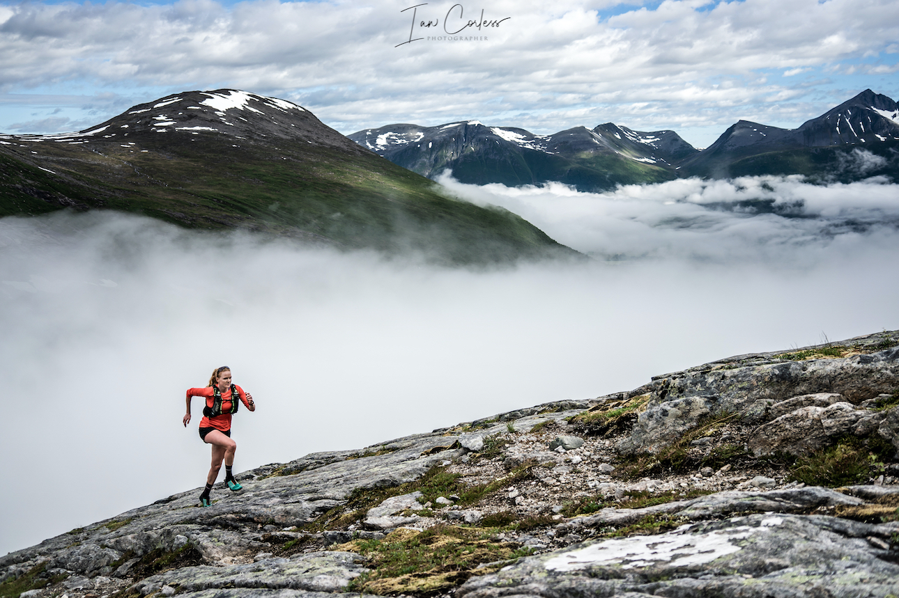
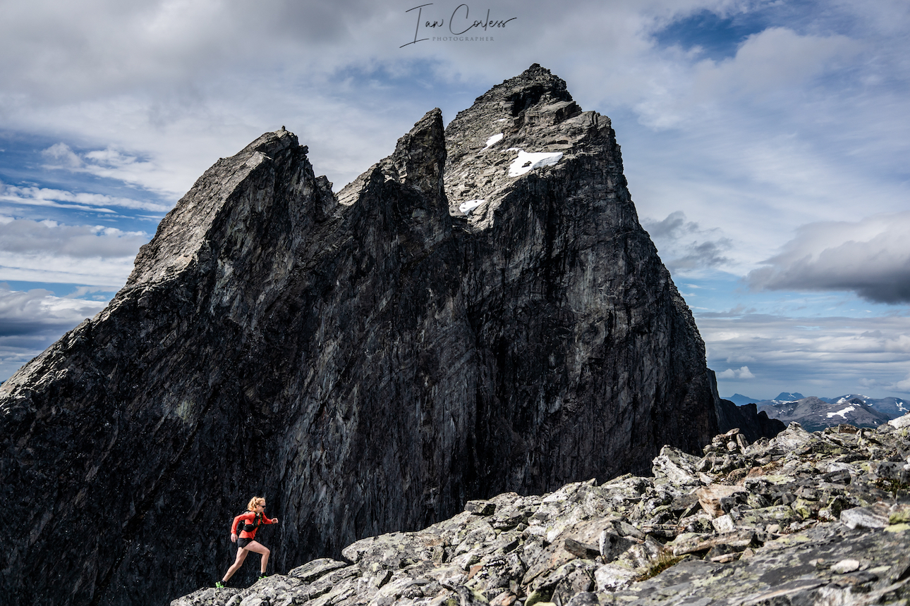
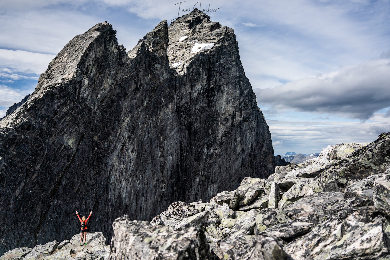
 You can access Romsdalshornet route from the same wild camping place next to the Venjesdalsvatnet lake. However, if you are going to have a clear and calm night, we strongly recommend that you start the climb to Romsdalshornet and wild camp close to Litlefjellet. There are a couple of small pools here and stunning views of the ‘Troll Wall.’ Amazing at sunset and sunrise.
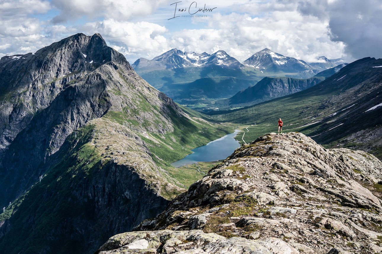
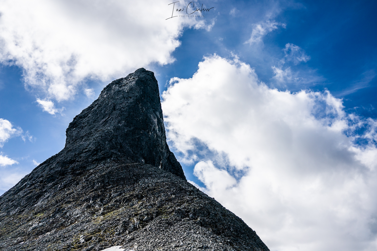
 The Troll Wall is the tallest vertical rock face in Europe, about 1,100 meters (3,600
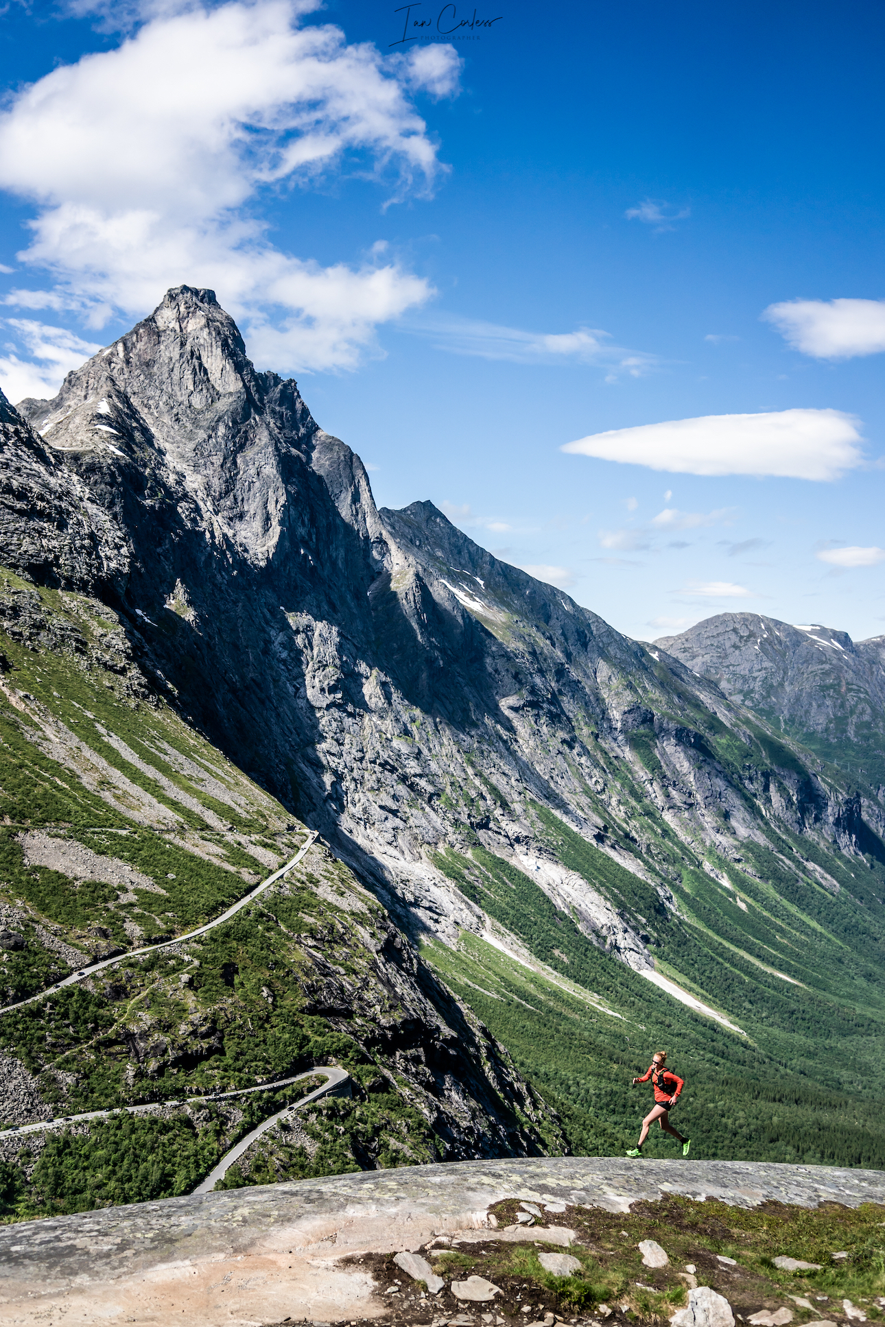
 The journey to Stranda should not take to look from Trollstigen, expect 90-minutes, however, you will need to take a ferry on the final leg. After many day’s camping and the mountains, now is a good time to spend a night in a hotel.
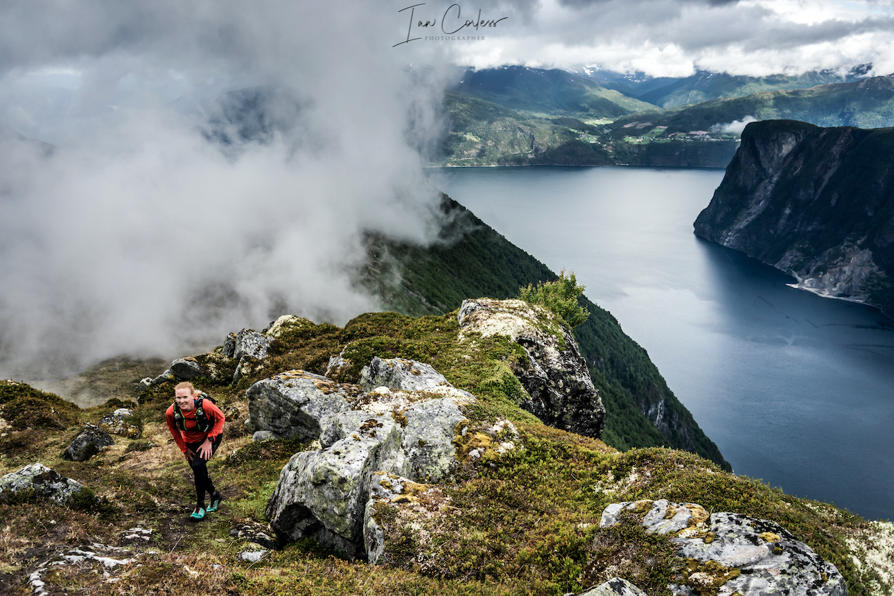
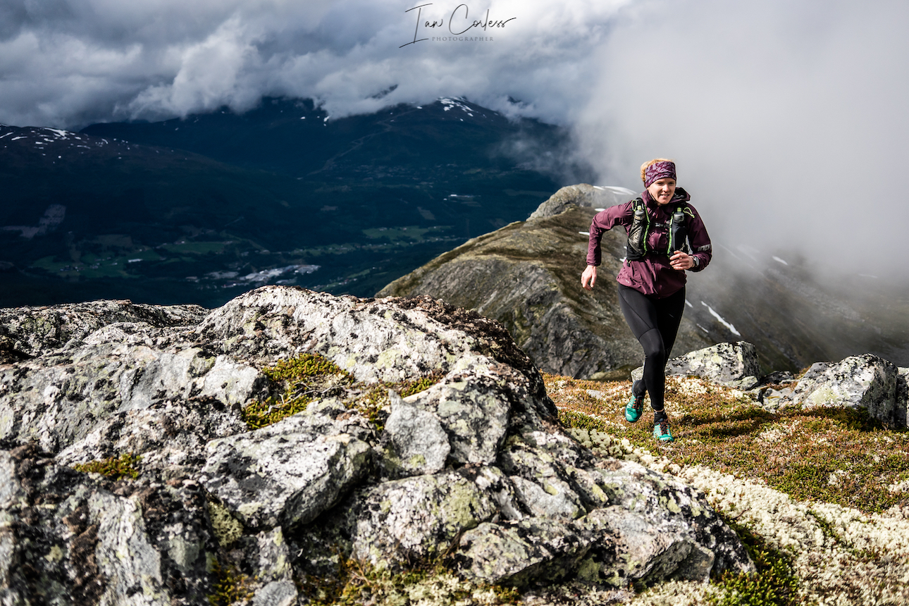
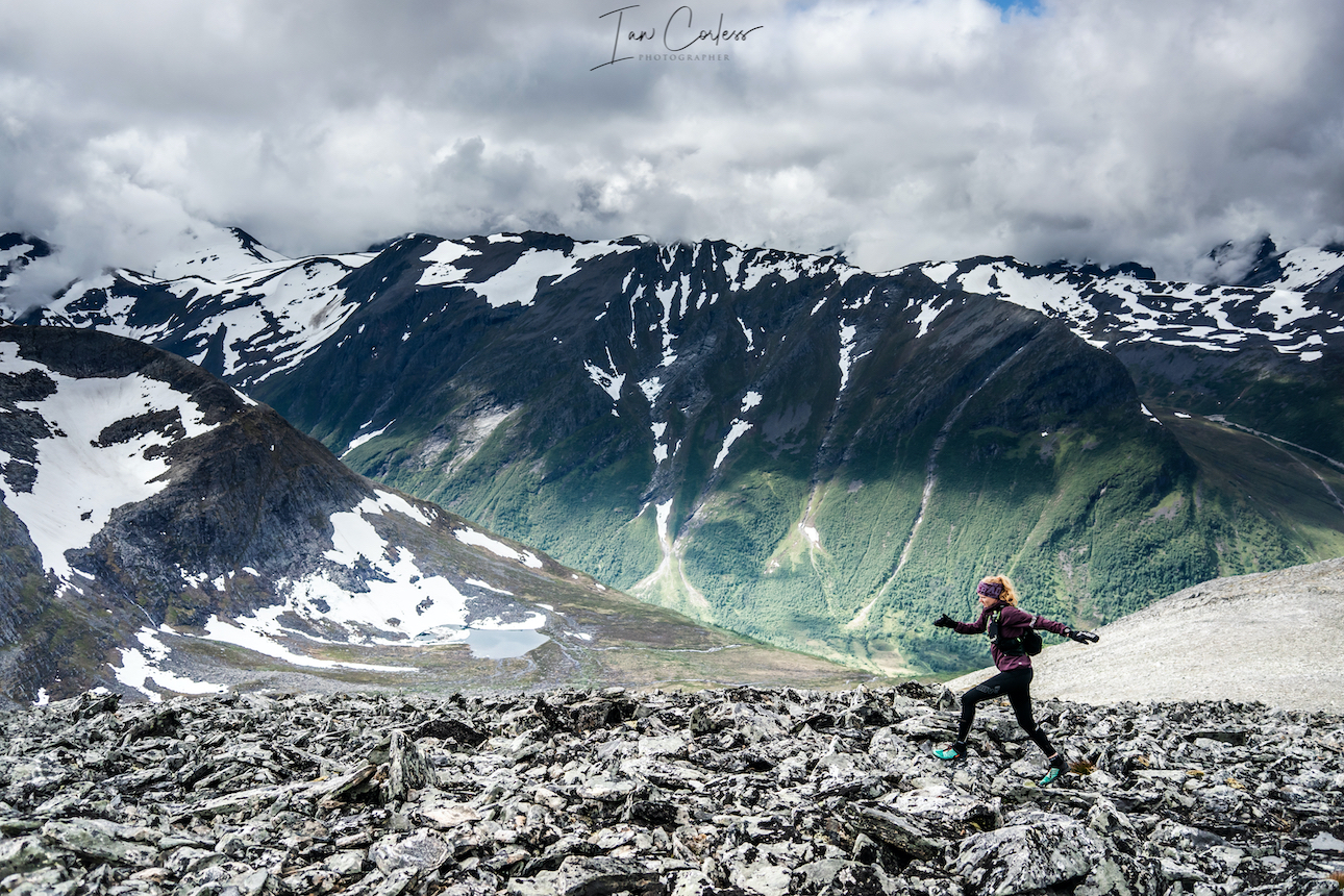
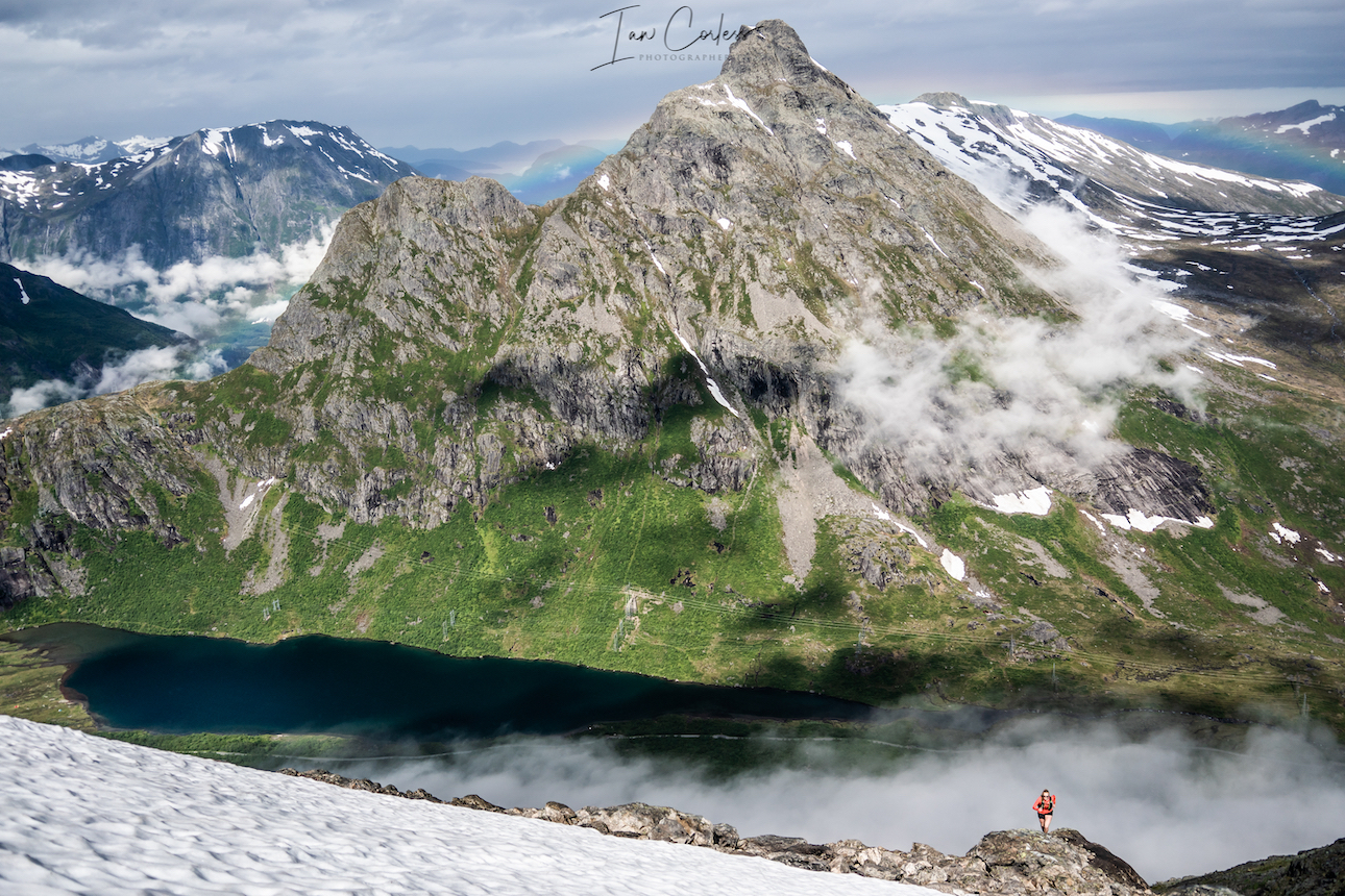
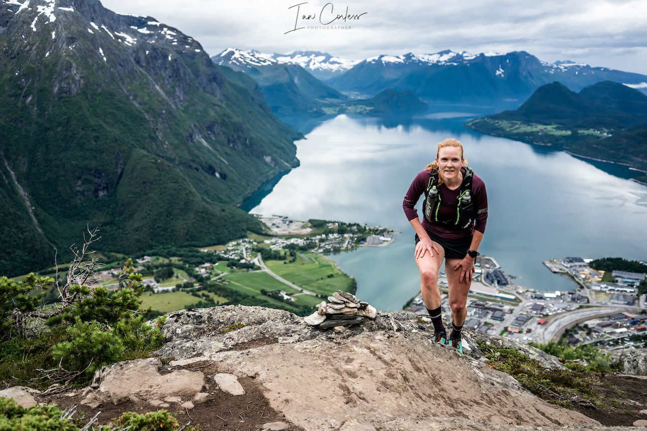
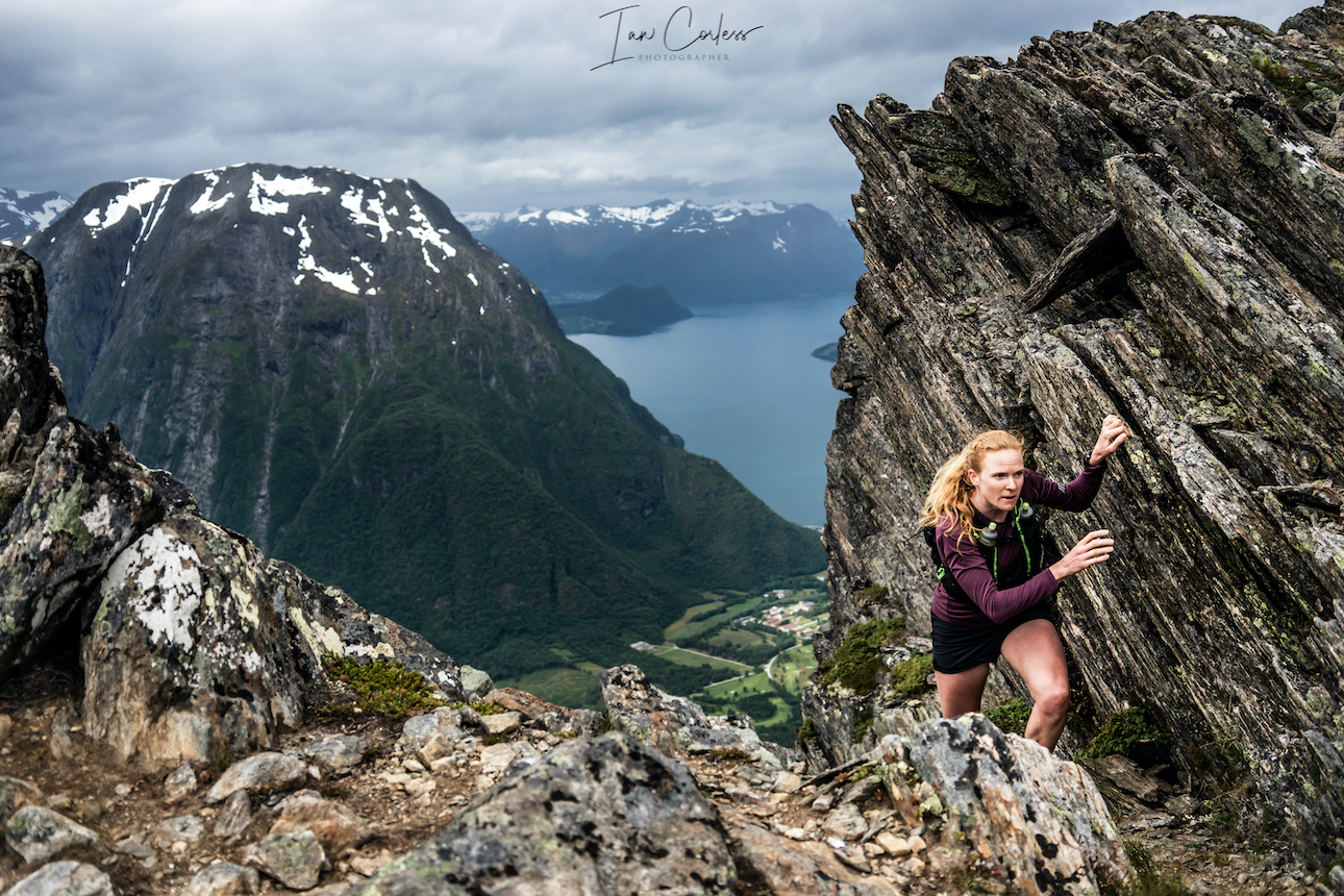
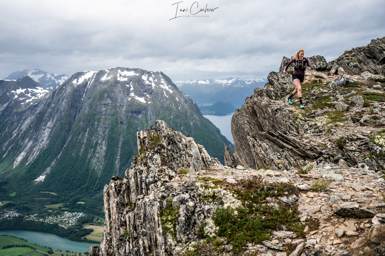
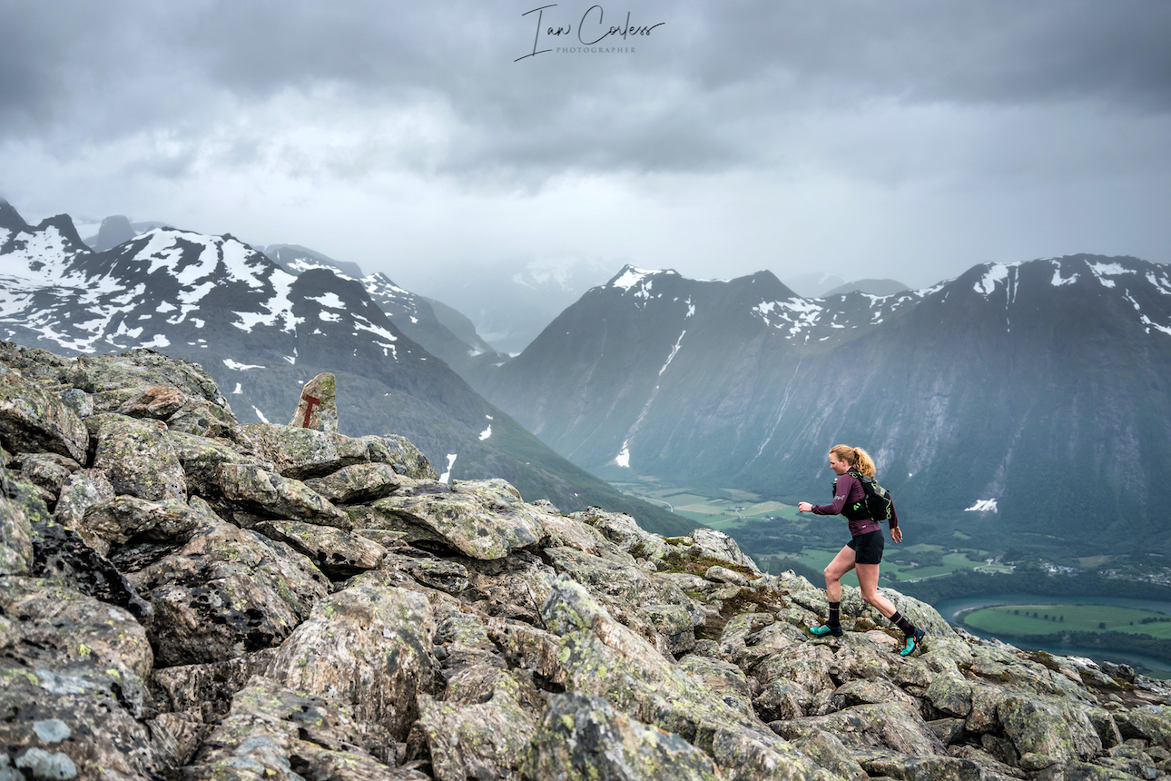
 At 1564m, Slogen is a straight up climb from sea level and as such, this route brings its own challenges. You can break the climb up by staying at Patchellhytta Cabin, however, our choice was up and down in the same day.


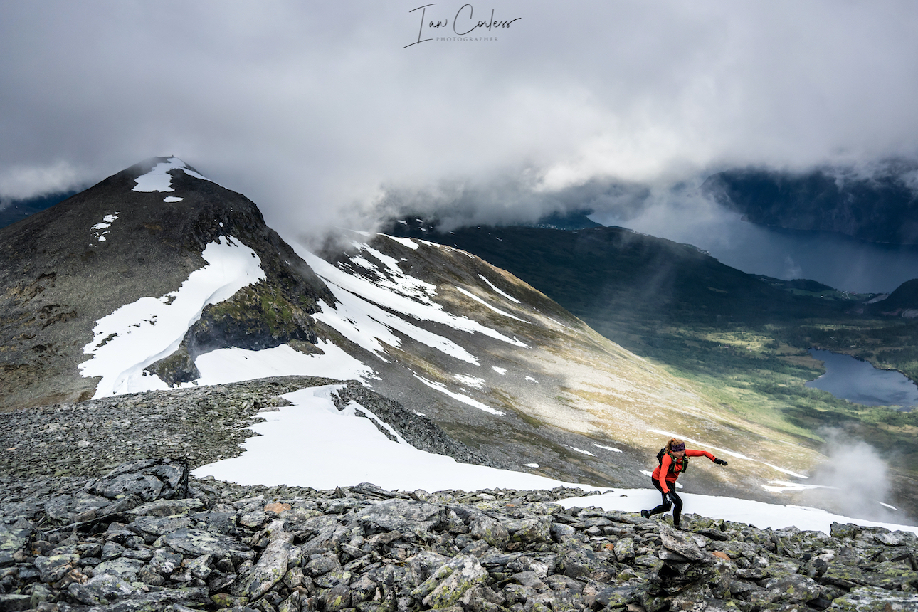
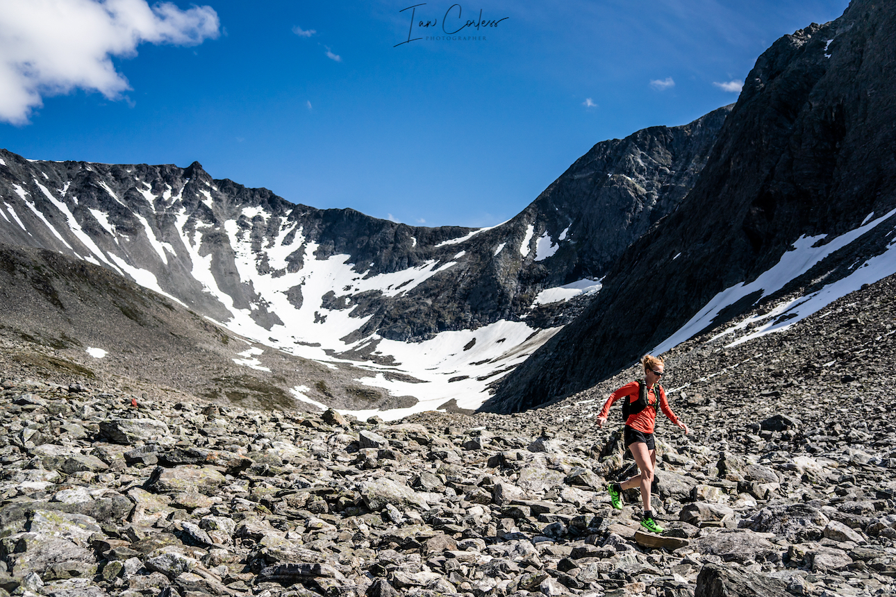
 Rock eventually becomes trail and before you know it, you will be at the bottom and next to the Gjende river. It is now possible to get water if needed?