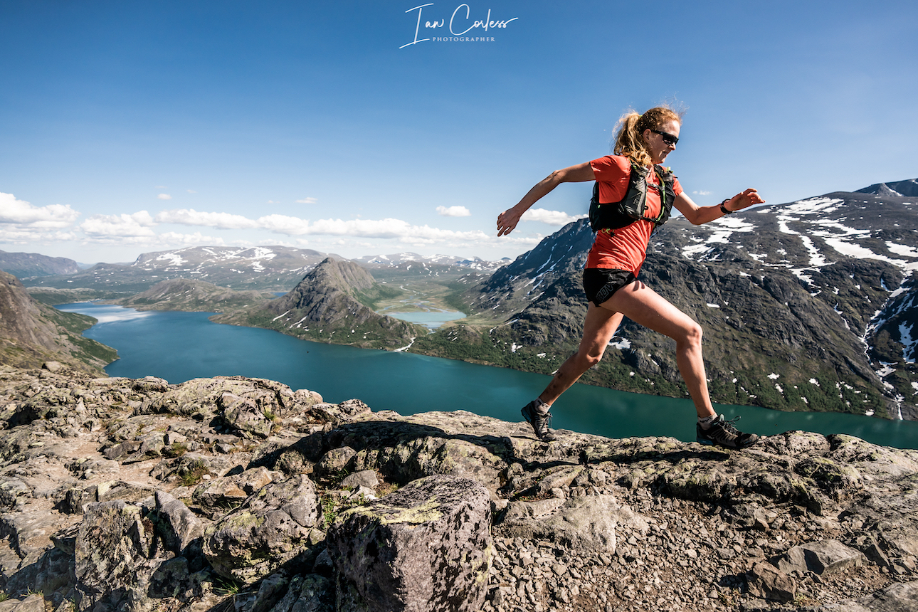
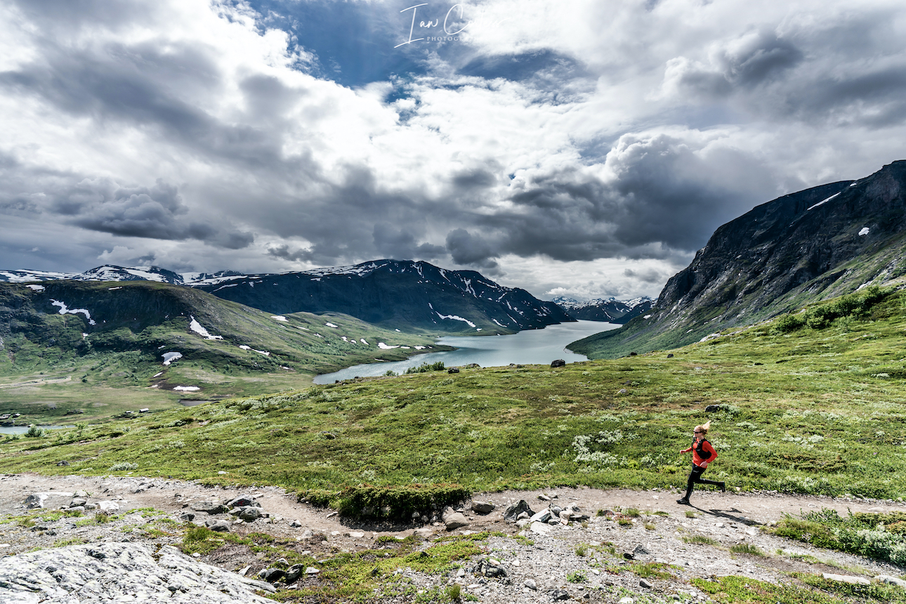
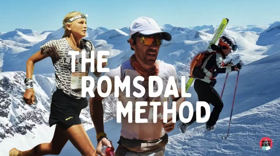
The Romsdal Method, directed by Hans Kristian Smedsrød, is a raw, immersive journey into the rugged training ethos of Romsdal, a Norwegian valley transformed into a living, breathing performance lab. Inspired by Kilian Jornet and Emelie Forsberg, three elite/ultra athletes: Ida Nilsson (Sweden), Jon Albon (Britain), and Petter Engdahl (Sweden) join this hub to progress their careers. What begins as a quiet exploration soon morphs into a testament to friendship, mutual respect, and the transformative power of place-based training.
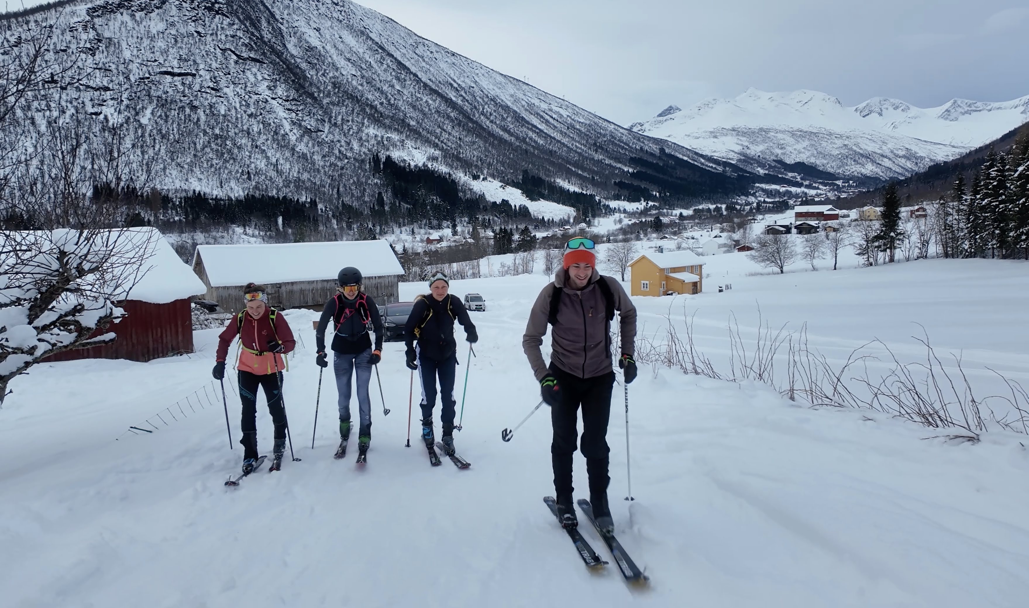
Group training
There are no egos here, on the contrary, there is a calm, understated respect of experience and knowledge. At the helm, the inspiration for Jon, Petter and Ida comes from Kilian who has pioneered the way for training in Romsdal.
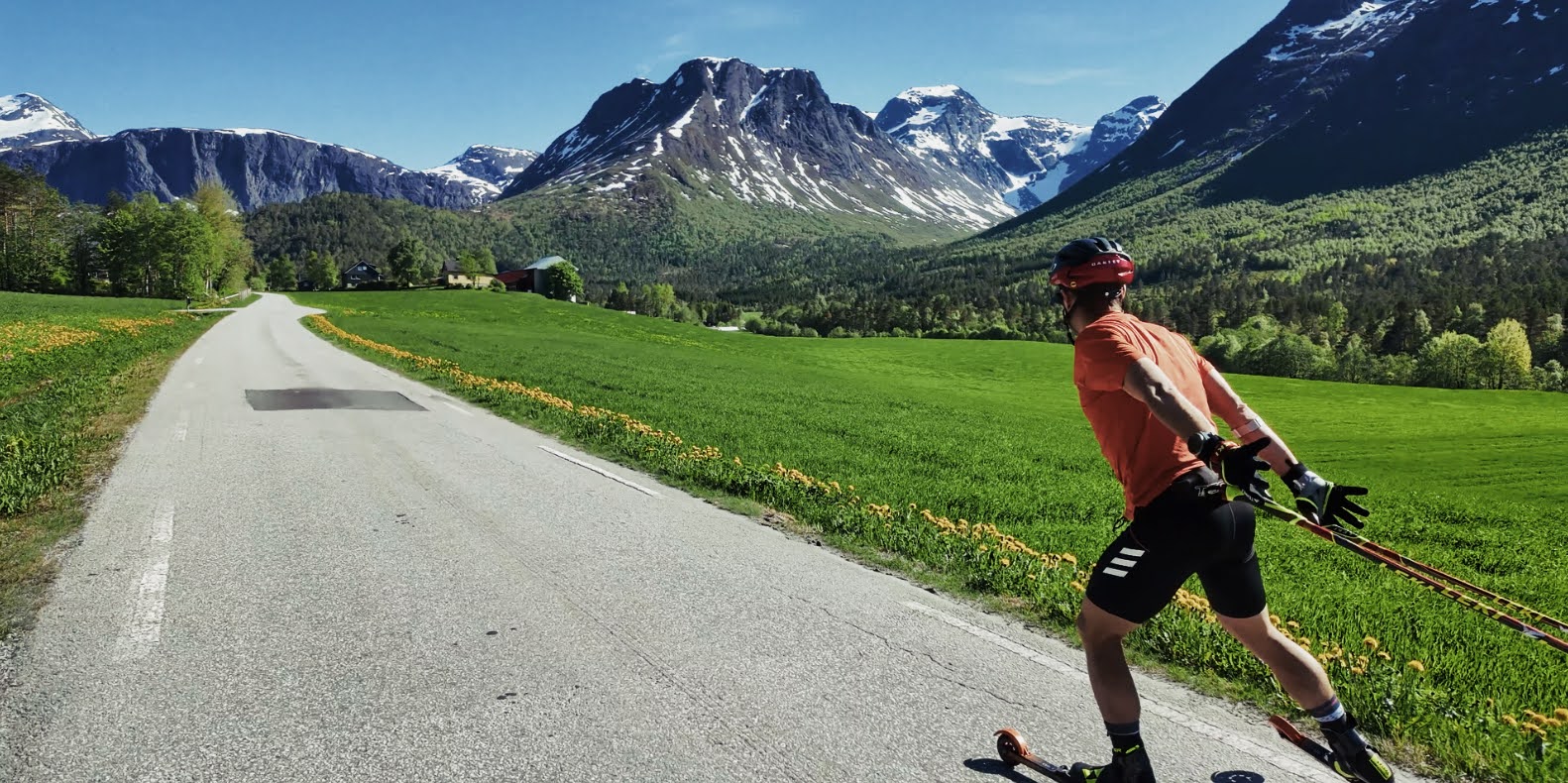
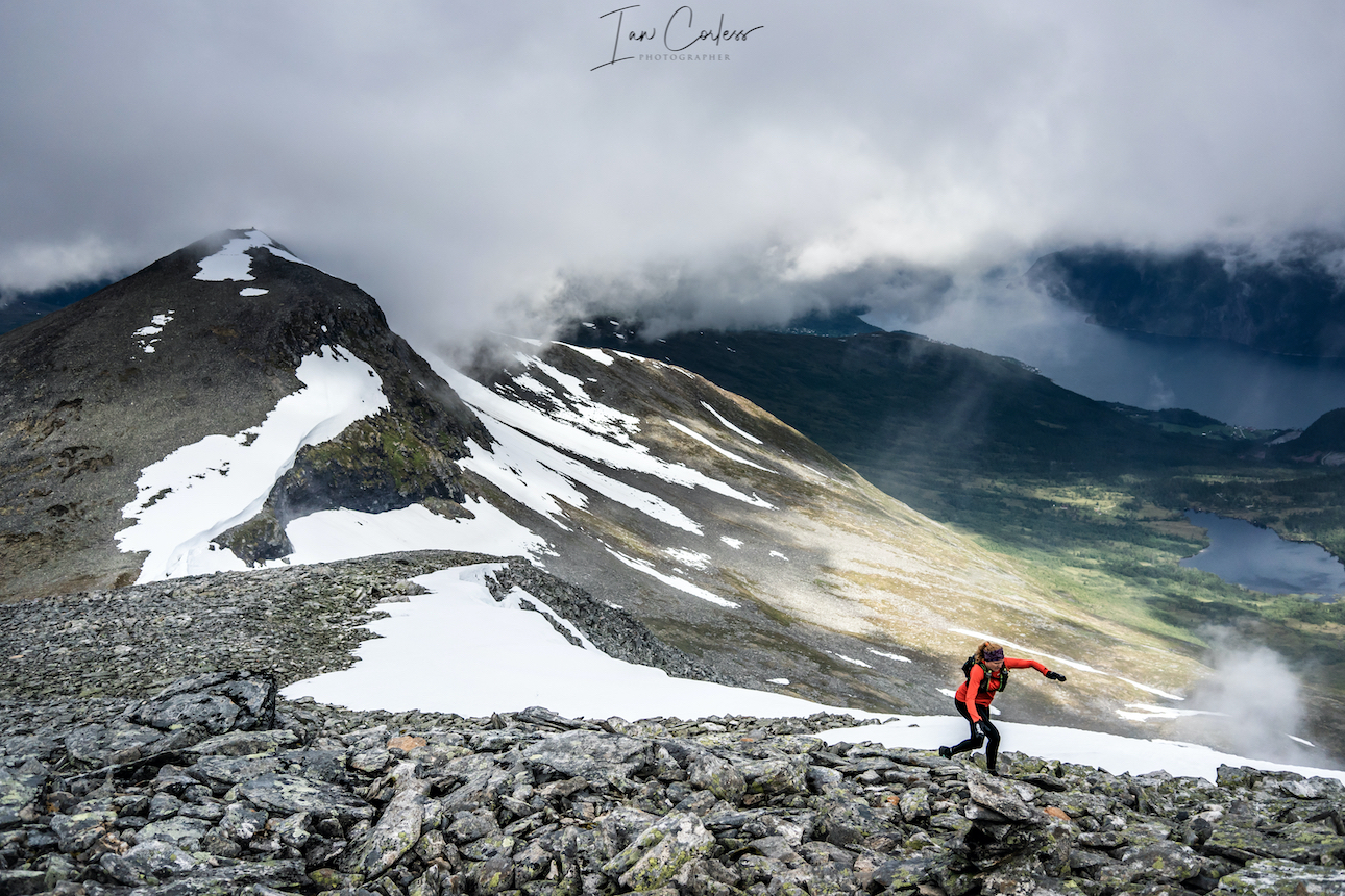
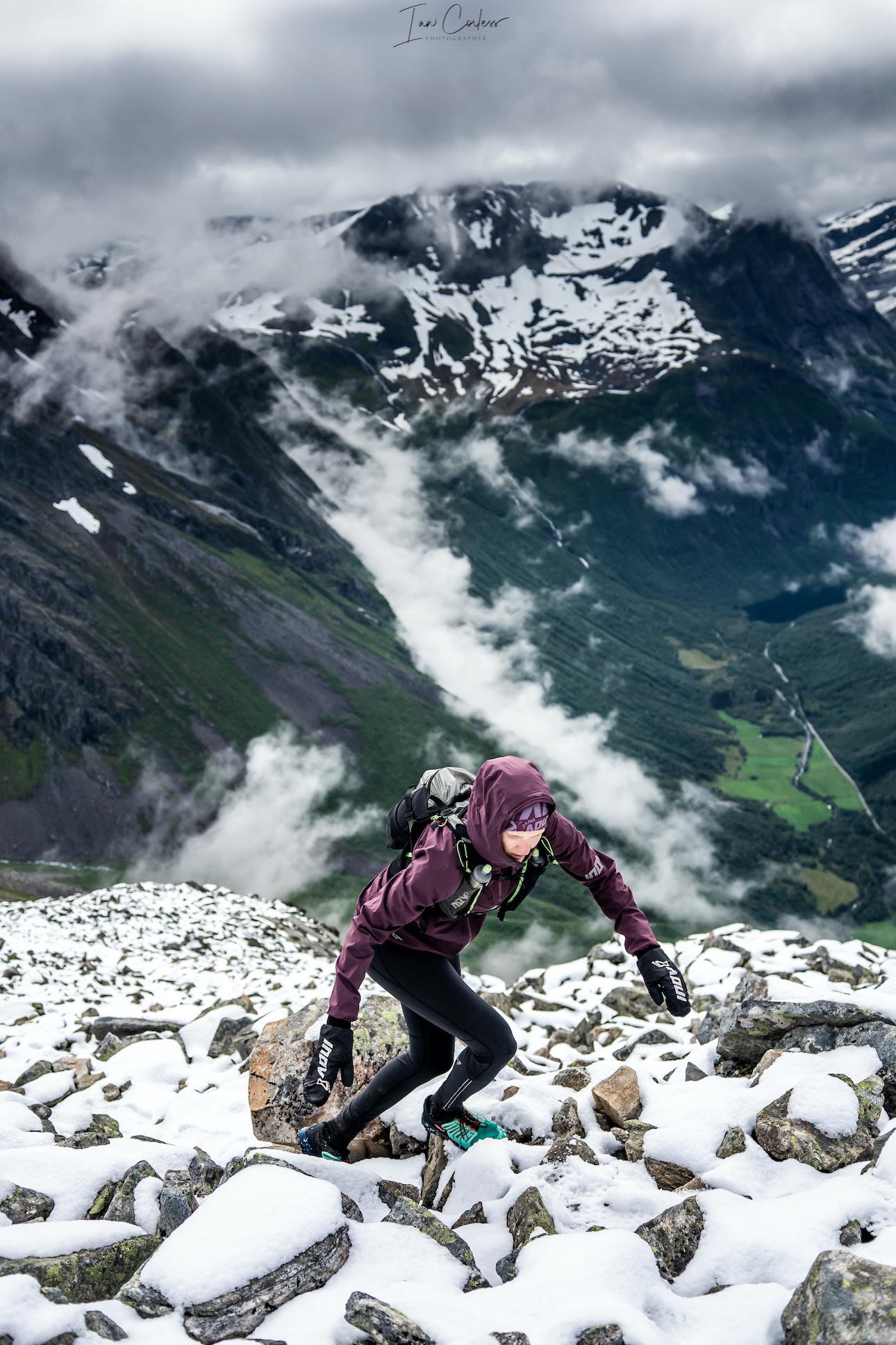
Petter on roller skis
Petter sums it up in a moment of reflection:
“Being the best in Romsdal and being the best in the world is kinda the same thing, it’s what makes this valley so insane.”
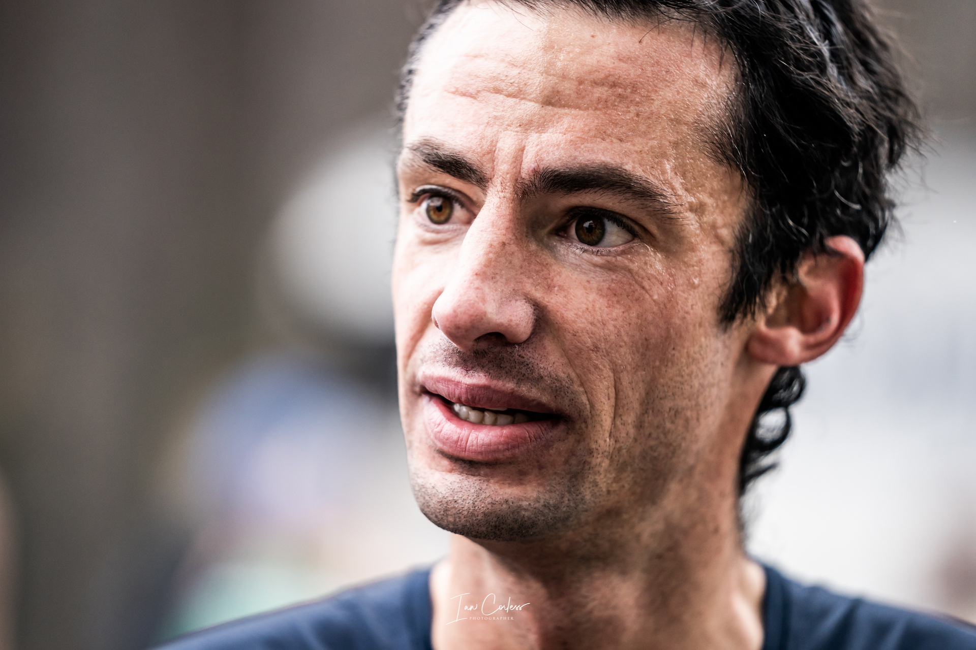
Jon, the Brit, is very much the scientist, the thinker, the analyst. He has a dry British humour that even Kilian acknowledges. Jon is a legend of the sport, a powerhouse athlete and he is the calming element that binds the group of three. Training sessions for Jon need to make sense, they need to be specific. His unassuming presence and measured discipline highlight the balance between elite drive and heartfelt connection with place and people.
Jon being specific with training
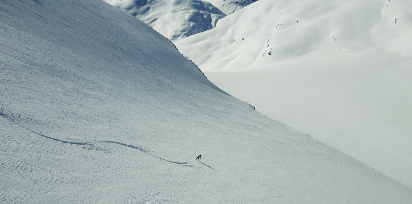
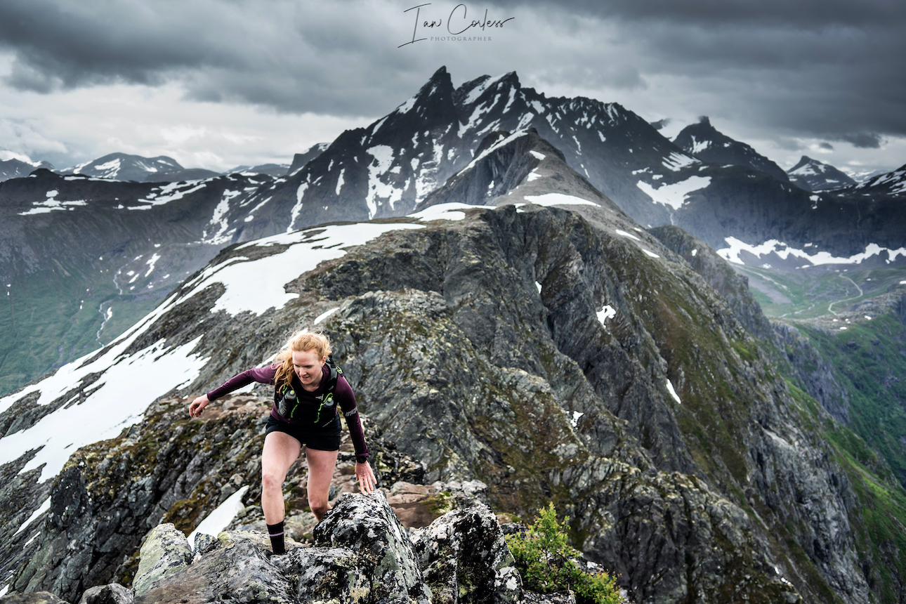
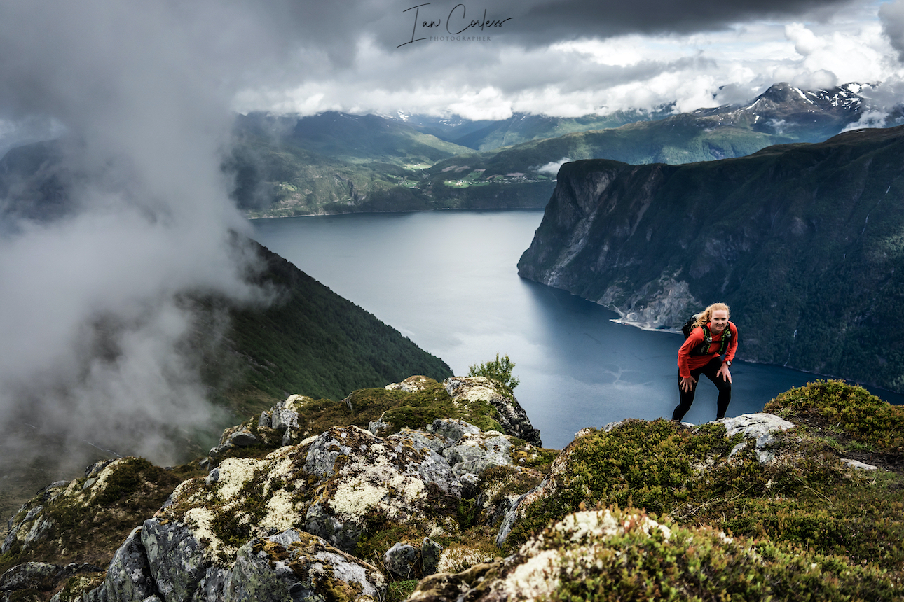
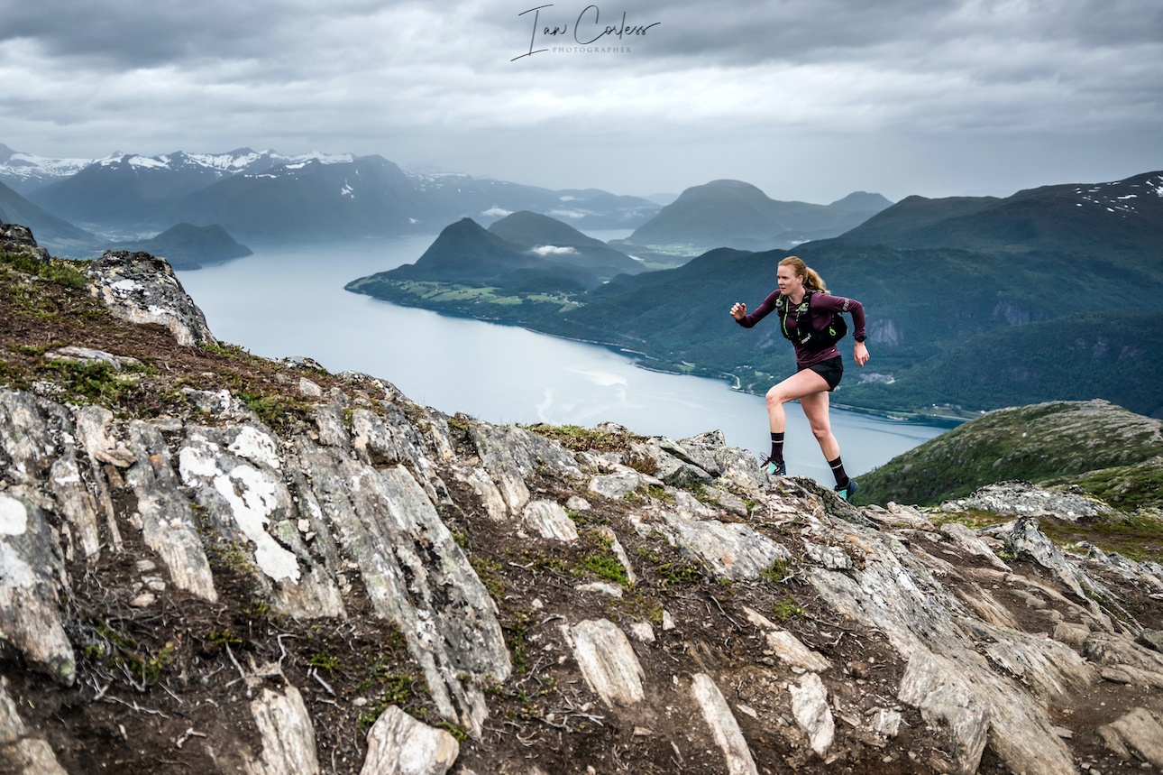
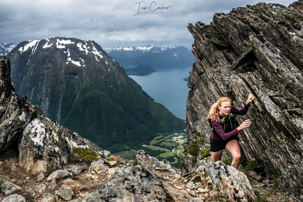
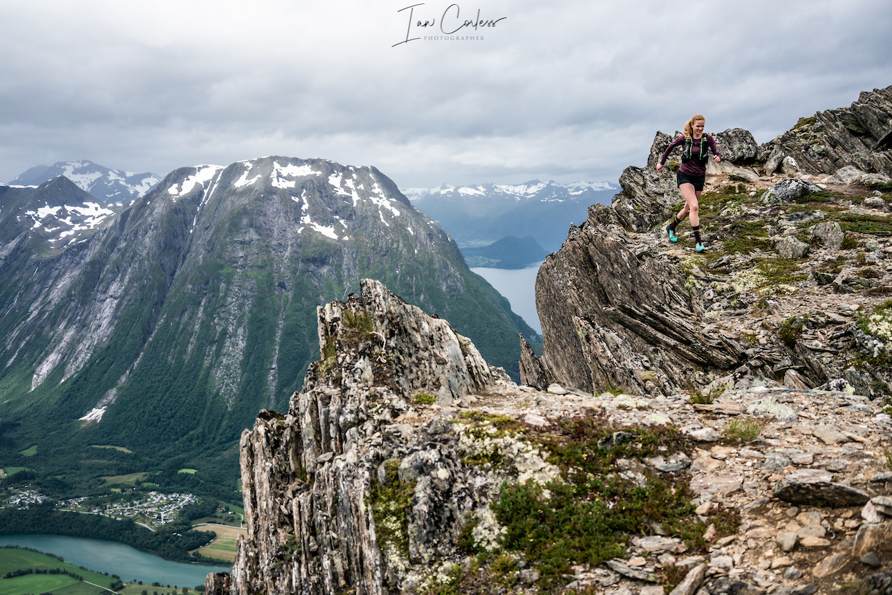
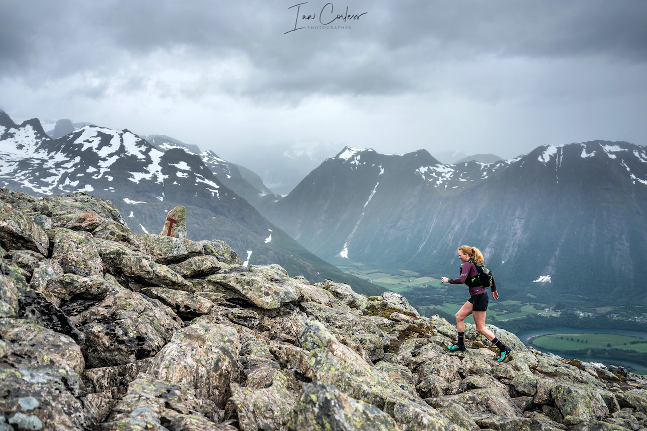
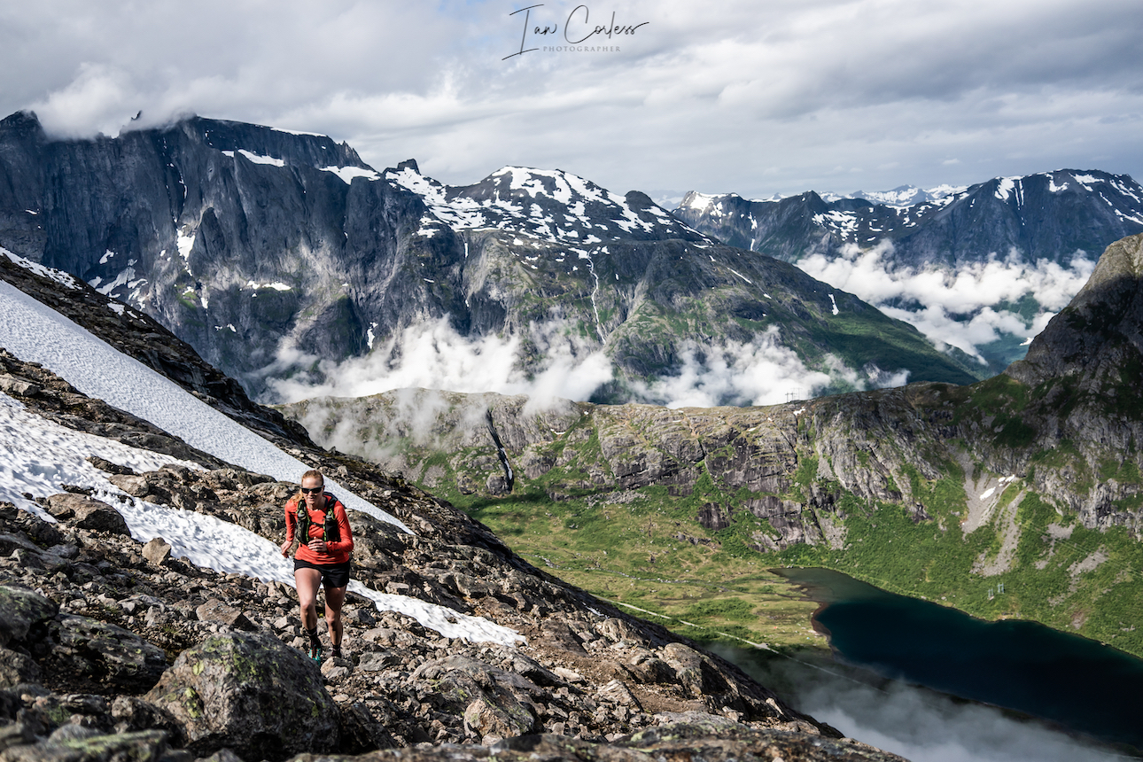
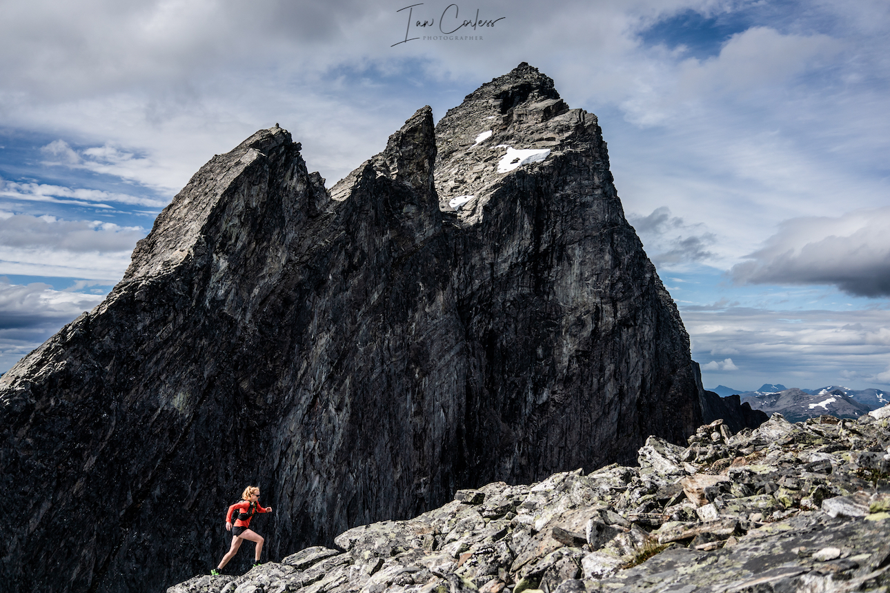
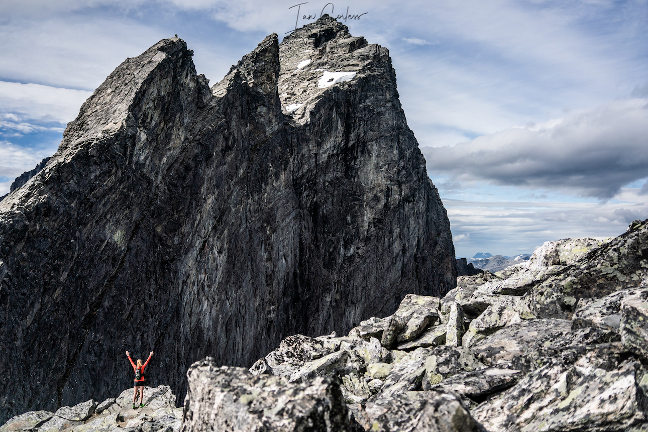
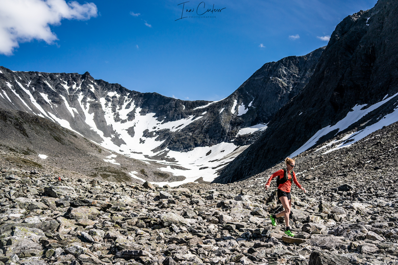
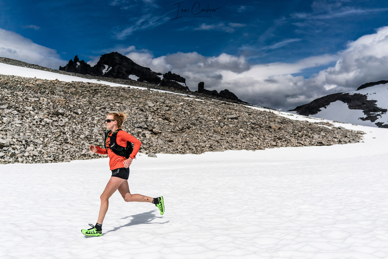
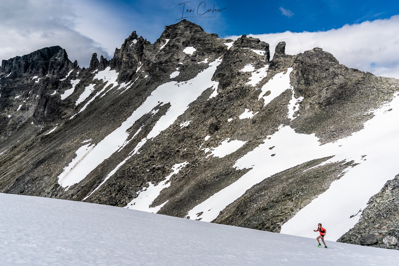
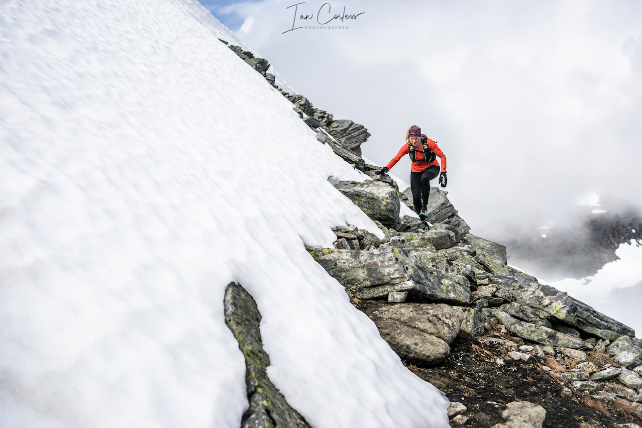
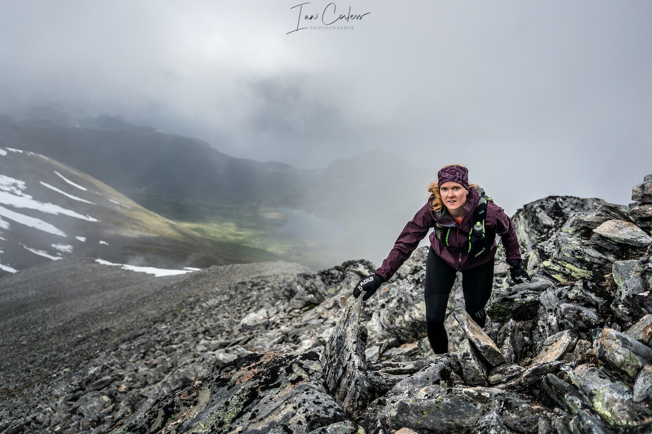
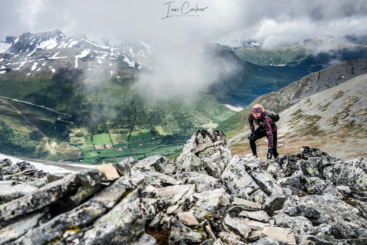
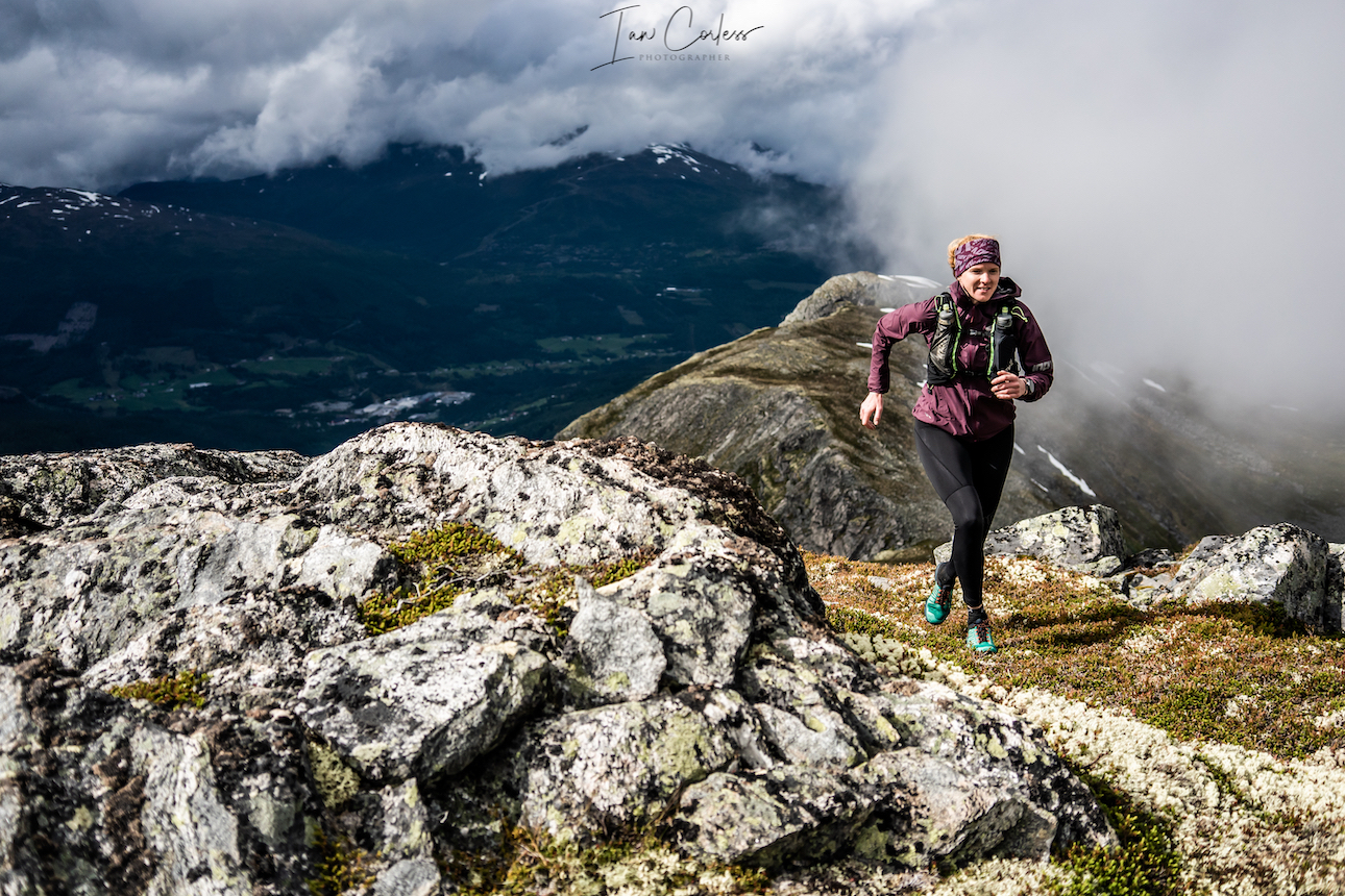
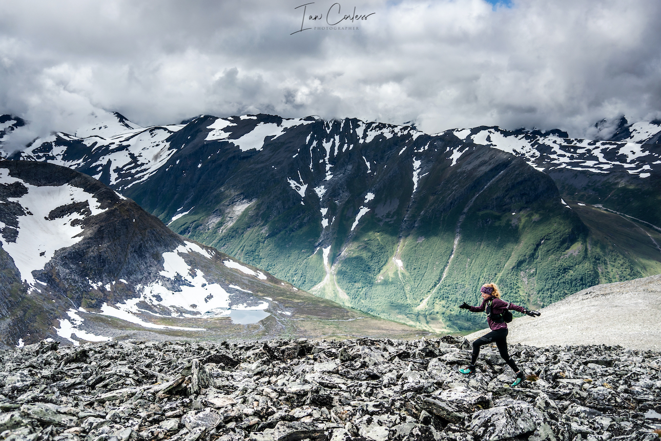
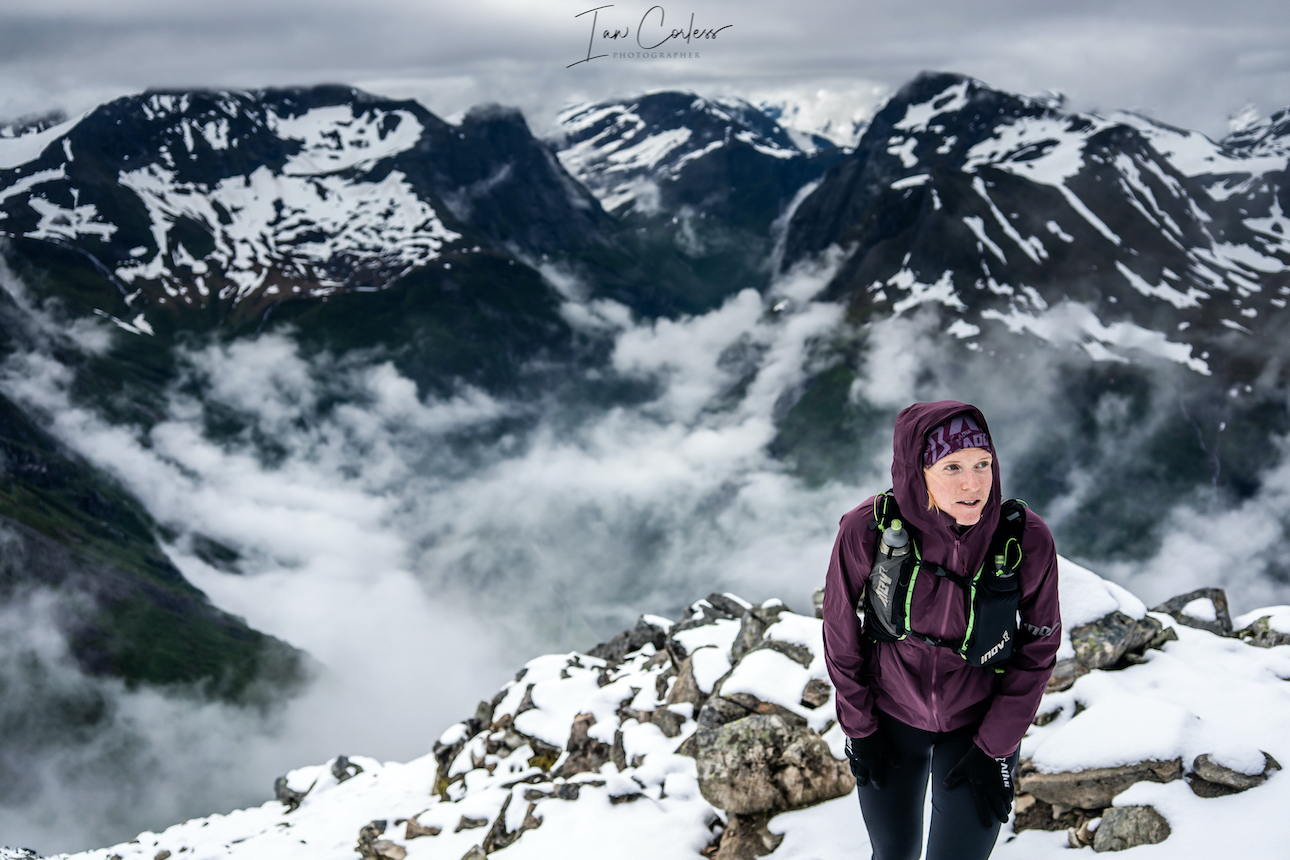
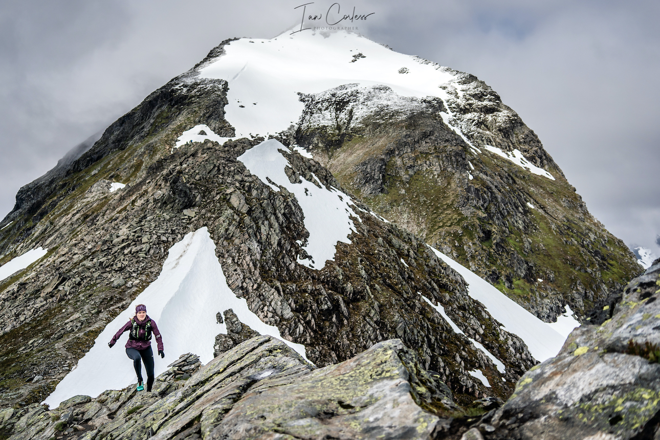
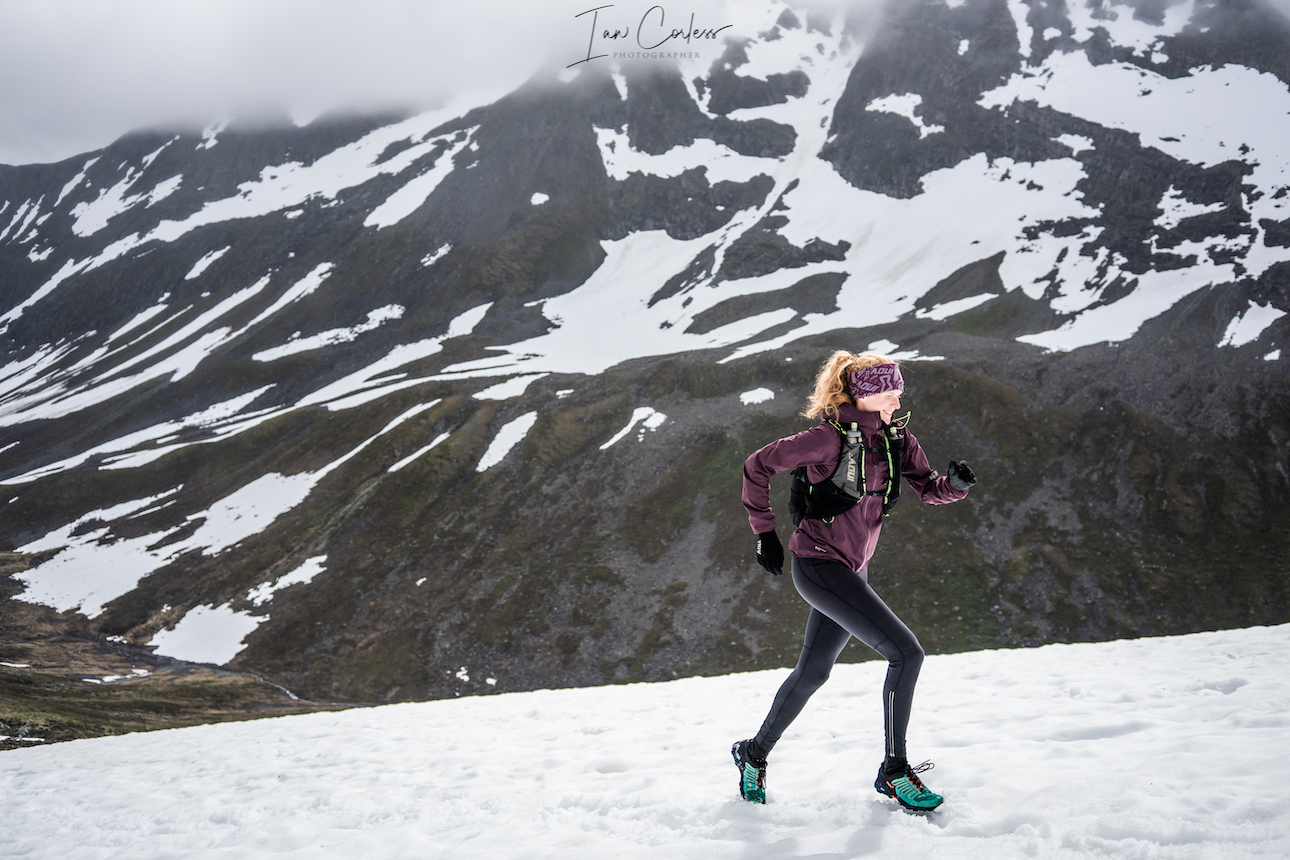
Ida, with a career that stems back to track running is an introspective, warm, and has a complete dedication and passion for sport. Sincere, sometimes quietly exuberant, Ida is motivated to perform, she’s looking for performance gains but at the same time, as shown on a ski mountaineering trip on a beautiful day, just being in the mountains for hours is what makes this life tick.
Ida in the best playground pointing to which peak she will climb
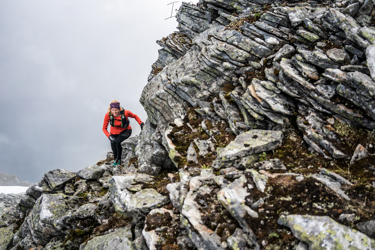
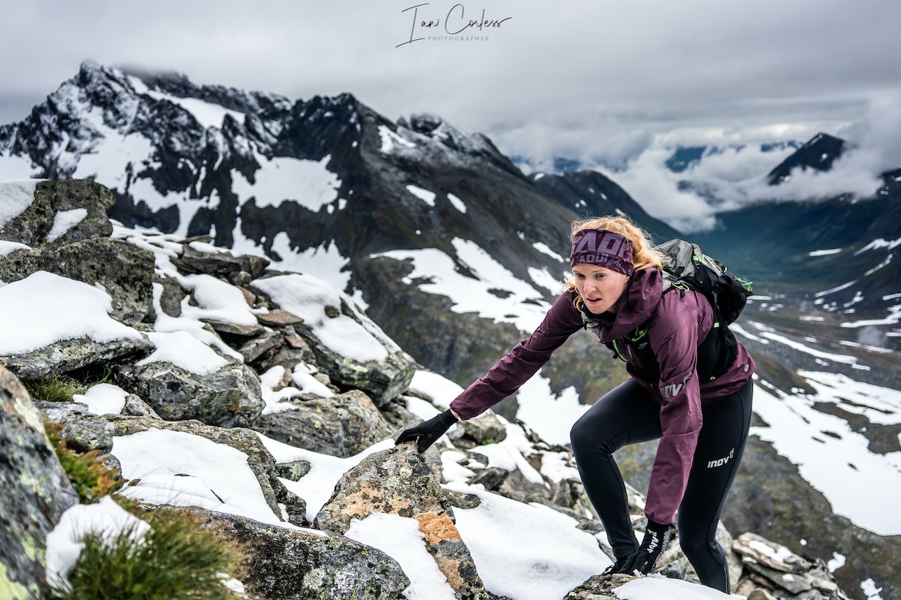
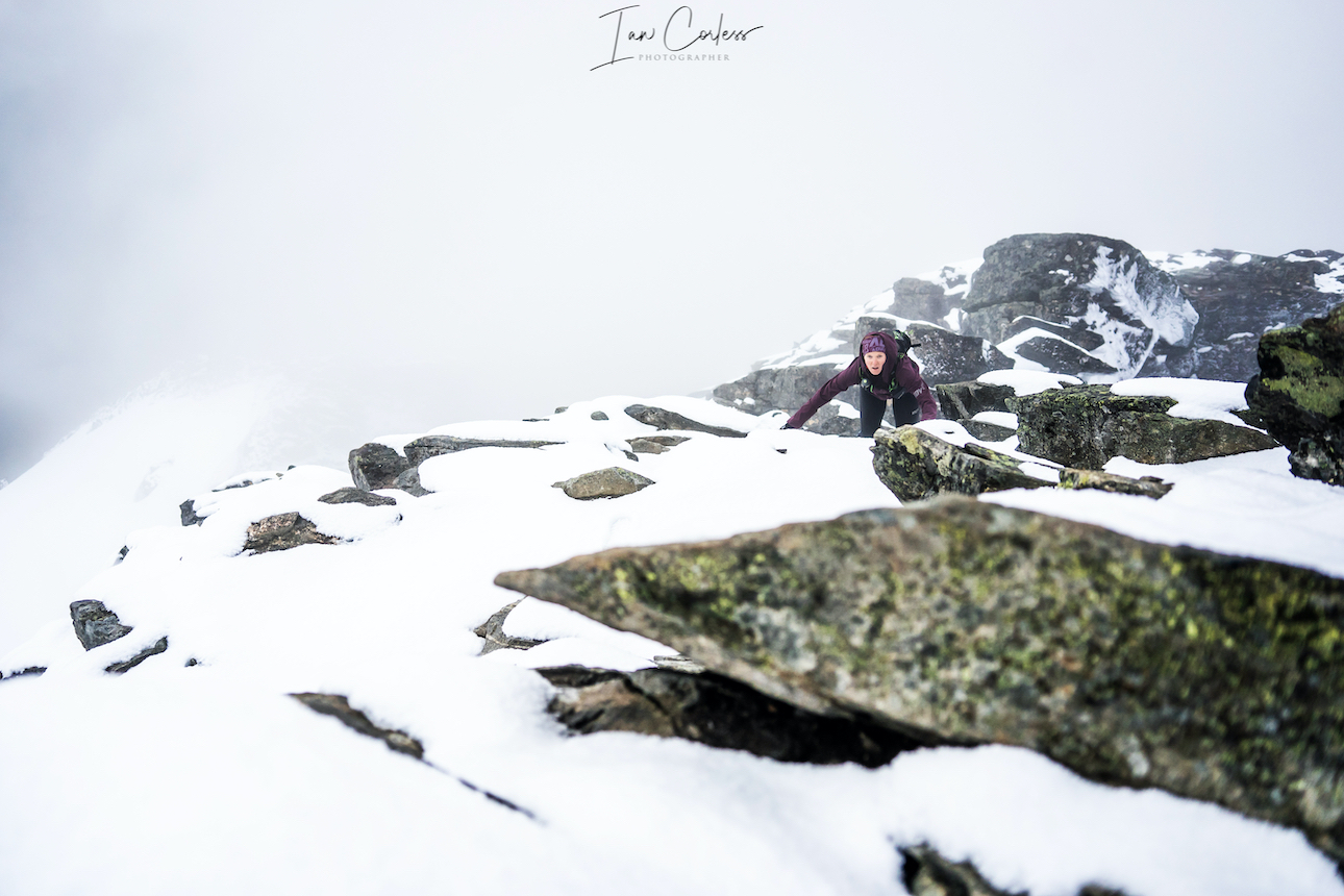
Petter, is calm, quiet, solid. He’s about grit and focus. He’s the silent undertow who likes his actions to speak louder than words, providing testament to a man pursuing the edge. He moved to Romsdal to be with and train with the best; Jon and Kilian. He acknowledges, that sometimes, particularly in his first year, that this ‘training’ in itself can be too much.
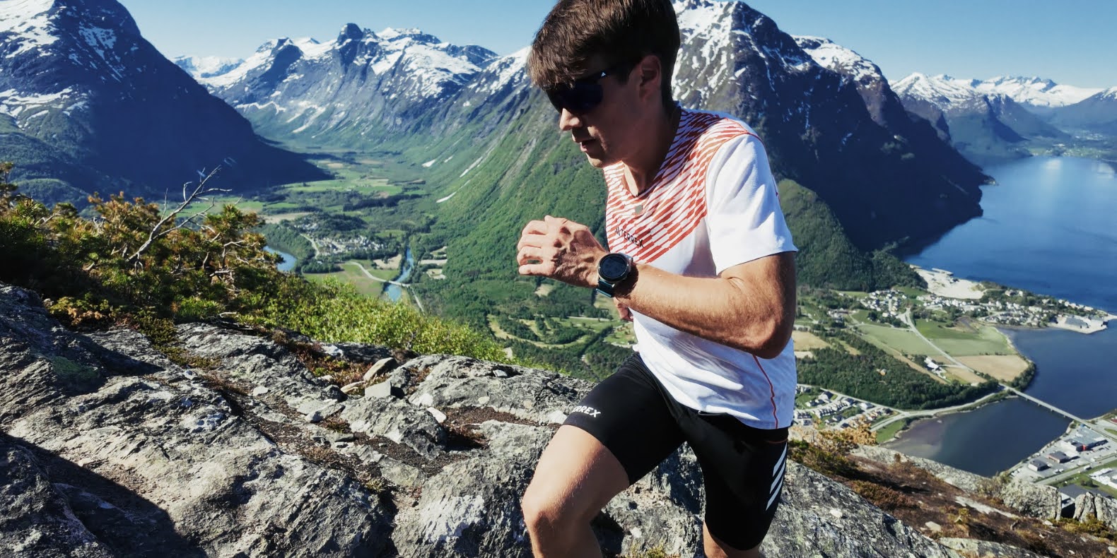
Petter at the top of Nesaksla
In many ways it can be summed up with a sound bite from Kilian Jornet:
“And many of the routes where we are training, if you do a mistake, if you slide, it’s not that you will break your ankle or hurt yourself, it’s that you will die!”
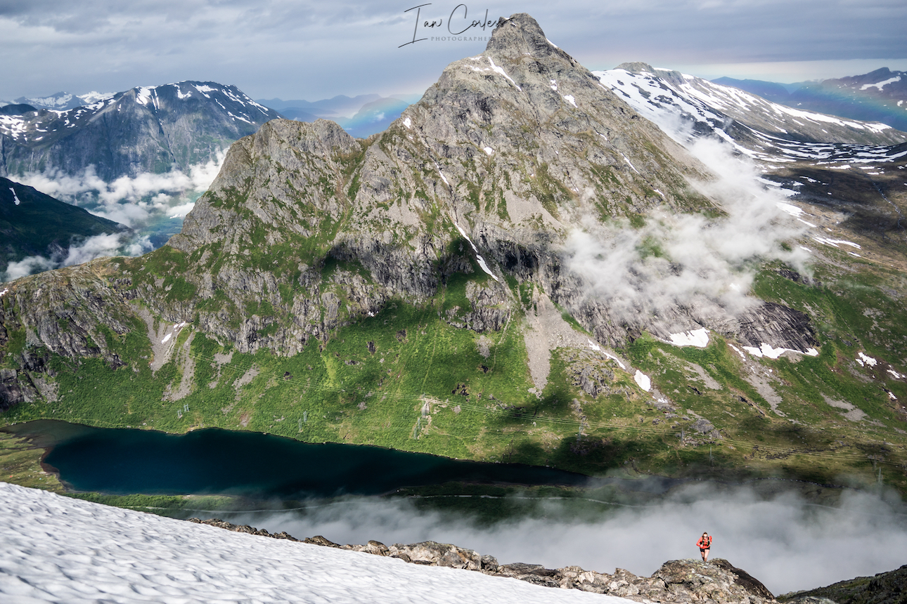
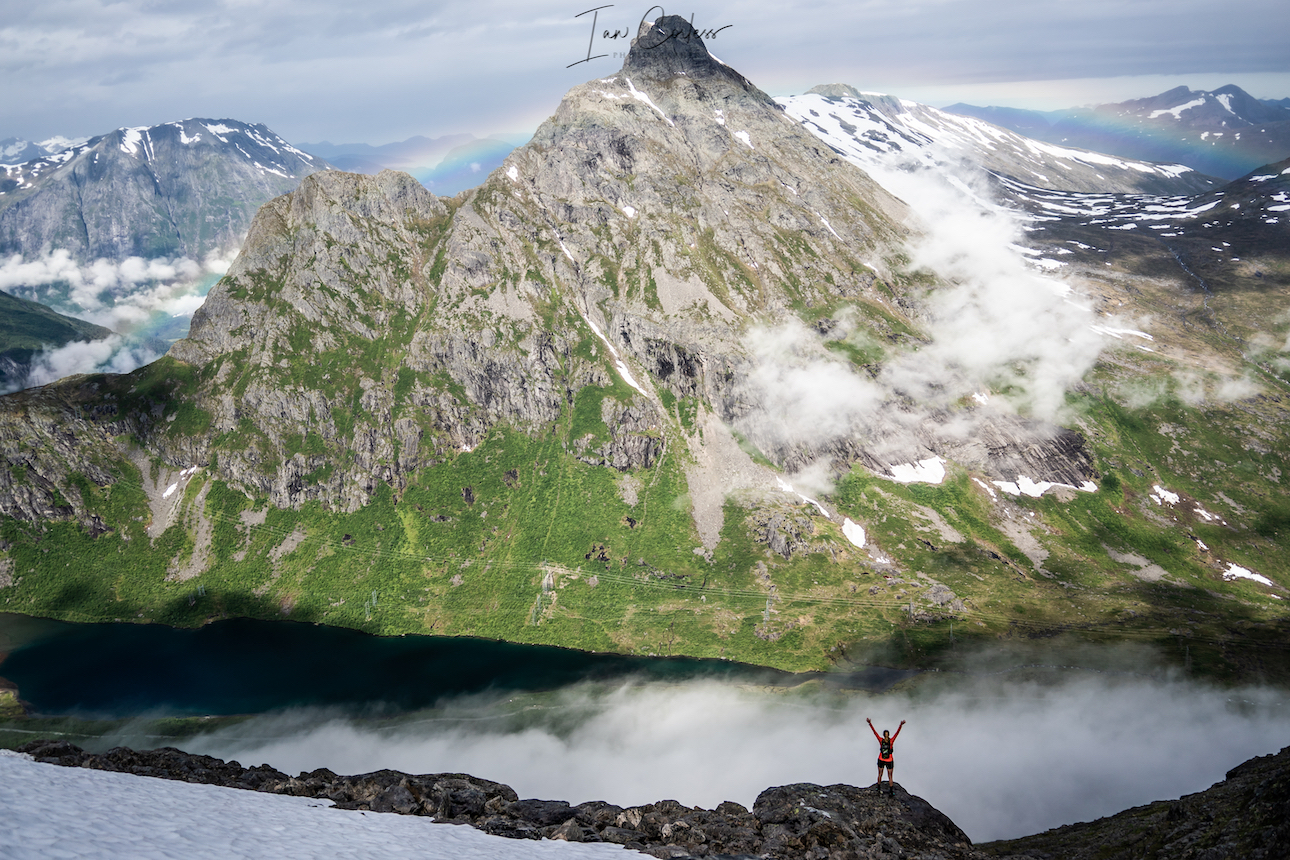
Romsdal isn’t just a backdrop or place, it’s arguably the key protagonist of what shapes the story, the experiences, the life and the training of those who live there.
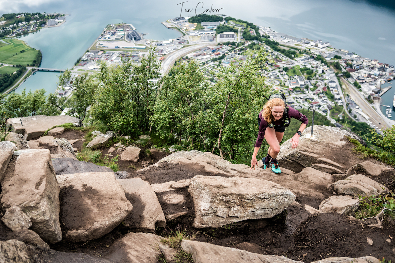
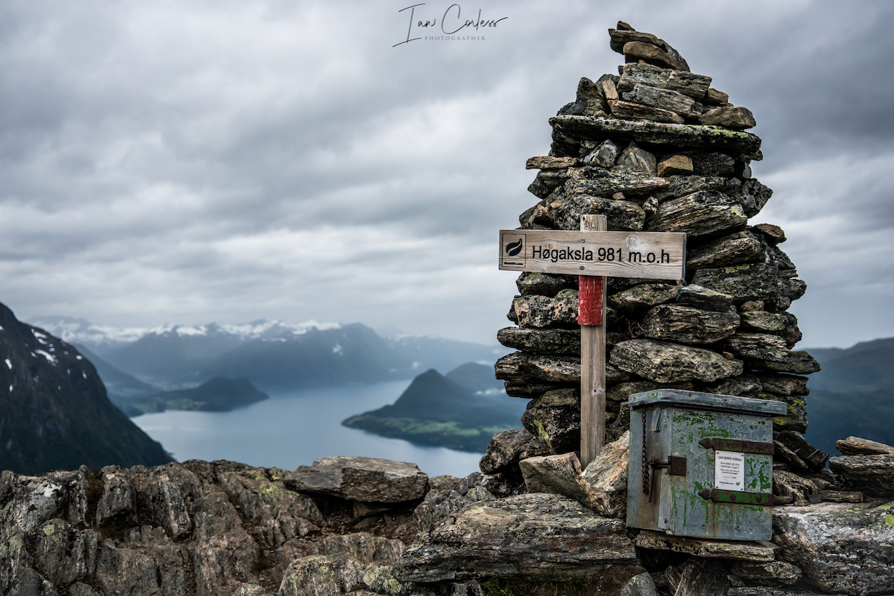
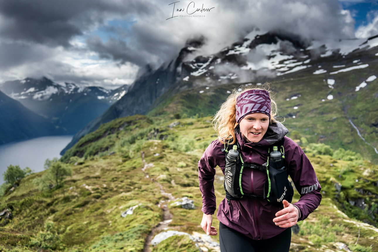
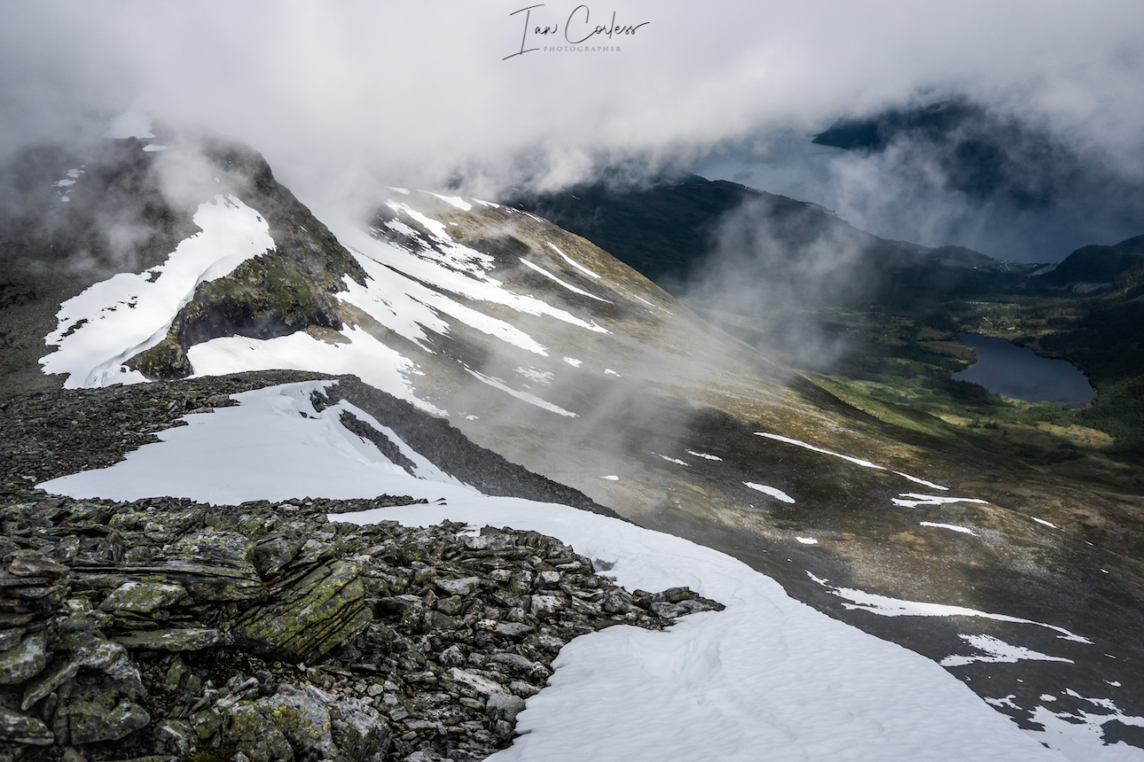
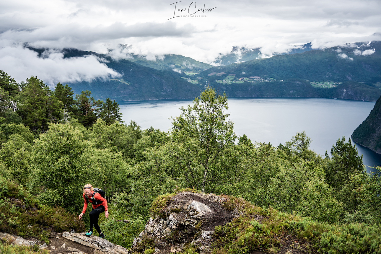
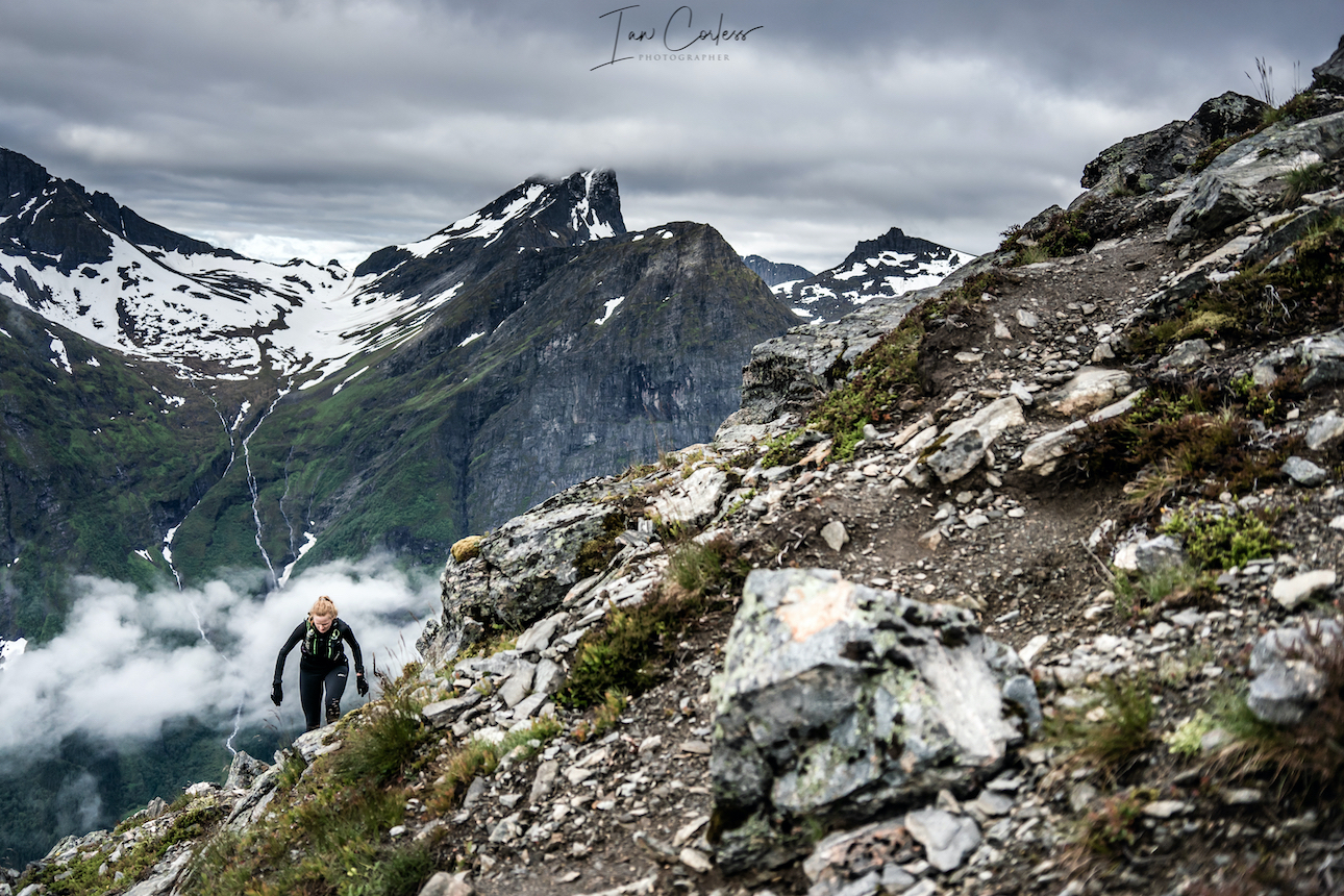
Towering granite, unpredictable weather, rivers through valleys, every scene in the film places Romsdal as central, it plays as a coach, mentor, and even antagonist. Ascending steep slopes, scrambling or racing up and down ski-mountaineering routes; the mountains demand creativity, humility and respect. As Jon says at the end of the film, this is maybe not the best place to live to train for many races that I do, but, I wouldn’t want to live anywhere else. Romsdal forces adaptation: intelligent, situational, and deeply rooted in respect for nature. A prime example coming from the Nesaksla session, which Petter admits, has been copied by athletes around the world.
Kilian Jornet
Kilian, the legendary Catalan mountain athlete, appears less as a star and more as a guiding spirit. His cameo moments, on screen and in conversation, provide quiet counsel: pushing boundaries, listening to one’s body, respect for the mountains, he embraces why we move and he has an immense respect for his peers. Kilian has pioneered the way; his deep bond with the mountains humbles the athletes. He is arguably the spiritual north of Romsdal.
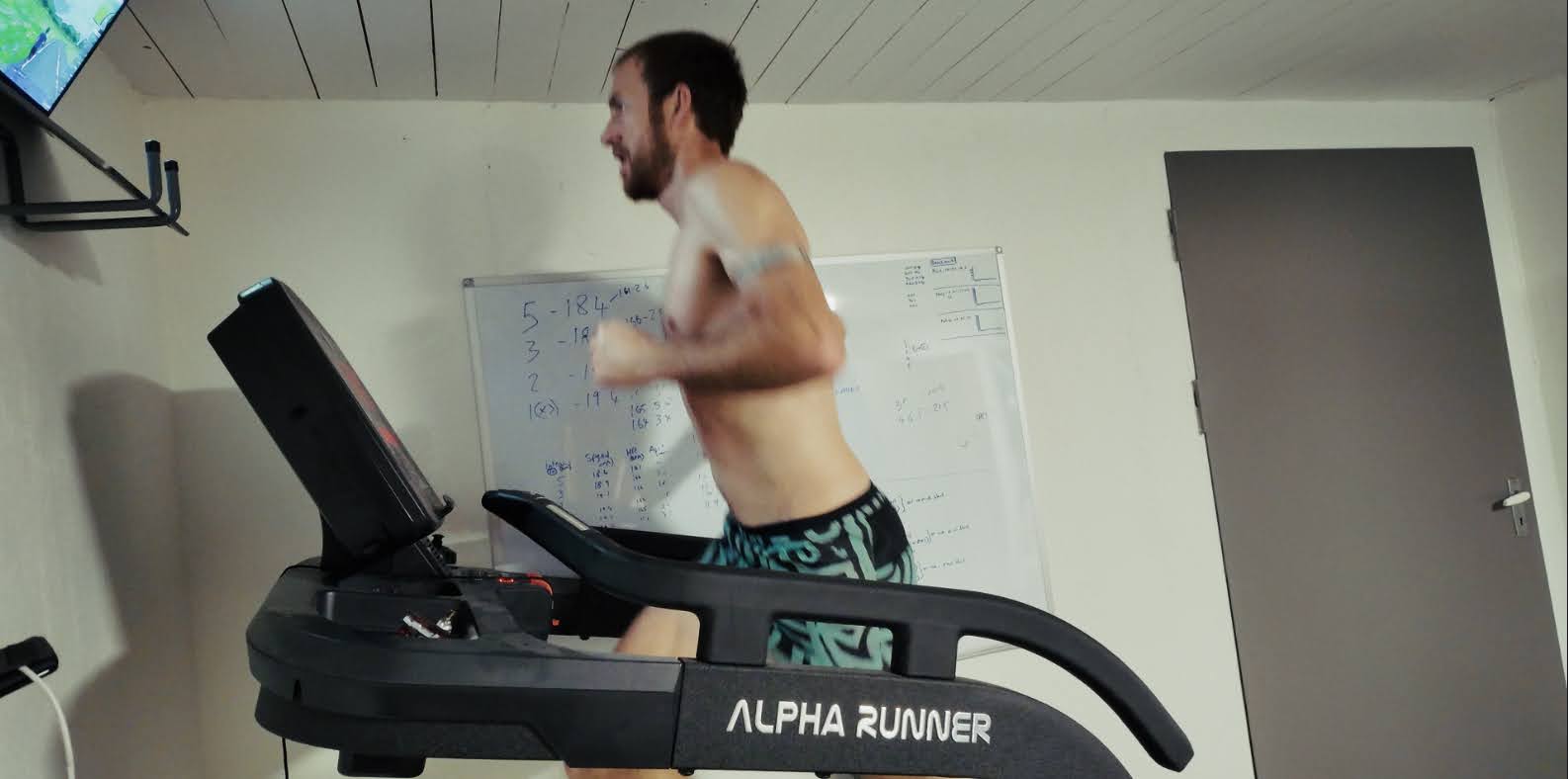
The film is called The Romsdal Method but there is no one answer here and Hans Kristian does a nice job of letting the location, the athletes and yes the weather, do a job of explaining that Romsdal requires creativity; multi-disciplinary skills, and community-driven training. A series of vignettes that show this, from epic ski mountaineering scenes, scrambling and climbing, cycling and yes, even the use of indoor sessions such as the treadmill.
Screenshot
It’s this layering of elements, skimo, run, scramble, climb, gym, cycle, heat work that defines the “method.” It’s adaptive, multi-modal, and very creative. It’s as much mental and communal than physical. And it’s deeply place-based: Romsdal is a training partner.
The first hour of the film lays the foundations for the Western States story, what sets The Romsdal Method apart is its emphasis on the collective group and how they each influence and help each others process.
These athletes didn’t relocate to Romsdal for solitude, they came to live and breathe together. From group runs, scrambling trips, skimo adventures and the sharing of knowledge indoors while next to a treadmill. Egos are not present, just respect: they challenge each other and they all listen and learn.
Hans Kristian made this a passion project. He spends the first 6-minutes of the film looking at a camera providing some history and outlining why the film came about. He’d be the first to admit that he came to this with little filmmaking experience and dare I say, this is arguably what makes The Romsdal Method appealing. Like the athletes, Jon, Petter, Ida and Kilian, Hans Kristian keeps the film raw and simple. There are some epic drone shots, wide angle shots of ridges, tight head-cams but ultimately, this is one man and a camera.
At its core, The Romsdal Method is about belonging through movement. Each athlete finds clarity and authenticity through their pursuits and Hans Kristian manages to capture this through simple conversation.
A bigger budget could have added more effects, more cameras, extra editing time and countless other transformations, but, would it have made the film better? In a world chasing flashy results, screen time, and metrics, this film says: slow down, surround yourself with people who respect the story and let the athletes and the story do its job.
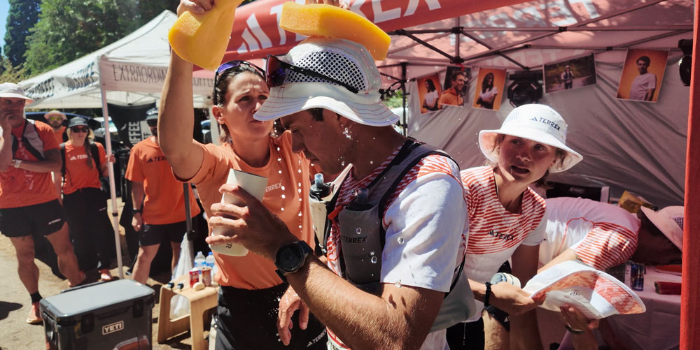
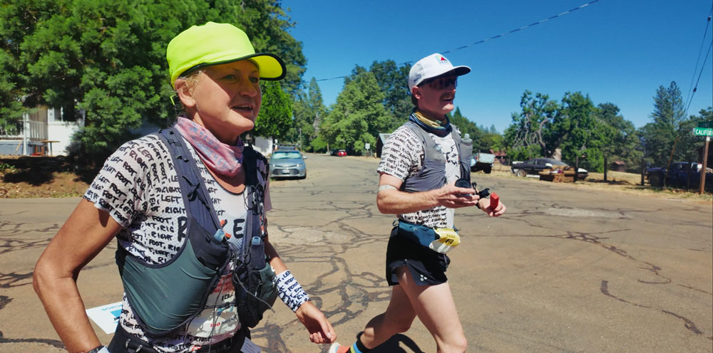
When we get to Western States, we are of course interested in the outcome, but, in many ways it almost seems secondary. Each athlete, of course, has a story to tell and each athlete performs at the highest level. Each viewer, I am sure, felt the pain of Petter’s fall and the potential disaster that this could create, his turnaround was phenomenal. We relish seeing Jon put the ice plan to use and make a top-10 debut in his first 100-mile race. We see Ida push with grit and determination and despite not feeling great, once again makes the top-10 and smashes the masters record. The Western States story is told both visually and with a series of post-race interview soundbites. The stories here just confirm that The Romsdal Method worked.
In conclusion, The Romsdal Method is not just a training film; it’s a journey into how place, community, and friendship can redefine performance. There are no shortcuts, it explains that a love for the sport, sweat, raw practice, and the joy of connection with others is what brings results. You, as a viewer are invited to reimagine your own training and ask simple questions of, ‘how do I train, where do I do it, who do I do it with and why?’
If you crave friendship, mountains, and the satisfaction of honest hard work, Hans Kristian’s film is essential. It may not be slick, but it has a genuine soul. And in a world drowning in disconnect, The Romsdal Method is a reminder that the deepest gains come not from gadgets, but from dedication, grit, passion all under taken under open skies that blanket Romsdal.
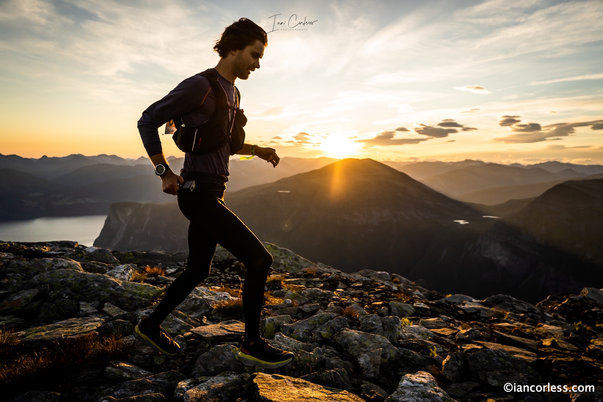
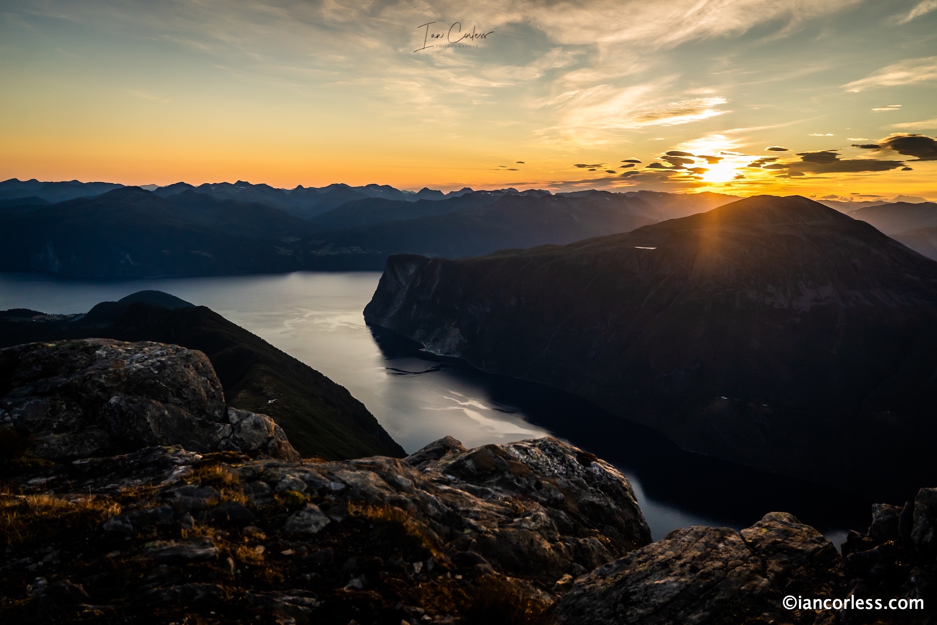
It was burned in my memory, waiting at Fremste Blåhornet at 0430, daylight was already arriving, but the sun had not risen, there was just a promise of what was to come. The first runner arrived quite literally as the sun peaked over the mountains and a glow of orange started to come illuminating Stranda Fjord, the mountains ahead and the runner. It was one of ‘those’ days you wish for as a runner and photographer.
Sunrise 2021
The 2021 Stranda Fjord Trail Race and, the 100km event was truly magical. Norway, Stranda, Slogen and the whole route has never looked so good.
Jump ahead one year and the 2022 edition was a completely different story. Ahead of race day, the weather forecast was greatly discussed both by runner’s and race team. A decision was made, the 48km and 25km races would go ahead as planned but the 100km event would have two key sections removed, the technical and airy ridge after Fremste Blåhornet would be removed and the out-and-back to the summit of Slogen – both considered too risky and dangerous in the expected weather.
With all the attention on the Golden Trail Series 25km event, the 100km was very much a secondary event. Starting at 0200, the 100km race would have already been going for 9-hours before the start of the GTS race. Yes, the 100km event is THAT tough.
Epic, beautiful and brutal are three words that sum up the racing and route here in Stranda, that is in good weather. In bad weather… Well, you can work it out. The physical and mental challenge is huge.
However, the Stranda Fjord Trail Race located in Møre go Romsdal, is one of the most truly spectacular experiences. The 100km distance offering a full and immersive 360 experience of what this magical area of Norway has to offer.
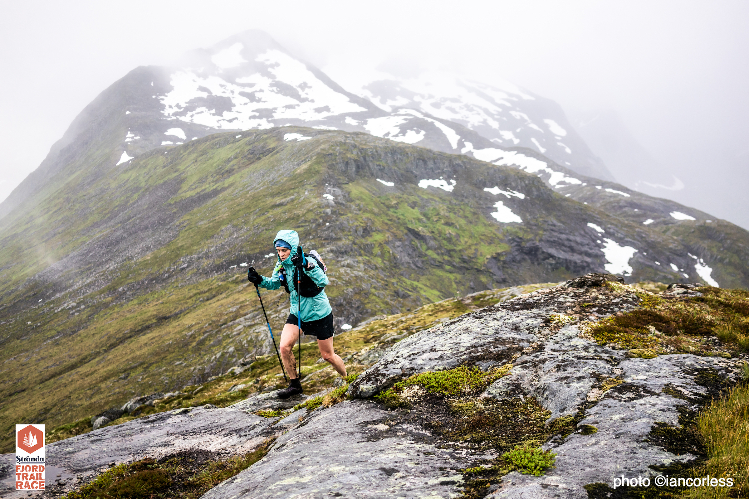
The 25km, 48km and 100km races are tough, challenging, and brutal and should not be underestimated. There is little easy running here, the climbing is hard and steep, the descents even on a dry day can be horrendous, in the wet, they are as one person said, “Terrifyingly slippery despite what shoes you use!’
Let’s be honest, Norway as a location is arguably one of the most beautiful places in the world, and as a runner or outdoor enthusiast, the options and possibilities are endless, be that in the south or north.
Stranda is located on one of the west Norwegian fjords, part of the Sunnmøre region, often accessed via ferry from Liabygda. It can also be accessed by road via Lom. For most, the easiest way to travel is to fly to Ålesund and then travel 50km by bus.
2022 was significant with the 25km being a stage of the Salomon Golden Trail Series, this event alone brought in more than 600-participants and many of the world’s best mountain and trail runners. The 4000 population of Stranda increased by approximately 30% over race weekend, an amazing boost for the local community. GTS brought a European razzamatazz to the event with live broadcasts, commentary, interviews, group runs and huge social presence – it was arguably the biggest promotion of trail running in Norway since the inception of the Tromso SkyRace which ironically was taking place on the same day further north.
There was huge anticipation of how the racing would go, key favourites such as Sara Alonso and Manuel Merillas would have a hard job of beating ‘local’ favourites of Jon Albon (Brit living in Norway) and Emelie Forsberg (Swedish) who has been living and running in Norway for many years. The inclement weather, challenging conditions and brutally slippery rock only played into the hands of those with local knowledge.
Jon Albon won the race in a new course record – amazing in the challenging conditions. Manuel Merillas (Esp) and Bart Przedwojewski (Pol) placed 2nd and 3rd ahead of Frederic Trancard (Era) and Davide Magnini (Ita)
For the women, we saw the rise of Sophia Laukli (USA) who won the event ahead of Elise Poncet (Fra) and Emelie Forsberg. Blandine HIrondel (Far) placed 4th and Sara Alonso 5th.
The stories post-race was truly mud, sweat and tears. Arguably the most challenging and technical race of the GTS and what a way to shine a light on Norway and its incredible landscape. I am sure there are many runners now thinking and planning future adventures in this epic playground.
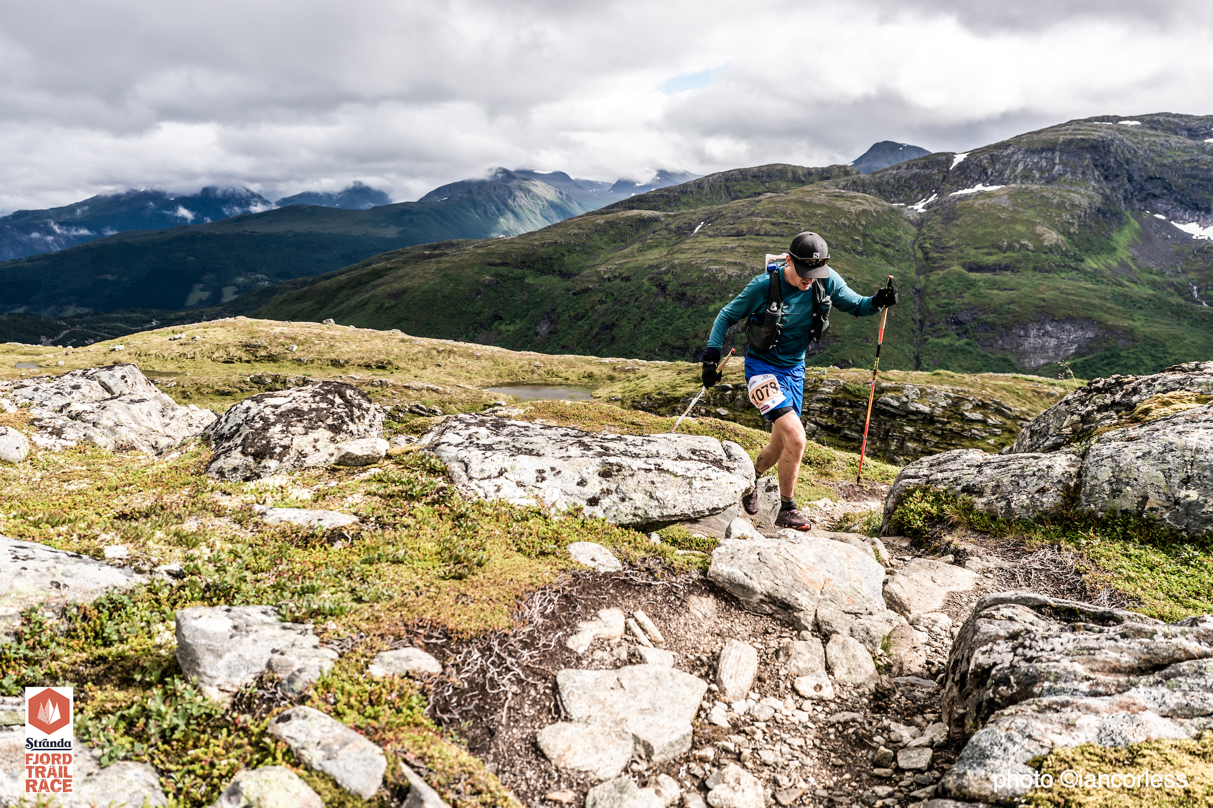
The 48km race, a big challenge but considerably more achievable than the 100k uses much of the opening miles of the 100km route, however, after reaching the summit of Fremste Blåhornet at 1478m returns to Stranda via Heimste Blåhornet, Løfonnfjellet and Rødesthornet. The route passes through Stranda start/ finish and continues on another loop summiting at Roaldshornet at 1230m and then following on to Blåfjellet and Skurdahornet before descending all the way down to the finish line.
Lasse Aleksander Finstad placed first ahead of Tolga Rambovski Olcay and Torbjørn Breansœter, 6:34, 6:50 and 7:07 respectively.
Mirjam Saarheim placed 7th overall and clinched female victory in 7:26. Jingling Tang and Anna Louise Astand Sørlie ran 7:50 and 8:02 to round out the podium.
Offering a 360 counterclockwise experience of this stunning area of Norway, the 100km route is a beast. It is quite simply stunning, even in bad weather. However, the physical and mental tenacity required to complete the race cannot be fully explained. This is reflected in only 33 participants finishing.
The course does contain some areas where you can switch off and just run, but they are few and far between. The opening miles may offer an illusion of the severity to come. The hard work starts to really kick in with approximately 20km covered at Liavarden. What follows are walls of grass, rock, scree, stone slabs, technical ridges, relentless vertical climbing, and challenging descending.
Reaching the summit of Fremste Blåhornet at 1478m and 23km the route was changed to avoid a technical ridge. The terrain that followed was rocky, slow, and brutal especially in the persistent rain and cold temperatures.
The aid station on the road of Dalevegen at 28km distance was followed by easy running before an extremely steep and challenging out-and-back climb to Storhornet at 1309m.
Liasætra aid station followed and then easy trail running to Patchellhytta DNT cabin. Here, the out -and-back to the summit of Slogen was removed – a shame but absolutely the correct call in the conditions.
Left in the valley and runners make their way to Velleseter, Brunstadsætra, Storevatnet, and then the road section crossing and aid station that leads to the final section of the course, 80km covered.
The climb to summit Roaldshornet at 1230m is long and relentless, the summit at 86km and it would be easy to think it’s all downhill from here. Considering what has gone before, it’s fair to say that it is. Eventually the 100km joins with the final section of the 48km track and the run in to the finish is welcome and hard earned.
Mathis Dahll Fenre battled with Vermund Upper Garden for victory, the duo separated by just 1-minute, 16:00 and 16:01 respectively. Thomas Wallin-Andersen placed 3rd in 16:59.
For the women, Wenfei Lie had led the early sections of the race ahead of Alexandra Narkowicz and although the duo was together on the climb to the final summit at Roaldshornet, Alexandra had more reserves to take victory in19:13 to 19:55 for Wenfei. Margrethe Fjetland rounded the podium.
One thing is for sure, running 25km, 48km or 100km in this area of Norway is not easy, ask anyone who toed the line of the respective distances. There is something truly magical here, 2021 opened up this area of Norway to the world, 2022 has elevated Stranda as a ‘must go’ location. I can only encourage and emphasise that you ‘need’ to add Stranda Fjord Trail Race to your bucket list. You will not be disappointed with the experience, BUT come prepared, you are going to earn that finish medal.
On October 26th 2020 I released via this website that Kilian Jornet would take on a 24-hour run at the Måndalen Stadium in Norway on November 8th.
This post was news to the ultra running world and it created a stir. It was BIG news. Just the thought that mountain man, climber, skier, alpinist, explorer and adventurer, Kilian Jornet, would contemplate running around a 400m loop was, well, crazy!
Kilian ‘Skyrunning’ at the iconic Trofeo Kima.
My news was copied, posted, re-quoted, shared and many media took my content, provided no credit and then shared the story.
Ironically, the news was short lived. Kilian direct messaged me to say he was too injured to contemplate this and then said via social media:
“Wow! I was all the day out and saw this just now 😅 Thanks for the idea guys!! At the moment I’m trying to get back from a injury (literally did my first run since last weekend) but why not to try to run something that long in the future..”
Suddenly, all the media who had posted were left perplexed and while many supported my news, I received countless negative comments, questions and basically nasty comments. I think the assumption was I had posted fake news, to coin a phrase.
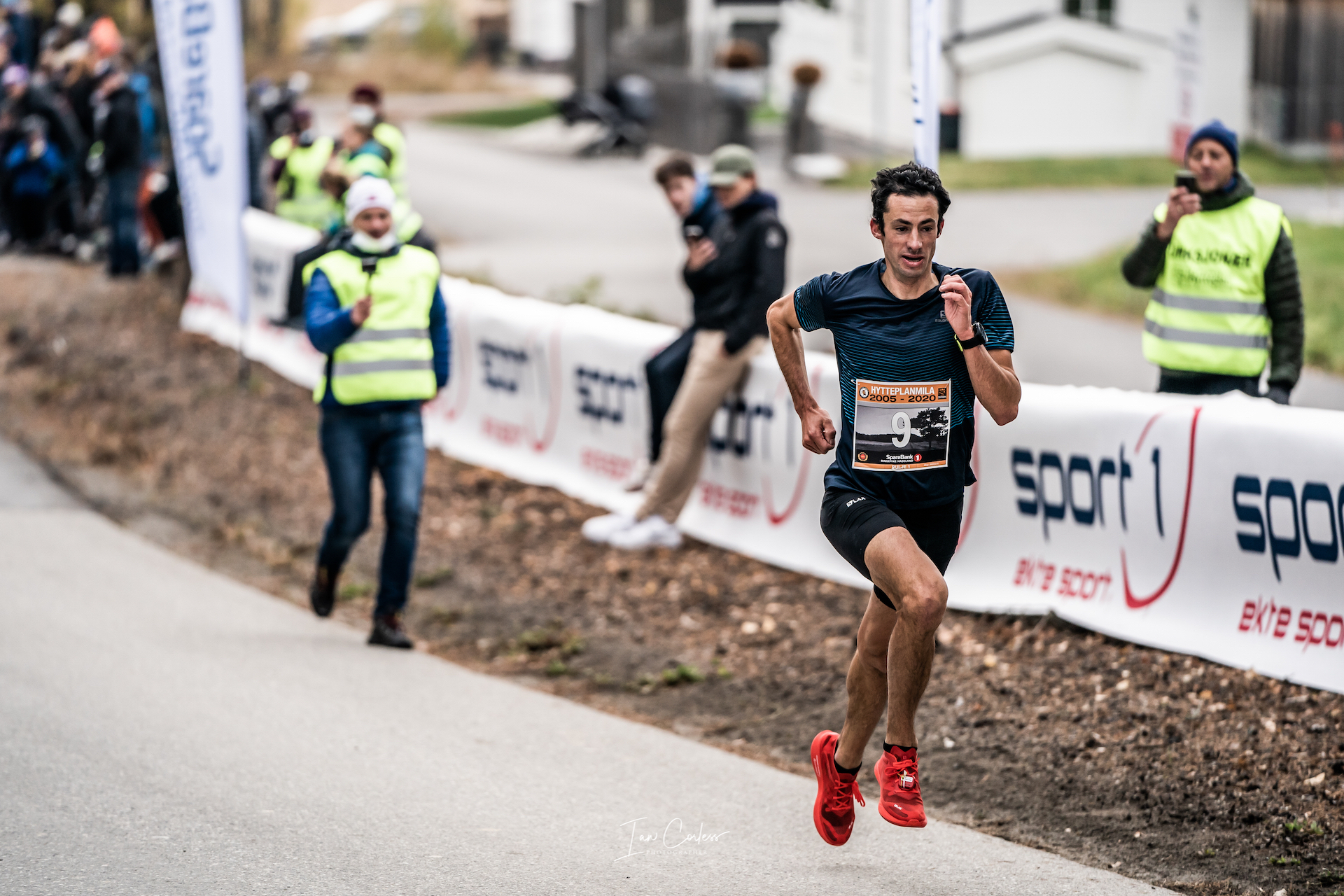
I had been with Kilian at Hytteplanmila 10km Road Race (HERE) where he ran 29:59 in his first ‘official’ road race. He told me of a niggling injury and that he would take a week off. In the following days (w/c Oct 19th), I heard news of the 24-hour attempt. This came from multiple sources, primarily athletes who were being invited to join Kilian on November 8th at Måndalen Stadium.
“In fact, the assault on the 24-hour challenge was scheduled for the first week of November, but Kilian was forced to delay it due to the discomfort that appeared after running his first 10 km race on asphalt, the Hytteplanmila, in 29 ‘ 59 ” in mid-October.” – Albert Jorquera writing for Runedia
It was difficult to confirm the story. That is until Sunday October 25th when a post on Norsk Ultra was made public. It was only a matter of time before this news became available for all.
I wrote my article HEREand reached out for quotes. The post once live went viral. I guess the rest is history… The announcement today by Salomon and Kilian is vindication, albeit the date of the event was wrong (injury doesn’t work to dates), of my original post.
*****
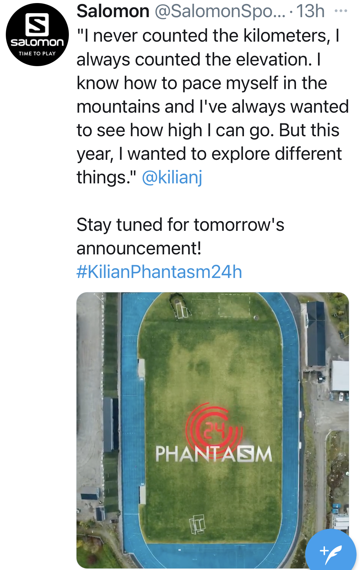
November 15th,Salomon and Kilian Jornet released simultaneously.
kilianphantasm24 announcement.
The date may have changed (due to injury) but the location and the concept remain the same. Kilian Jornet will run 24-hours on a track.
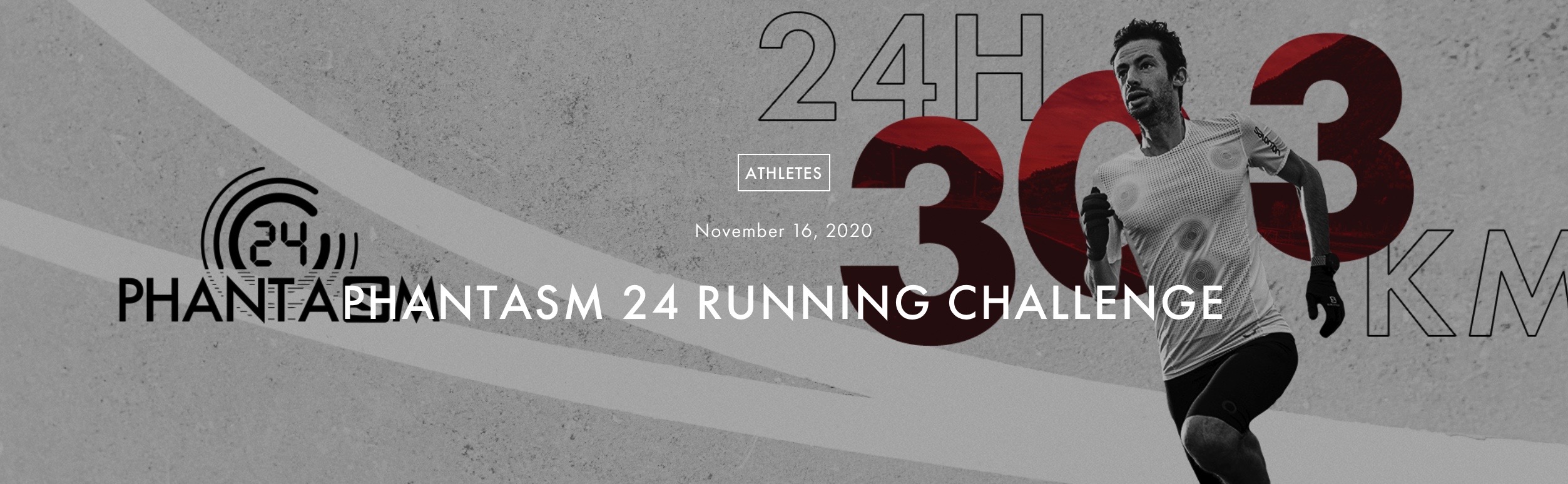
The release of the news by Salomon is extremely welcome and it so wonderful to hear the Kilian will push himself on a new stage. The original concept was an attempt to break the record of ultrarunnning legend Yiannis Kouros. The reality is 756 laps of a 400m track. Yiannis set the world record at 188.590-mile.
The event will take place at *Måndalen Stadium, and should have happened on the weekend of November 21/22 and as per my original post, the provision of +/- 2-days may need to be considered for weather. (*Lymbus who manage Kilian confirm the location to be Måndalen.)
Kilian writing on Facebook
The attempt has now been pencilled for Friday 27th November with a 1030 am start – to be confirmed! Weather looks cloudy with some sun but temperatures could drop to -7 if long term forecasts are to be relied on.
Salomon say, “The start time of Kilian’s Phantasm24 challenge is slightly weather dependent…”
Currently, weather forecasts are very poor with 70/80% chance of snow and temperatures between -1 and -3 during the day, they would be much colder at night. The stadium Måndalen Stadium is outdoor and this in itself brings a whole new dynamic to any 24-hour should this be the confirmed location. Norway in November, minimal daylight and cold temperatures, this will be a tough 24-hour.
To follow all the health prevention measures against the Covid pandemic, the challenge will be closed to the public. But it will be possible to watch live HERE
Phantasm shoe – Kilian used this for the 10km road race.
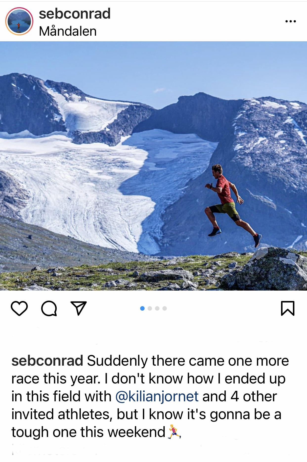
Titled #kilianphantasm24 – the project will see Kilian push new personal boundaries and at the same time, provide exposure for the Phantasm shoe. I am currently aware (tbc) of several other high-profile athletes who ‘may’ join Kilian on the track, Didrik Hermansen, Simen Holvik, Sebastian Conrad and two more, Harald Bjerke and Jo Inge Norum I believe.
“My hopes are to set a new national record and to have the honor to run 24 hours with these fantastic people.” – Simen Holvik
Didrik Hermansen Oslo 2020.
“So, now we all know! Going to be exiting. I will do the 24h, zero degrees.. hopefully no wind!” – Didrik Hermansen.
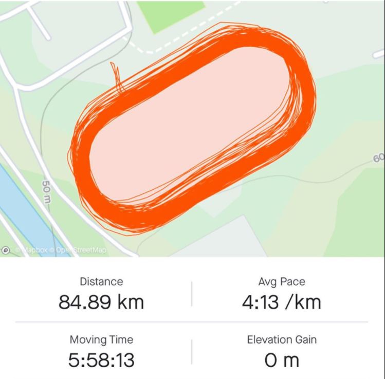
For perspective, to break the Yiannis Kouros world record, any runner would need to be able to cover an incredible 7.875-miles per hour. Statistics show that from the ‘test’ run by Kilian earlier in August 2020 that this objective may be possible? He ran 84.89km in 5:58:13 with an average 4:13/km pace. The numbers speak for themselves, it’s a huge undertaking, especially on an outdoor tack. However, it is going to be fascinating to see what happens with each journey of the 400m.
“…and now I am super excited to test myself doing something that long (and far from what I like) but where I will learn so much and grow as an athlete. (And probably doing this 24h in a track because I love that pain feeling.)”
Kilian Jornet, Twitter
Please support this website. I believe everyone deserves to read quality, independent and factual articles – that’s why this website is open to all. Free press has never been so vital. I hope I can keep providing independent articles with your help. Any contribution, however big or small, is so valuable to help finance regular content. Please support me on Patreon HERE.
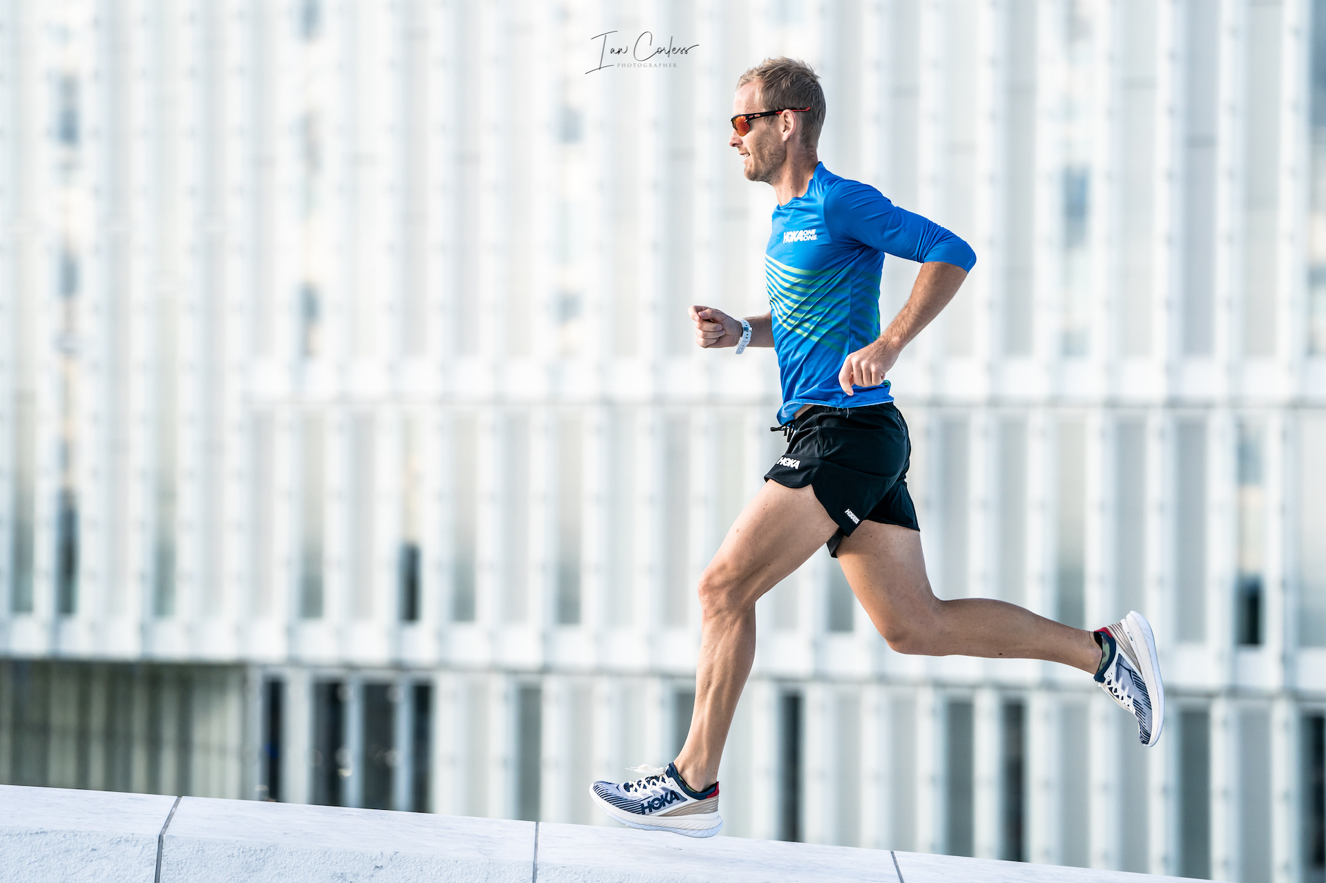
Kilian running his first official 10km on the road.
Kilian Jornet to attempt the 24-hour track record at the Moonvalley 24-Hour, Norway, on November, 8th – Måndalen Stadium.
Important update: 26th October PM:
“Right now I’m pretty injured, trying to start running ok again in a week or so. I had plan to do different road distances during this year but for the moment I need to recover well 😦 Maybe in the future, if injures allow would be fun to try to run that far… :)” – Kilian Jornet via whatsapp
Kilian goes on to say… “No problem! This running roads thing is so hard to manage on staying injury free! Looking forward for next year climbing more again 😅”
2020 has been a stange year, races have been cancelled, the FKT scene is booming and mountain running star, Kilian Jornet ran his first official 10km on the road clocking a 29:59 – report HERE.
All images copyright iancorless.com – all rights reserved
Warming up.
For many, Kilian running on the road was a surprise, only a couple of year’s ago, the thought of this was but a dream. Even Kilian himself thought a road race to be highly unlikely.
Coronavirus, restricted travel, no races and embracing new challenges seem to be the new normal. And Kilian is no exception…
Yiannis Kouros, the legend of ultra running has always been treated as a god in long-distance running, his stats speak for themselves. In 1984 he won Spartathlon in a record time. What followed set the benchmark for road and track running. His ability to run remarkabkle distances and times over 100-miles. 1000km, 1000-miles, 12hr, 24hr, 48hr and 6-days are incredible.
“When other people get tired, they stop. I don’t. I take over my body with my mind. I tell it that it is not tired and it listens.”
Yiannis Kouros stats : Image wikipedia
In 24-hours, he has run 180.335 on the road and 188.590 (1997) on the track. He has a 100-mile personal best of 11:46:37.
Camille Herron holds the women’s record 167.842 miles from the 2019 worlds in Albi. For perspective, Camille believes the record is possible and she has great ambitions for over 170-miles personally.
Scott Jurek, the ultra-running legend mixed road and trail, he ran 165.7-miles in 2010 for 24-hours. But many have come along and mixed disciplines, Mike Morton and Zach Bitter to name just two. Anatoliy Kruglikov ran 171.48-miles in 1995, besides Yiannis Kourus, he is the only one to come close on a track.
“I think 24 is unique enough and Yannis’ mark stout enough that it will likely take anyone more than one try. If anyone can get it on round one though, it’s Kilian. Norway did seem a bit strange with weather, but I suppose he is staying true to limited travel. That would be a bit cooler than I would like even with warmer clothes. Rather have that than too warm, but still not ideal.” – Zach Bitter
The news that Kilian will run a 24-hour race on a track is a real surprise. The additional news that he will attempt the 188.590-mile distance set by Yiannis Kouros is mind-blowing. To be held at the Måndalen Stadium, the race will potentially happen on November 8th with the provision of +/- 2-days to allow for weather. The stadium is outdoor and this in itself brings a whole new dynamic to any 24-hour, especially in Norway during November. Daylight will be minimal, temperatures will fluctuate greatly and the evening has the potential to be very cold.
For a any performance to stand in regards to records, certain criteria must be met and Måndalen IL and Salomon will guarantee that the necessary protocols are in place. Of course, situations my arise that make the attempt not possible.
For perspective, to break the Yiannis Kouros world record, any runner would need to be abale to cover an incredible 7.875-miles per hour. Statistics show that from the ‘test’ run by Kilian earlier in August 2020 that this objective may be possible. He ran 84.89km in 5:58:13 with an average 4:13/km pace. Many looked on and wondered, why would Kilian run on a track….? It would appear we have an answer.
Image Kilian Jornet Strava
“Progression comes from adaptations, adaptations come from training and resting. Training comes from knowledge and knowledge comes from testing. Yesterday I did a nutrition test. On a stable environment (a track) and an easy but steady effort I was testing different fueling and hydration protocols that I hope can help me to improve the energy levels during different goals….”
“…From a race where we can have access to fluid and food (almost) when we want, or, to a high climb where we have very limited food and fuel since we need to carry all. I believe testing is important to have better knowledge of oneself and to apply knowledge in training, racing or projects.”
This challenge is something I thought I would never see. I would imagine it’s a challenge Kilian never imagined he would undertake. But, here we are discussing the possibility of what may happen come early November…
The numbers speak for themselves, it’s a huge undertaking, especially on an outdoor tack. However, it is going to be fascinating to see what happens with each journey of the 400m loop at Måndalen Stadium.
Before the 10km road race in Norway, Kilian had a slight injury and that did impact on his race. However, post-race he took time off to recover. I guess the big question mark will be how that recovery has gone and what impact that will have over a 24-hour period. Maybe the injury will require to delay or cancel the attempt?
“I don’t think the injury is a real problem but I need to rest a little and get rid of it. When I run a VK the effort is typically 30-minutes but this is different. In terms of cardio, for me it was kind of easy all the time. It’s the legs, you need to feel light and keep the speed. It’s very different. The first 4 to 5km with more people was a challenge as you are almost cm’s from the other runners. I need to get used to that. I learned a great deal. I will try again, at least in the short term, but next year I want to climb… I have some specific goals. I just need more experience.”
The reality is 756 laps of a 400m track – we wish Kilian well with his new undertaking!
Please support this website. I believe everyone deserves to read quality, independent and factual articles – that’s why this website is open to all. Free press has never been so vital. I hope I can keep providing independent articles with your help. Any contribution, however big or small, is so valuable to help finance regular content. Please support me on Patreon HERE.
Norway has long been a desirable location for the mountain enthusiast. One only needs to add the word ‘Norway’ to a Google search engine and you will be rewarded with photos that make the jaw drop.
At roughly 33% bigger than the UK and 1/3rd the size of USA, one begins to understand the scale of this Scandinavian country and its 5.3 million inhabitants.
Just think about it, Norway is 33% bigger than the UK, but the UK has 66.6 million inhabitants.
Needless to say, outside of Oslo (681,000), Bergen (271,000) and other key locations such as Trondheim and Stavanger, open space and amazing landscape is available for all to explore.
In a series of articles and posts, we intend to introduce you to the magic of Norway.
Norway is the longest country in Norway and therefore, travelling anywhere is not a quick process. It has 60.000 miles of coastline, towering mountains and dramatic fjords. Remarkably it has 2-300 peaks over 2000m+, Galdhøpiggen the highest at 2469m closely followed by Glittertind at 2464m. There are over 1000 peaks over 1650m, so, if you love mountains, Norway should be at the top of the ‘to-do’ list!
We started with HARDANGER (HERE) and followed up with JOTUNHEIMEN (HERE).
The list will grow as we progress through Norway, but expect additional posts on:
Stavanger
Senja
Tromso
Lofoten Islands
Lyngen
Svalbard
And more…
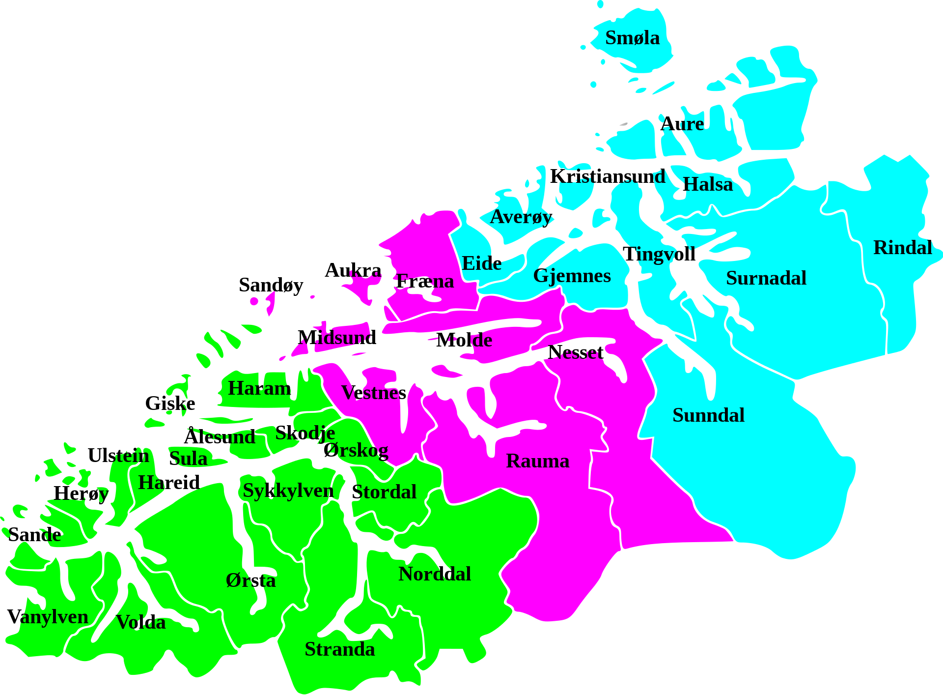
Møre og Romsdal
The name Møre og Romsdal was created in 1936. The first element refers to the districts of Nordmøre and Sunnmøre, and the last element refers to Romsdal. The three districts still have their own identities in many ways. Due to its difficult terrain, Møre og Romsdal has been very dependent on boat traffic, and its main car ferry company, MRF.
In terms of distance and travel, the entry to the Møre og Romsdal region is roughly 7.5-hours of driving from Oslo and 9-hours+ from Bergen. Møre og Romsdal is served by nine airports, of which only four airports have regular domestic flights. The largest airport in the county is Ålesund Airport, Vigra, which offers the only scheduled international routes from any airport in Møre og Romsdal.
The area is vast with 26 municipalities. Travel around the area, at times, can be lengthy and time consuming and if travelling by car, the need to use ferries may be required. We will look at the following areas:
Stranda
Strandais amunicipality in Møre og Romsdal county, Norway. It is part of theSunnmøre region.
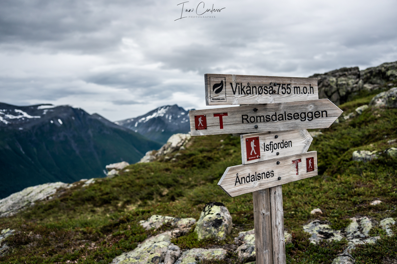
Romsdalseggen
Romsdalis atraditional districtin the Norwegian countyMøre og Romsdal, located betweenNordmøre and Sunnmøre. The district of Romsdal is named after the valley ofRomsdalen, which covers part of Rauma.
It is a popular area and in the months of June, July, August and September, you can fully expect routes to be popular with hikers, climbers and tourists. July and August being the key months due to more stable weather.
PRACTICALITIES
First and foremost, this is an introduction to Møre og Romsdal and we hope that you will read this article, digest the information and then plan your own adventure. There is much to explore in this area and countless trips will be required.
Møre og Romsdal ideally requires a vehicle, especially if you wish to travel say, from Romsdal to Stranda. However, you can take mini-breaks and stay in one area. Romsdal being a prime example, there are many route options.
In regard to accommodation, the best options are camping or using a hotel/ cabin. Remember, the word ‘cabin’ in Norway will often refer to an individual building (amongst many) on a campsite (different to a DNT Cabin). A cabin may well combine the best of both worlds, a cross between camping and a hotel. Please check details for each cabin, often, you need to bring your own sheets (silk liner for sleeping bag?) and towels. Trollstigen Resort (here) is an excellent example of what is on offer. On a personal perspective, camping is preferable with the option to stay 1, 2 or maybe 3 nights in a hotel (depending on the trip) to shower/ freshen up and then camp again. Also helps keep costs down. Although wild camping is allowed in Norway, some areas have less options than others. For example, on arrival in Åndalsnes the option to wild camp was limited, so, we stayed on an official site called Soggebru Camping which was a short drive from Åndalsnes but much quieter than others on offer.
OVERVIEW
Looking down on Åndalsnes
Åndalsnes is the start point for our journey and provides a central hub from which to explore. However, if you have a tent, the opportunity to wild camp is a ‘must do’ for several of the routes. (More information to follow below.)
Dramatic landscape of Stranda
In Stranda, we used the option to stay one night in a hotel (Strand Hotel), this allowed us an opportunity to shower, launder clothes, have a good dinner/ breakfast and we then resumed wild camping.
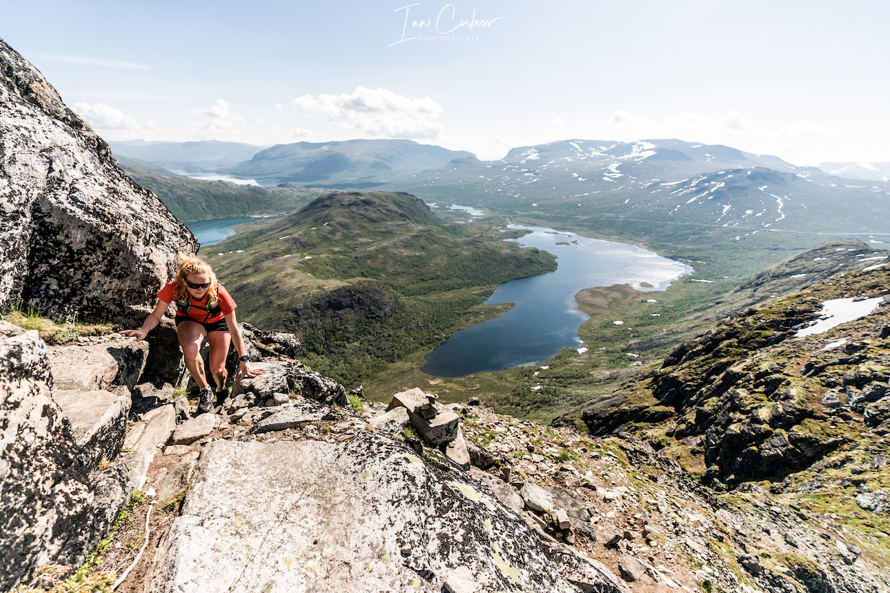
Climbing to summit Slogen.
Our final location Urke Møre og Romsdal, we camped at Urke Camping which provided access to Slogen and Saksa peaks. However, should you wish, there is an excellent hotel called Hotel Union Øye or there is a DNT Cabin (self-service cabin with provisions) that is ideal for the ascent/ descent of Slogen, Patchellhytta cabin.
Proposed Trip:
As mentioned, Møre og Romsdal has many options here are our ‘must do’ routes.
Day 2 – Åndalsnes and the complete Romsdalseggen (inc Blånebba) out and back route. Drive to Vengjedalssetra Valley and wild camp. Camp near Venjesdalsvatnet lake or take the small climb to Litlefjelletand have a stunning wild camp with the Toll Wall facing you-
Day 3 – Store Venjetinden and wild camp as previous night.
Day 4 – Romsdalshornet and then drive up the impressive Trollstigen route, options for sight-seeing and walking if required. Wild camp.
Day 5 – Trollveggen via out and back route. Starts at the tourist center. Onward drive to Stranda for night in hotel.
Day 6 – Stranda Fjord Trail route and wild camp.
Day 7 – Drive to *Urke Møre og Romsdal and then climb Saksa.
Day 8 – Slogen climb and then overnight camp or onward travel.
*options for camping, cabins, hotel or DNT cabin.
Please note:
Some roads on this route are one way in and one way out. They often have a toll charge which is payable via a bank card. Many also need a mobile phone. A system is used in Norway called Vipps it may be worth doing some research to see if you can use this system, as I understand it, you need Norwegian bank account and phone number.
THE ROUTES
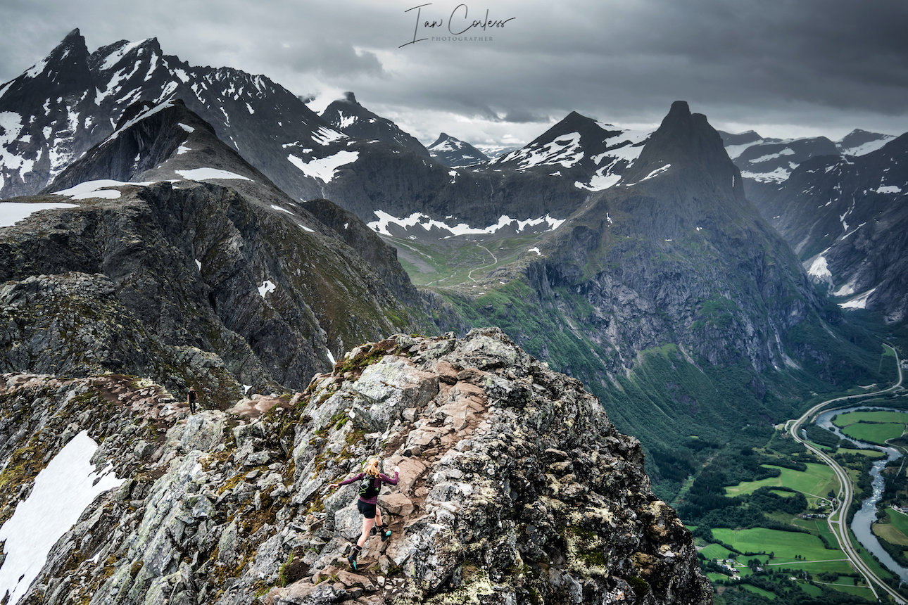
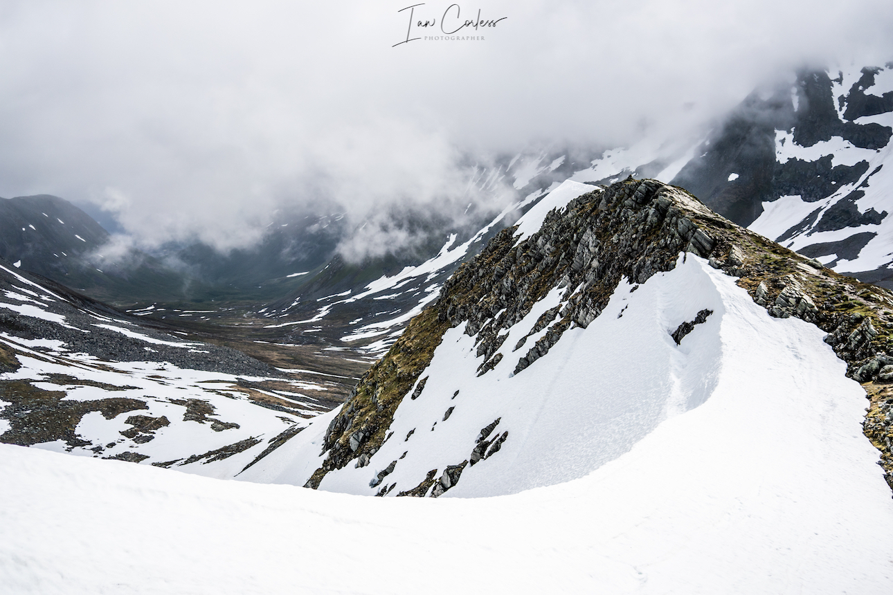
Romsdalseggen
Romsdalseggen Ridge
This route is often undertaken as a point-to-point starting at Vengjedalssetra and finishes at Åndalsnes. To do this, the best option is to take the bus which leaves 08:30 or 09:30 (June 15 to August 30.) If this is your plan, you are strongly advised to book in advance.
However, our recommendation is a full day out, starting and finishing in Åndalsnes.This is a tough and challenging day and includes the highest point Blånebba.
The route includes, Mjølvaskaret , Mjølvafjellet 1216m and Halsaskaret ridge.
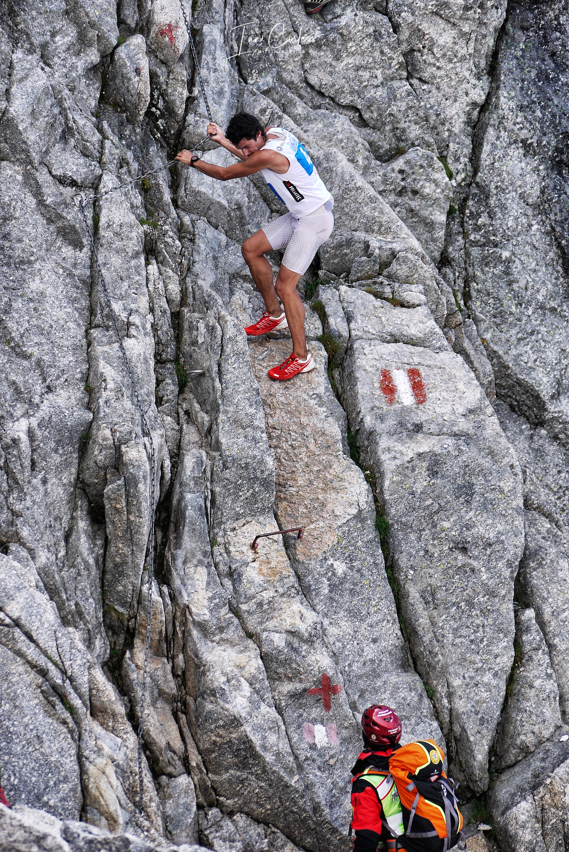
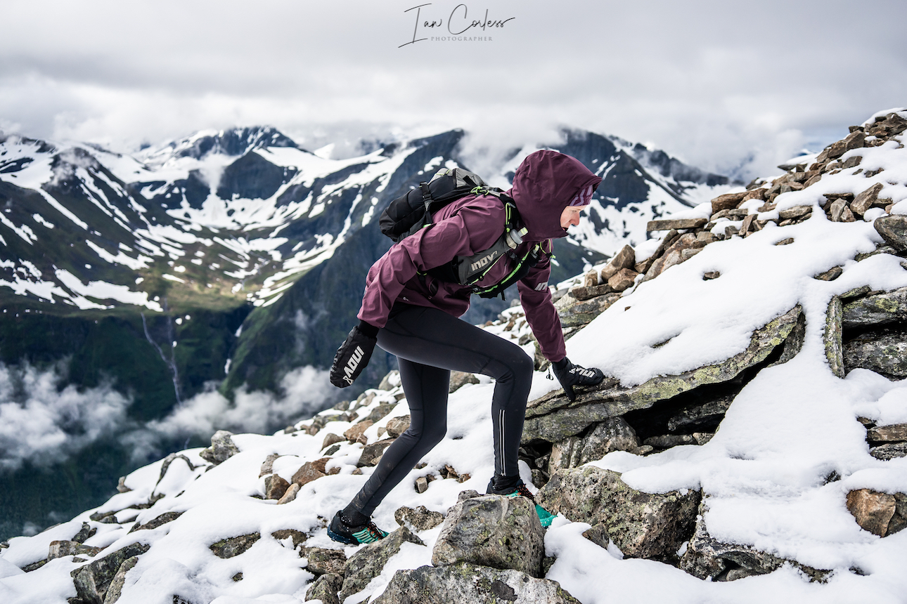
The route starts in Åndalsnes next to a parking ground and immediately rises up with the first highlight being the Rampestreken viewpoint. This is a metal platform that allows you to walk out with stunning views over Åndalsnes (weather depending.) Romsdalstrappa rock steps lead upwards and finally everything opens up. A stone cabin Ottarbu is situated on Nesaksla should you need shelter in bad weather. From here, the route becomes more challenging and exposed depending on experience. The ridge narrows at Mjølvaskaret. Mjølvafjellet follows and now the terrain is more challenging with fixed chains and some exposure. Halsaskaret ridge is steep in places and in the wet, care is needed.
Progressing along, follow directly ahead to Blånebba. Any turn to the left here will take you to the valley where the bust takes the point-to-point hikers. The terrain steepens and is extremely rocky, Blånebba is the high point at 1320m. It is possible to explore here, look around and of course take photos. At all times take care.
The return route is via the way you came and although backtracking, it has a very different feel. What was down climbing is reversed and vice versa providing a great stimulus. The route is 20km+/- and the time it will take depends on many factors, for example we had rain and snow. However, a good pace and 4-hours would be achievable with photo stops.
Store Venjetinden
Wild camp close to Vengjedalssetra, we suggest you go near Venjesdalsvatnet lake, there are some great camp spots at the top closer to Romsdalshornet and you have access to water.
The route to Store Venjetinden on the face of it looks like a straight out and back. Starting just off the road the start of the route is easy to miss due to overgrown trees. Expect your feet to get wet early on.
You start climbing right from the start and continue to do so all the way. You need to feel comfortable moving over rock. Much of the rock is loose here, so, at all times take care. Snow may very well be present the higher up you go, so, be prepared with micro crampons and ice axe.
The higher you go, the more challenging the route becomes and some scrambling and climbing skills are required. At all times, keep asking, ‘can I go down the way I have come up?’ There is no shame in turning around.
The views on a clear day are remarkable providing stunning vistas over all the surrounding area.
The route down is the same as the way you came. Again, care is needed on all the loose rocks.
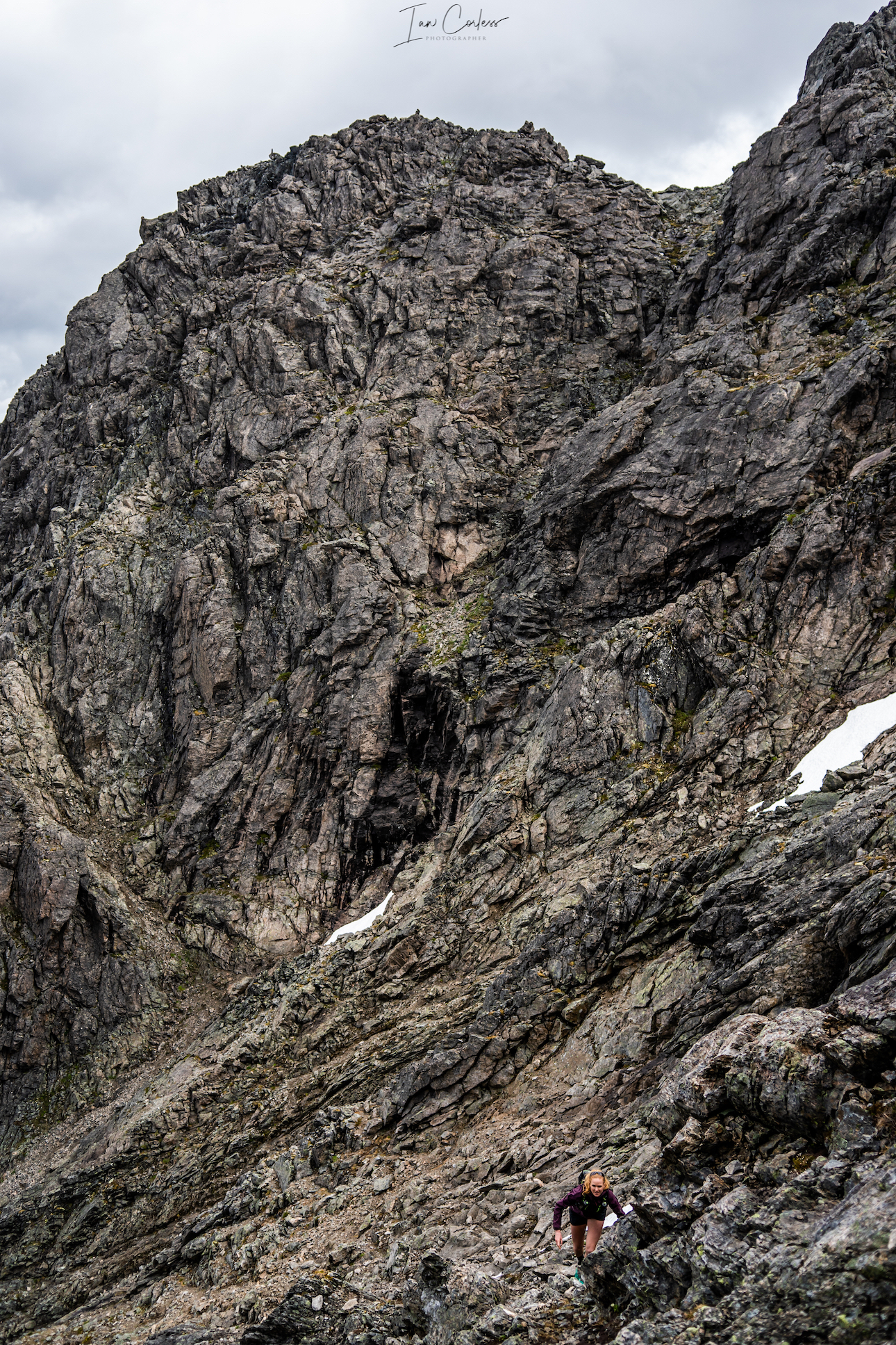
Romsdalshornet
You can access Romsdalshornet route from the same wild camping place next to the Venjesdalsvatnet lake. However, if you are going to have a clear and calm night, we strongly recommend that you start the climb to Romsdalshornet and wild camp close to Litlefjellet. There are a couple of small pools here and stunning views of the ‘Troll Wall.’ Amazing at sunset and sunrise.
In the morning you can start the upward climb to Romsdalshornet which requires some climbing and scrambling at easy level until you arrive at the base of the horn. Continuing on very much depends on skill level and if you have climbing and mountaineering experience. Most people use ropes here, however, someone like Kilian Jornet considers this an easy scramble.
“Fortunately – for most people – it is experienced as more demanding and dramatic from a distance than when you actually start climbing. From afar, it looks almost impossible, but as you get closer and closer, more and more formations appear and you see that the mountain is not so steep. Romsdalshorn is still a real challenge for most people. And an experience of a lifetime.” – Fjellguide.no
Trollstigen
It is a popular tourist attraction due to its steep incline of 10% and eleven hairpin bends up a steep mountainside. Visually spectacular, there are options to stop and soak in the views. Should you wish, there is a trail that starts in the valley and goes all the way up. Stigfossen falls is a highlight of the region which drops 320 metres down the mountainside.
Trollveggen
Trollveggen is the main reason why you would take the hair pin bends of Trollstigen. At the plateau once you have finished driving upwards, you will see a large parking area to the left. Here is a tourist center, cafe and several options for viewing platforms.
It also provides a wonderful out-and-back route to Trollveggen.
The Troll Wall is the tallest vertical rock face in Europe, about 1,100 meters (3,600ft) from its base to the summit of its highest point. At its steepest, the summit ridge overhangs the base of the wall by nearly 50 meters.
The wall has an incredibly history of climbing, however, it is extreme and requires great skill. The route we take is a run/ hike and depending on time of year and conditions, much snow can be encountered.
The route is an uncomplicated out-and-back over initially easy terrain, however, there are some significant boulder fields to cross and in the latter stages, a great deal of potential for snow. Be prepared for all weather.
The route is not long, at most 12km however, the terrain can be slow and all the way out, you are climbing. The return is much quicker.
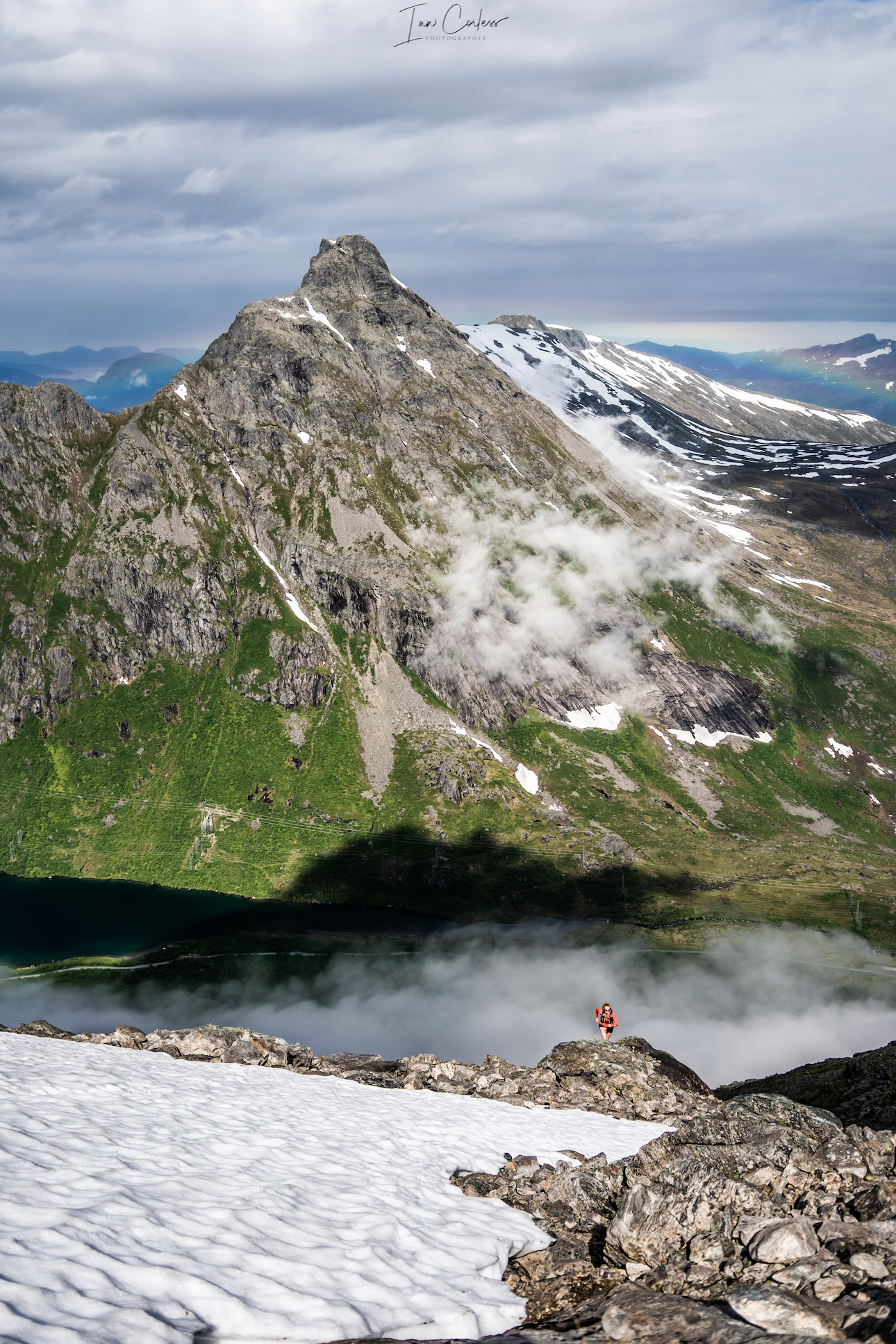
Stranda
The journey to Stranda should not take to look from Trollstigen, expect 90-minutes, however, you will need to take a ferry on the final leg. After many day’s camping and the mountains, now is a good time to spend a night in a hotel.
The Stranda Fjord Trail Race has several route options 25km, 48km and 100km. Our recommendation is the 48km and there are options to make this a fastpack over 2-days or, you can cut the route short finishing at Stranda. Slogen which appears in our schedule later was also part of the 100km route, so, you get the best of both worlds. A GPX track is available here.
The routes here are stunning and challenging. Be prepared for tough terrain, changeable weather and stunning views. There will most likely be snow at times.
You have the option to start in Stranda adding km’s or take a bus to the race start point at Opshaug.
The early sections of the route are easy and at times runnable. Forest trail opens up with stunning views of the Fjord. Eventually, the trail will become steeper and steeper and you will climb an almost vertical wall of green moss.
Once through this, the terrain turns to rock and boulder and you will climb and climb all the way to Fremste Blåhornet 1478m. At the summit, you will turn around and retrace but instead of turning right and taking the path you came up, you will continue on. Heimste Blåhornet is the next peak. The terrain is at all times challenging and although the route has markers, you are advised to follow a gpx.
Lofonmfjellet is the next significant peak at 1178m but what is between is no means easy, the terrain constantly asks questions of you.
Rodsethornet 1085m follows. This section has some great ridges and exposure with stunning views below.
Now you make your way back to Stranda with approximately 30km covered. You have the option to end the day, or continue on for the additional loop which takes in 3 significant peaks at 1230m, 1144m and 849m.
Note – This whole route is a challenge!
Saksa
The drive from Stranda to Urke Møre og Romsdal takes approximately 1-hour and the final section is stunning. Please note it is a dead end at Urke, you need to return via the way you came.
There are many possibilities for wild camping in this area, both in the valley and when out on the trails. We decided to stay at Urke Camping as it was very close to the climb of Saksa.
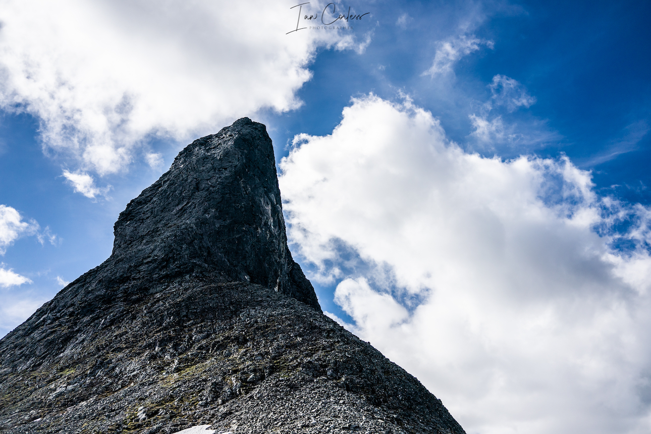
While Saksa may be one of the lower peaks in the area, it’s a wonderful little climb up and down that can be fitted in to any day. On a clear day, the views apparently are magnificent. For me, it was wind, rain, mud and pretty much no visibility.
The route is like a classic VK winding up the mountain, at times on good single-track, other times, Nepali steps. In the wet, the trail gets very muddy and the rocks slippery. The final push to the summit is steep but there is little difficult terrain to worry about.
Slogen
At 1564m, Slogen is a straight up climb from sea level and as such, this route brings its own challenges. You can break the climb up by staying at Patchellhytta Cabin, however, our choice was up and down in the same day.
We chose the steeper and direct route starting near Øye.
Early climbing is in forest and once out of the tree line, the views and trail open up. At times it is steep but not technical. Eventually you will arrive at a ’T’ junction, almost certainly a snow field will be ahead of you. Here you go left to the summit. Notably, right will take you to Patchellhytta Cabin – this will be the route down.
From this ’T’ to the summit, the challenge increases as does the difficulty. For our ascent, snow had fallen over night adding to the challenge. Experience and comfort with some mountain exposure is recommended but not essential. Moderate climbing and scrambling skills are required; and the challenges increase closer to the summit. As always, self-check and ask, ‘can I go down what I have come up?’
Even though it is not among the highest peaks in Norway, the mountain is rated among the top ten mountain hikes in Norway. This is largely due to its beauty, view, and the fact that it’s rising directly from afjord.
At the summit, there is a box and you can sign the book. On a clear day, views are amazing.
On the descent, continue in a reverse direction as to the way up. At the ’T’ continue on along the ridge and follow the markers. In the distance you will see Patchellhytta Cabin.
At the cabin, turn right and then follow the trail back down to the main road at Skylstad. The route down is rocky at first and then transitions to forest trail. If there has been a great deal of rain, expect mud and slippery conditions.
It’s a stunning round trip route.
As a recommendation, start early. We were on the trail up by 6am.
RECOMMENDATIONS
Never underestimate the mountains and the environment in which you are exploring. Snow can be a factor on all of the above routes and in July, we had some snow on every route. In particular Slogen. It is advisable to have micro crampons and an ice axe as a back-up for some of the routes.
Weather is crucial and many of the above routes would become very dangerous in bad weather. I cannot emphasize enough that grip is essential! You need an outsole that works on wet and dry rock. Running shoes are very personal but recommendations are VJ Sport MAXx and XTRM, Scott Supertrac RC2 and inov-8 Roclite.
Be prepared, Norway can throw 4 seasons at you in 4 hours.
Suitable pack
Hat
Gloves
Warm insulated layer
Warm trousers
Waterproof jacket/ pants
Food for the duration of the hike and some contingency
1,5 ltrs of water (which can be replenished on all the routes via streams/ waterfalls)
Take water purification tablets as a just in case and consider a water purifier such as MSR Water purifier
Map/ Compass
Charged mobile phone with a suitable App such as ‘Footpath’ (here)
Cash/ Card
Garmin InReach or similar
Bivvy bag
Sunglasses
Suncream
Plan your routes, be realistic on timings and always start early. One of the huge advantages of outdoor activity in Norway is daylight. In June, July, August you have plenty of light.
CONCLUSION
Møre og Romsdal has a great deal of variety and has something for experience and relatively inexperienced.
We touch on the possibilities available and trust me, you can spend months and months here and still have plenty of routes and options to keep you occupied.
This article is created as a gateway to the area knowing only too well that it will whet your appetite for other adventures.
A car is advisable to get around and facilitate more exploration but of course, it is not essential.
In comparison to our other articles on Exploring Norway, Hardanger and Jotunheimen, Møre og Romsdal is more extreme and on a par with Jotunheimen.
We cannot emphasize enough the role of weather and the impact it has on all of the above recommendations. The mountains will always be there, cancelling a planned route or turning back is acceptable and wise.
PERSONAL NOTE
Special thanks to Abelone Lyng who has extensive knowledge of the area, her experience was invaluable in planning routes and making a workable itinerary.
Please support this website. I believe everyone deserves to read quality, independent and factual articles – that’s why this website is open to all. Free press has never been so vital. I hope I can keep providing independent articles with your help. Any contribution, however big or small, is so valuable to help finance regular content. Please support me on Patreon HERE.
Norway has long been a desirable location for the mountain enthusiast. One only need to add the word ‘Norway’ to a Google search engine, and you will be rewarded with photos that make the jaw drop.
At roughly 33% bigger than the UK and 1/3rd the size of USA, one begins to understand the scale of this Scandinavian country and its 5.3 million inhabitants.
Just think about it, Norway is 33% bigger than the UK, but the UK has 66.6 million inhabitants…
Needless to say, outside of Oslo (681,000), Bergen (271,000) and other key locations such as Trondheim and Stavanger, open space and amazing landscape is available for all to explore.
In a series of articles and posts, we intend to introduce you to the magic of Norway.
Norway is the longest country in Europe and therefore, travelling anywhere is not a quick process. It has 60.000 miles of coastline, towering mountains and dramatic fjords. Remarkably it has 2-300 peaks over 2000m+, Galdhøpiggen the highest at 2469m closely followed by Glittertind at 2464m. There are over 1000 peaks over 1650m, so, if you love mountains, Norway should be at the top of the ‘to-do’ list!
We started our articles with HARDANGER which you can read HERE.
The list will grow as we progress through Norway, but expect posts on:
Stavanger
Senja
Tromso
Lofoten Islands
Romsdal
Lyngen
Svalbard
And more…
JOTUNHEIMEN
The ‘home of the giants’ contains the 29 highest mountains in Norway, and as such, it is a playground waiting to be explored. It has 250 peaks over 1900m! Established in 1980, Jotunheimen National Park covers more than 1,000 square kilometers of Sogn og Fjordane and Oppland counties. Reinder, elk, mink and wolverines live in the park and most certainly, in the more remote and quiet areas, it is possible to have a sighting.
In terms of distance and travel, the entry to the Jotunheimen region is roughly 4-hours of driving from Oslo or Bergen.
The area is vast with a multitude of possibilities and therefore, this article will be very much be a ‘part one’ to be followed up with additional posts as we explore more of the area.
It is a popular area and in the months of June, July, August and September, you can fully expect routes to be popular with hikers, climbers and tourists. July and August being the key months due to more stable weather. However, June is a wonderful month as snow can linger on many routes.
Any visitor to Jotunheimen, particularly on a first visit, will have the iconic Besseggen top of the list along with the highest peak in Norway, Galdhøpiggen at 2469m. We will include both of these here in this article and introduce you to other options: Knutshøe, Surtningssue and Besshø.
PRACTICALITIES
First and foremost, this is an introduction to Jotunheimen, and we hope that you will read this article, digest the information and then plan your own adventure.
Jotunheimen is expansive and in all honesty, best travelled on foot.
DNT – CABINS
Jotunheimen has a plethora of cabins (DNT) which link all the major trails and routes and certainly, the DNT option provides the easiest and most logical way to link routes for an amazing multi-day experience. There are 550 cabins in Norway looked after by The Norwegian Trekking Association. There are different cabins: staffed, self-service and no service.
Staffed – Staffed lodges serve breakfast and dinner. Many have showers and electricity, either from the power grid or from a local generator.
Self-Service – The self-service cabins are equipped with all that trekkers need for cooking and sleeping. Firewood, gas, kitchen utensils, table linen and bunks with blanks or duvets and pillows (hut sacks, also known as hut sleepers, are required!)
No service – No service cabins usually have the same equipment as self-service cabins, but they have no provisions. There also are a few simpler no-service cabins where you’ll need a sleeping bag and perhaps more equipment.
Use ut.nohere for what is available, there is also a very good phone app.
If you plan to use DNT it makes sense to become a member as you will save money, join here.
In nearly all cases, particularly in high-season and for popular routes, booking ahead (here) is a good idea. But rest assured, DNT will never turn you away, ‘…but everyone who comes to a cabin will have a place to sleep, either in a bunk or on a mattress on the floor.’ A 2020 price list is available here. A full board option is a great idea as you get a bed, 3-course dinner (always excellent), breakfast and a packed lunch. So, if moving from DNT to DNT you can really travel fast and light and make the most of the days. NOTE: You do not need a sleeping bag, just a sleeping bag liner – great for weight saving!
WILD CAMP
Jotunheimen is a paradise for wild camping, so, if you are on a budget, looking for a raw experience or want to fastpack, this is the place for you. In most cases, you can camp close to or at a DNT cabin. So, it can be possible to save on lodging and still eat at a DNT. Especially useful if venturing out for multi-days, that way you can really save on food weight.
Screenshot of DNT meal prices:
HOTEL
Hotels are in abundance in Jotunheimen and they provide an option to be used as a base or as stops as one travels around. They are great as a start and end to a holiday in this area, but not the best option if you really want to explore.
OVERVIEW
Bygdin is perfect entranceway to Jotunheimen and you could start the journey with a little luxury at the Bygdin Fjellhotell. It is also possible to wild camp in this area, even close to the hotel. Located at the end of Bygdin lake, it’s a perfect start point.
This fjord has a ferry which you can use to access Torfinnsbu or Eidsbugarden – both of these provide great start points for a fastpacking journey.
Fastpacking Journey:
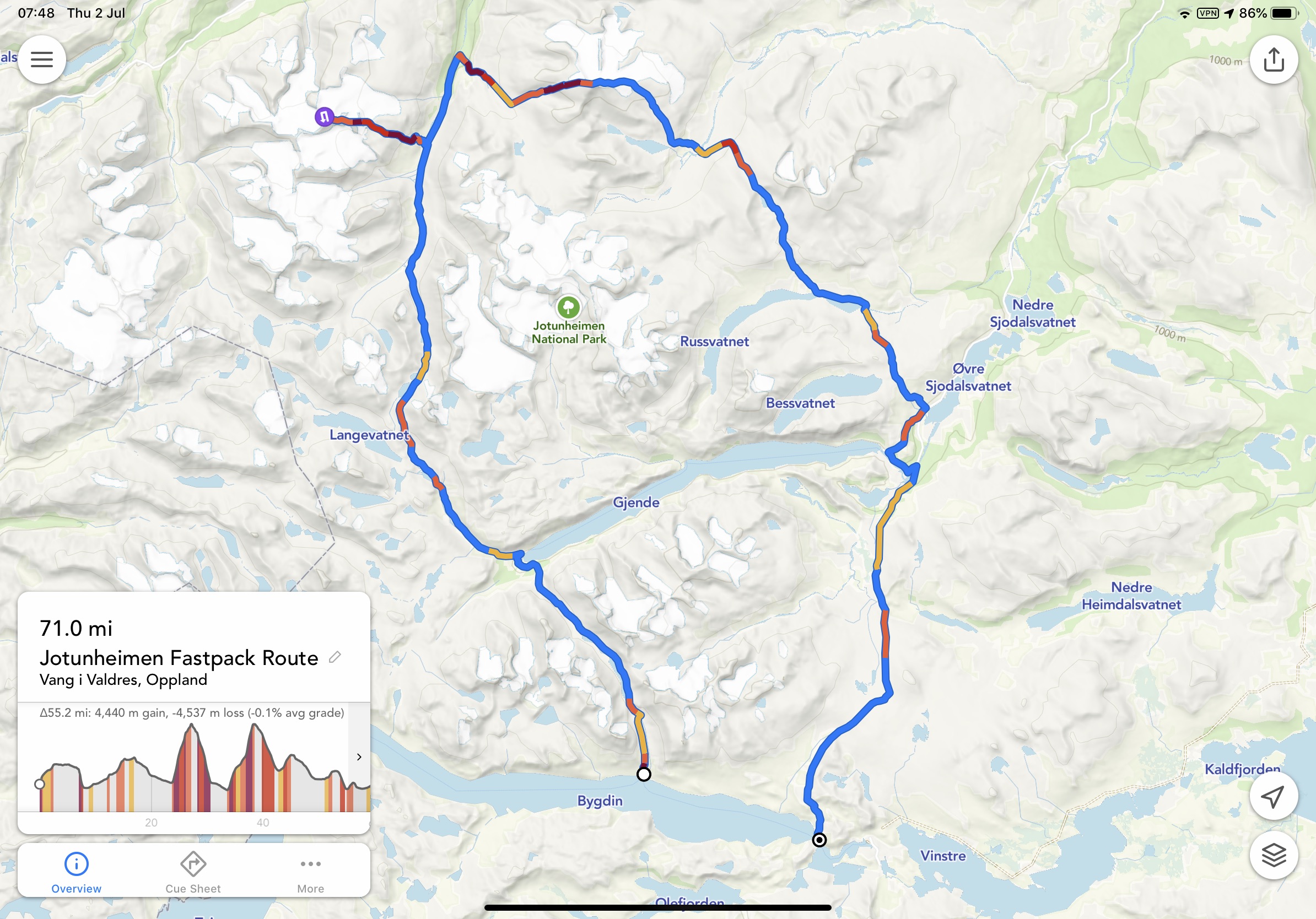
Although not discussed in-depth this article, you could leave your car at Bygdin, take the ferry to Torfinnsbu then take the trail to Gjendebu. From here you could then head north via Storådalen, Urdadalen and then to Spiterstulen which is the gateway to Galdhøpiggen. You could then climb Galdhøpiggen and return to Spiterstulen. From here, proceed to Glittertinden, on to Glitterheim and then follow the trail down to Gjendesheim via Tjørnholtjørna and Russa. From Gjendesheim take the trail via Vargebakken and Valdrersflya to arrive back at Bygdin Fjord. GPX here.
From Gjendesheim you could take the ferry to Gjendebu (you were here on day 1 or 2 of the fastpack) and now follow the trail to Memurubu. At Memurubu you have several options? A great day out is to take the trail to Surtningssue summit heading out on the lower trail that passes Memurudalen. At the summit, return via the way you came and then the trail splits and you can return to Memurubu via different route (full details listed below). From Memurubu you can now take the Besseggen route (details below) to Gjendesheim.
Proposed Trip:
As mentioned, Jotunheimen has many options and while the above fastpacking route and option is probably the ‘ideal’ way to explore the area, we wanted to break options down into manageable junks.
Areas to explore:
Knutshøe
Galdhøpiggen
Surtningssue
Besseggen
Besshø
Schedule:
Day 1 – Travel and overnight at Bygdin area.
Day 2 – Knutshøe route and then drive to Spiterstulen (2 hours) to either wild camp or stay at the DNT hut.
Day 3 – Climb Galdhøpiggen and then drive to Gjendesheim to stay in the DNT or wild camp.
Day 4 – Take the first ferry from Gjendesheim to Memurubu. Pitch tent or check-in at DNT and then do the Surtningssue route. Overnight at Memurubu.
Day 5 – Besseggen ridge to Gjendesheim – You can send luggage/ tent on the ferry so that it will be at Gjendesheim when you arrive from the trek. Overnight in either DNT or wild camp.
Day 6 – You can either travel home OR add an extra day with the climb to Besshø and return to Gjendesheim for an additional overnight wild camp or DNT.
Day 7 – Travel
Please note:
Make sure you book the ferries in advance here. They get very busy, particularly the first one from Gjendesheim. If you have a car, you need to stay at the Reinsvangen ‘Long Stay’ car park (here,) make sure you pay for parking to cover the duration of your stay. A shuttle takes you to the ferry or you can walk, approximately 1.5 miles. When possible, book the DNT’s you require in advance.
THE ROUTES
Knutshøe
A short drive from Bygdin, Knutshøe is a great introduction to Jotunheimen. Many consider Knutshøe a more challenging route than Besseggen? However, it is very much considered the younger brother or sister.
The total route is approximately 12km taking an anti-clockwise loop. You reach a high point of 1517m and in total you will accumulate 700m +/- while covering the distance. It is rated as ‘difficult’ and without doubt, it does have some exposure. Depending on experience and speed, the route could take up to 6-hours. However, moving fast and light and combining running and hiking, it is easy to complete in well under 3-hours. All the difficulty is in the first half of the route when you climb up and then descend. Once down, you have a flat 6/7km valley to cross back to where you started. GPX here.
Access to the route is from the main road and there is a small parking area that can accommodate approximately 20 cars. It is possible to wild camp here too. Either way, arrive early and start the route as soon as possible.
Note! If raining, this is NOT a good route to take. There is a considerable amount of rock both up and down and it can become very slippery.
Leaving the car park, follow the trail and when at a fork, go right and head up the climb. The route requires scrambling, some climbing and at several points you will encounter steep drop-offs.
Depending on experience, you may find some areas of the route really rewarding or terrifying. It is not a very difficult route; however, it does demand respect and patience.
At all times, the views are spectacular and ahead of you, on the other side of the lake, you have Besseggen completely in view pulling you in.
At the summit, you have a wonderful 360 view and if timed correctly, you will be able to see the ferry boats going back and forth on the lake below.
The descent is rocky, challenging and requires patience. Make sure hand and foot holds are secure and take your time.
Rock eventually becomes trail and before you know it, you will be at the bottom and next to the Gjende river. It is now possible to get water if needed?
You now go left and follow the trail back. At times, it’s easy to lose the trail so be attentive, as a recommendation, stick with the tree line and not the river. Your feet will get wet, guaranteed!
Once back at the car, take time to rest, change clothes and then make the 2-hour journey to Spiterstulen. En-route, there are possibilities to stop and buy food/ supplies.
Galdhøpiggen
The drive to Spiterstulen brings you straight to the start point for Galdhøpiggen. Having the journey out of the way allows for good recovery in the evening and an early start the next day. As mentioned, you can stay at the DNT or wild camp in this area.
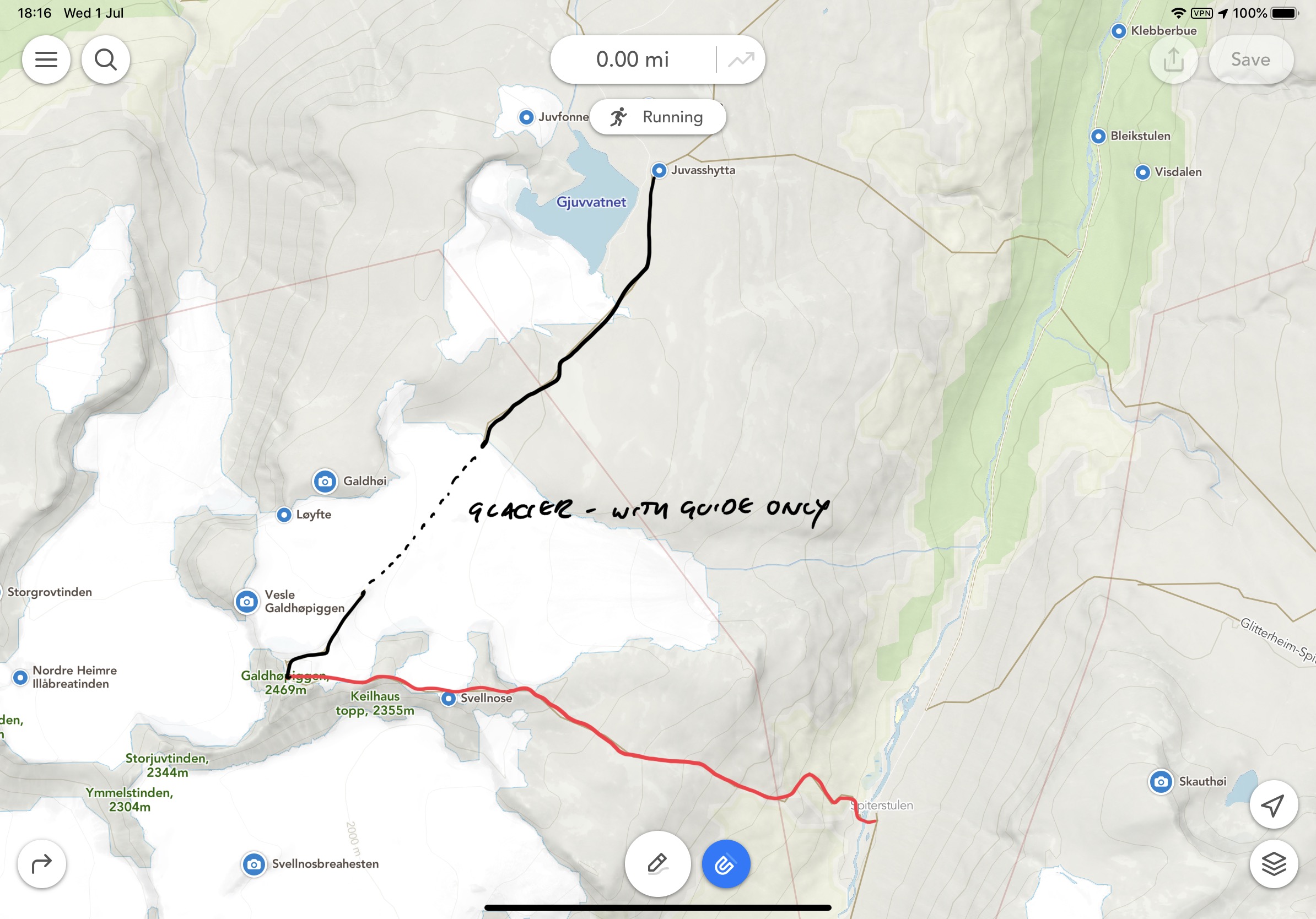
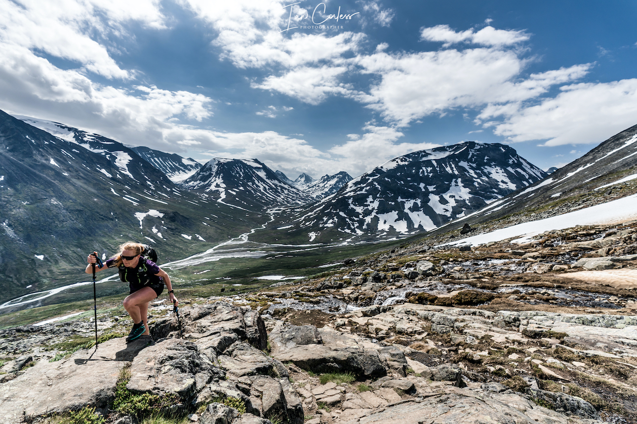
The highest peak in Norway (2469m) and Northern Europe is understandably a huge draw. For many, they take a guided trip leaving from Juvasshytta mountain lodge (1841m.) Guides take groups across the glacier. The glacier of course sounds appealing… However, it is an easy route with far too many people.
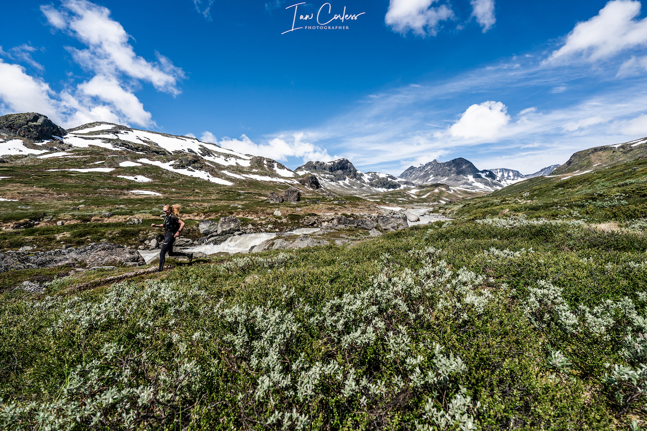
The route from Spiterstulen mountain lodge may not contain a glacier, but the 1400m vertical climb offers far more challenges. Especially if one travels in June as snow will still be present. The route is up and down is via a well-marked trail, GPX here.
Considered demanding, the route can take 8-hours plus, again, we completed the route in half the time.
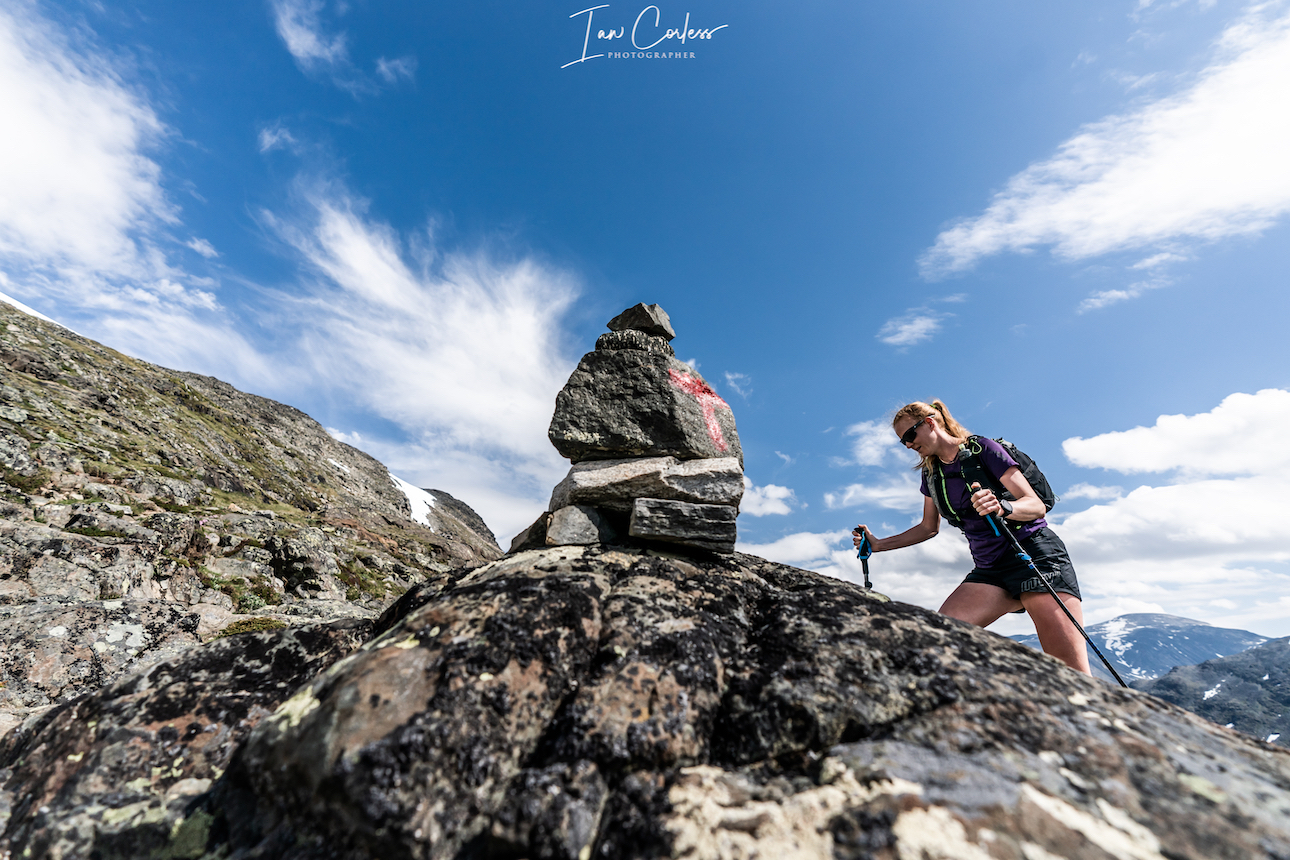
During the adventure, you will scale two peaks, totaling over 2,000 meters in height, Svellnose 2272m and Keilhaustopp 2355m! The terrain is tough and requires concentration at all times. Made up of rocks and boulders, for much of the time you are constantly piecing together a jigsaw puzzle to find the best route through. In wet weather, the route is very dangerous. Remember to follow the red “T”s that indicate the trail.
At times, you will cross snowfields and of course, stick to well used routes. Take no risks on the snow!
Several points can take you very close to the edge of the ridge. At all times be attentive, not too much of a problem in good weather, but in poor visibility you need to make sure of the route.
As you go up you feel several times that the summit is ahead only to reach a peak and then see several more in the distance. The final push becomes obvious as a hut is at the final summit and you will probably see a stream of people coming in from the right who have crossed the glacier.
At the summit the views are magnificent and well worth all the effort. An early start may well guarantee you some quiet time and space.
You descend via the way you came and in all honesty; due to the amount of rocks, it may well be more difficult to go down? Certainly, if you have tired or sore knees, you will feel every meter of the 1400m.
The route out and back is approximately 14km.
If you had an early start, you will be back by midday/ early afternoon and then you can take the 2-hour drive to Gjendesheim.
At Gjendesheim you can stay at the DNT or wild camp. This allows you a good night so that you can get the first ferry the next day.
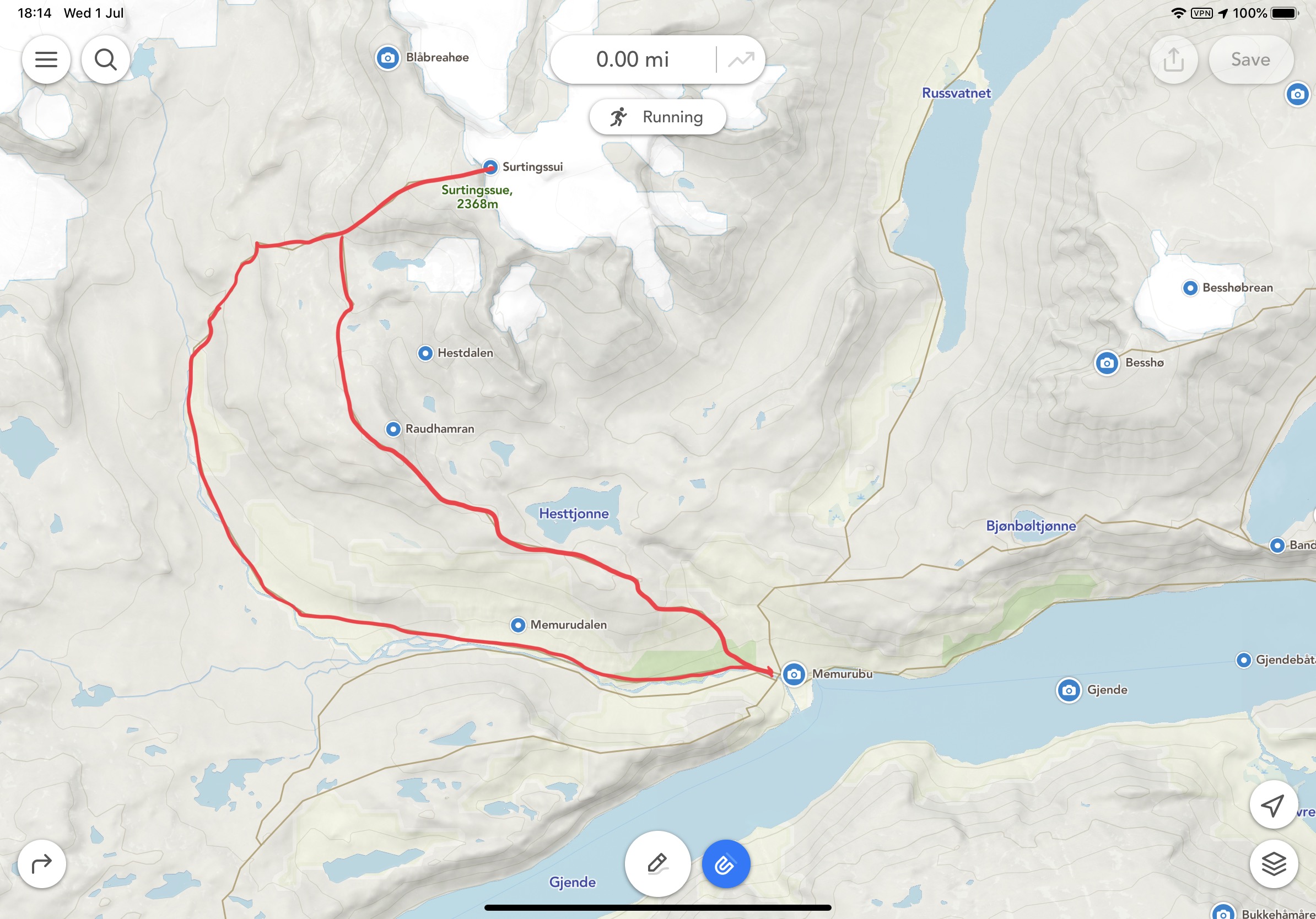
Surtningssue
Make sure you have a place booked on the first ferry from Gjendesheim to Memurubu. This is typically 0745 arriving at 0805.
On arrival at Memurubu you can pitch your tent (got to cabin and pay) or go to the cabin and check-in for your booking. Note, the cabin here is not a DNT and we recommend you book here.
Once ready, you can then start the Surtningssue route. This, in our opinion, is a hidden gem and is often neglected as Besseggen takes all the glory.
At 24km long, it’s a great day out that offers many challenges and importantly, you will see hardly any other people. On our trip, we saw nobody.
Leaving Memurubu the route is clearly marked. Make sure that you branch left when the opportunity arises. This will provide you with a clockwise route to the summit at 2368m and then back to Memurubu via a different route.
The first 8km’s are single-track trail that is very runnable. The views are stunning and only get better as you move up the trail. One advantage of experiencing the trail in June is lingering snow.
Once through the valley you start to head east. It is definitely worth having the GPX route (here) available either on a phone or watch so that you can stick with the route. Although marked, it has considerably less markings than other routes and often you are following stone cairns.
From 8/9km the route now winds up to the summit through rocks and boulders. Care is needed! At approximately 11km the trail will split with a very clear red sign showing a left and right option. This is where you go left to the summit. On your return, this is the place where you split and take the ‘other’ route back to Memurubu and therefore creating a loop.
The trail up is now steep with several false summits. You will finally see a stone hut that is open and available for shelter if required. The final push to the summit is approximately another 200m. For those in the know, they say the summit provides the greatest view and panorama of Jotunheimen.
It’s exposed at the top, airy, with plenty of potential hazards, so, take care.
The descent is via the same route until you reach the red marker. Now you veer left. Once again, the terrain is challenging as there are countless rocks and boulders.
For most of the way, the route is well marked until the final km’s. We lost the trail but could see Memurubu ahead and therefore self-navigated back to the cabin.
This route is a stunner. We felt alone and isolated. We saw nobody and encountered wild reindeer with their young.
Besseggen
Besseggen is a classic ridge that ‘must’ be done. Some Norwegian’s say that you cannot be Norwegian until you have done the route. It’s a point-to-point route, so, plan ahead and send any luggage/ tent with the ferry boat. They will have your luggage waiting for you after the trek at the ferry port in Gjendesheim.
At 14km long, with approximately 1100m of vertical gain it may not appear to be a too demanding route? However, many consider it is! Many take 8-hours to do the route and 10/12-hours is not unusual. GPX here.
For perspective, there is a mountain race that takes on the exact route and the course record is an unbelievable 1hr 15min 40sec by Thomas Bereket. Trust me, if you experience this 14km point-to-point, you will wonder (continuously) how is it possible to run this so quick? Kilian Jornet ran the race in 2016, along with Thorbjørn T. Ludvigsen, Kilian won in 1.17.54.
We completed the route in 3-hours 30-minutes and that was with many photo/ video stops.
The route is very, very popular and we therefore recommend you start early. One advantage of running and fast hiking is you soon catch anyone ahead and trust me, you want to be alone as much as possible to experience the trail and views.
All this who stay at the cabin or camp will start (usually) before 0800 and then the first boat arrives at 0805 releasing another wave of people.
Characterized by the colourful emerald Gjende and deep blue Bessvatnet lakes, Besseggen ridge splits the landscape. It’s dramatic and bold and in wet weather, treacherous, so be careful!
Leaving Memurubu the trail immediately rises up and twists, mixing rock and single-track. It’s a fun trail and the first plateau already provides great views. You will pass Bjønbøltjønne lake, a good opportunity to get water if needed? Continuing up, eventually another plateau arrives and now you have a stunning view of the Besseggen ridge. It’s quite intimidating. To the right the Gjende lake and you will clearly see Knutshøe which looks fantastic.
The trail now drops, it is steep in places. Bessvatnet lake (1374m) is to your left and you walk along its edges with Besseggen looking down on you.
Bandet ridge is a significant point with approximately halfway covered and Besseggen the next challenge.
Rising 300m, Besseggen (in my opinion) is less intimidating when climbing, however, there is plenty of opportunity for exposure. It’s relatively steep but there are plenty of foot and hand holds. It’s worth stopping many times for photos. The views are remarkable.
The steepest section comes towards the end but does not last long and then you are on a plateau that gently and continually rises to Veslfjellet (1743m) which is the highest point.
The trail is now very flat and after about 1 kilometer you reach a trail junction. Follow that trail to the right down towards Gjendesheim. The route now twists and bends. Follow the markers and in here the trail is steepest with many rocks. Take care, they can be slippery, even in dry weather.
Gjendesheim ferry finally comes to view and then the final 1 or 2km is easy to the finish.
If you sent luggage with the boat, it will be available under the wooden shelter at the port. A shuttle bust will take you to the car park for the journey home.
Or, you may wish to wild camp or sleep at the cabin and the following day tackle Besshø.
Besshø
At 2258m, Besshø is 500m higher than Besseggen and it is a trail that sees little foot fall. In many respects, it is like Surtningssue and as such, it has a huge attraction.
From Gjendesheim it is an out-and-back route of 22km with 1300m +/-. It’s a route that could take 12-hours but if moving fast and light, sub 6-hours is perfectly achievable.
The route starts with the end of the Besseggen route but instead of turning left for Besseggen, you veer right in the direction of Russa/ Glitterheim.
Bessvatnet lake will appear on the left and eventually you will cross a small bridge in the eastern corner. Cross the river you will see two small cabins on the left, now follow the trailer 2 to 3 miles north on flat/ boggy trail. Besseggen will be on your left and at the far end of the lake is Bandet which you crossed just before climbing Besseggen.
Look out for the right turn that leads to Besshø summit. The climb is at times demanding and marked with stone cairns which often disappear. It’s easy to lose the route so it’s advisable to have a GPX available (route here). Depending on the time of year, you may need to cross snow fields – care needed. The route is very rocky and strewn with boulders of different sizes. Many are loose, so, caution is required. It’s a challenging route but visually stunning.
The return route is via the way you came.
RECOMMENDATIONS
Never underestimate the mountains and the environment in which you are exploring. June in particular is the start of the hiking season and as such, snow can be a factor on all of the above routes. This adds an additional potential for injury and problems. Particularly as the snow is melting and this can create snow holes, snow bridges and crevices. Do not take any risks and follow established routes and existing footprints.
It is definitely worth carry Micro-Crampons as a safety measure, particularly in June and September. Also, trekking poles are a great addition but not essential.
Make sure you check in with DNT cabins for all the routes and check conditions to make sure that you have no surprises.
Weather is crucial and many of the above routes would become very dangerous in wet weather. Rocks and boulders in Jotunheimen are everywhere, when wet, they can be treacherous. Boots are always recommended for hikers but if moving fast and light, top quality mountain running shoes are perfectly acceptable on experienced feet. I cannot emphasize enough that grip is essential! You need an outsole that works on wet and dry rock. Running shoes are very personal but recommendations are VJ Sport MAXx and XTRM, Scott Supertrac RC2 and inov-8 Roclite.
It may be 30deg next to the fjord and glorious sunshine, but at the summit, it can be below zero, blowing a gale and torrential rain. You must take personal responsibility and be prepared for all conditions. At a minimum please take:
Suitable pack
Hat
Gloves
Warm insulated layer
Warm trousers
Waterproof jacket/ pants
Food for the duration of the hike and some contingency
1,5 ltrs of water (which can be replenished on all the routes via streams/ waterfalls)
Take water purification tablets as a just in case and consider a water purifier such as MSR Trailshot (here)
Map/ Compass
Charged mobile phone with a suitable App such as ‘Footpath’ (here)
Cash/ Card
Garmin InReach or similar
Bivvy bag
Sunglasses
Sun cream
Plan your routes, be realistic on timings and always start early. One of the huge advantages of outdoor activity in Norway is daylight. In June, July, August it is light at 0300 and goes dark after 2200 hrs.
CONCLUSION
Jotunheimen is to mountain lovers, what Disney is to fair ride lovers.
It’s a playground of trails, routes, summits, views, experiences and wildlife all wonderfully interconnected with marked trails and DNT cabins.
This article is created as a gateway to the area knowing only too well that it will whet your appetite for other adventures.
As mentioned at the beginning, the best way to explore this area is by foot and we are sure that once you have followed our weeklong adventure above, you will already be planning to return and explore.
In comparison to our first Exploring Norway article on Hardanger, I would consider Jotunheimen a more challenging environment, so please consider experience and fitness when contemplating any of the above routes.
We cannot emphasize enough the role of weather and the impact it has on all of the above recommendations. The mountains will always be there, cancelling a planned route or turning back is acceptable and wise.
PERSONAL NOTE
Special thanks to Abelone Lyng who has extensive knowledge of Jotunheimen. Her experience was invaluable in planning routes and making a workable itinerary.
Please support this website. I believe everyone deserves to read quality, independent and factual articles – that’s why this website is open to all. Free press has never been so vital. I hope I can keep providing independent articles with your help. Any contribution, however big or small, is so valuable to help finance regular content. Please support me on Patreon HERE.


 Wild camp close to Vengjedalssetra, we suggest you go near Venjesdalsvatnet lake, there are some great camp spots at the top closer to Romsdalshornet and you have access to water.
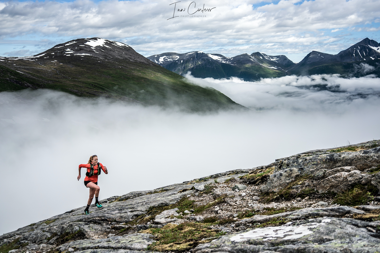
 You can access Romsdalshornet route from the same wild camping place next to the Venjesdalsvatnet lake. However, if you are going to have a clear and calm night, we strongly recommend that you start the climb to Romsdalshornet and wild camp close to Litlefjellet. There are a couple of small pools here and stunning views of the ‘Troll Wall.’ Amazing at sunset and sunrise.
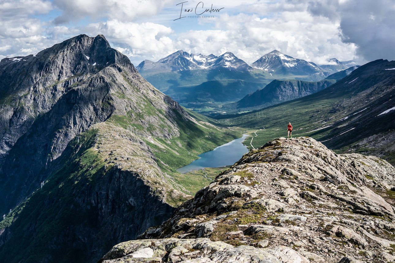
 The Troll Wall is the tallest vertical rock face in Europe, about 1,100 meters (3,600
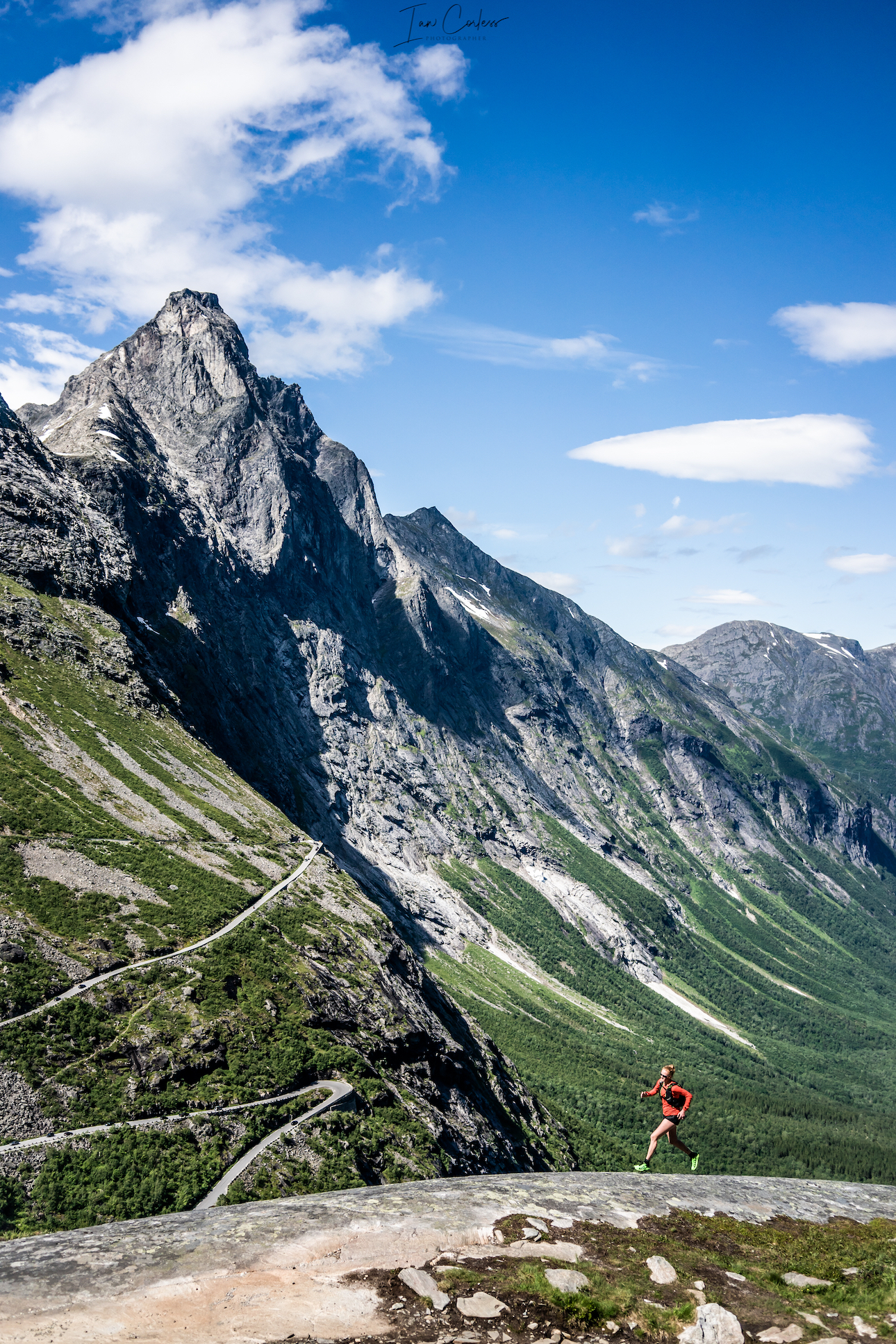
 The journey to Stranda should not take to look from Trollstigen, expect 90-minutes, however, you will need to take a ferry on the final leg. After many day’s camping and the mountains, now is a good time to spend a night in a hotel.
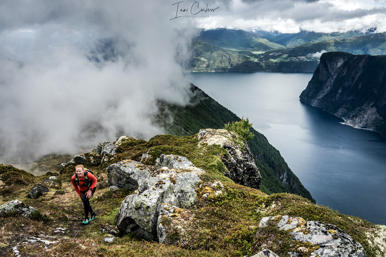
 At 1564m, Slogen is a straight up climb from sea level and as such, this route brings its own challenges. You can break the climb up by staying at Patchellhytta Cabin, however, our choice was up and down in the same day.
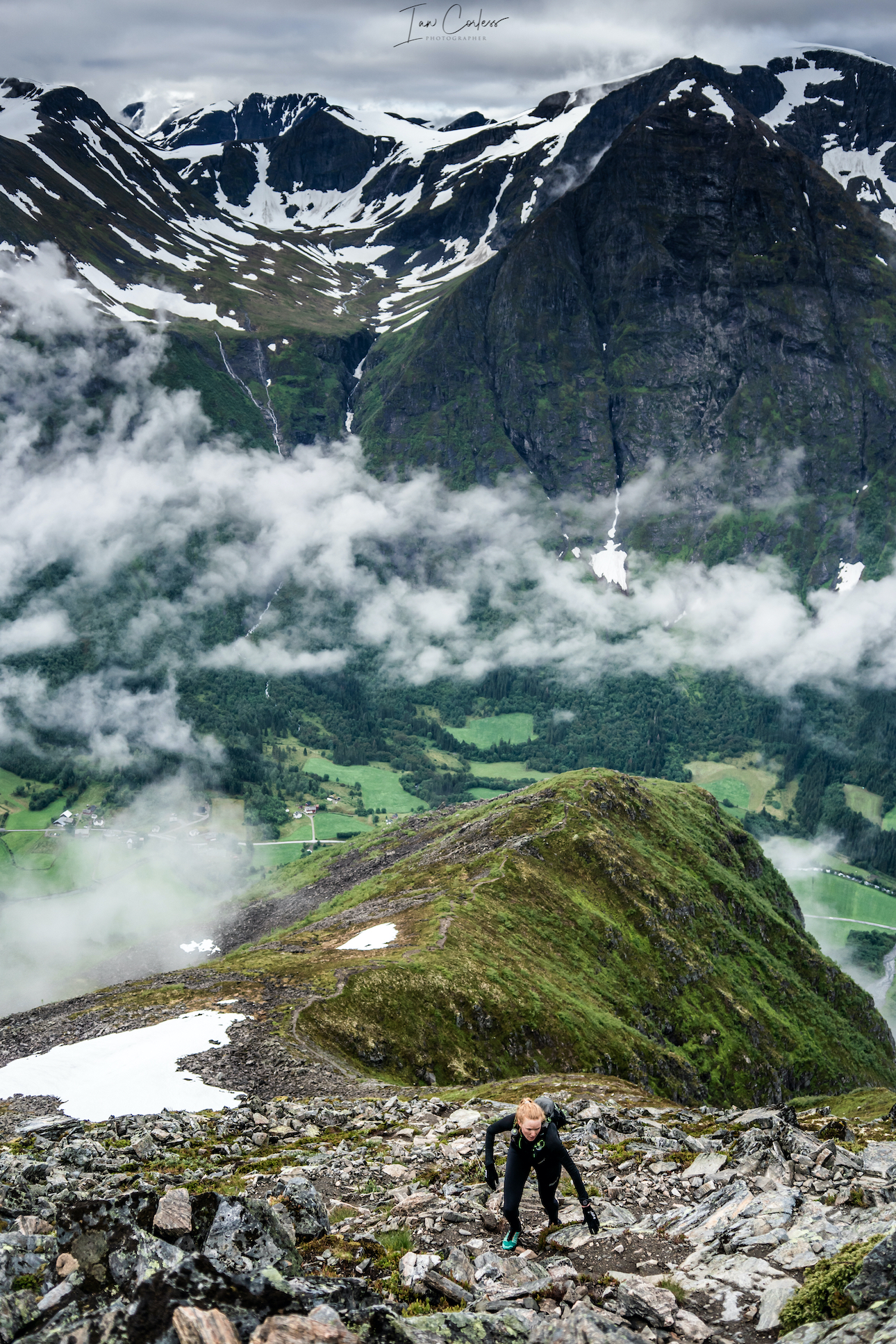


 Rock eventually becomes trail and before you know it, you will be at the bottom and next to the Gjende river. It is now possible to get water if needed?