Lofoten Stage Run by the team at The Arctic Triple – Is the world’s most beautiful stage run, a rare kind of race that feels less like an event and more like a journey.
From 26 to 31 May 2026, a small group of just 30 runners will cross one of the most dramatic landscapes on the planet, moving step by step through mountains, fjords, beaches, and fishing villages under the returning light of the Arctic summer.
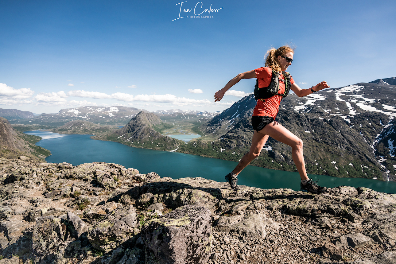
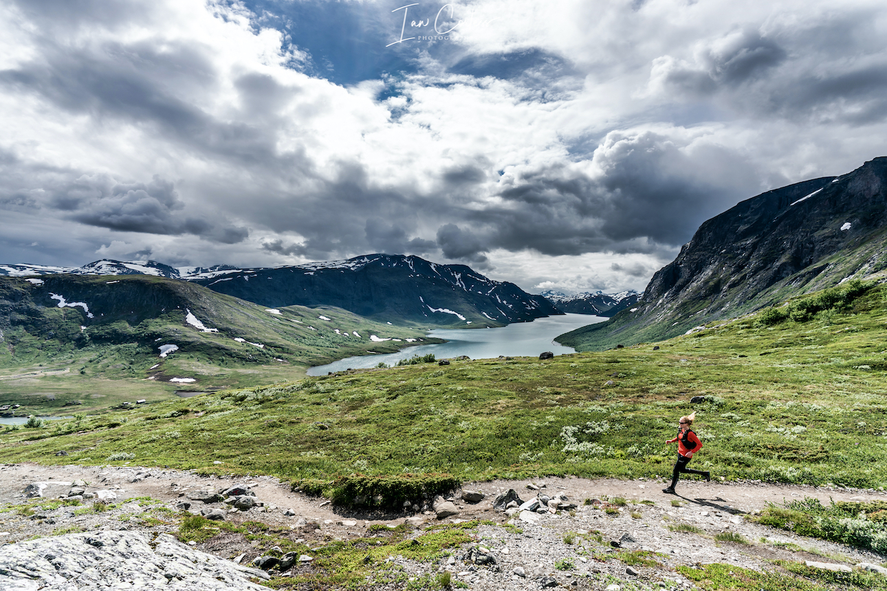
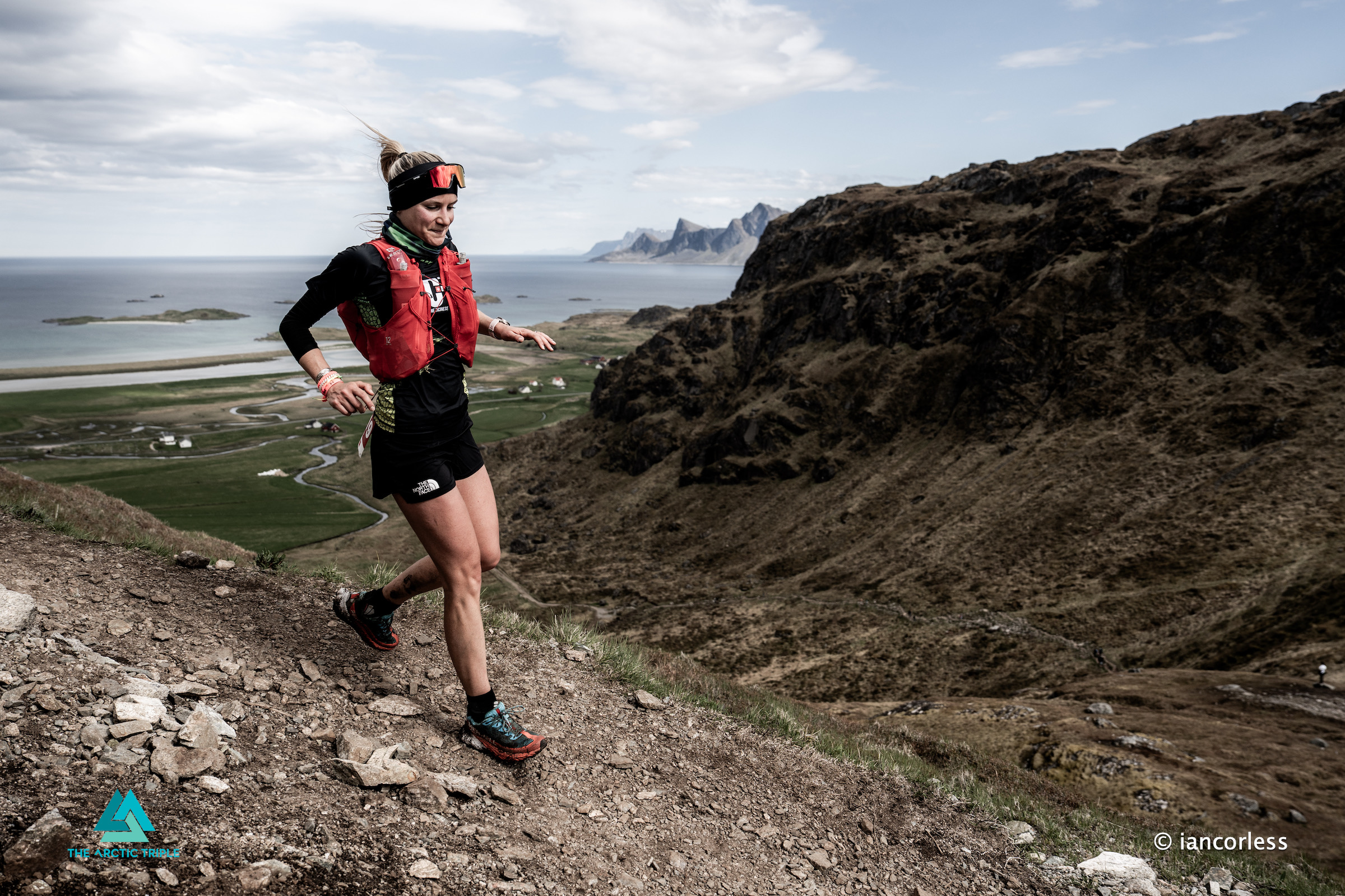
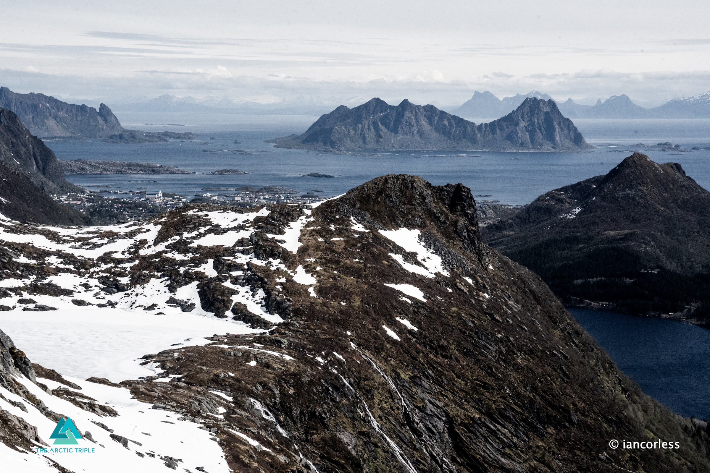
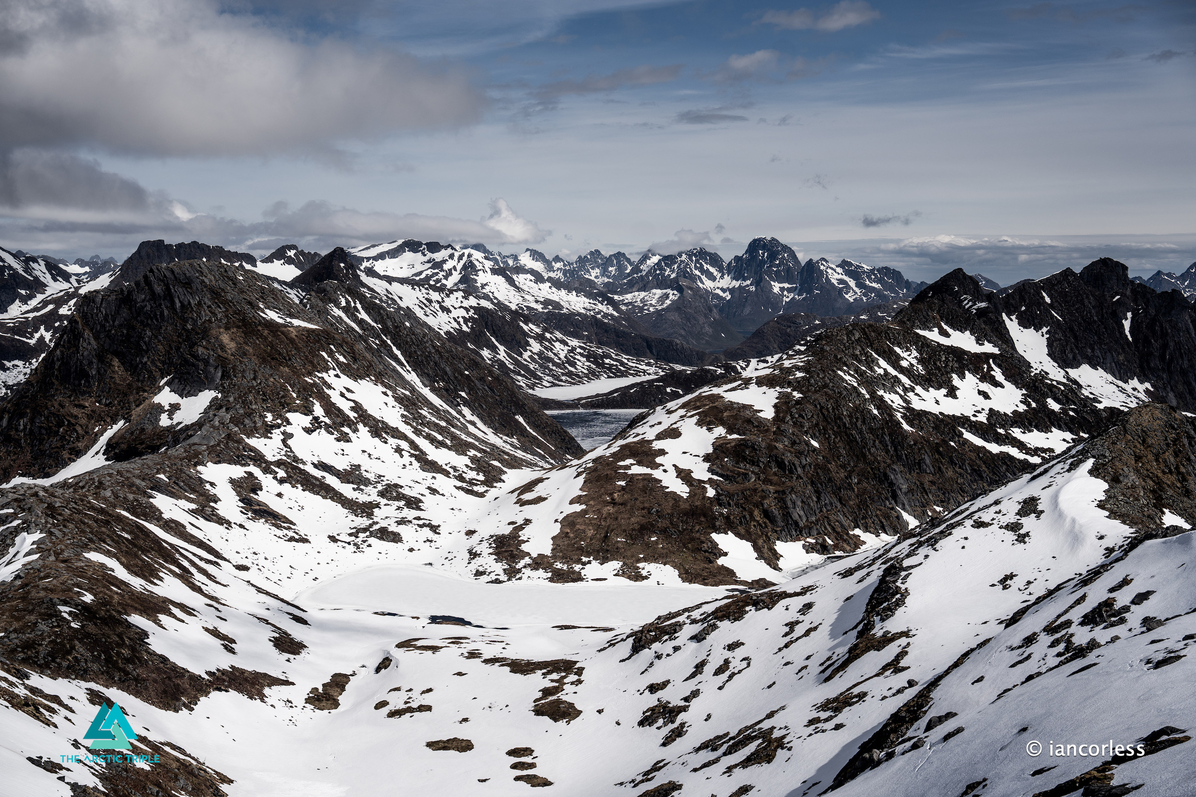
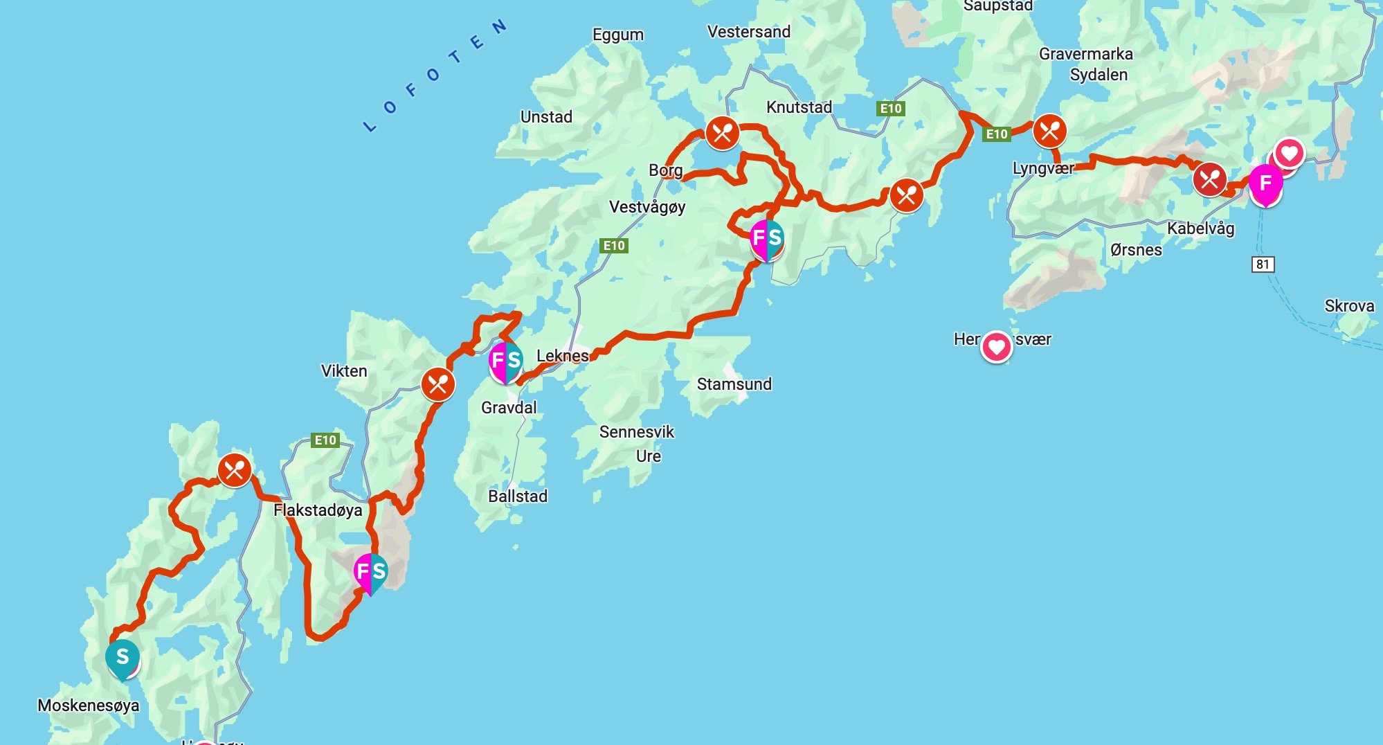
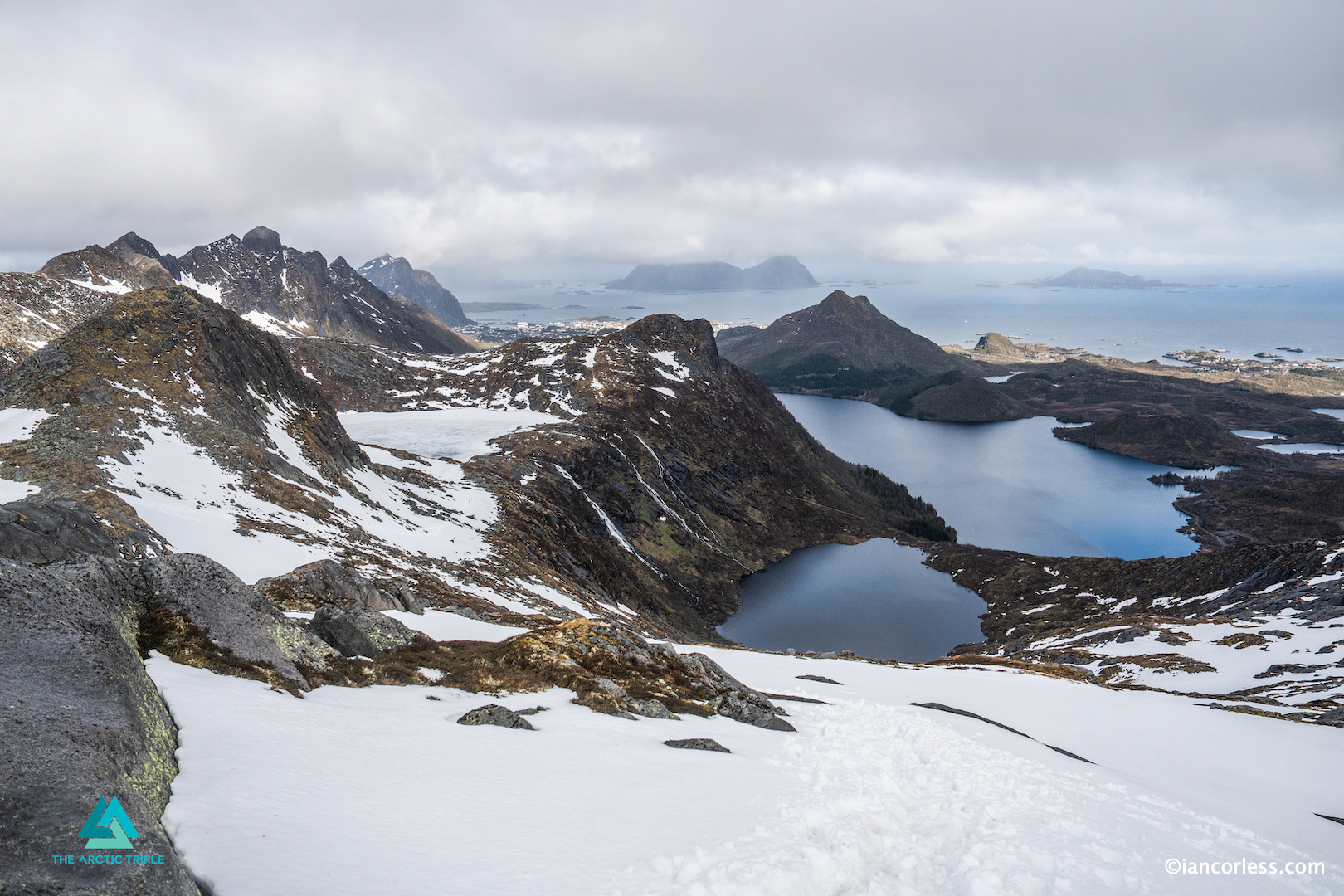
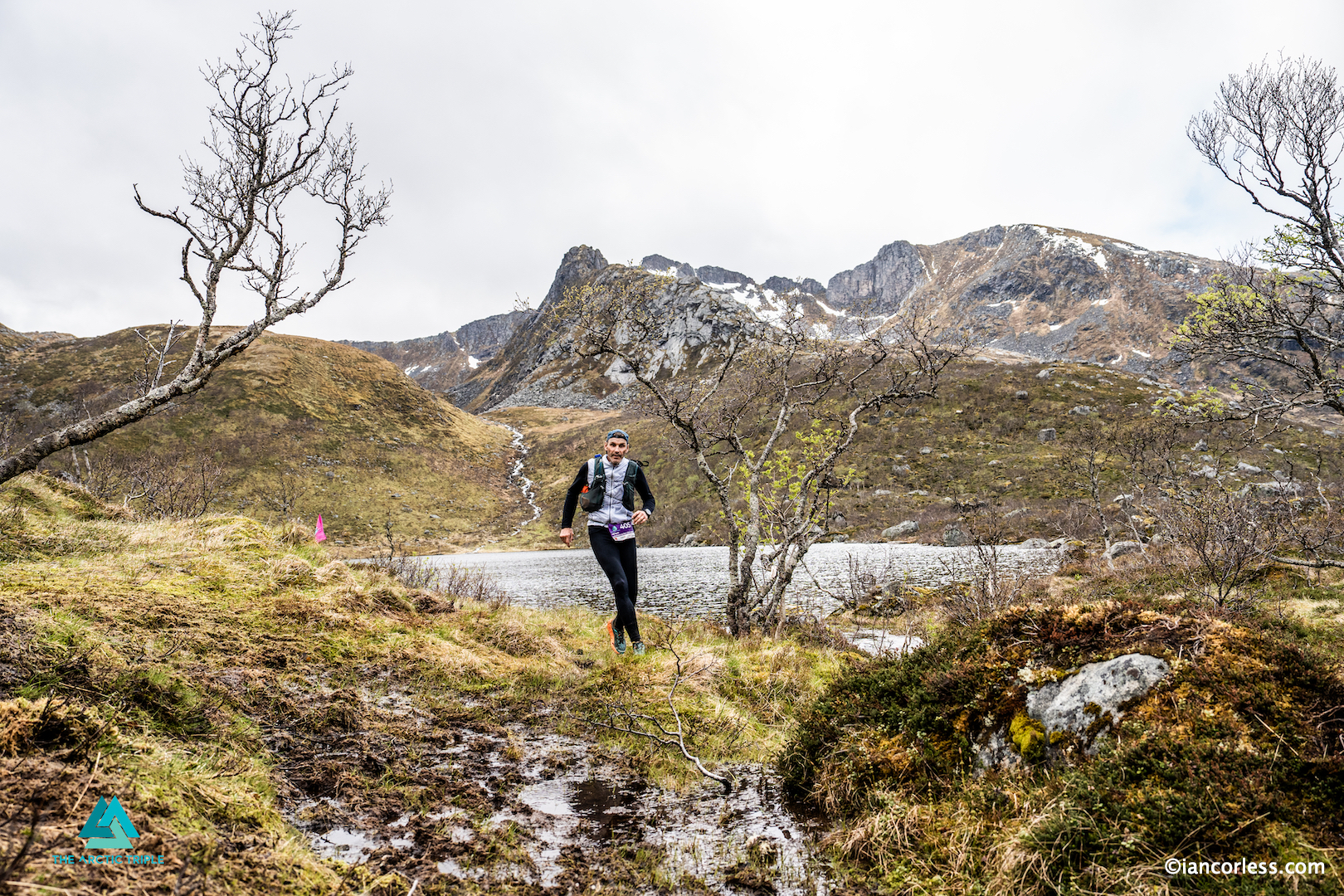
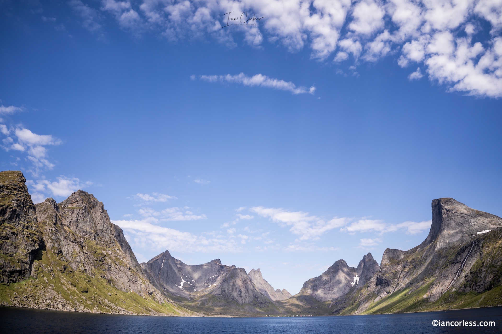
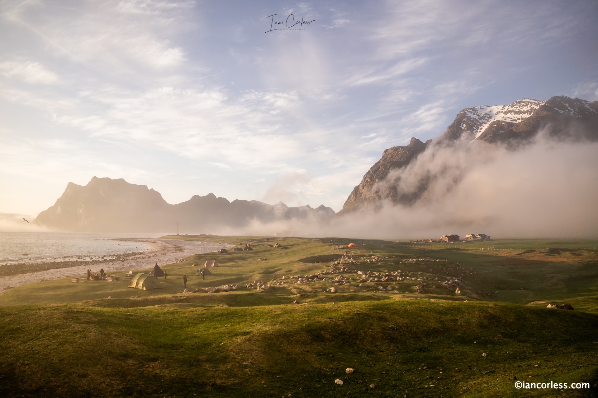
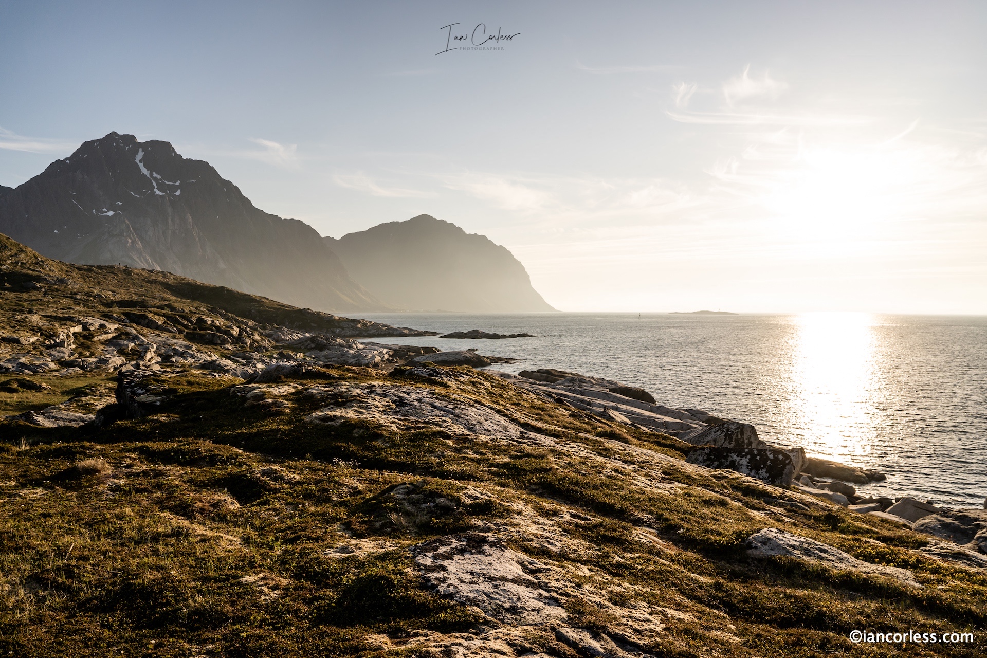
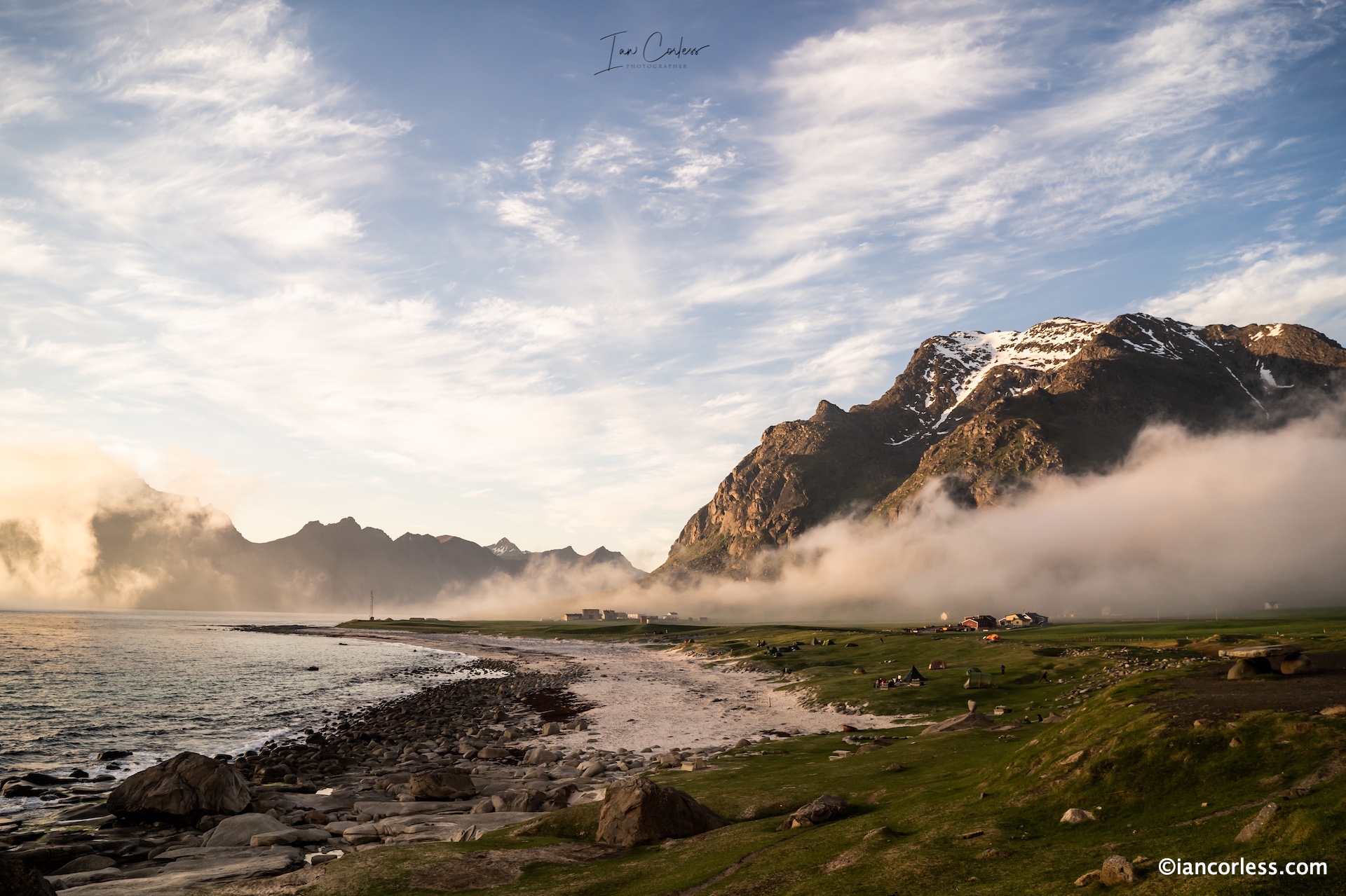
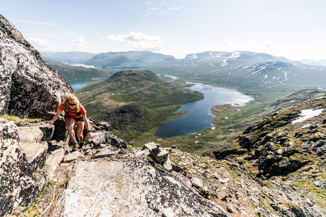
Set in Lofoten, Norway, this is a real multi-day adventure race spread over six days and four stages. The archipelago rises straight from the sea, with sharp granite peaks, narrow coastal trails, and open horizons in every direction. Late May is when the midnight sun begins to settle in, stretching the days and bathing the landscape in soft, golden light that never quite fades. You’ll run when the sun hangs low above the water, when shadows move slowly across the mountains, and when time feels different.
The race offers two distances. The 170 km Expedition Run covers four demanding stages between 34 and 52 kilometres, designed for runners who want a deep, physical immersion in the terrain. The 100 km Adventure Run follows the same spirit across four stages between 17 and 35 kilometres, offering a shorter but equally powerful experience. Both routes blend runnable sections with technical trails that require focus, respect for the landscape, and a steady rhythm rather than speed alone.
What sets Lofoten Stage Run apart is the way everything is woven together. From the moment we meet in Svolvær the day before race day, the experience is fully taken care of. Accommodation is comfortable, meals are generous and rooted in local flavors, and your luggage moves seamlessly from basecamp to basecamp. You run light, recover well, and wake up ready for the next stage. Every detail is designed so you can stay present in the experience rather than worry about logistics.
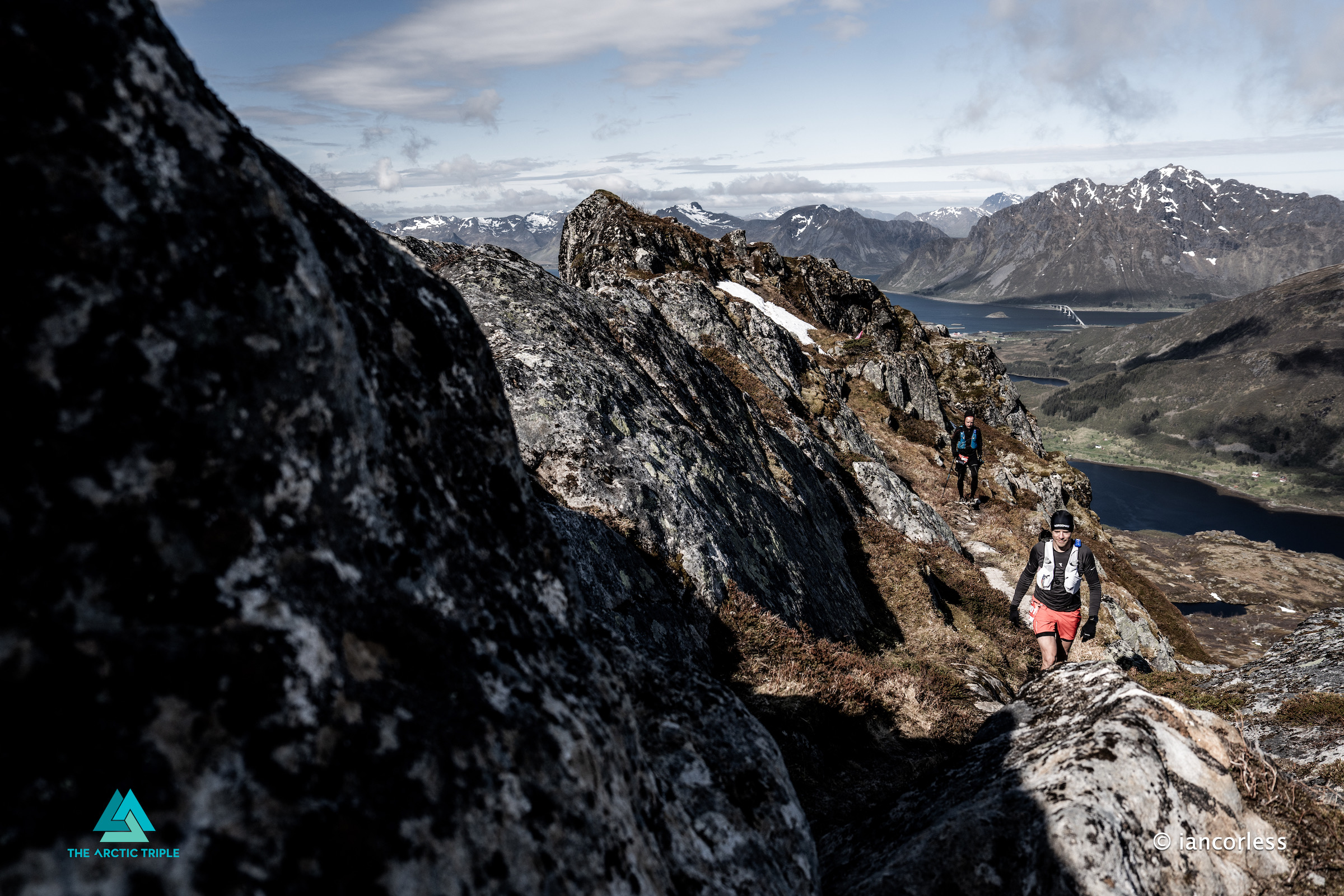
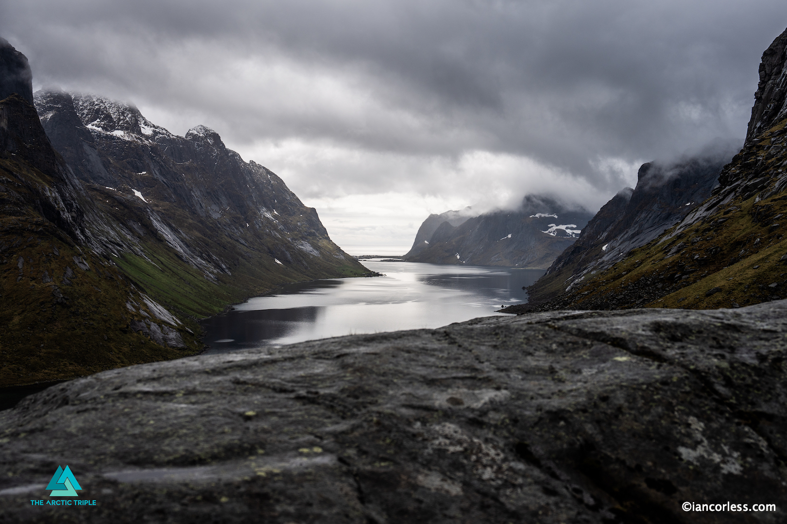
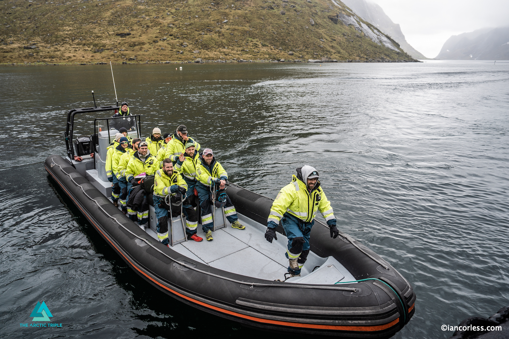
Each day on the trail brings something new. A climb that opens onto a wide fjord. A quiet stretch along white sand with turquoise water at your side. A remote valley where the only sounds are your breath and the wind. One stage begins with a boat ride into the heart of the landscape, delivering you to the start line in Kjerkfjorden, surrounded by steep walls of rock and sea. These are the moments that stay with you long after the race is over.
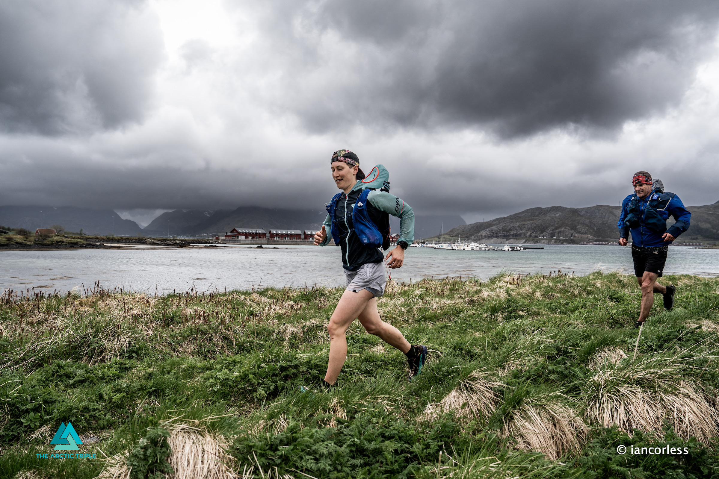
Evenings slow the pace. Warm dinners are shared around the table, stories traded between tired legs and smiling faces. With such a small field, the atmosphere stays personal and welcoming. You don’t disappear into a crowd. You become part of a temporary community moving together through a wild place. There is time to rest, to talk, to look out over the water and realise how far you’ve come.
The entry fee includes the entire package: five nights of accommodation, including the night before the race and the night after finishing, race registration, luggage transport, all meals from the first day in Svolvær until breakfast on day six, start kit, The Arctic Triple buff, service stations, first aid and evacuation transport, timing and tracking, warm dinner every night, the boat transfer to the starting line, and a quality finisher award. Everything is included so the focus stays where it should be, on the running and the place.
Lofoten Stage Run is not about crowds, noise, or chasing records. It’s about long days on epic trails, running beneath the midnight sun, and experiencing Norway at its most raw and beautiful. This is a race for runners who want more than a finish line, who are drawn to wild landscapes, shared effort, and the quiet magic that happens when movement, nature, and light come together.
Only 10-places remain for the 2026 edition, be quick!
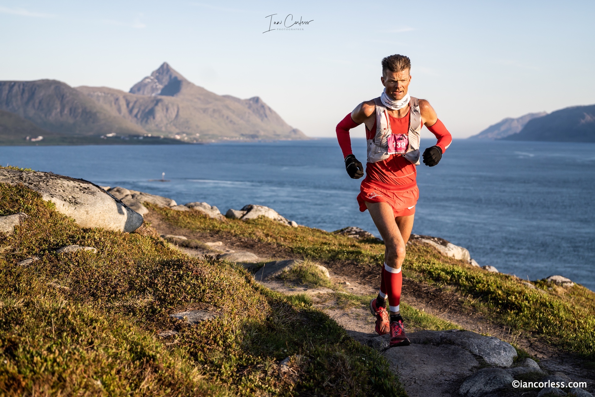
There are races, and then there’s the Lofoten Stage Run by The Arctic Triple team. What unfolded in May 2025 wasn’t just a footrace; it was a deep, soul-grinding, awe-inspiring journey through one of the world’s most arresting landscapes. Four stages. Two distances, 170 km and 100 km.
Across wild coasts, knife-edge ridges, fishing villages, and snow-streaked mountains, runners pushed their limits, and often redefined them, surrounded by the raw power and beauty of Norway’s Lofoten archipelago. Sleep came in hytte and seaside rorbuer; rest was fleeting, but memories were burned in.
Stage 1: Into the Wild – Kjerkfjorden to Nusfjord (39 km / 20 km)
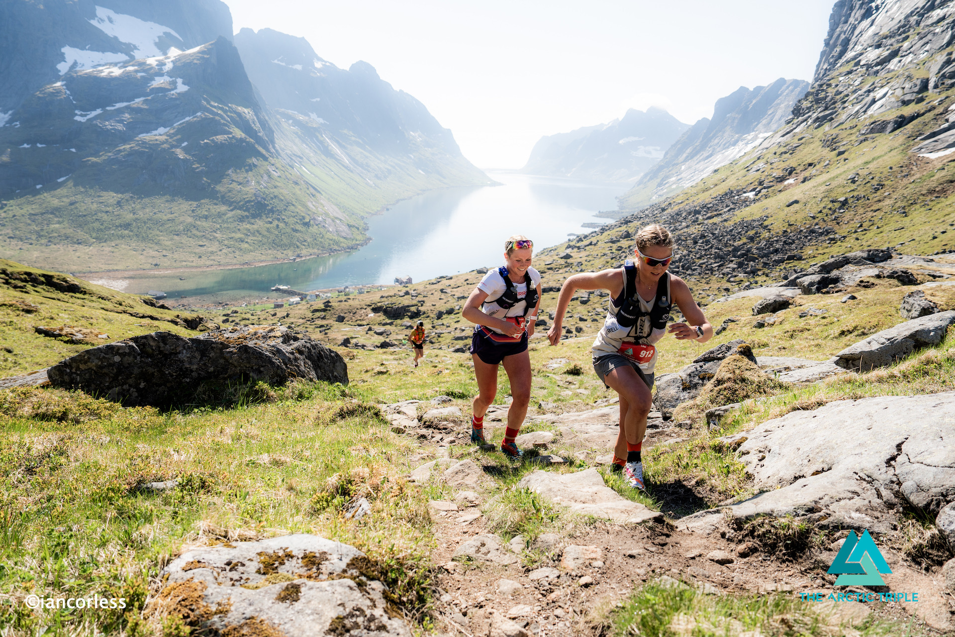
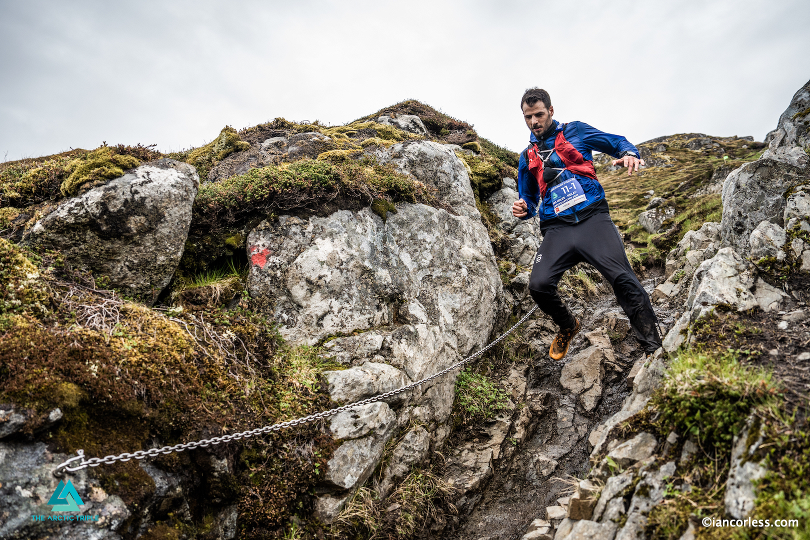
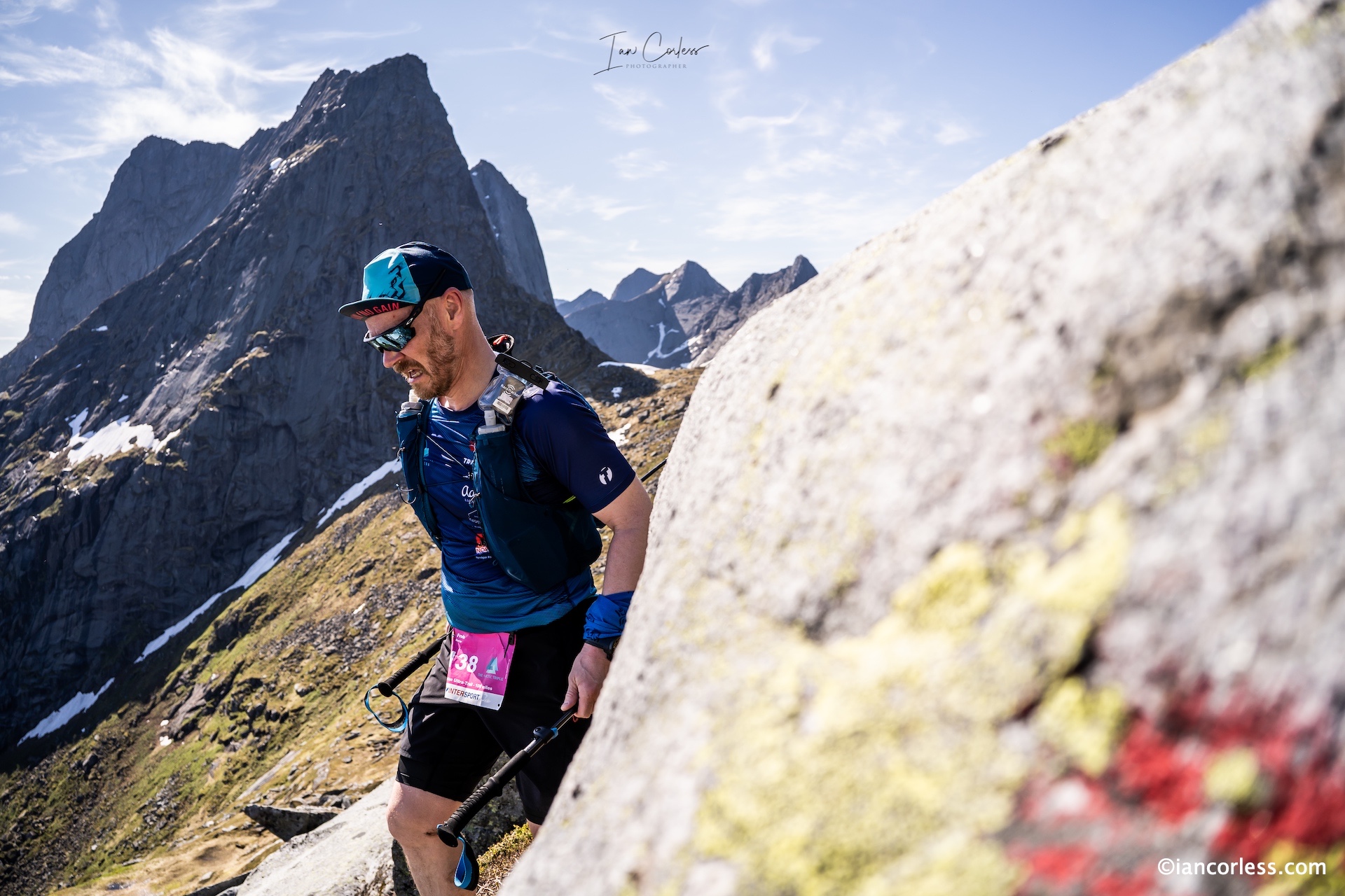
The race began like a dream: a boat ride through cold, steel-blue fjords, cliffs rising on all sides like the jaws of some ancient creature. As runners disembarked at Kjerkfjorden, the silence was broken only by soft footsteps and shallow breaths, nerves on edge, anticipation sharp.
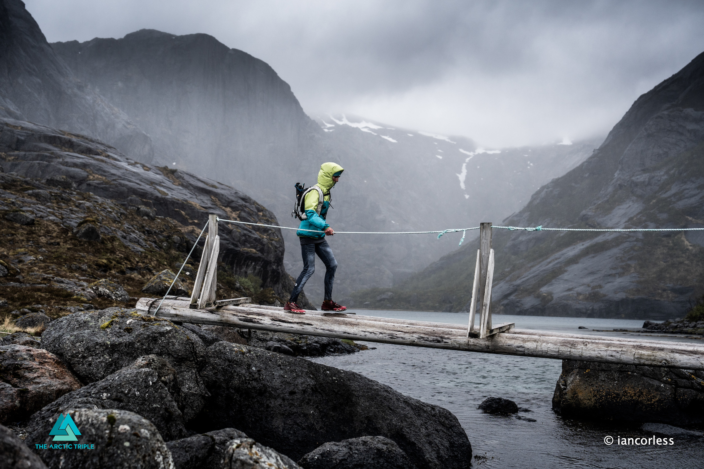
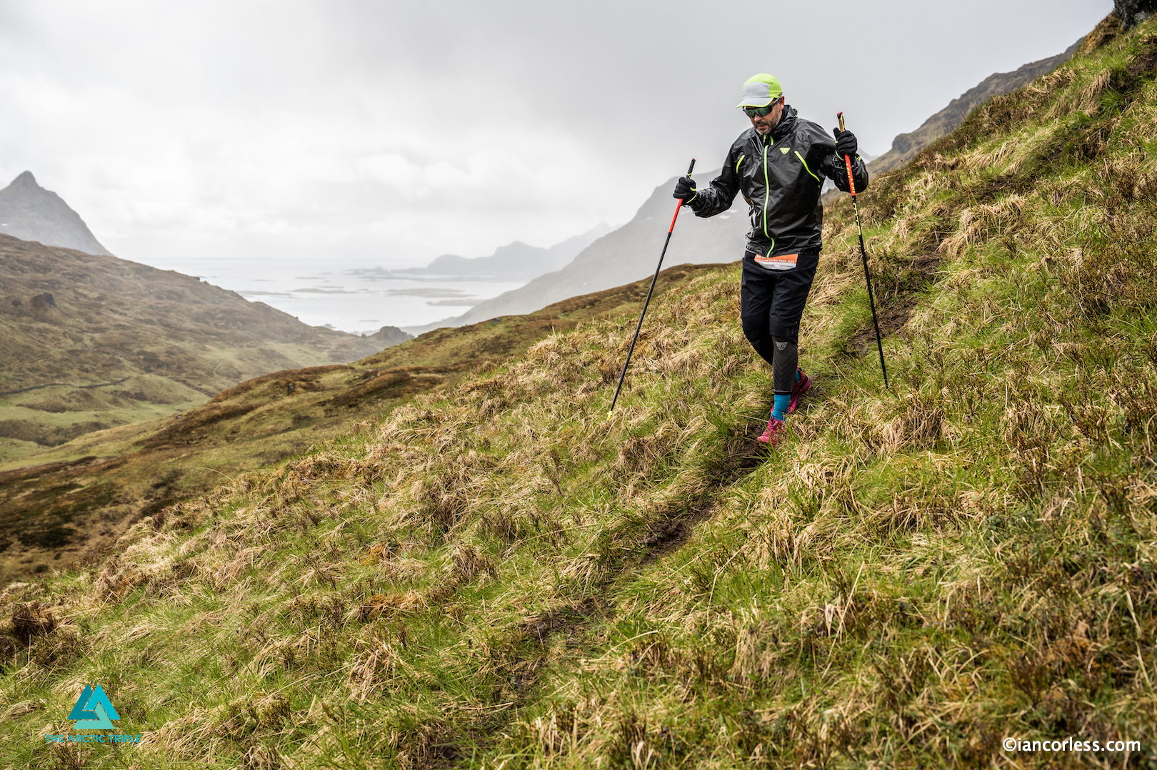
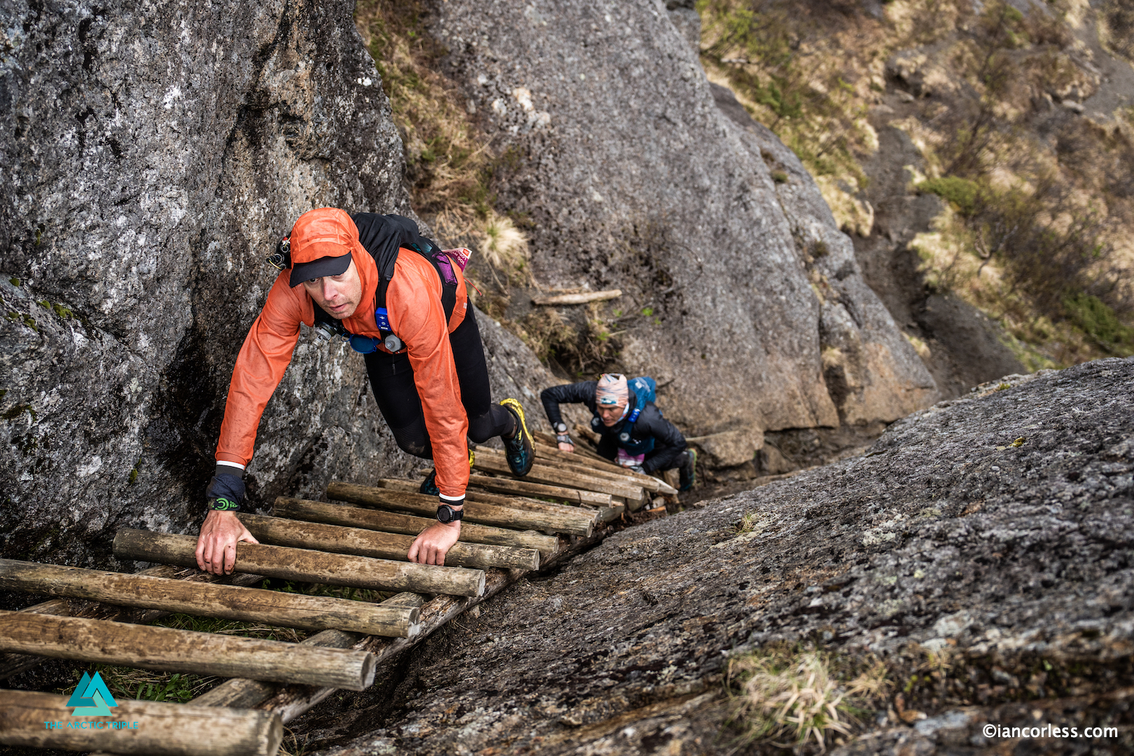
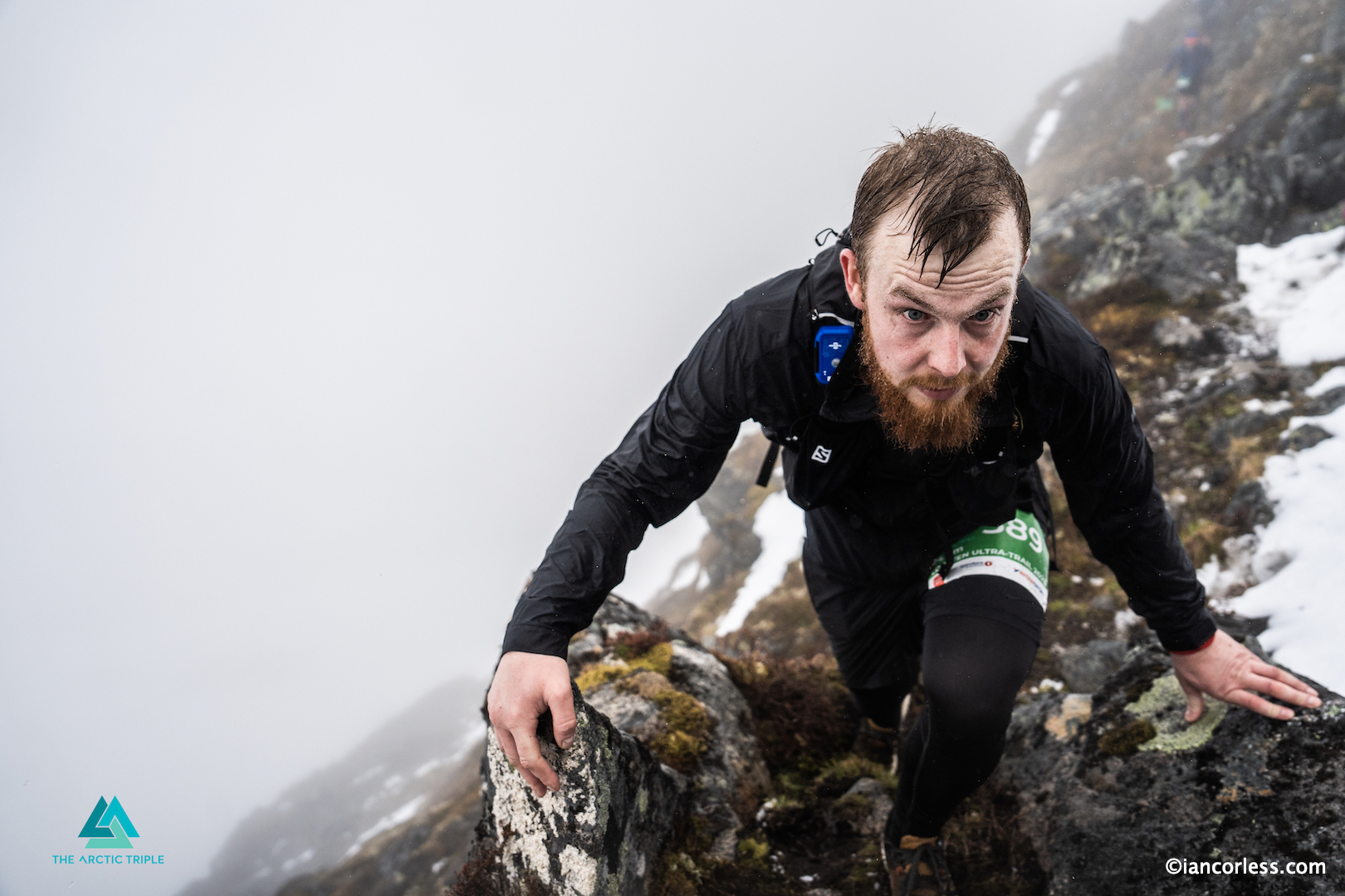
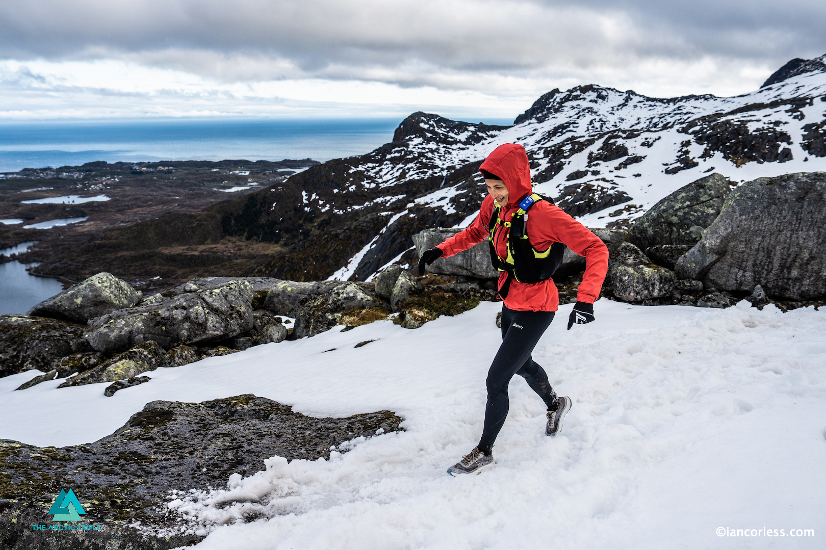
The terrain wasted no time. A steep climb out of the fjord led straight into deep snow patches and slick rock. Then came the surreal beauty of Kvalvika Beach, where sand met snow and the ocean roared its approval. For the 170 km runners, the day stretched long into the day, ending with a technical coastal section into the storybook village of Nusfjord. Legs screamed, but hearts were full.
Stage 2: Edge of the Earth – Nusfjord to Leknes (34 km / 17 km)
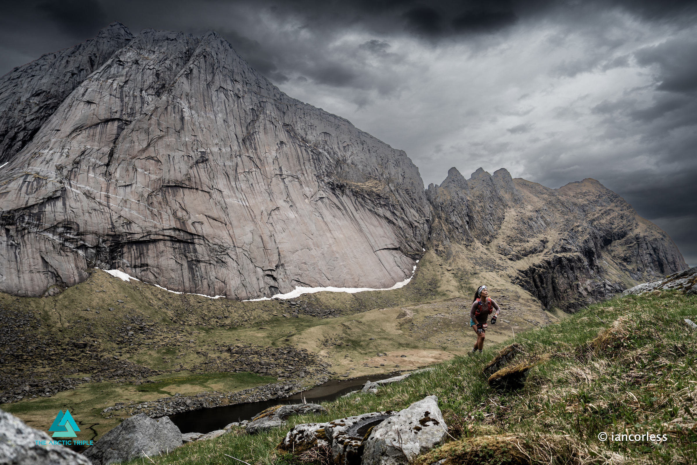
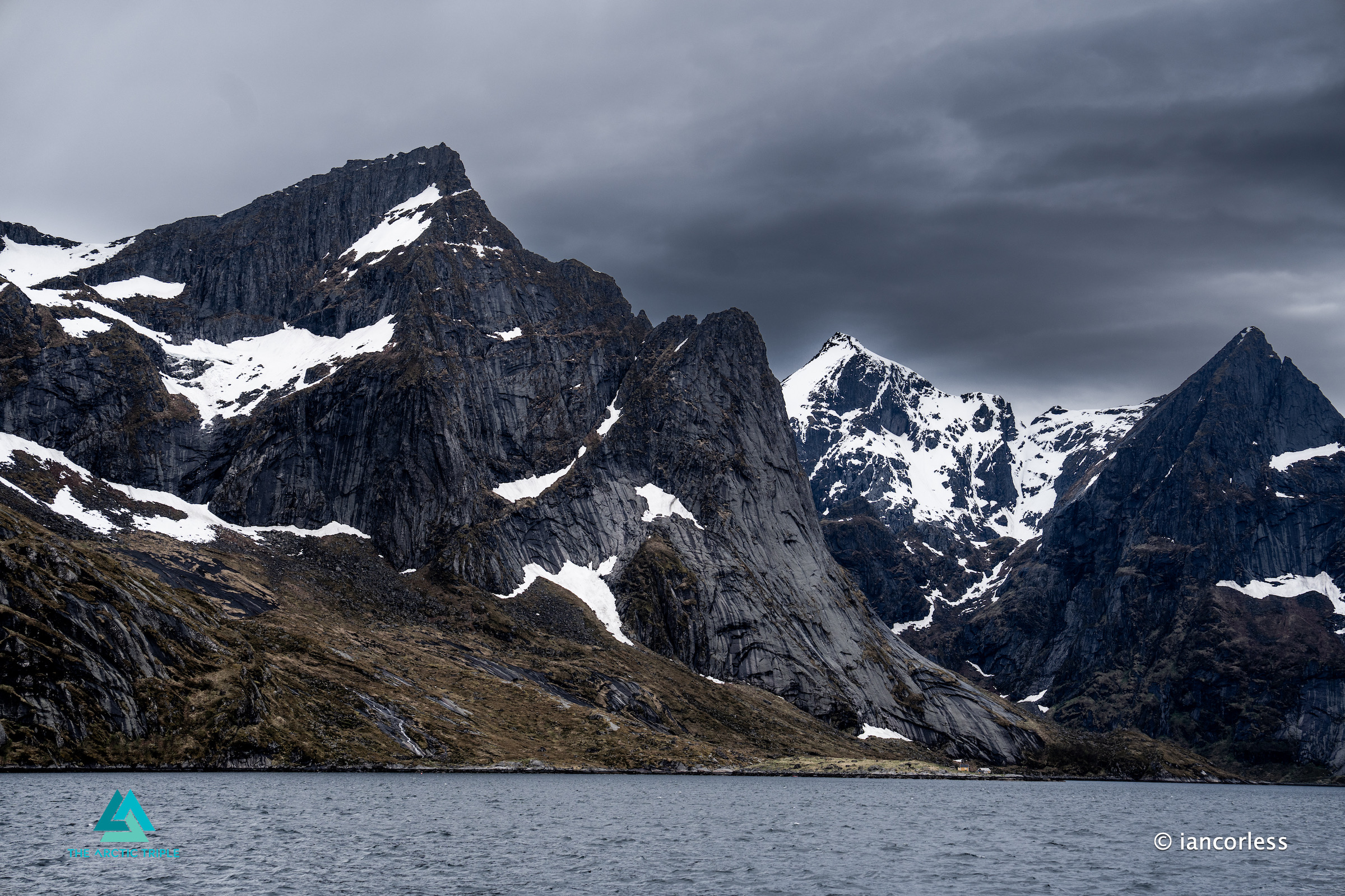
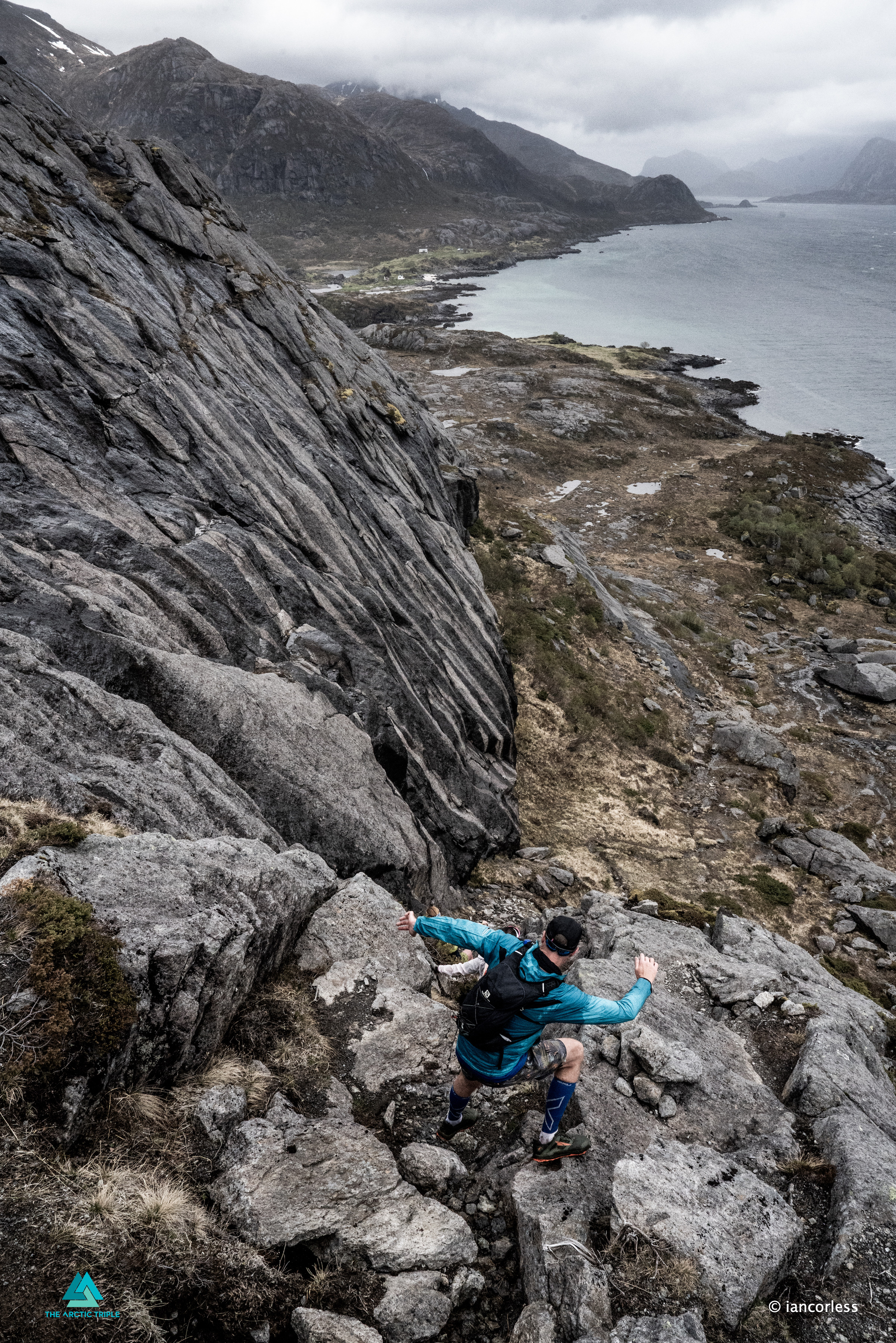
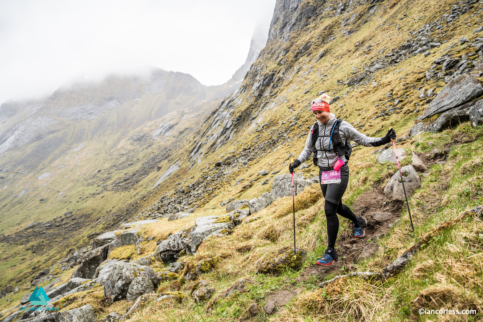
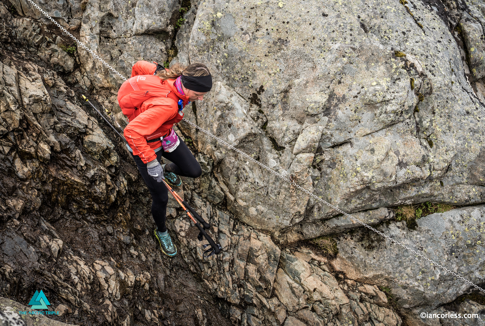
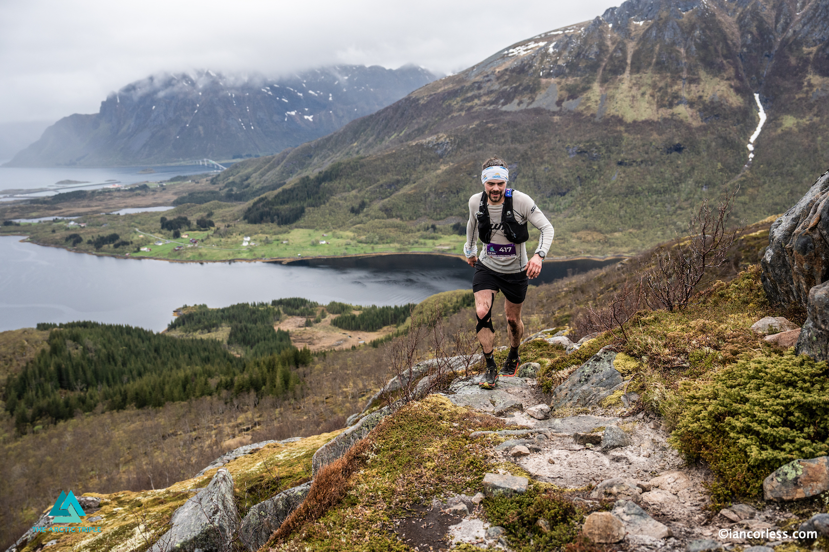
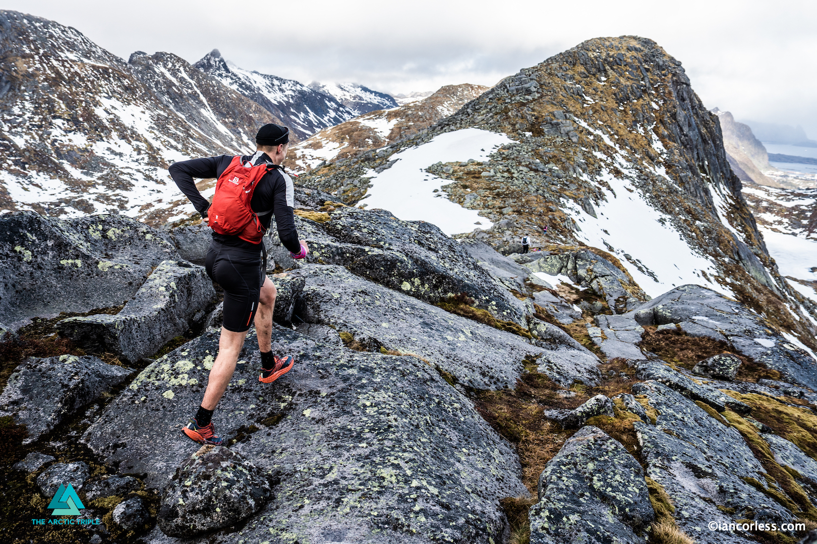
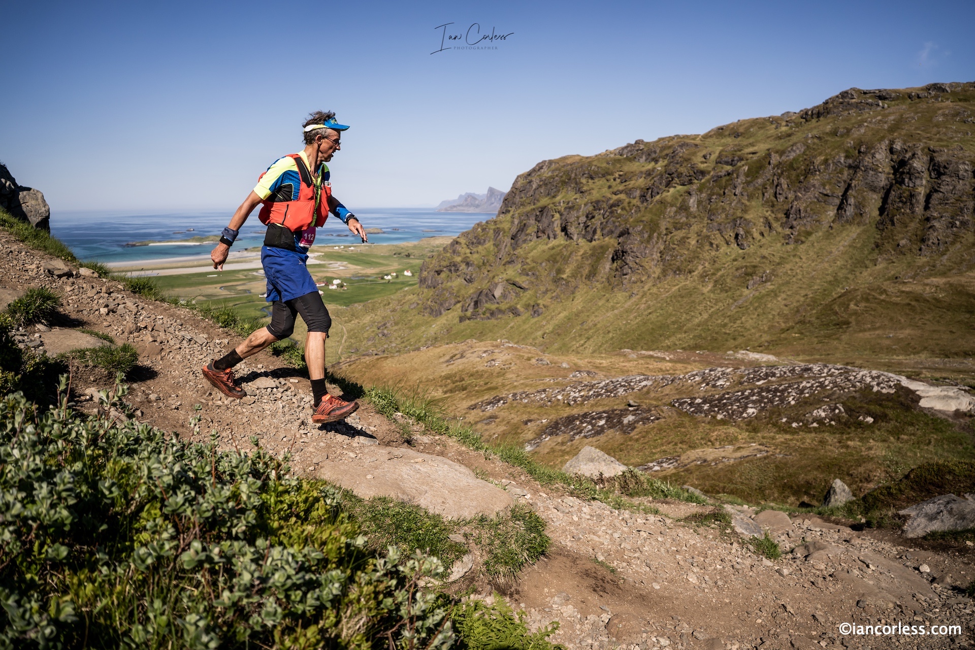
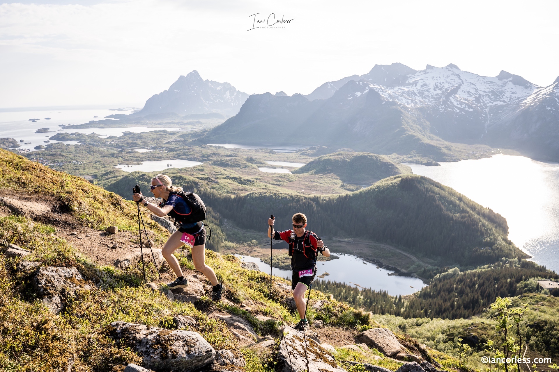
Day two was tougher. Tighter trails, more scrambling. The wind picked up, mist rolling in from the Norwegian Sea like smoke, rain fell, at times, hard and relentless. Between breaths, runners caught glimpses of jagged peaks piercing the sky and turquoise bays far below. This was Lofoten in full cinematic glory, wild, moody, and impossibly vast.
A tunnel under the sea added a surreal twist, legs burning as they climbed out of the darkness and back into the light. Offersøykammen offered panoramic views, but it demanded everything. As runners arrived in Leknes, drenched, scraped, and shivering, you could see it in their faces: wonder, pain, pride.
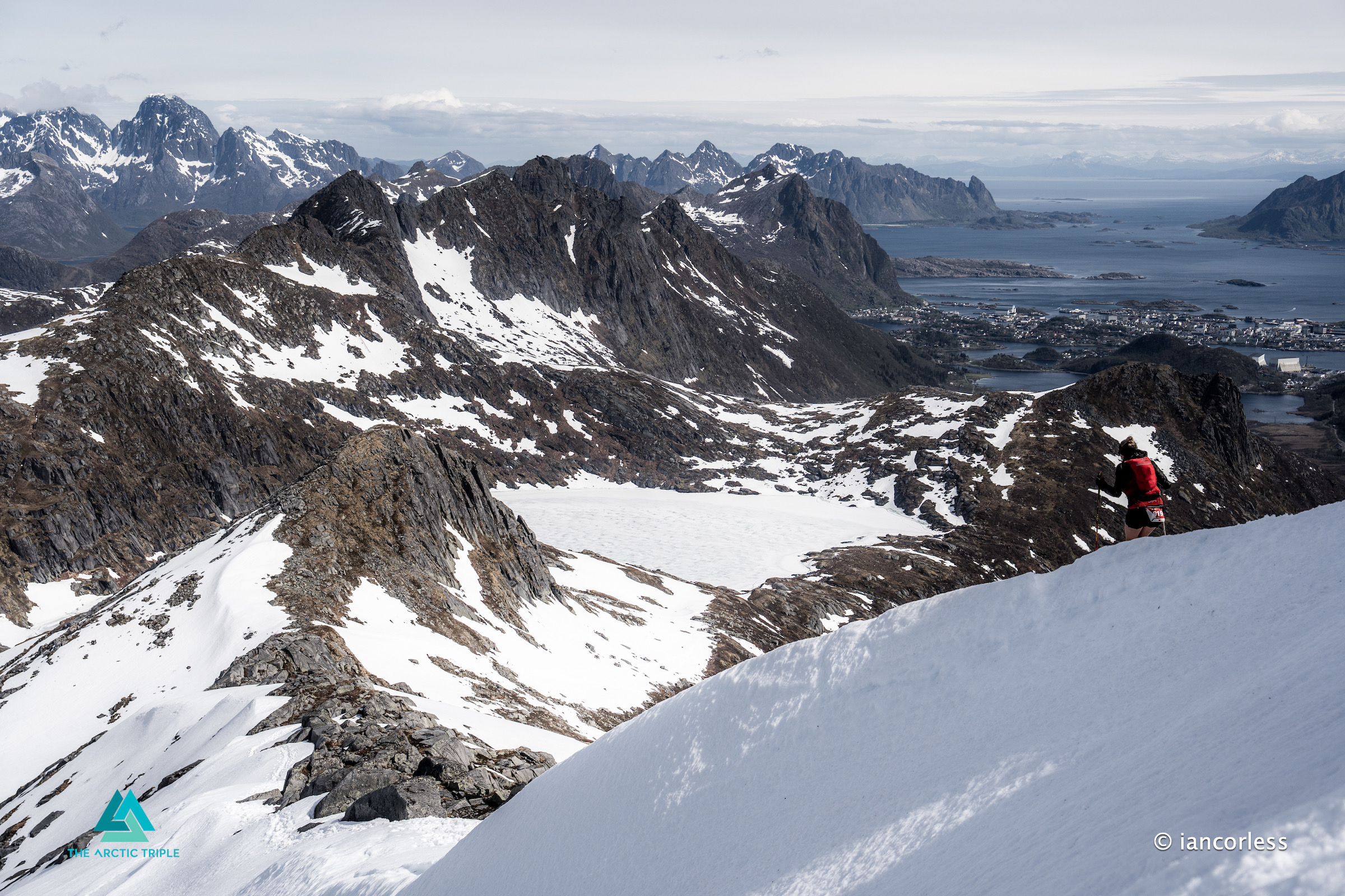
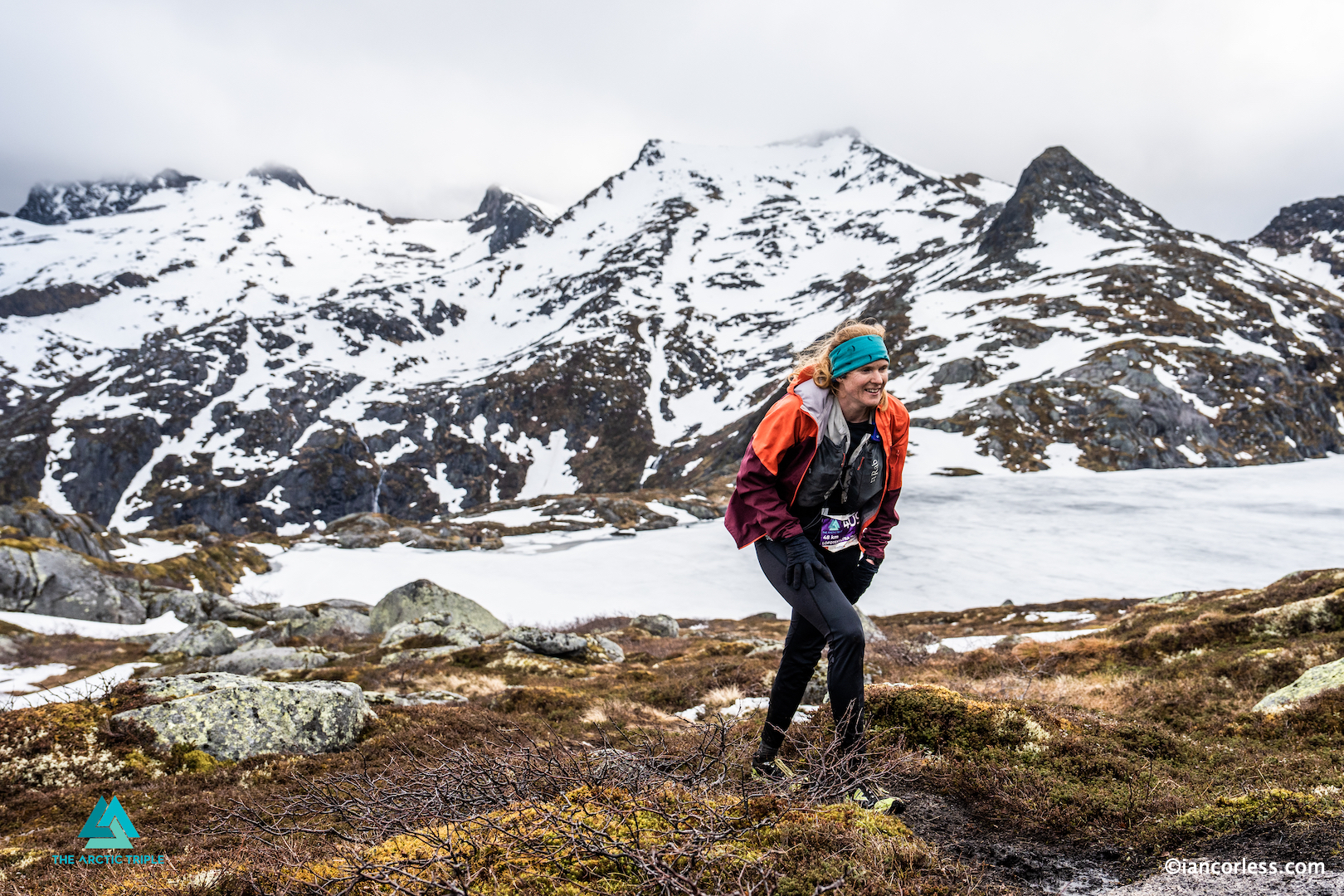
Stage 3: The Long Haul – Leknes to Rolvsfjorden (52 km / 35 km)
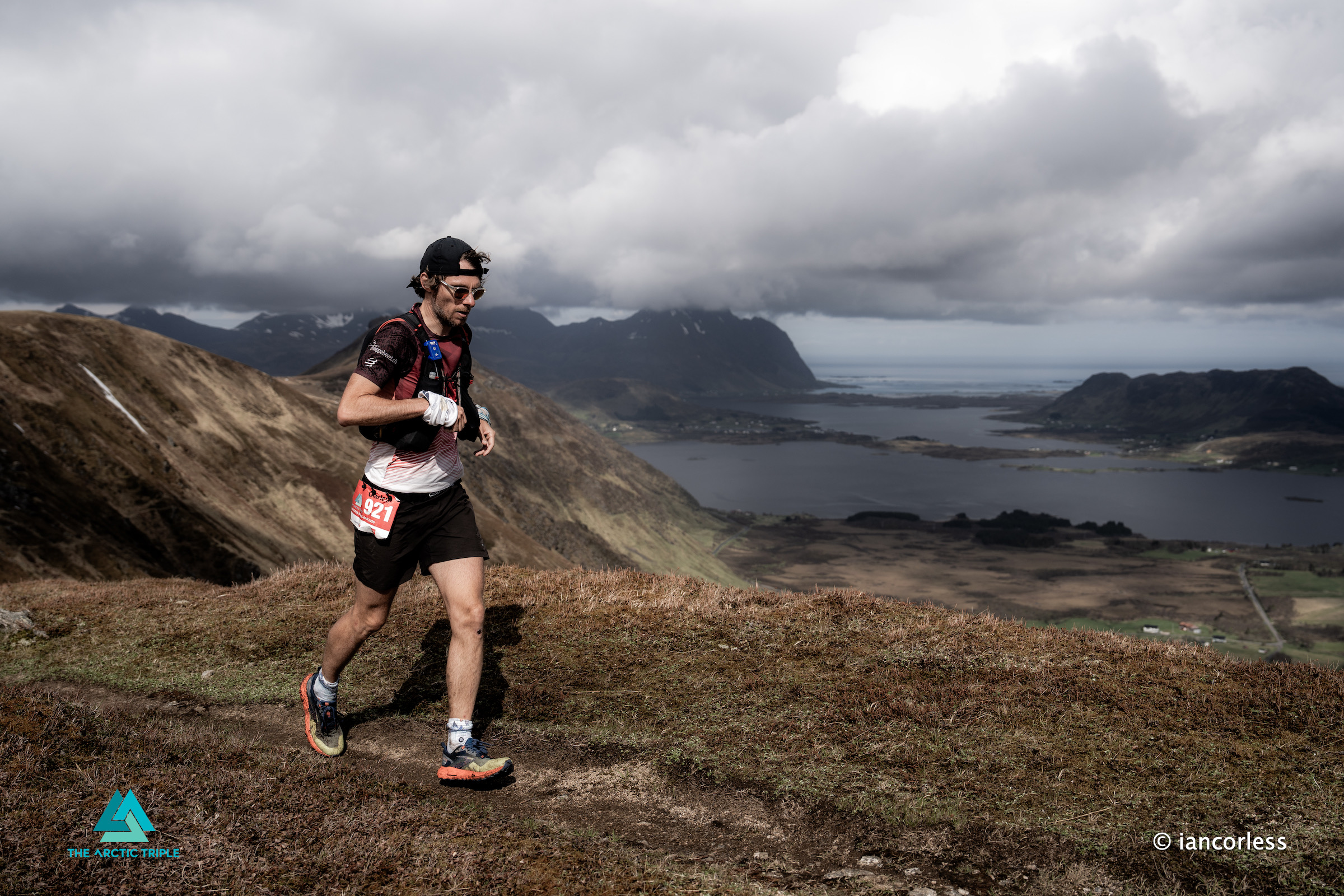
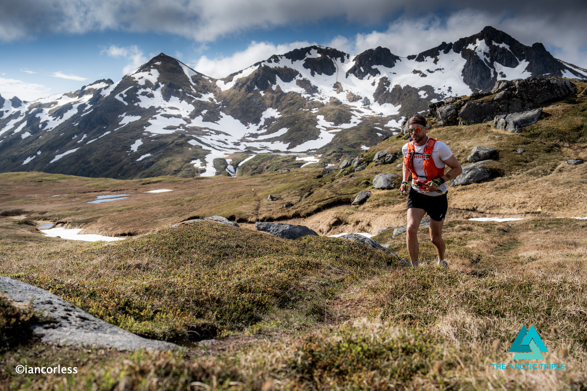
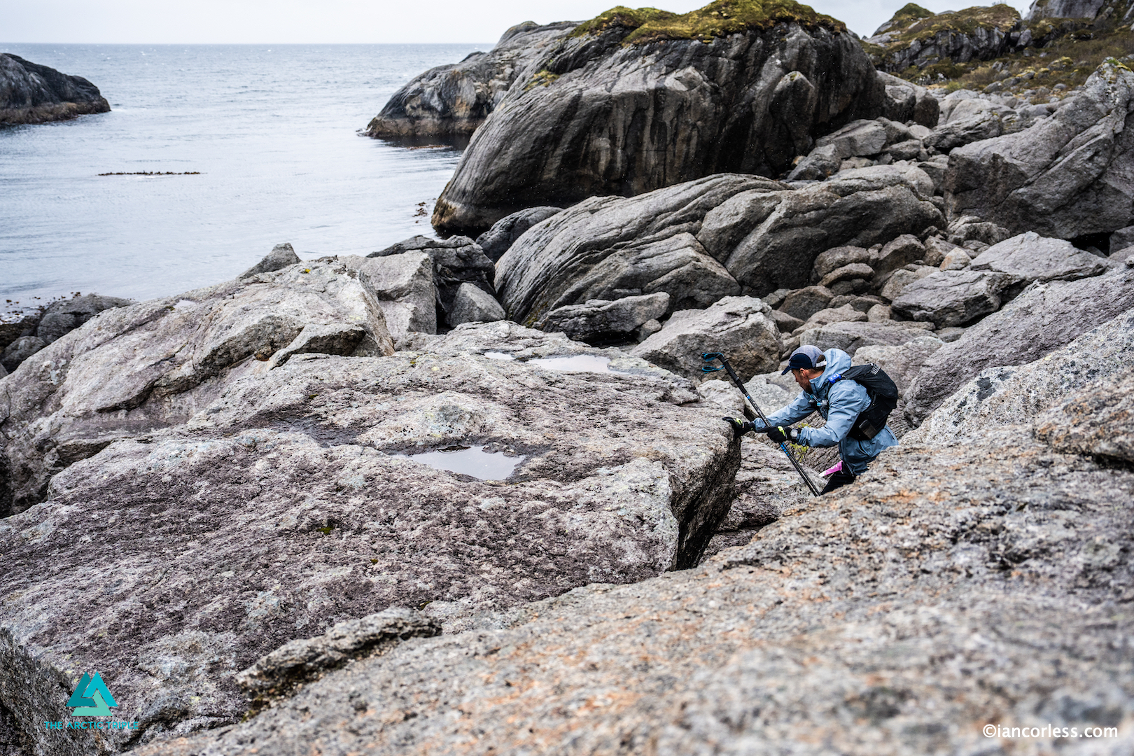
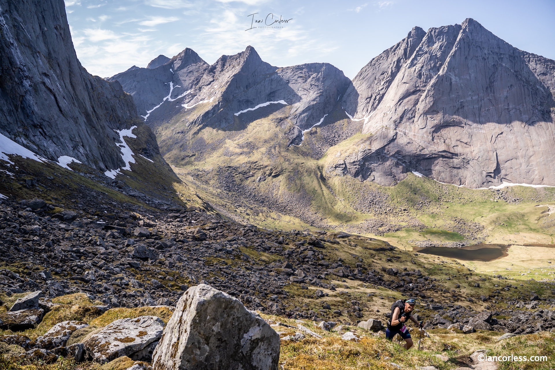
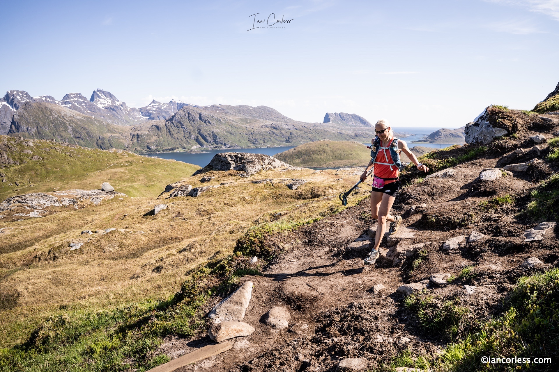
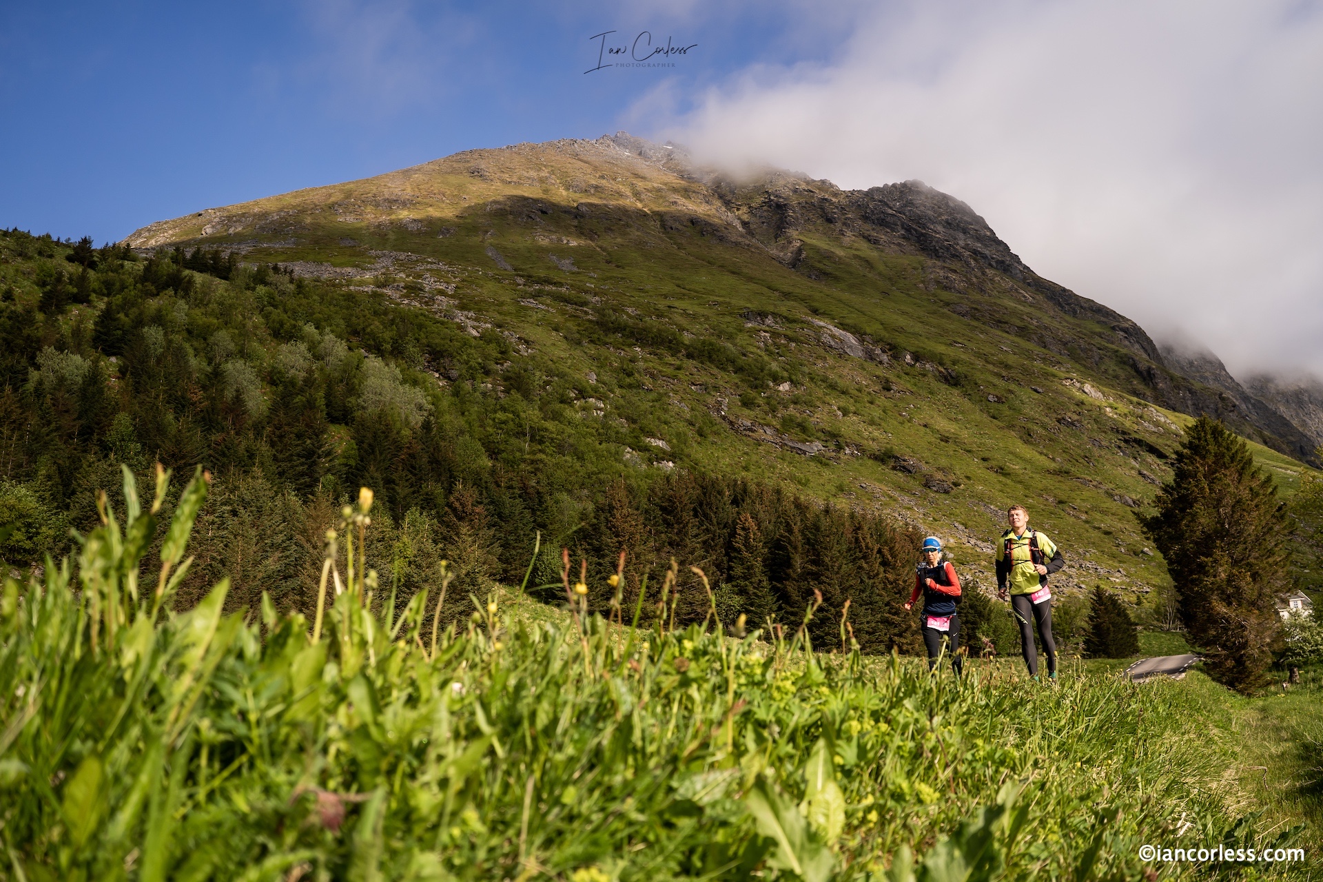
This was the crucible. The longest stage. Bodies were already breaking down, but the terrain opened up, longer runnable sections, smoother single track. The landscape changed too. From rugged coastline to sweeping highlands and serene lakes, this was Lofoten in its gentler form.
As the finish line at Brustranda Fjordcamping came into view, many had run out of words. “This is insane,” one runner muttered, grinning. “But it’s beautiful.”
Stage 4: The Final Push – Rolvsfjorden to Svolvær (45 km / 21 km)
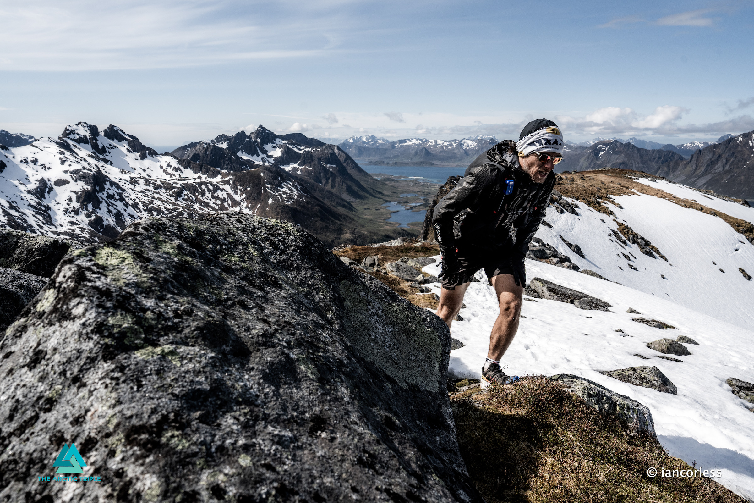
The last day was emotional. Legs were dead weight. Ankles rolled. Minds fogged. But everyone knew what waited: the end, the reward, the moment of elation.
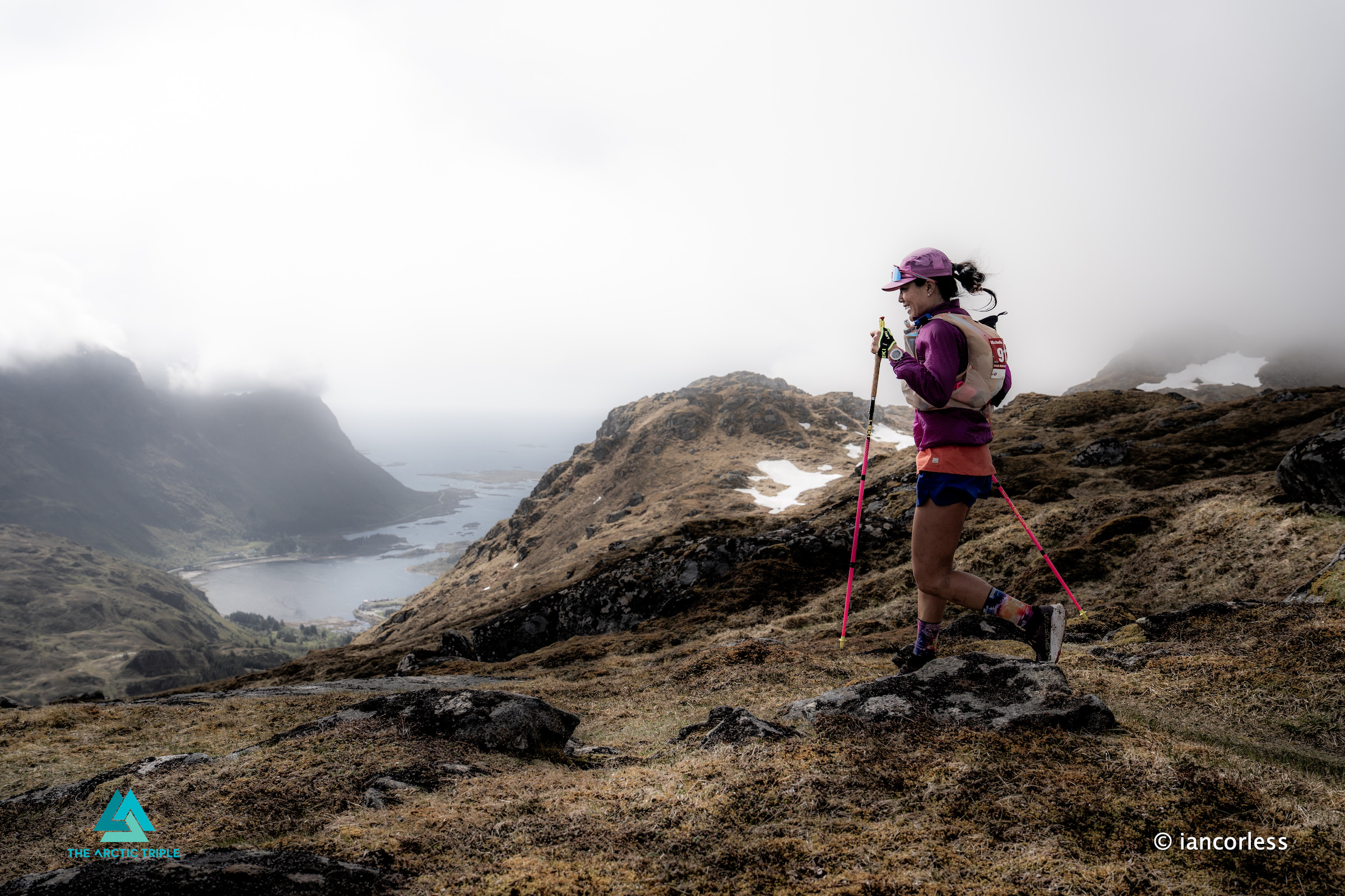
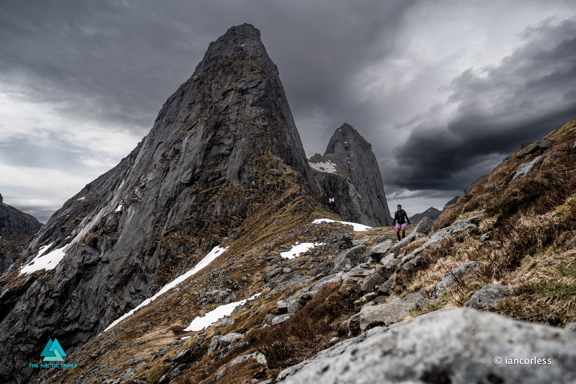
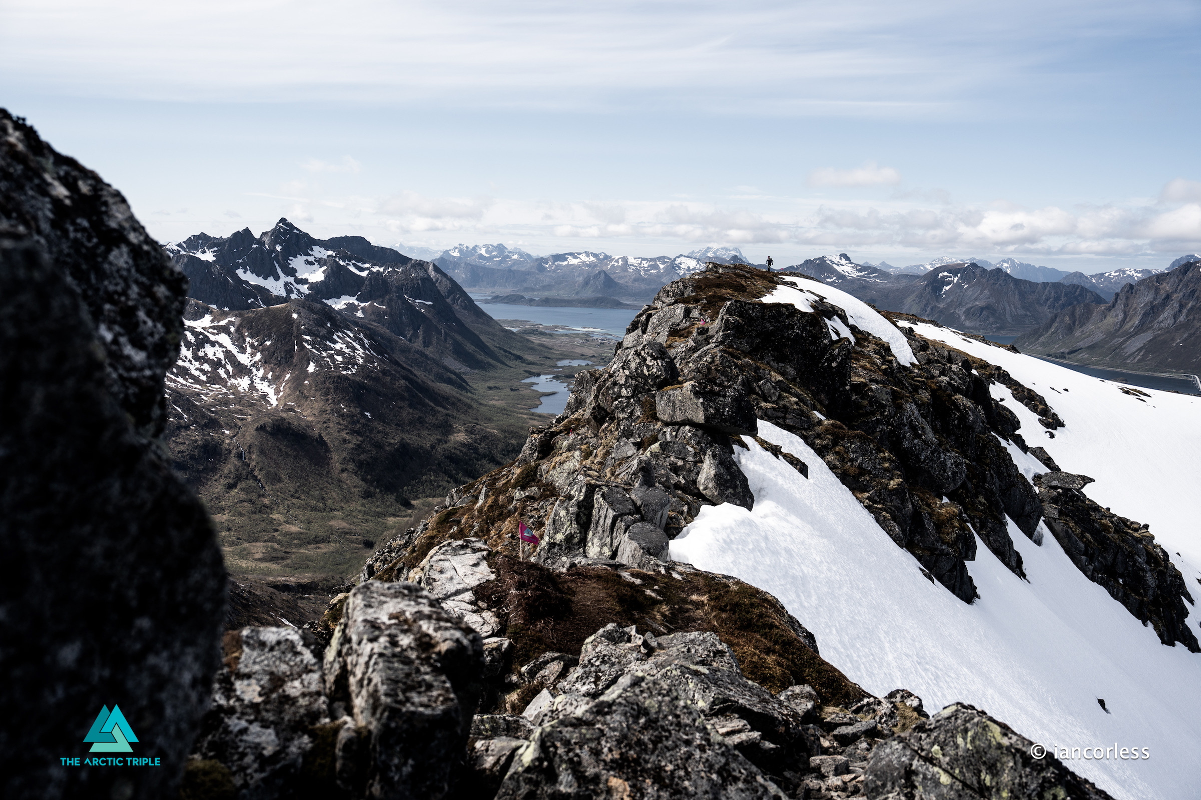
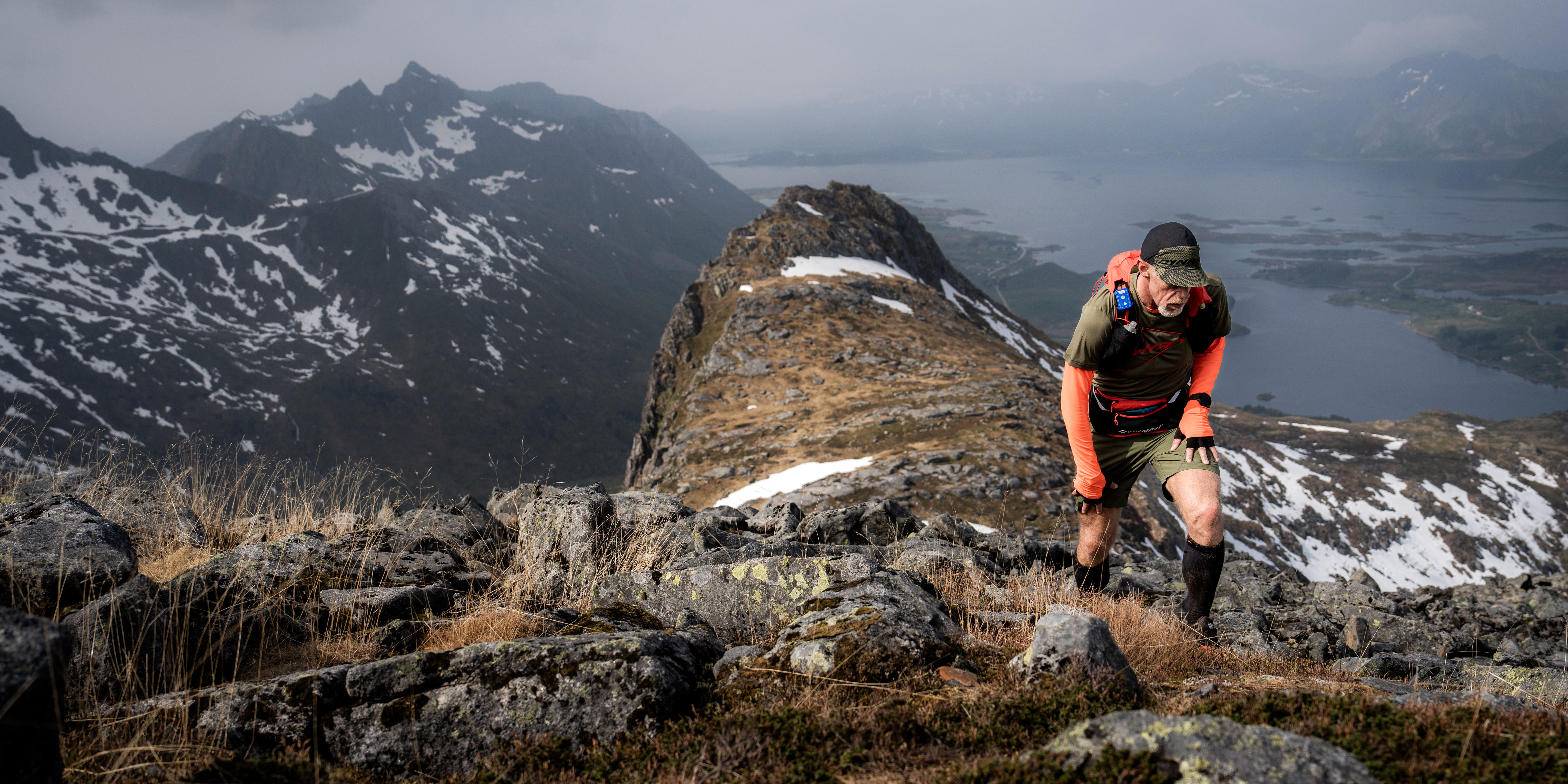
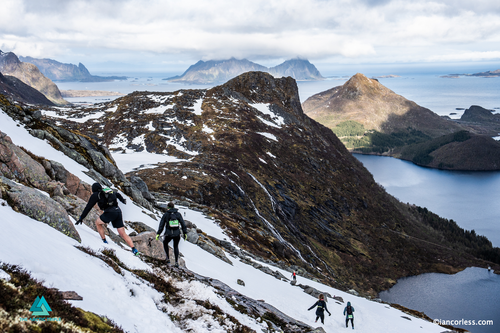
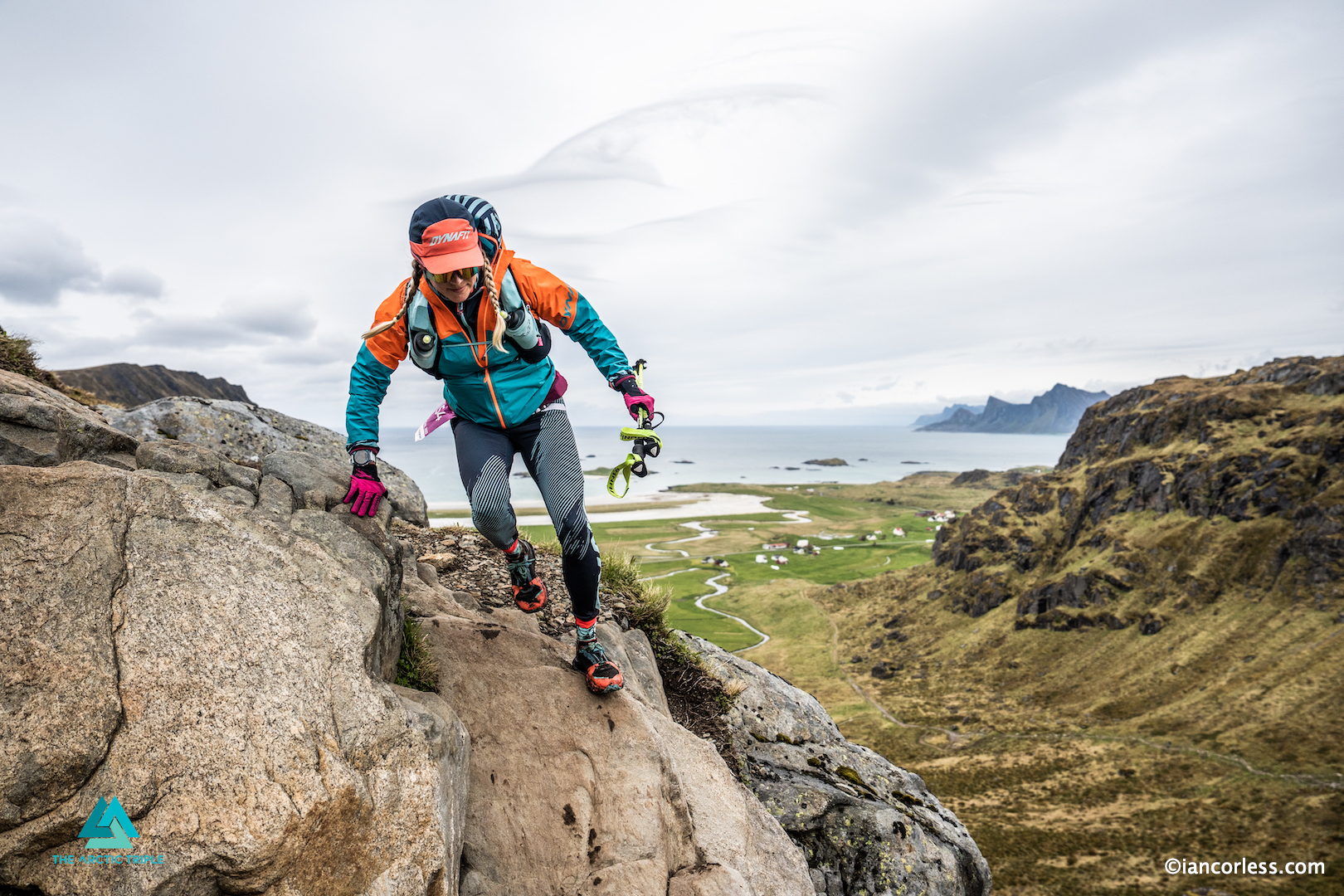
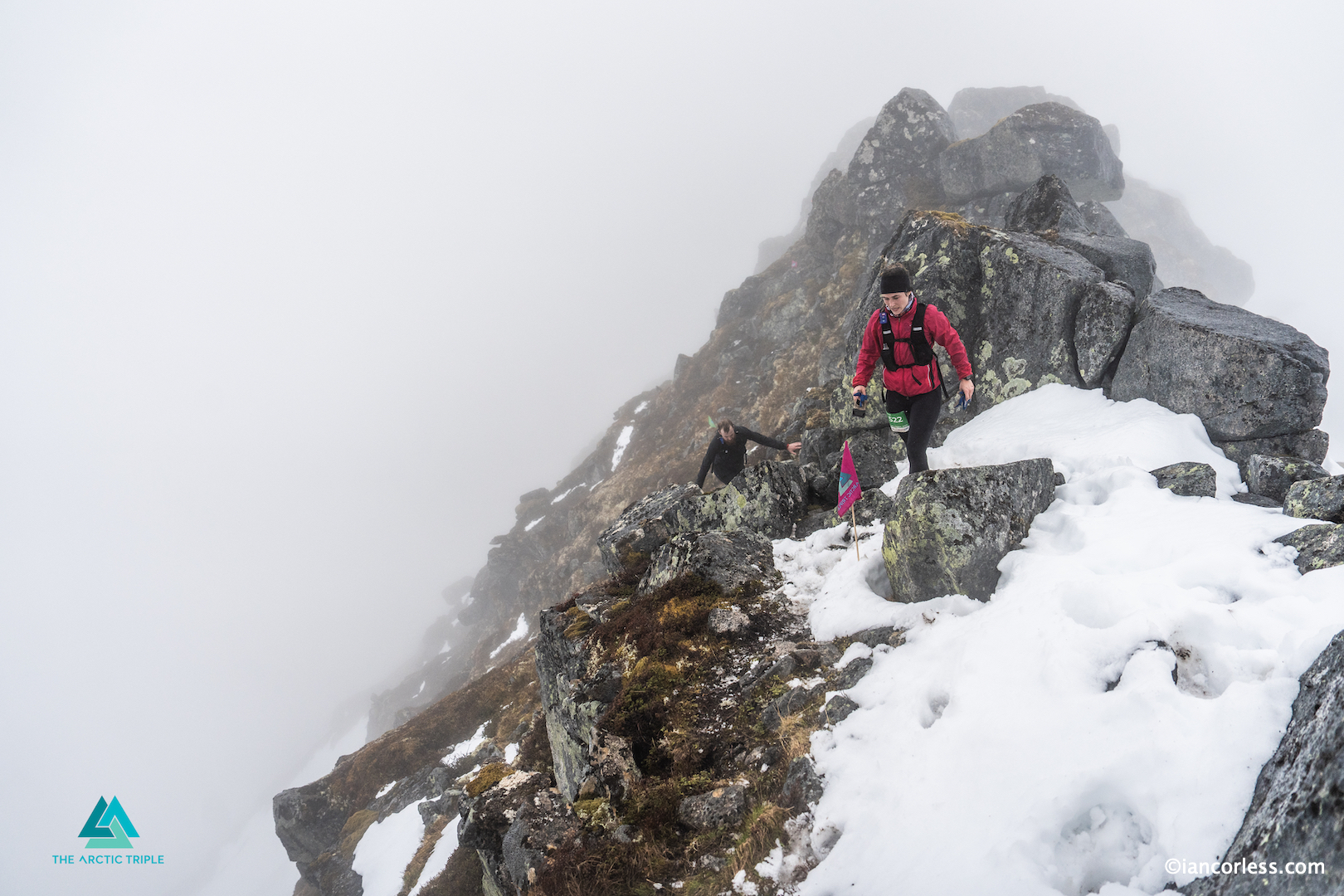
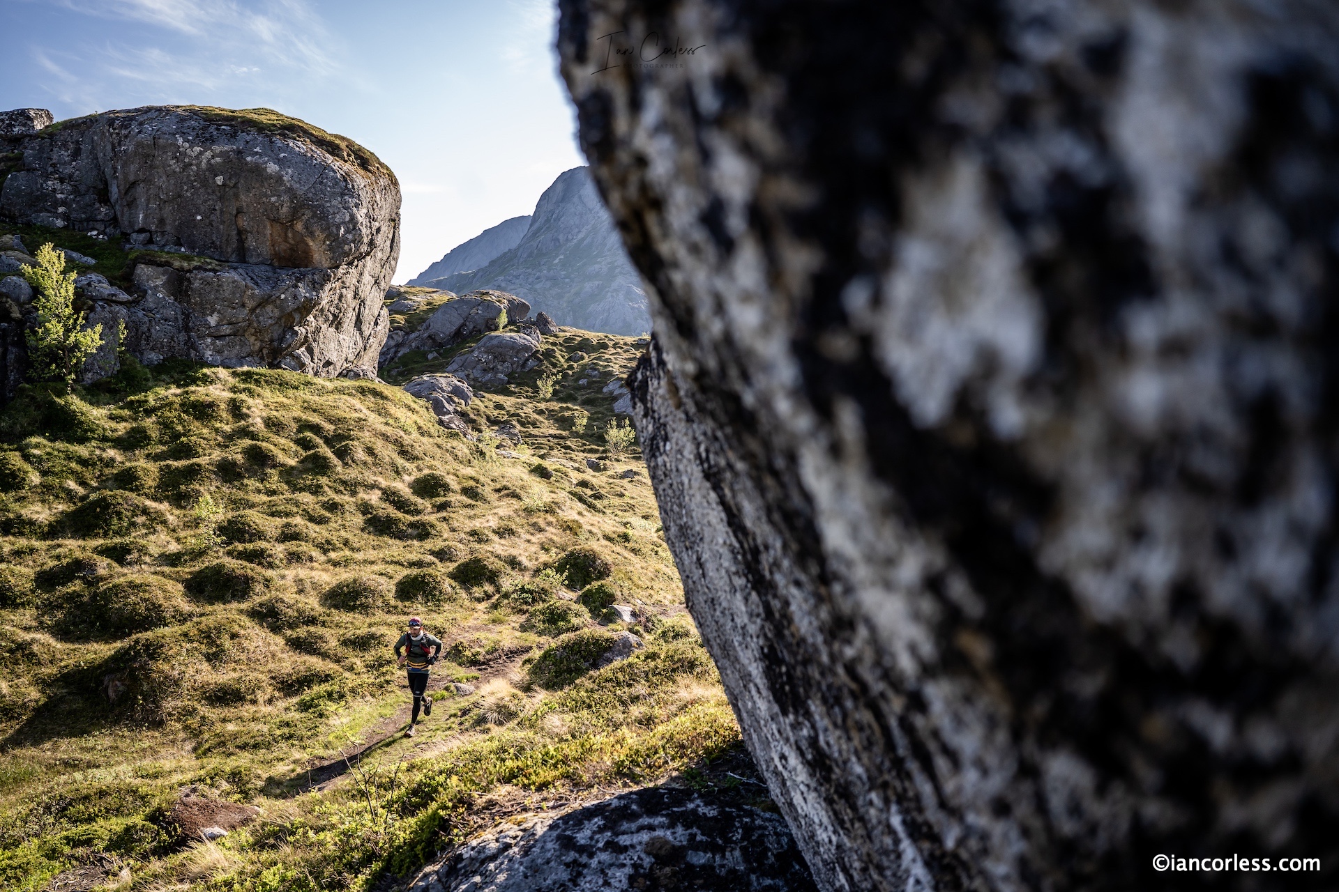
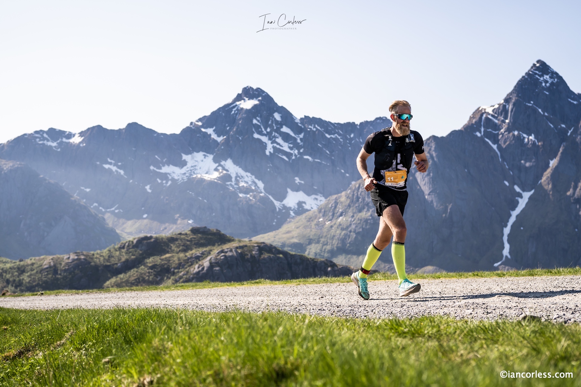
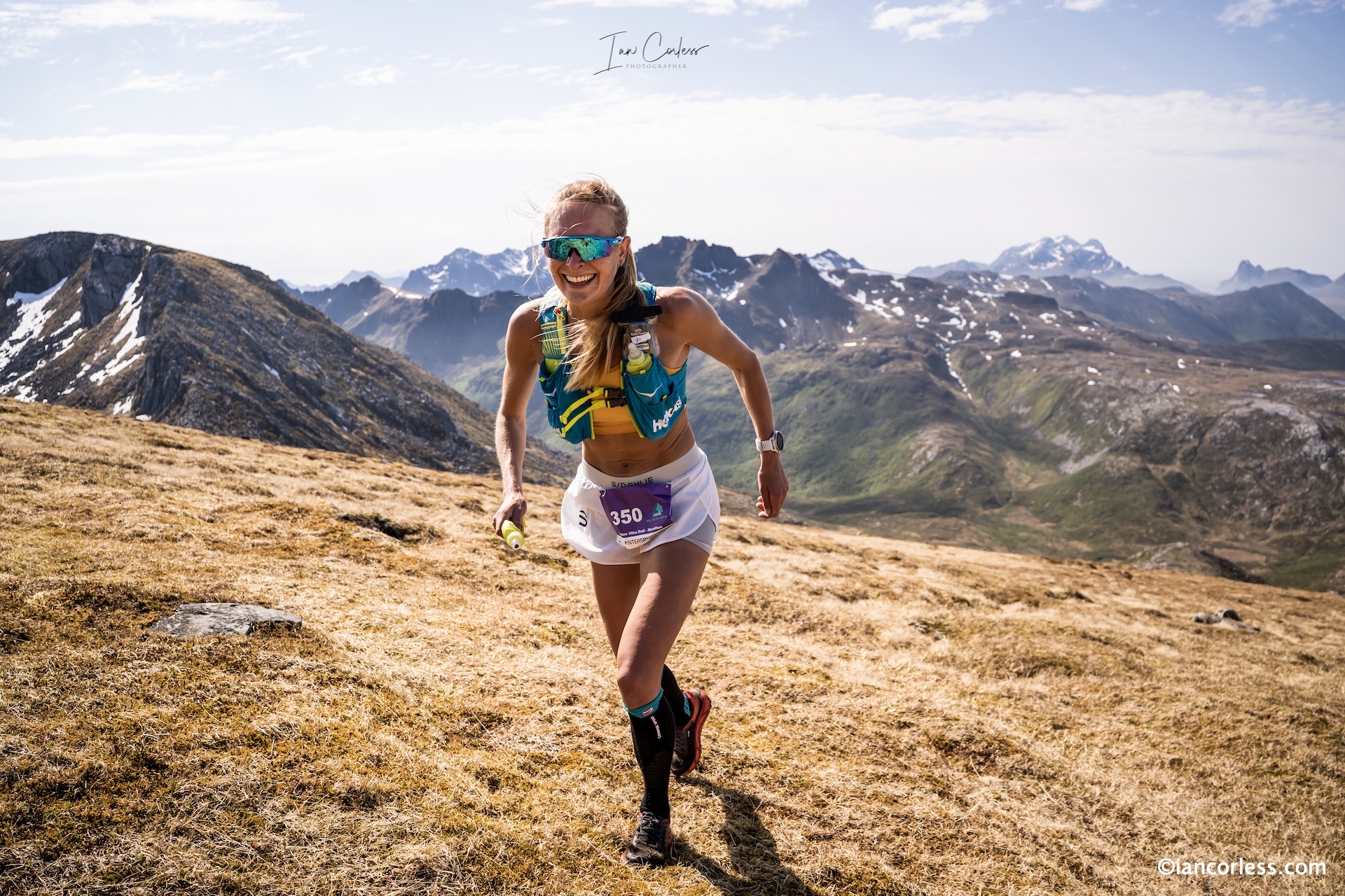
Jordtinden loomed: steep, snowy, relentless. At its summit, clouds lifted like curtains, revealing a 360-degree panorama that stopped runners in their tracks, the ridgeline ahead bringing a sense of awe and fear in equal measure.
This is the queen stage, the terrain bringing together all that makes Norway and Lofoten unique, marvellous and special.
You could see all the way back, mountains, inlets, the journey behind. Some cried. Some screamed. Some just stood there, stunned.
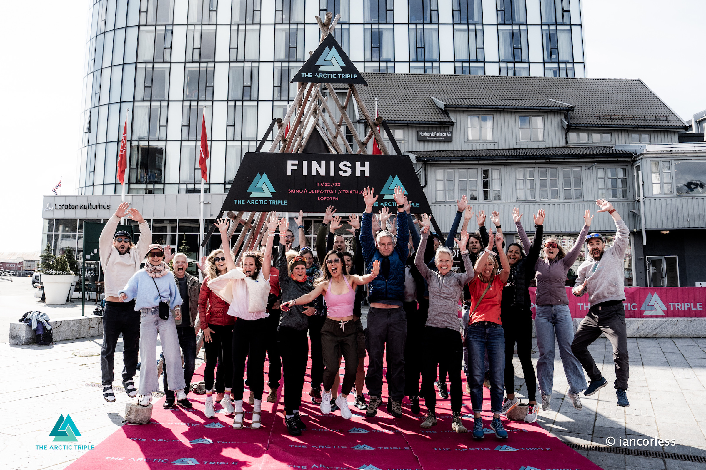
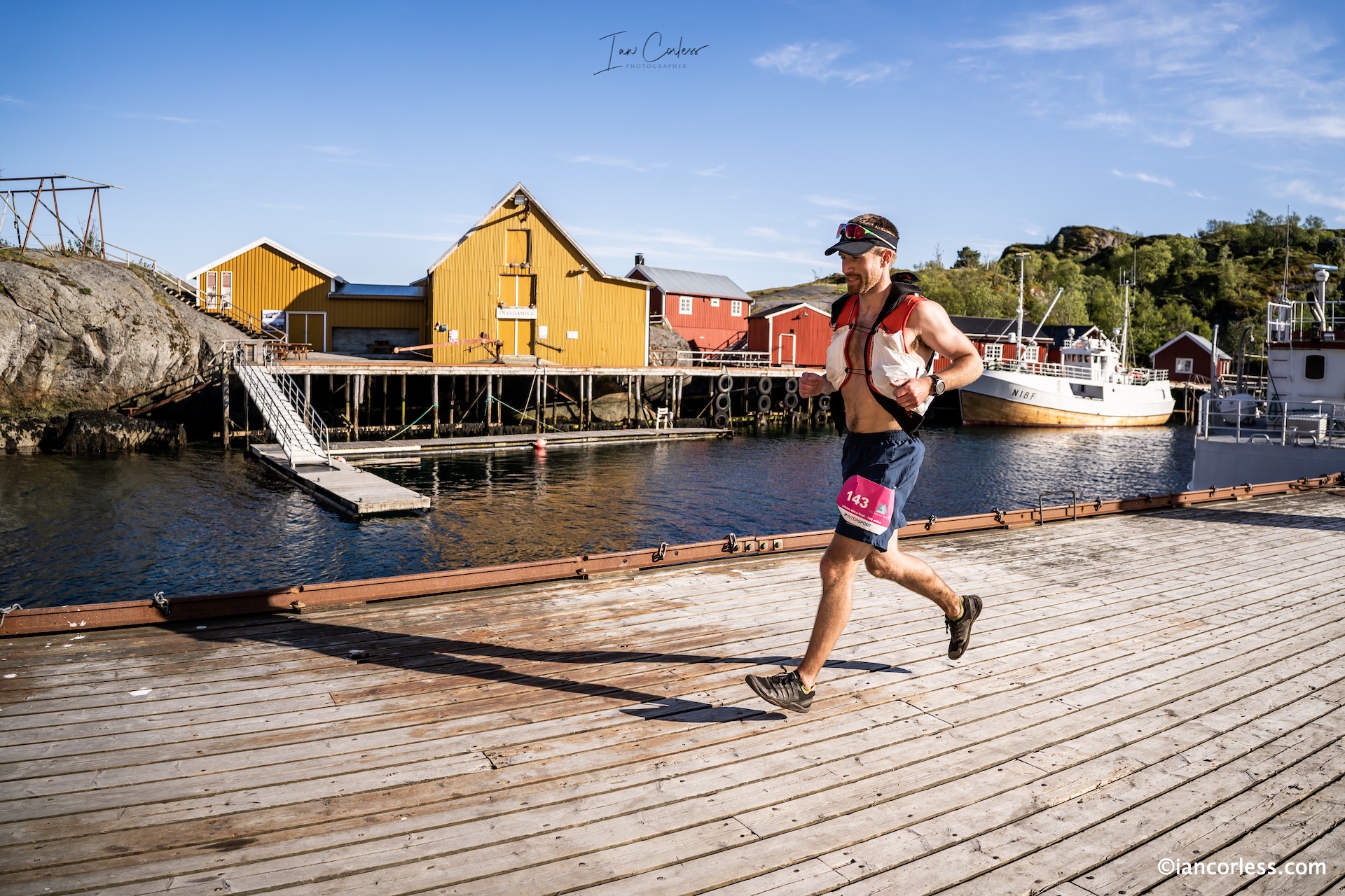
The descent into Svolvær was pure adrenaline, fuelled by joy and relief. The last stretch along the harbour felt like flying. Locals clapped. Teammates waited. People hugged. Some collapsed. Others danced.
More Than KM’s
But the Lofoten Stage Run wasn’t just about distance or finish times. It was about the strange intimacy of shared suffering, of strangers becoming friends over bowls of traditional Norwegian food and stories told in cabins. It was the moment you stepped outside at midnight, sun still hanging low over the sea, and realised how small we are.
It was the rawness of the terrain mirrored in every aching limb. It was the magic of Lofoten, weather that shifted like a mood, peaks that stabbed the sky, and a landscape that didn’t just surround you, it swallowed you whole.
In the end, it wasn’t a race, it never was, the Lofoten Stage Run is an experience, a 360 immersive journey that shocked the mind and the senses and revealed to each and every participant that this route, arguably, is one of the BEST in the world. It was a rite of passage. A storm-chased, mud-caked, heart-thumping reminder that the wild is still out there, and if you’re lucky, it might just let you in.
The inaugural 2024 Lofoten Stage Run paved the way for what is Norway’s premiere multi-stage running event. Taking place over 6-days (4-days running,) the LSR event was inspired by the 170km solo event taking place under the umbrella of events titled The Arctic Triple – ski mountaineering, trail running and triathlon.
2025 will see the 2nd edition take place and once again two distance options will be available, 170km ‘Expedition‘ and the 100km ‘Adventure‘ run.
While 100km may seen extremely manageable over 4-days, one must take into account the challenging terrain the race takes place over and the vertical climb and descent. This is not an easy option.
There is no better way to fully immerse oneself and experience that magic that Lofoten offers by moving under ones own power, running or walking. Lofoten is considered one of the most desireable places to visit in the world.
The Lofoten Stage Run has the added bonus of taking participants to hidden places, often only experienced by the most adventurous tourist.
After a tough day on the trails, each stage concludes with a typical Norwegian Hytte experience with excellent local cuisine, a shower and of course a comfy bed. Participants luggage is transported each day, so, while running, you can travel lighter and faster.
The Lofoten Stage Run is designed to be a running holiday, however, do not be fooled, those cozy and comfortable evenings are worked for. The terrain and weather in Lofoten is challenging; a mixture of all terrains and elements that can bring for many, the ultimate challenge.
THE EXPERIENCE
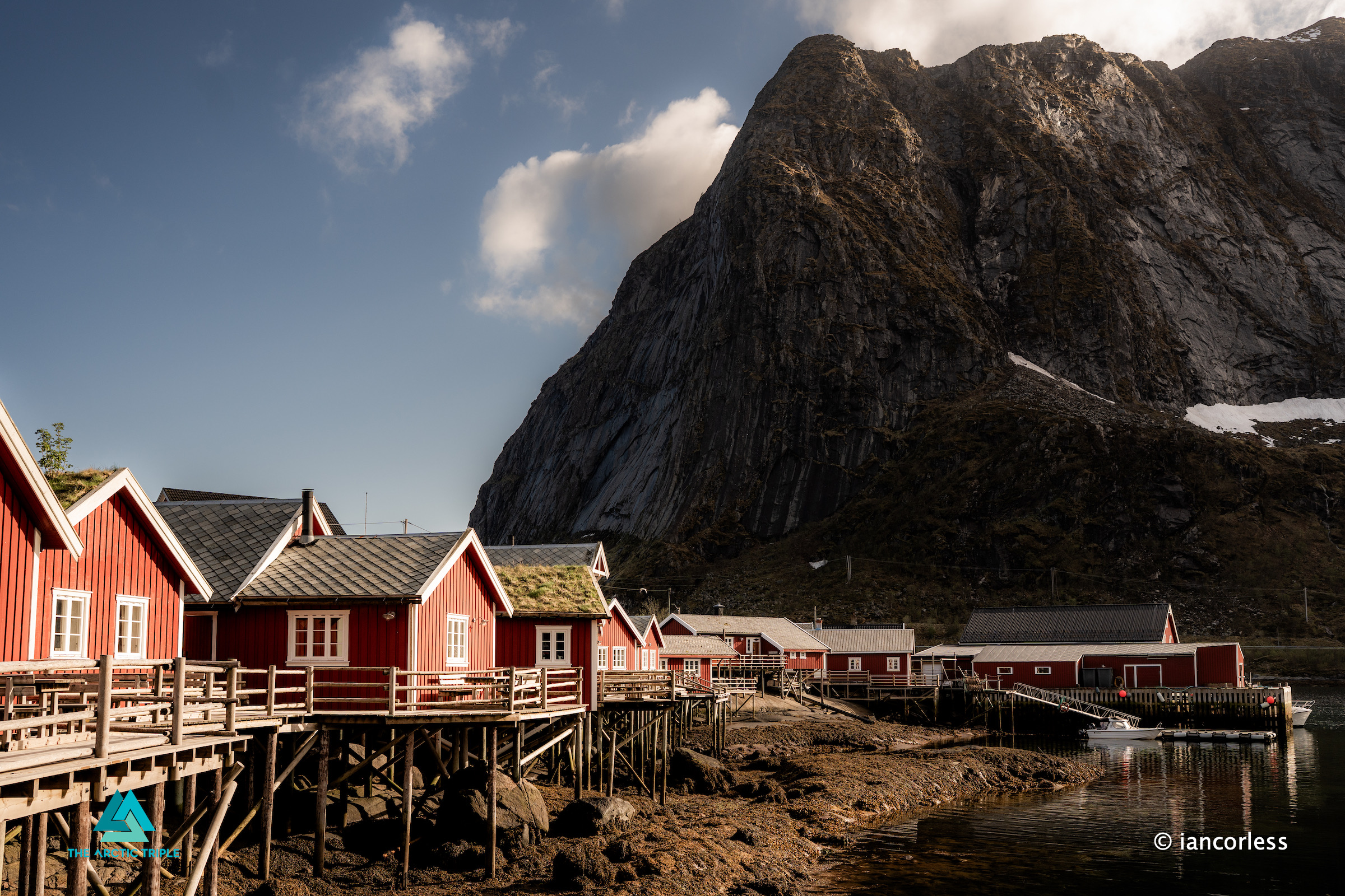
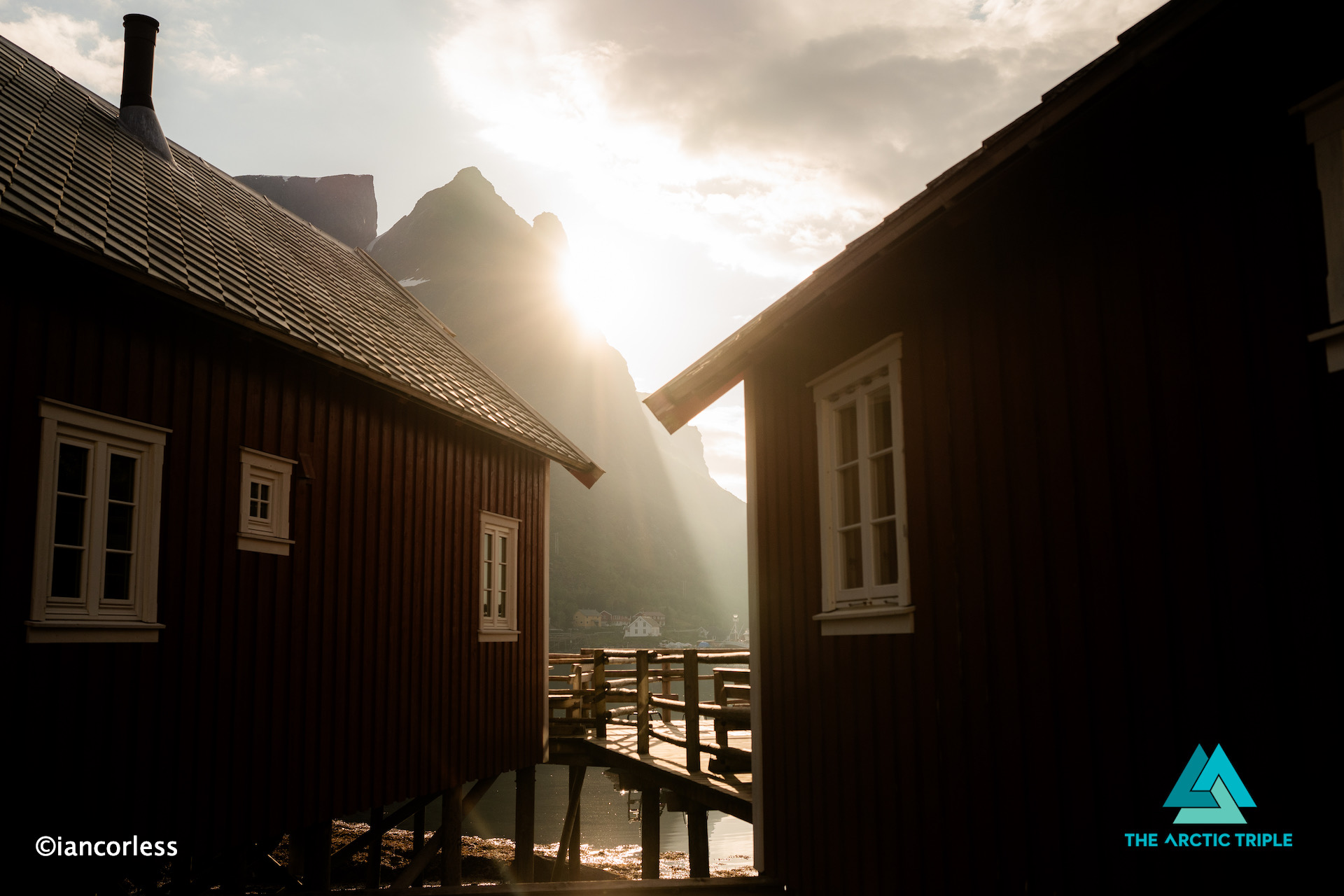
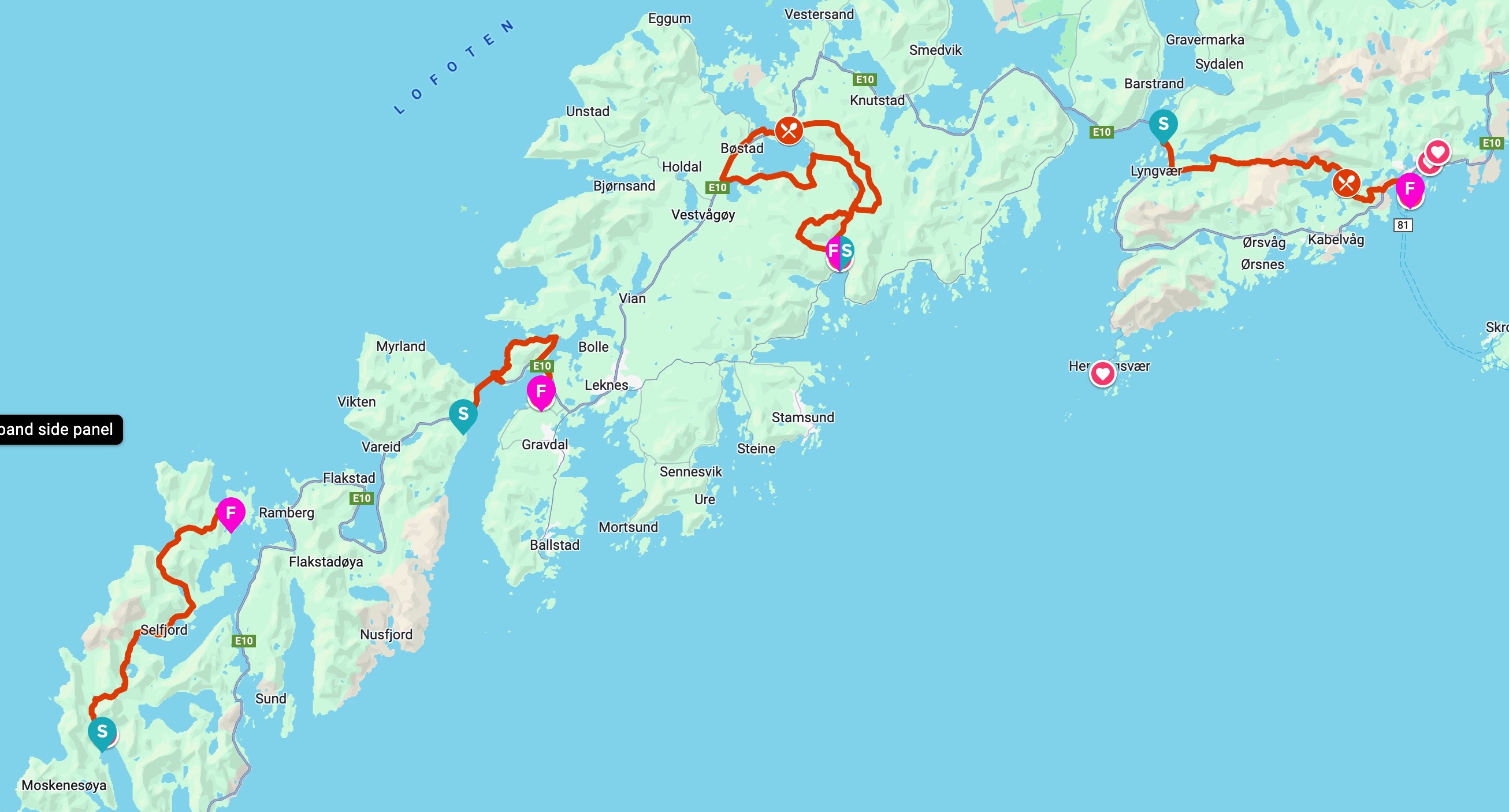
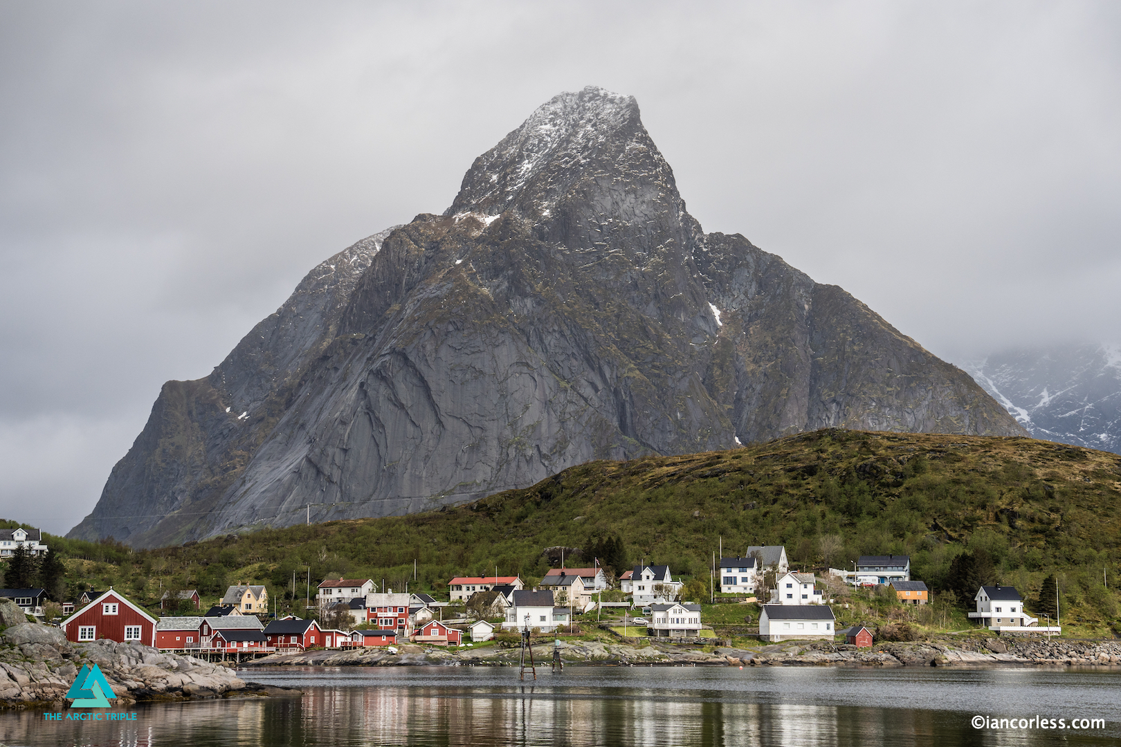
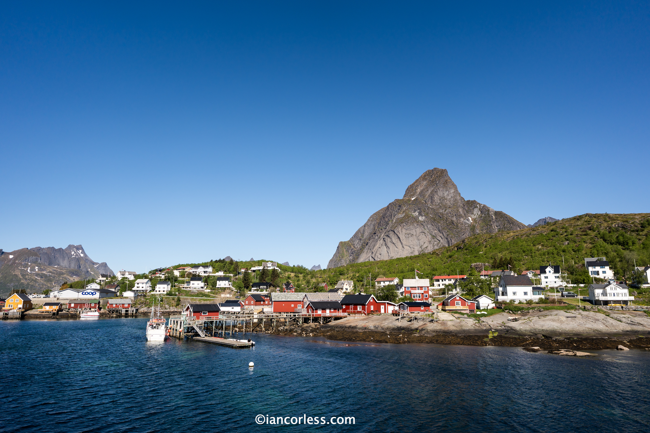
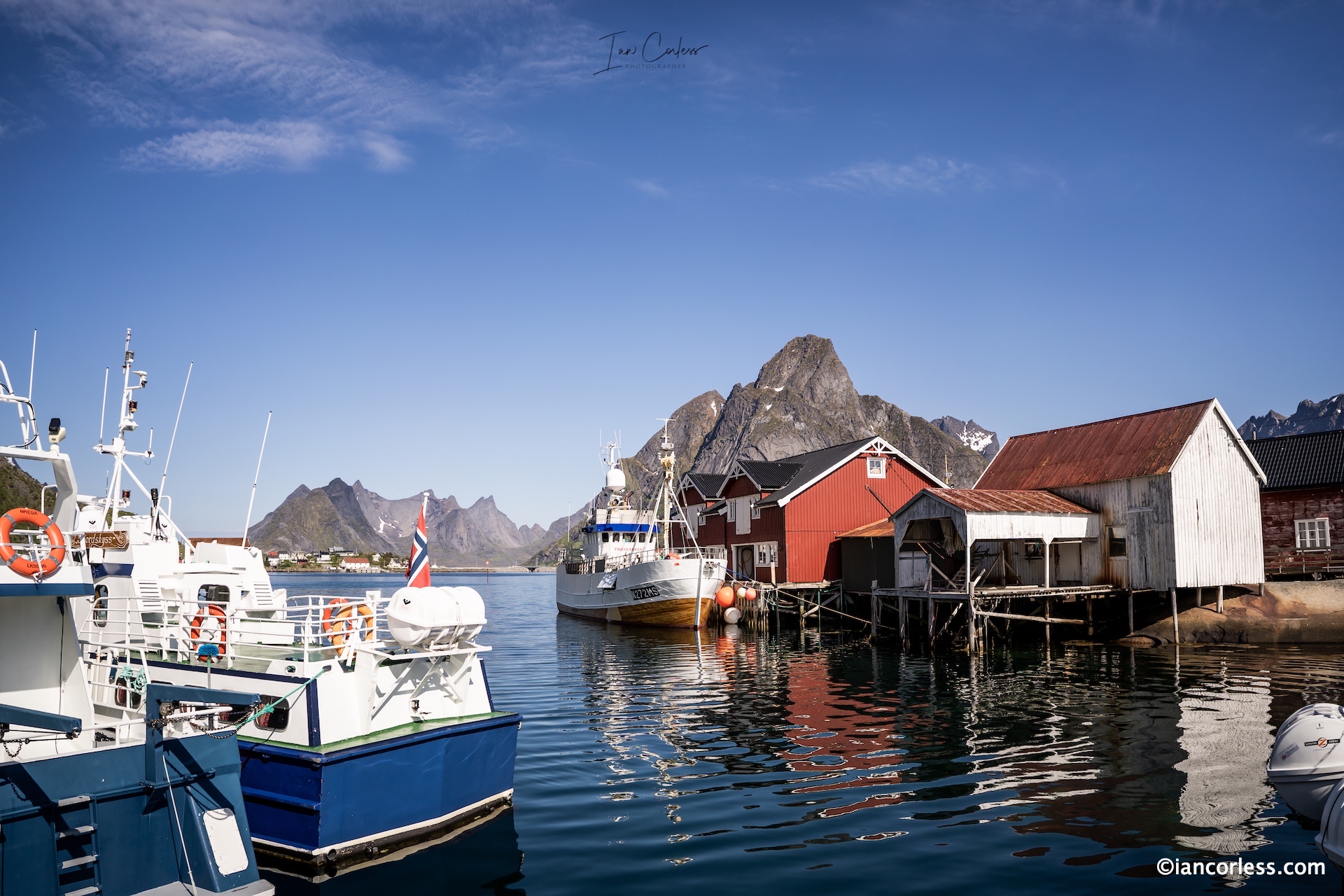
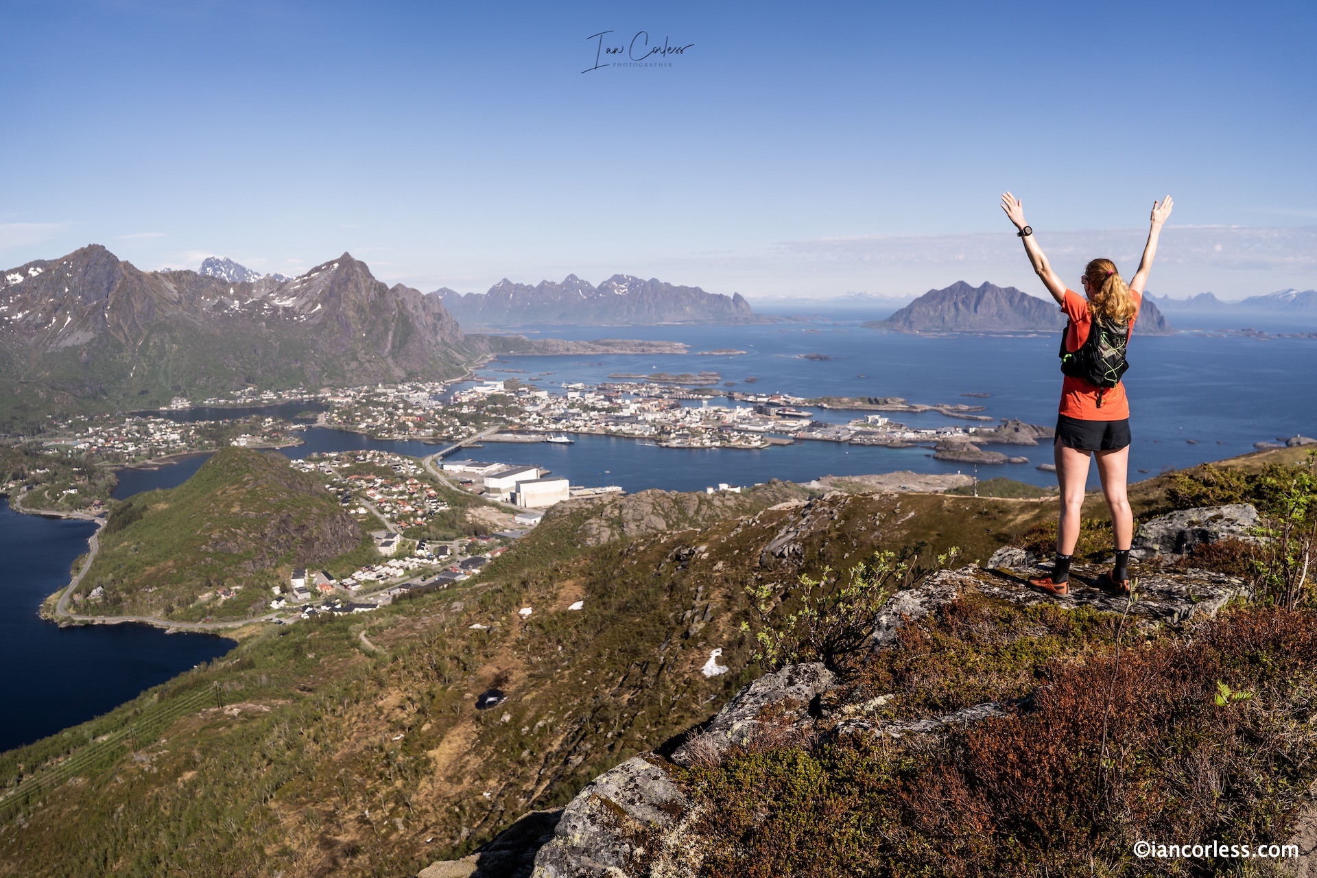
Taking place during week 22, participants need to be in Svolvær on May 27th for a transfer to Reine and a stay at Reine Rorbuer. Located in the western part of Lofoten, at the entrance to the Reinefjord, lies the stunning fishing village, considered one of the most beautiful in Norway.
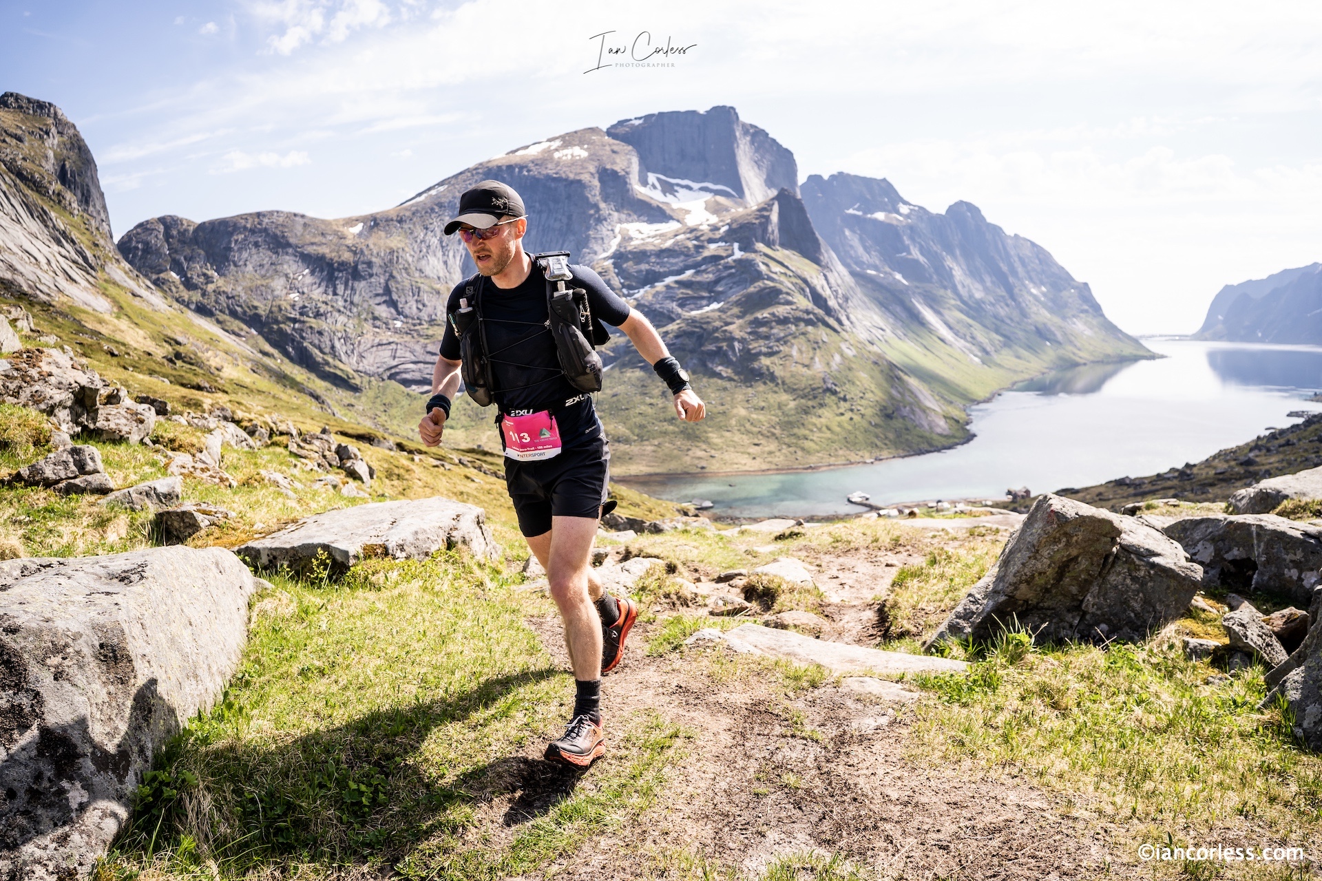
Wednesday, stage 1, starts with a boat trip from Reine to Kjerkfjorden. The route ahead, 39km’s for 170km race and 20km for the 100km. The opening 10km’s a real challenge with tough climbs, technical terrain, snow sections and soft/ boggy ground. Kvalvik beach offers some opportunity for flat terrain before a steep climb and eventually a descent to Fredvang and checkpoint. Here the 20km distance stops. A road section leads to Nesland for the 170km runner’s and the final technical trail sections before arriving in the picture postcard, Nusfjord and the Nusfjord Arctic Resort– a tough day!
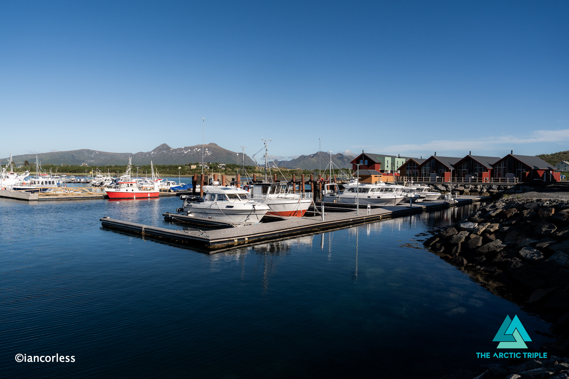
Stage 2 at 34km’s (17km for the 100km starting at Napp) concludes at Lofoten Rorbuutleie another amazing location surrounded by sea and mountains. The early route to Napp bringing many a challenge, technical trails and mild hands-on scrambling sections before sweeping single-track with stunning views. Road gives way to coastal trail and another road section before arriving at Lilleeidetholmen marina, the buildings are located with water on both sides and direct access to quays and floating docks.
Stage 3 for 170km Expedition runner’s is the long day, covering 52km’s with arguably the most ‘runnable’ terrain of the whole week. For the 100km it is also a long day at 35km starting at Rolvsfjorden.. Technical aspects are reduced and much of the route is single-track interspersed with some road. The finish at Brustranda Fjordcamping once again offering a wonderful Norwegian hytte experience of cabin surrounded by water and mountains.
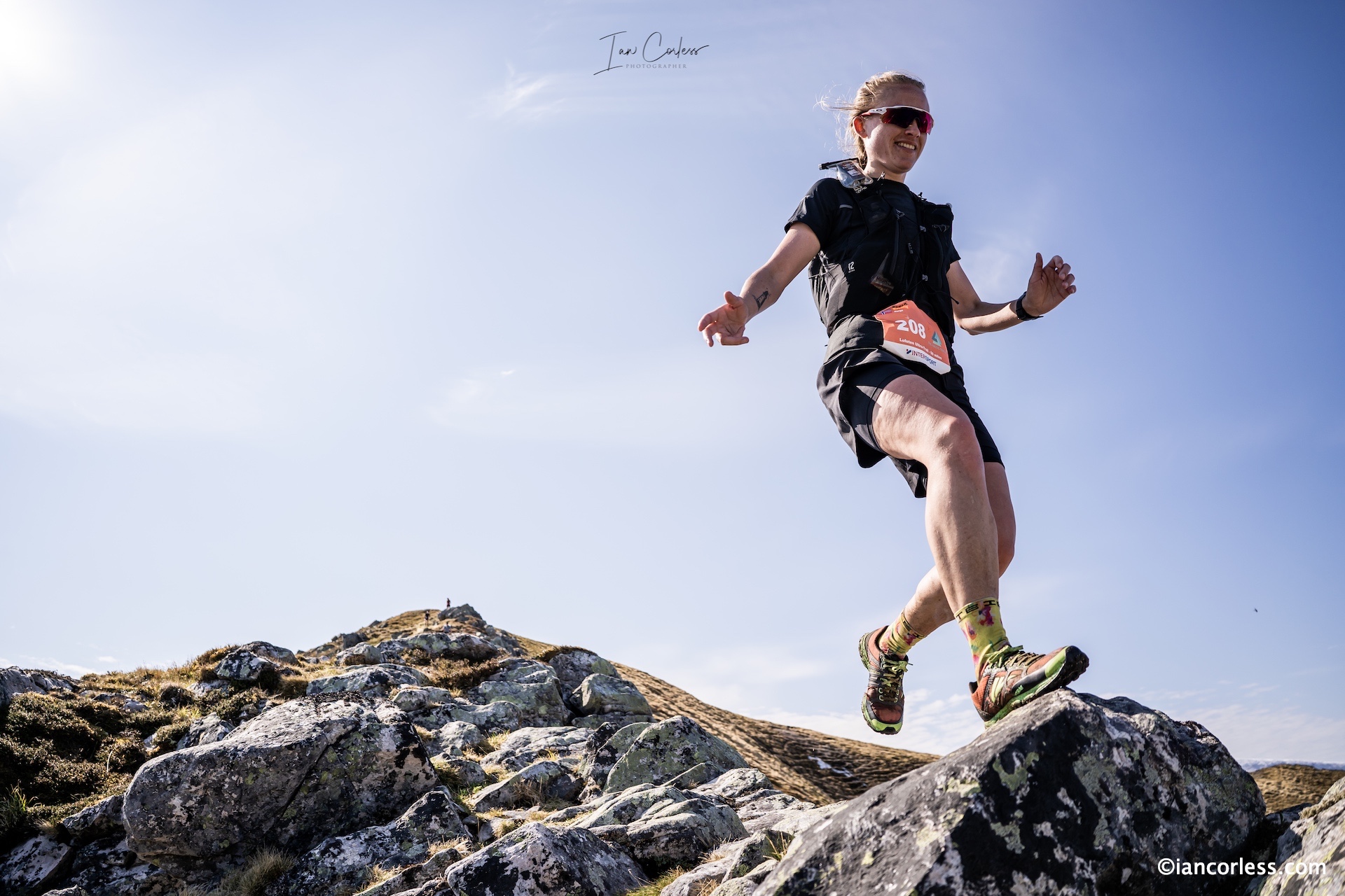
Stage 4, the final day at 45km’s brings some of the most technical terrain of the whole Lofoten Stage Run experience, especially the climb to Jordtinden and the ridge that follows with some exposure form an ‘airy’ single-track, snow fields and at times, challenging terrain. The final peak of Tjeldbergtinden a final challenge before the run in to Svovær and the conclusion of four magical days. For the 100km runner’s they cover the last 21km starting at Kleppstad, and yes, they get to experience Jordtinden, the ridge and the final summit of Tjeldbergtinden – it is the highlight section of the whole Lofoten Stage Run.
After the race, a meal at the event hotel, Thon Hotel Lofoten, where the focus is some of the best local food from the area. A perfect evening to share new and old stories with your new friends and relive the magic of Lofoten and the Lofoten Stage Run.
THE RUN
170km or 100km, one thing is for sure, running in Lofoten is tough and challenging. Terrain constantly switches from demanding and technical sections to easy flowing single-track. Experience, excellent endurance and an ability to handle technical and challenging terrain is required for those who sign up for the 170km.
The same requirements apply for the 100km distance, however, the shorter distance does allow for a considerably slower pace and more walking. Rest assured, the 100km is not an ‘easy’ option, it is a real Norwegian mountain experience, especially the 21km on the last day.
The Lofoten Stage Run is all about enjoyment and experiencing the best of Norway, not only its magical terrain but its hytte and food.
It is no coincidence that this is called a run and not a race, the ultimate relaxed trail running experience that brings so much more than just running. Traveling point-to-point, on foot, experiencing the magnificence of Norway. Stunning trails, majestic mountains, resplendent views, and all during the endless daytime of the midnight sun. It gets no better!
Experience Lofoten.
Experience the Arctic Circle.
Experience the midnight sun.
Experience the majesty and beauty of Norway under your own power.
The inaugural 2024 Lofoten Stage Run has just concluded, two experiences, the 170km Expedition Run and the 130km Adventure Run brought to you by The Arctic Triple team. Six days and four stages inspired by the Lofoten Ultra-Trail 100 Miles solo race, the Lofoten Stage Run brings the same route broken down into manageable chunks.
Epic landscape and views
There is no better way to fully immerse oneself and experience that magic that Lofoten offers. The routes journey to hidden places, often only experienced by the most adventurous tourist. Each day concluding with the Norwegian Hytte experience and local cuisine.
Norwegian Hytte – Reine Rorbuer
Designed to be a running holiday, however, do not be fooled, those cozy and comfortable evenings are worked for. The terrain here in Lofoten is challenging; a mixture of all terrains and elements that can bring for many, the ultimate challenge.
Mountains, snow, single-track and amazaing views with Johan Cajdert.
THE EXPERIENCE
Arriving in Svolvær on Tuesday May 28th, participants were transported to Reine, considered by many to be the most beautiful village in Norway. It is certainly iconic.
Reine Rorbuer
Staying in an authentic fisherman cabin in Reine Rorbuer, the 2024 experience kicked-off with a race briefing and then dinner.
Race briefing
Wednesday, stage 1, started with a boat trip from Reine to Kjerkfjorden.
What a way to start a journey.
The route ahead, 39km’s. The opening 10km’s a real challenge with tough climbs, technical terrain, snow sections and soft/ boggy ground.
Lina and SannaRock, trail, grass and snow.
Kvalvik beach offers some opportunity for flat terrain before a steep climb and eventually a descent to Fredvang and checkpoint.
It’s more than just running.
A road section leads to Nesland and the final technical trail sections before arriving in the picture postcard, Nusfjord – a tough day!
Tzvetie at the end of stage 1Twin power finishing in Nusjford
Stage 2 at 34km’s concludes at Lofoten Rorbuutleie another amazing location surrounded by sea and mountains.
Early miles of stage 2 and epic viewsClimbing to coastal trails
The early route to Napp bringing many a challenge, technical trails and mild hands-on scrambling sections before sweeping single-track with stunning views.
Hands-on scramblingMagical terrainRoad sections provide some easy running and link the key trails
Road gives way to coastal trail and another road section before arriving at Lilleeidetholmen Marina, the buildings are located with water on both sides and direct access to quays and floating docks.
Lilleeidetholmen Marina
Stage 3 for 170km Expedition runner’s is the long day, covering 52km’s with arguably the most ‘runnable’ terrain of the whole week.
Between a rock and a hard placeSnow fields add to the experience
Technical aspects are reduced and much of the route is single-track interspersed with some road.
Johan Cajdert
The finish at Brustranda Fjordcamping once again offering a wonderful Norwegian hytte experience of cabin surrounded by water and mountains.
This is Lofoten
Stage 4, the final day bringing some of the most technical terrain of the whole Lofoten Stage Run experience, especially the climb to Jordtinden and the ridge that follows with some exposure form ‘airy’ single-track, snow fields and at times, challenging terrain.
Graeme Murdoch at Jordtinden.On the way down the ridge.The twins dominated each stage
The final peak of Tjeldbergtinden a final challenge before the run in to Svovær and the conclusion of four magical days. After the race, a meal at the event hotel, Thon Hotel Lofoten, where the focus is some of the best local food from the area. A perfect evening to recap from the race and share new and old stories with your new friends.
Great food a feature of the experience
THE RUN
Run, walk or hike.
170km or 130km, one thing is for sure, running in Lofoten is tough and challenging. Terrain constantly switches from demanding and technical sections to easy flowing single-track. For sure, day 1 was a surprise to many and a warning of the challenge that would be ahead to complete the 4-day experience.
Always some snow throughout each stage
Despite schedules for the 170/130km runs, this journey was all about enjoyment and experience, therefore, participant requests for shorter days, or even rest days were accommodated. The Lofoten Stage Run is as explained, a running holiday and therefore it should provide the right experience for the individual.
Reiner completed the 170km mixing walking and running
What was key was the unified enjoyment through the whole group of participants, key to this was the evening hytte experience and the sharing of a meal together.
Hytte in great locations
Of course, racing did take place, and Lina and Sanna Elkott Helander were the stand out champions of the 170km distance along with Johan Cajdert.
The twins!
Graeme Murdoch and Tzvetie Erohina lead the way for the 130km.
Graeme and Tzvetie
Results though don’t tell the story, the Lofoten Stage Run was a relaxed trail running experience that brought so much more than just running.
Wow
The weather played ball and provided not only pleasurable temperatures but also allowed Lofoten to be visible, this really is a truly magical landscape. Traveling point-to-point, on foot, experiencing the majesty of Norway. Stunning trails, majestic mountains, resplendent views, and all during the endless daytime of the midnight sun. It gets no better!
New for 2024, Norway’s first multi-day trail running event, the LOFOTEN STAGE RUN brought to you by the team behind The Arctic Triple taking place Week 22 2024 (w/c 27th May)
Located in the stunning and world-renowned Archipelago of Lofoten, The Arctic Triple team will offer two stunning races, the 175km Expedition Run and the 120km Adventure Run, both starting in the iconic, beautiful, and picturesque Reine and concluding in Svolvær.
Travel point-to-point, on foot, experiencing the majesty of Norway. Stunning trails, majestic mountains, resplendent views, and all during the endless daytime of the midnight sun. A fully supported journey over 4-days (6-days in total) and remembered for a lifetime.
The Lofoten Stage Run will bring the best of what Norway has to offer – fjords, fishing villages, beaches, mountains, ridges and of course the world-renowned Hytte experience.
Kristian Nashoug at Reine
“Lofoten Stage Run came about after the 2021 Arctic Triple and the realisation that only the 100-mile runners were getting a full 360 Lofoten experience. Not everyone wants or can run 100-miles in one go, especially here in Lofoten. So, we have created the Lofoten Stage Run which effectively breaks down our 100-mile race in 4-stages and therefore offers a more manageable way to experience all that Lofoten has to offer.”– Kristian Nashoug
The Lofoten Stage Run, either the 175km or 120km versions offer a full day to cover the respective stages and the opportunity to really experience all that this area has to offer. In the evening, runners will meet local hosts, experience local food, have comfortable lodging, and create new bonds and friendships with like-minded people. Lofoten is one of the most ‘desired’ places to visit in the world, what better way to experience it?
This is no ordinary multi-day race!
Stages will consist of 4-days, 39km, 60k, 31km and 45km for the 175km Expedition Run and 39km, 29km, 31km and 21km for the 120km Adventure Run, it’s The Arctic Triple’s aim to make this experience available to all.
Day 3 at Brustranda Fjordcamping in Rolvsfjord, a real gem on the inside of the Lofoten archipelago.
And finally, all races conclude in Svolavær.
Experience Lofoten.
Experience the Arctic Circle.
Experience the midnight sun.
Experience the majesty and beauty of Norway under your own power.
PRICE NOK 32.900 (ca €2950)
What is included? Accomodation 5 nights (one night before and after is also included) Race registration Luggage transport from basecamp to basecamp All meals from when we meet in Svolvær day 1 until breakfast day 6 Start kit The Arctic Triple buff Service stations First Aid Evacuation transport Timing Tracking Warm meal after finish Boat ride to the starting line in Kjerkfjorden Quality Finisher shirt
Located 800 miles from Oslo and 95 miles north of the Arctic Circle. Lofoten is an archipelago in Nordland county, known as the land of the midnight sun, from the end of May to the middle of July sunset merges into sunrise, with no darkness in between. Majestic mountains, lush valleys, chalk-white beaches, seagull cries, the smell of sea and houses where you would not believe that anyone could live. It’s Lofoten in a nutshell.
Highlights are countless, especially for an enthusiastic tourist, however, as a runner, you are in an amazing position to explore. Off the beaten track you get to see the ‘real’ Lofoten that only the hardy get to see. Higravtind, 1146m is the highest peak, what Lofoten lacks in height, it more than compensates for with a plethora of mixed terrain and endless peaks connected via sea, beach, road, and trail.
The Arctic Triple isa series of races (skimo, ultra-trail and triathlon) that take place at 3 key points of the year, March week 11, June week 22, and August week 33. Created to showcase this stunning archipelago; the Ultra-Trail (and shorter races) takes place in June bringing endless days and nights of light.
Providing a perfect opportunity to sightsee while running, it comes as no surprise that the 160km, 80km, 48km, 24km and 12km races are extremely popular, 750 toed the line in 2023. In addition, there is a 160km relay competition and a 80km relay competition.
Passing through amazing scenery of mountain ridges, white beaches, green hills, and grey cliffs, the race routes are stunning and for almost the entire time, the ocean is in view. All the races conclude in Svolvær.
Reine, the classic picture postcard view of Lofoten, is a small fishing village located on the island of Moskenesøya, surrounded by towering mountains, this is where The Arctic Triple experience starts for 160km runners leaving by boat for Kirkefjord, the official start line.
Highlights come thick and fast, the peak of Kråkhammar towering the opening km’s to cp1 at Selford. The beach of Kvalvika is by far the loneliest beach in Lofoten on the way to cp2 at Fredvang. In previous editions, Unstad, Uttakleiv and Haukland beach have been part of the race route, but for 2023, changes were made to accommodate local farmers and livestock. A coastal section from Nesland to Nusjford providing rolling and at time technical trail.
Nusford, like Reine, is a picture postcard fishing village on the southern shore of the island of Flakstadøya. What follows is arguably one of the more challenging sections of the whole race route and the cp at Napp (56km) is a key aid station. The coastal trail loop of Offersøy leads eventually to Leknes, 73km covered and it is here that the 80km race starts.
Now, as the 160km route counts down to the finish in Svolvær, the respective 48km, 24km, and 12km races start. The route from Brustranda climbing up from the coastline into Grønbakkan being a highlight.
Torvdalshalsen and the 48km start leads to Vetten and some challenging terrain before climbing a steep wall of grass and a race highlight of Dalstuva ridge. Road miles follow and now, with approximately 20km’s to go, the route enters the whammy of Jordtinden, Nonstinden, Spisstinden and finally Tjeldbergtinden before finally arriving in Svolvær, exhausted!
Lofoten, on foot, is relentlessly beautiful and challenging and for 2023, even more so, with persistent rain, strong winds at time varying amounts of snow; the final section over Nonstind, Spisstind and Tjeldbergtinden providing an even greater challenge with recent snowfall, varying levels of visibility and cold temperatures.
“You run on some absolutely fantastic trail, and you are constantly surrounded by sea and lush mountains. It is a raw experience, steep mountain sides, narrow edges and 100% concentration is required. There are airy parts that offer a challenge and incredible views. Single-track, road, marshland, dense forest, mud and views to make my eyes sore – what a place Lofoten is!” – Abelone Lyng
Ultimately, Lofoten is a magical paradise that is waiting to be explored. There is so much to do and see that one trip will not be enough and it will only whet the appetite for future visits and plans.
However, if you need an introduction to this magical part of the world, signing up for one of The Arctic Triple races would be a great introduction. Of course, the 160km race provides the ultimate point-to-point immersive experience from Reine to Svolvær, for many though, this is too far and too challenging, but watch this space, new for 2024 (in addition to the 160km single-stage) the 160km race will be broken down in to four stages and offer Norway’s first multi-stage race (more info HERE), it will provide a full and immersive experience.
160km, 80km, 48km, 24km, 12km or the new stage race, running The Arctic Triple lets you experience the nature, views and atmosphere of Lofoten – there is no better way to experience any place!
The Arctic Triple Ultra-Trail series of races concluded in Svolvær, Lofoten today after two stunning days of racing. With distances at 12km, 24km, 48km and 80km, there is a distance for everyone! The whopping 100-mile race, that journeys the length of this stunning archipelago started with a boat ride from Reine to the races start line in Kirkefjord.
It’s difficult to some up in any meaningful words how truly spectacular this stunning part of Norway is, Lofoten has distinctive scenery with dramatic mountains, peaks, open sea, sheltered bays, beaches and untouched lands.
The Arctic Triple races bring a stunning trail and road running experience that links the best of the area with a stunning journey on foot, which for the brave starts in Kirkefjord, a 100-mile journey ahead.
Travelling from the south west, the races encapsulate the entire group of islands from Moskenesøy to Austvågøy. Passing through an amazing scenery of mountain ridges, white beaches, green hills and grey cliffs – almost the entire time the ocean is in view. All the races conclude in Svolvær, next to the ocean with 80km, 48km, 24km and 12km races all taking part of the respective sections of the 100-mile route.
The 100-mile started at midday on Friday June 4th, the 80km at 0900 the following day, the 48km at 1300 and the remaining two races, 24 and 12km at 1600 and 1700. In addition, there is a 100-mile and 50-mile relay.
With 24-hours of daylight, darkness was no issue for any runner to deal with and incredible wall-to-wall sunshine made the journey for all, a truly remarkable experience. The only problematic conditions arrived during the nighttime hours when a heavy mist and cooler temperatures rolled in from the sea.
A full report on the journey, the landscape and the race routes will follow in the coming days.
Race Results
100-Mile
Terje Sandness 26:36:43
Lena-Britt Johansen 31:34:16
80-km
Gaute Løset 10:20:46
Tore Bergbjørn 11:09:44
48km
Sylvia Nordskar 5:33:03
Joanes Veka Tretli 6:05:34
24km
Pavel Serov 2:28:39
Marlene Jasund 2:55:46
12km
William Fjellheim Urliksen 1:03:17
Elisabeth Brevik 1:24:49
Please support this website. I believe everyone deserves to read quality, independent and factual articles – that’s why this website is open to all. Free press has never been so vital. I hope I can keep providing independent articles with your help. Any contribution, however big or small, is so valuable to help finance regular content. Please support me on Patreon HERE.
Norway has long been a desirable location for the mountain enthusiast. One only need to add the word ‘Norway’ to a Google search engine, and you will be rewarded with photos that make the jaw drop.
At roughly 33% bigger than the UK and 1/3rd the size of USA, one begins to understand the scale of this Scandinavian country and its 5.3 million inhabitants.
Just think about it, Norway is 33% bigger than the UK, but the UK has 66.6 million inhabitants…
Needless to say, outside of Oslo (681,000), Bergen (271,000) and other key locations such as Trondheim and Stavanger, open space and amazing landscape is available for all to explore.
In a series of articles and posts, we intend to introduce you to the magic of Norway.
Norway is the longest country in Europe and therefore, travelling anywhere is not a quick process. It has 60.000 miles of coastline, towering mountains and dramatic fjords. Remarkably it has 2-300 peaks over 2000m+, Galdhøpiggen the highest at 2469m closely followed by Glittertind at 2464m. There are over 1000 peaks over 1650m, so, if you love mountains, Norway should be at the top of the ‘to-do’ list!
We started our articles with HARDANGER which you can read HERE.
The list will grow as we progress through Norway, but expect posts on:
Stavanger
Senja
Tromso
Lofoten Islands
Romsdal
Lyngen
Svalbard
And more…
JOTUNHEIMEN
The ‘home of the giants’ contains the 29 highest mountains in Norway, and as such, it is a playground waiting to be explored. It has 250 peaks over 1900m! Established in 1980, Jotunheimen National Park covers more than 1,000 square kilometers of Sogn og Fjordane and Oppland counties. Reinder, elk, mink and wolverines live in the park and most certainly, in the more remote and quiet areas, it is possible to have a sighting.
In terms of distance and travel, the entry to the Jotunheimen region is roughly 4-hours of driving from Oslo or Bergen.
The area is vast with a multitude of possibilities and therefore, this article will be very much be a ‘part one’ to be followed up with additional posts as we explore more of the area.
It is a popular area and in the months of June, July, August and September, you can fully expect routes to be popular with hikers, climbers and tourists. July and August being the key months due to more stable weather. However, June is a wonderful month as snow can linger on many routes.
Any visitor to Jotunheimen, particularly on a first visit, will have the iconic Besseggen top of the list along with the highest peak in Norway, Galdhøpiggen at 2469m. We will include both of these here in this article and introduce you to other options: Knutshøe, Surtningssue and Besshø.
PRACTICALITIES
First and foremost, this is an introduction to Jotunheimen, and we hope that you will read this article, digest the information and then plan your own adventure.
Jotunheimen is expansive and in all honesty, best travelled on foot.
DNT – CABINS
Jotunheimen has a plethora of cabins (DNT) which link all the major trails and routes and certainly, the DNT option provides the easiest and most logical way to link routes for an amazing multi-day experience. There are 550 cabins in Norway looked after by The Norwegian Trekking Association. There are different cabins: staffed, self-service and no service.
Staffed – Staffed lodges serve breakfast and dinner. Many have showers and electricity, either from the power grid or from a local generator.
Self-Service – The self-service cabins are equipped with all that trekkers need for cooking and sleeping. Firewood, gas, kitchen utensils, table linen and bunks with blanks or duvets and pillows (hut sacks, also known as hut sleepers, are required!)
No service – No service cabins usually have the same equipment as self-service cabins, but they have no provisions. There also are a few simpler no-service cabins where you’ll need a sleeping bag and perhaps more equipment.
Use ut.nohere for what is available, there is also a very good phone app.
If you plan to use DNT it makes sense to become a member as you will save money, join here.
In nearly all cases, particularly in high-season and for popular routes, booking ahead (here) is a good idea. But rest assured, DNT will never turn you away, ‘…but everyone who comes to a cabin will have a place to sleep, either in a bunk or on a mattress on the floor.’ A 2020 price list is available here. A full board option is a great idea as you get a bed, 3-course dinner (always excellent), breakfast and a packed lunch. So, if moving from DNT to DNT you can really travel fast and light and make the most of the days. NOTE: You do not need a sleeping bag, just a sleeping bag liner – great for weight saving!
WILD CAMP
Jotunheimen is a paradise for wild camping, so, if you are on a budget, looking for a raw experience or want to fastpack, this is the place for you. In most cases, you can camp close to or at a DNT cabin. So, it can be possible to save on lodging and still eat at a DNT. Especially useful if venturing out for multi-days, that way you can really save on food weight.
Screenshot of DNT meal prices:
HOTEL
Hotels are in abundance in Jotunheimen and they provide an option to be used as a base or as stops as one travels around. They are great as a start and end to a holiday in this area, but not the best option if you really want to explore.
OVERVIEW
Bygdin is perfect entranceway to Jotunheimen and you could start the journey with a little luxury at the Bygdin Fjellhotell. It is also possible to wild camp in this area, even close to the hotel. Located at the end of Bygdin lake, it’s a perfect start point.
This fjord has a ferry which you can use to access Torfinnsbu or Eidsbugarden – both of these provide great start points for a fastpacking journey.
Fastpacking Journey:
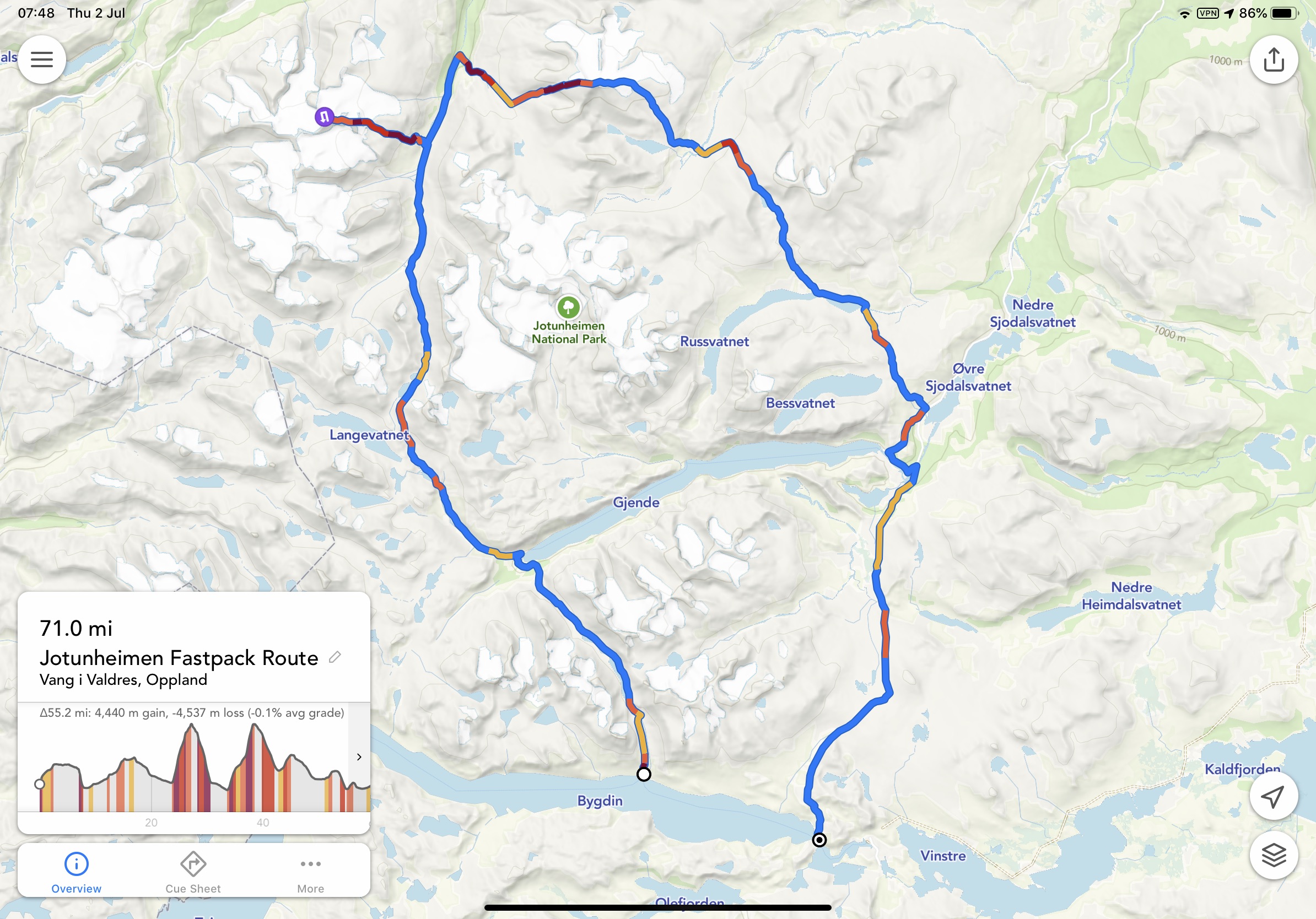
Although not discussed in-depth this article, you could leave your car at Bygdin, take the ferry to Torfinnsbu then take the trail to Gjendebu. From here you could then head north via Storådalen, Urdadalen and then to Spiterstulen which is the gateway to Galdhøpiggen. You could then climb Galdhøpiggen and return to Spiterstulen. From here, proceed to Glittertinden, on to Glitterheim and then follow the trail down to Gjendesheim via Tjørnholtjørna and Russa. From Gjendesheim take the trail via Vargebakken and Valdrersflya to arrive back at Bygdin Fjord. GPX here.
From Gjendesheim you could take the ferry to Gjendebu (you were here on day 1 or 2 of the fastpack) and now follow the trail to Memurubu. At Memurubu you have several options? A great day out is to take the trail to Surtningssue summit heading out on the lower trail that passes Memurudalen. At the summit, return via the way you came and then the trail splits and you can return to Memurubu via different route (full details listed below). From Memurubu you can now take the Besseggen route (details below) to Gjendesheim.
Proposed Trip:
As mentioned, Jotunheimen has many options and while the above fastpacking route and option is probably the ‘ideal’ way to explore the area, we wanted to break options down into manageable junks.
Areas to explore:
Knutshøe
Galdhøpiggen
Surtningssue
Besseggen
Besshø
Schedule:
Day 1 – Travel and overnight at Bygdin area.
Day 2 – Knutshøe route and then drive to Spiterstulen (2 hours) to either wild camp or stay at the DNT hut.
Day 3 – Climb Galdhøpiggen and then drive to Gjendesheim to stay in the DNT or wild camp.
Day 4 – Take the first ferry from Gjendesheim to Memurubu. Pitch tent or check-in at DNT and then do the Surtningssue route. Overnight at Memurubu.
Day 5 – Besseggen ridge to Gjendesheim – You can send luggage/ tent on the ferry so that it will be at Gjendesheim when you arrive from the trek. Overnight in either DNT or wild camp.
Day 6 – You can either travel home OR add an extra day with the climb to Besshø and return to Gjendesheim for an additional overnight wild camp or DNT.
Day 7 – Travel
Please note:
Make sure you book the ferries in advance here. They get very busy, particularly the first one from Gjendesheim. If you have a car, you need to stay at the Reinsvangen ‘Long Stay’ car park (here,) make sure you pay for parking to cover the duration of your stay. A shuttle takes you to the ferry or you can walk, approximately 1.5 miles. When possible, book the DNT’s you require in advance.
THE ROUTES
Knutshøe
A short drive from Bygdin, Knutshøe is a great introduction to Jotunheimen. Many consider Knutshøe a more challenging route than Besseggen? However, it is very much considered the younger brother or sister.
The total route is approximately 12km taking an anti-clockwise loop. You reach a high point of 1517m and in total you will accumulate 700m +/- while covering the distance. It is rated as ‘difficult’ and without doubt, it does have some exposure. Depending on experience and speed, the route could take up to 6-hours. However, moving fast and light and combining running and hiking, it is easy to complete in well under 3-hours. All the difficulty is in the first half of the route when you climb up and then descend. Once down, you have a flat 6/7km valley to cross back to where you started. GPX here.
Access to the route is from the main road and there is a small parking area that can accommodate approximately 20 cars. It is possible to wild camp here too. Either way, arrive early and start the route as soon as possible.
Note! If raining, this is NOT a good route to take. There is a considerable amount of rock both up and down and it can become very slippery.
Leaving the car park, follow the trail and when at a fork, go right and head up the climb. The route requires scrambling, some climbing and at several points you will encounter steep drop-offs.
Depending on experience, you may find some areas of the route really rewarding or terrifying. It is not a very difficult route; however, it does demand respect and patience.
At all times, the views are spectacular and ahead of you, on the other side of the lake, you have Besseggen completely in view pulling you in.
At the summit, you have a wonderful 360 view and if timed correctly, you will be able to see the ferry boats going back and forth on the lake below.
The descent is rocky, challenging and requires patience. Make sure hand and foot holds are secure and take your time.
Rock eventually becomes trail and before you know it, you will be at the bottom and next to the Gjende river. It is now possible to get water if needed?
You now go left and follow the trail back. At times, it’s easy to lose the trail so be attentive, as a recommendation, stick with the tree line and not the river. Your feet will get wet, guaranteed!
Once back at the car, take time to rest, change clothes and then make the 2-hour journey to Spiterstulen. En-route, there are possibilities to stop and buy food/ supplies.
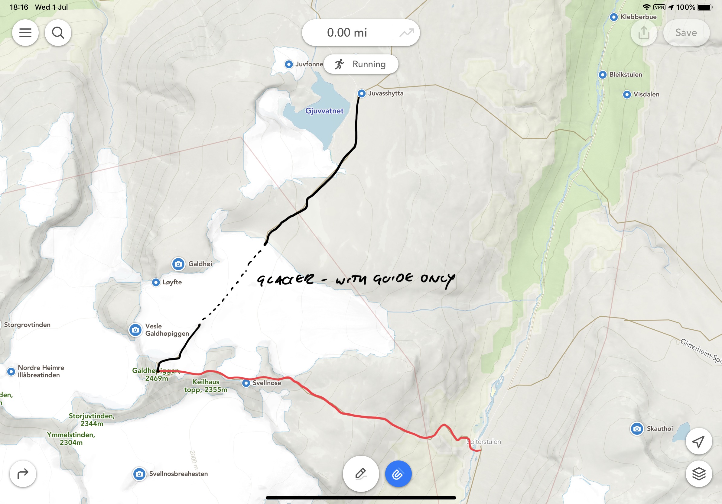
Galdhøpiggen
The drive to Spiterstulen brings you straight to the start point for Galdhøpiggen. Having the journey out of the way allows for good recovery in the evening and an early start the next day. As mentioned, you can stay at the DNT or wild camp in this area.
The highest peak in Norway (2469m) and Northern Europe is understandably a huge draw. For many, they take a guided trip leaving from Juvasshytta mountain lodge (1841m.) Guides take groups across the glacier. The glacier of course sounds appealing… However, it is an easy route with far too many people.
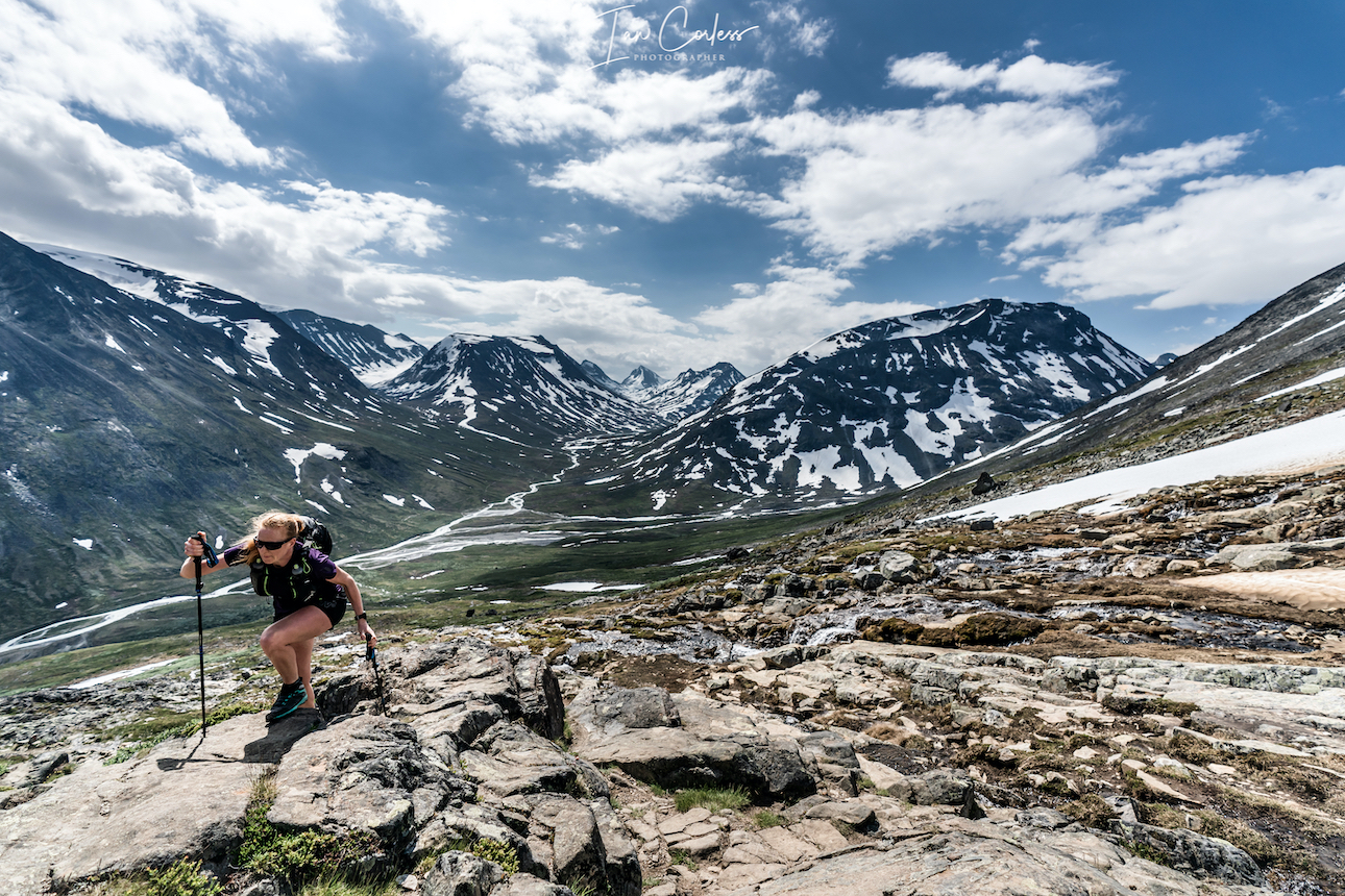
The route from Spiterstulen mountain lodge may not contain a glacier, but the 1400m vertical climb offers far more challenges. Especially if one travels in June as snow will still be present. The route is up and down is via a well-marked trail, GPX here.
Considered demanding, the route can take 8-hours plus, again, we completed the route in half the time.
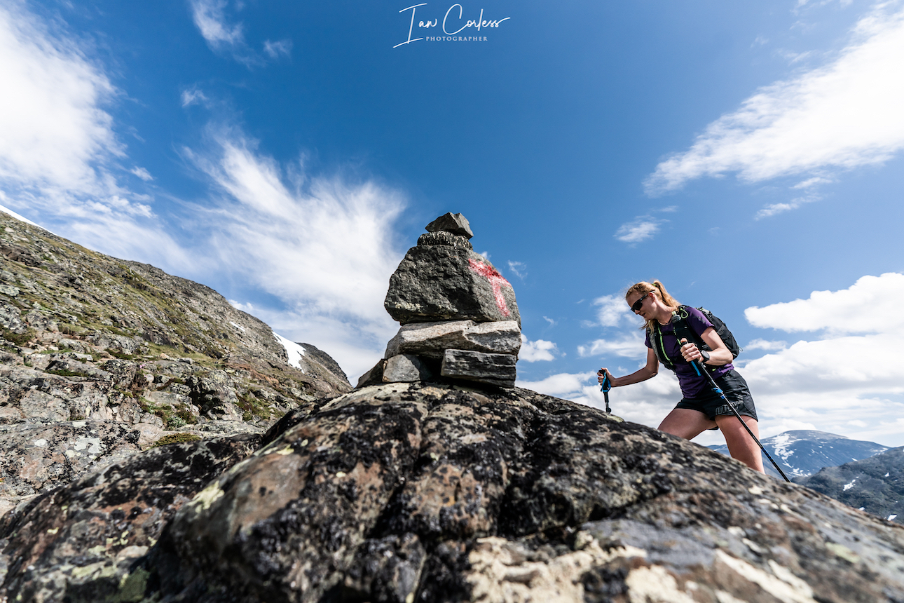
During the adventure, you will scale two peaks, totaling over 2,000 meters in height, Svellnose 2272m and Keilhaustopp 2355m! The terrain is tough and requires concentration at all times. Made up of rocks and boulders, for much of the time you are constantly piecing together a jigsaw puzzle to find the best route through. In wet weather, the route is very dangerous. Remember to follow the red “T”s that indicate the trail.
At times, you will cross snowfields and of course, stick to well used routes. Take no risks on the snow!
Several points can take you very close to the edge of the ridge. At all times be attentive, not too much of a problem in good weather, but in poor visibility you need to make sure of the route.
As you go up you feel several times that the summit is ahead only to reach a peak and then see several more in the distance. The final push becomes obvious as a hut is at the final summit and you will probably see a stream of people coming in from the right who have crossed the glacier.
At the summit the views are magnificent and well worth all the effort. An early start may well guarantee you some quiet time and space.
You descend via the way you came and in all honesty; due to the amount of rocks, it may well be more difficult to go down? Certainly, if you have tired or sore knees, you will feel every meter of the 1400m.
The route out and back is approximately 14km.
If you had an early start, you will be back by midday/ early afternoon and then you can take the 2-hour drive to Gjendesheim.
At Gjendesheim you can stay at the DNT or wild camp. This allows you a good night so that you can get the first ferry the next day.
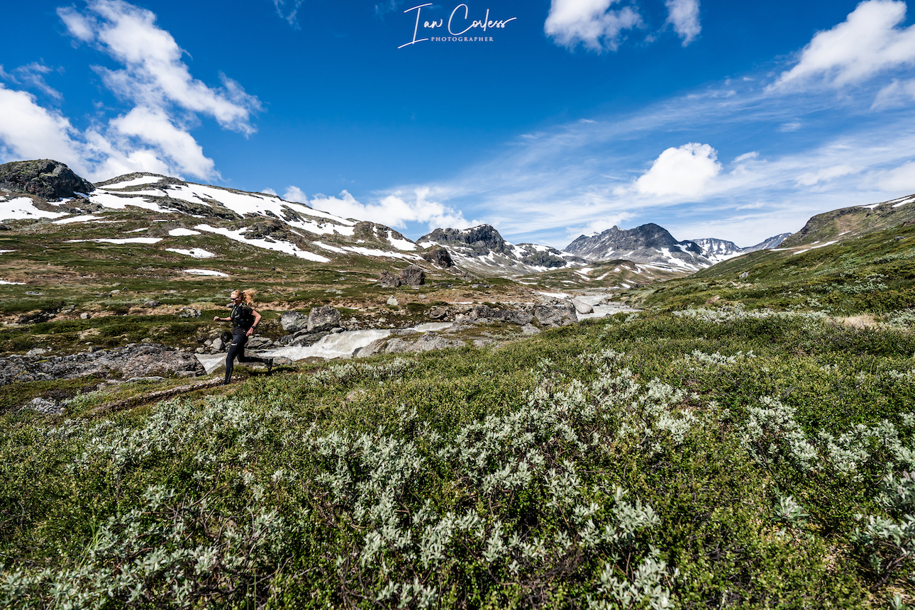
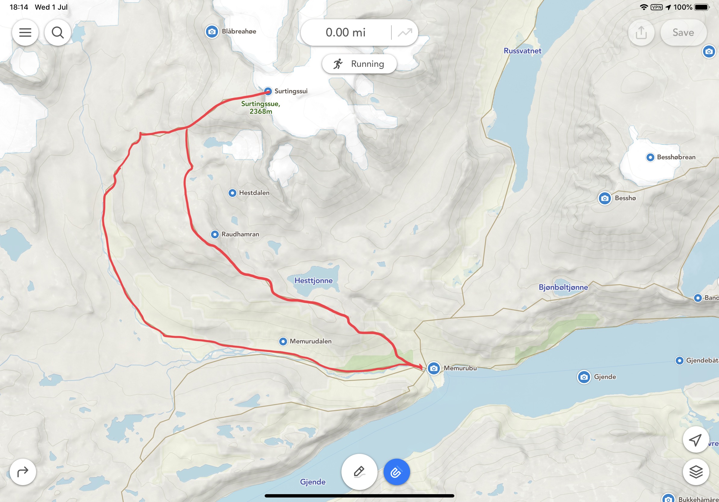
Surtningssue
Make sure you have a place booked on the first ferry from Gjendesheim to Memurubu. This is typically 0745 arriving at 0805.
On arrival at Memurubu you can pitch your tent (got to cabin and pay) or go to the cabin and check-in for your booking. Note, the cabin here is not a DNT and we recommend you book here.
Once ready, you can then start the Surtningssue route. This, in our opinion, is a hidden gem and is often neglected as Besseggen takes all the glory.
At 24km long, it’s a great day out that offers many challenges and importantly, you will see hardly any other people. On our trip, we saw nobody.
Leaving Memurubu the route is clearly marked. Make sure that you branch left when the opportunity arises. This will provide you with a clockwise route to the summit at 2368m and then back to Memurubu via a different route.
The first 8km’s are single-track trail that is very runnable. The views are stunning and only get better as you move up the trail. One advantage of experiencing the trail in June is lingering snow.
Once through the valley you start to head east. It is definitely worth having the GPX route (here) available either on a phone or watch so that you can stick with the route. Although marked, it has considerably less markings than other routes and often you are following stone cairns.
From 8/9km the route now winds up to the summit through rocks and boulders. Care is needed! At approximately 11km the trail will split with a very clear red sign showing a left and right option. This is where you go left to the summit. On your return, this is the place where you split and take the ‘other’ route back to Memurubu and therefore creating a loop.
The trail up is now steep with several false summits. You will finally see a stone hut that is open and available for shelter if required. The final push to the summit is approximately another 200m. For those in the know, they say the summit provides the greatest view and panorama of Jotunheimen.
It’s exposed at the top, airy, with plenty of potential hazards, so, take care.
The descent is via the same route until you reach the red marker. Now you veer left. Once again, the terrain is challenging as there are countless rocks and boulders.
For most of the way, the route is well marked until the final km’s. We lost the trail but could see Memurubu ahead and therefore self-navigated back to the cabin.
This route is a stunner. We felt alone and isolated. We saw nobody and encountered wild reindeer with their young.
Besseggen
Besseggen is a classic ridge that ‘must’ be done. Some Norwegian’s say that you cannot be Norwegian until you have done the route. It’s a point-to-point route, so, plan ahead and send any luggage/ tent with the ferry boat. They will have your luggage waiting for you after the trek at the ferry port in Gjendesheim.
At 14km long, with approximately 1100m of vertical gain it may not appear to be a too demanding route? However, many consider it is! Many take 8-hours to do the route and 10/12-hours is not unusual. GPX here.
For perspective, there is a mountain race that takes on the exact route and the course record is an unbelievable 1hr 15min 40sec by Thomas Bereket. Trust me, if you experience this 14km point-to-point, you will wonder (continuously) how is it possible to run this so quick? Kilian Jornet ran the race in 2016, along with Thorbjørn T. Ludvigsen, Kilian won in 1.17.54.
We completed the route in 3-hours 30-minutes and that was with many photo/ video stops.
The route is very, very popular and we therefore recommend you start early. One advantage of running and fast hiking is you soon catch anyone ahead and trust me, you want to be alone as much as possible to experience the trail and views.
All this who stay at the cabin or camp will start (usually) before 0800 and then the first boat arrives at 0805 releasing another wave of people.
Characterized by the colourful emerald Gjende and deep blue Bessvatnet lakes, Besseggen ridge splits the landscape. It’s dramatic and bold and in wet weather, treacherous, so be careful!
Leaving Memurubu the trail immediately rises up and twists, mixing rock and single-track. It’s a fun trail and the first plateau already provides great views. You will pass Bjønbøltjønne lake, a good opportunity to get water if needed? Continuing up, eventually another plateau arrives and now you have a stunning view of the Besseggen ridge. It’s quite intimidating. To the right the Gjende lake and you will clearly see Knutshøe which looks fantastic.
The trail now drops, it is steep in places. Bessvatnet lake (1374m) is to your left and you walk along its edges with Besseggen looking down on you.
Bandet ridge is a significant point with approximately halfway covered and Besseggen the next challenge.
Rising 300m, Besseggen (in my opinion) is less intimidating when climbing, however, there is plenty of opportunity for exposure. It’s relatively steep but there are plenty of foot and hand holds. It’s worth stopping many times for photos. The views are remarkable.
The steepest section comes towards the end but does not last long and then you are on a plateau that gently and continually rises to Veslfjellet (1743m) which is the highest point.
The trail is now very flat and after about 1 kilometer you reach a trail junction. Follow that trail to the right down towards Gjendesheim. The route now twists and bends. Follow the markers and in here the trail is steepest with many rocks. Take care, they can be slippery, even in dry weather.
Gjendesheim ferry finally comes to view and then the final 1 or 2km is easy to the finish.
If you sent luggage with the boat, it will be available under the wooden shelter at the port. A shuttle bust will take you to the car park for the journey home.
Or, you may wish to wild camp or sleep at the cabin and the following day tackle Besshø.
Besshø
At 2258m, Besshø is 500m higher than Besseggen and it is a trail that sees little foot fall. In many respects, it is like Surtningssue and as such, it has a huge attraction.
From Gjendesheim it is an out-and-back route of 22km with 1300m +/-. It’s a route that could take 12-hours but if moving fast and light, sub 6-hours is perfectly achievable.
The route starts with the end of the Besseggen route but instead of turning left for Besseggen, you veer right in the direction of Russa/ Glitterheim.
Bessvatnet lake will appear on the left and eventually you will cross a small bridge in the eastern corner. Cross the river you will see two small cabins on the left, now follow the trailer 2 to 3 miles north on flat/ boggy trail. Besseggen will be on your left and at the far end of the lake is Bandet which you crossed just before climbing Besseggen.
Look out for the right turn that leads to Besshø summit. The climb is at times demanding and marked with stone cairns which often disappear. It’s easy to lose the route so it’s advisable to have a GPX available (route here). Depending on the time of year, you may need to cross snow fields – care needed. The route is very rocky and strewn with boulders of different sizes. Many are loose, so, caution is required. It’s a challenging route but visually stunning.
The return route is via the way you came.
RECOMMENDATIONS
Never underestimate the mountains and the environment in which you are exploring. June in particular is the start of the hiking season and as such, snow can be a factor on all of the above routes. This adds an additional potential for injury and problems. Particularly as the snow is melting and this can create snow holes, snow bridges and crevices. Do not take any risks and follow established routes and existing footprints.
It is definitely worth carry Micro-Crampons as a safety measure, particularly in June and September. Also, trekking poles are a great addition but not essential.
Make sure you check in with DNT cabins for all the routes and check conditions to make sure that you have no surprises.
Weather is crucial and many of the above routes would become very dangerous in wet weather. Rocks and boulders in Jotunheimen are everywhere, when wet, they can be treacherous. Boots are always recommended for hikers but if moving fast and light, top quality mountain running shoes are perfectly acceptable on experienced feet. I cannot emphasize enough that grip is essential! You need an outsole that works on wet and dry rock. Running shoes are very personal but recommendations are VJ Sport MAXx and XTRM, Scott Supertrac RC2 and inov-8 Roclite.
It may be 30deg next to the fjord and glorious sunshine, but at the summit, it can be below zero, blowing a gale and torrential rain. You must take personal responsibility and be prepared for all conditions. At a minimum please take:
Suitable pack
Hat
Gloves
Warm insulated layer
Warm trousers
Waterproof jacket/ pants
Food for the duration of the hike and some contingency
1,5 ltrs of water (which can be replenished on all the routes via streams/ waterfalls)
Take water purification tablets as a just in case and consider a water purifier such as MSR Trailshot (here)
Map/ Compass
Charged mobile phone with a suitable App such as ‘Footpath’ (here)
Cash/ Card
Garmin InReach or similar
Bivvy bag
Sunglasses
Sun cream
Plan your routes, be realistic on timings and always start early. One of the huge advantages of outdoor activity in Norway is daylight. In June, July, August it is light at 0300 and goes dark after 2200 hrs.
CONCLUSION
Jotunheimen is to mountain lovers, what Disney is to fair ride lovers.
It’s a playground of trails, routes, summits, views, experiences and wildlife all wonderfully interconnected with marked trails and DNT cabins.
This article is created as a gateway to the area knowing only too well that it will whet your appetite for other adventures.
As mentioned at the beginning, the best way to explore this area is by foot and we are sure that once you have followed our weeklong adventure above, you will already be planning to return and explore.
In comparison to our first Exploring Norway article on Hardanger, I would consider Jotunheimen a more challenging environment, so please consider experience and fitness when contemplating any of the above routes.
We cannot emphasize enough the role of weather and the impact it has on all of the above recommendations. The mountains will always be there, cancelling a planned route or turning back is acceptable and wise.
PERSONAL NOTE
Special thanks to Abelone Lyng who has extensive knowledge of Jotunheimen. Her experience was invaluable in planning routes and making a workable itinerary.
Please support this website. I believe everyone deserves to read quality, independent and factual articles – that’s why this website is open to all. Free press has never been so vital. I hope I can keep providing independent articles with your help. Any contribution, however big or small, is so valuable to help finance regular content. Please support me on Patreon HERE.


 Rock eventually becomes trail and before you know it, you will be at the bottom and next to the Gjende river. It is now possible to get water if needed?