Everest Trail Race 2018 Kharikhola to Phakding #ETR2018

Day 4 Everest Trail Race #ETR2018

Kharikola to Phakding is very much a transition stage. The first 3-days have been quiet with an occasional glimpse of life. From here on in, the experience changes, the trails become busier – mules and yaks are seen regularly and they must be respected… It can be a confusion for a runner, as they force a slower pace and one must wait for the correct time to pass. In addition, Porters are seen regularly, these people are the hub of this area of Nepal, without them, supplies would not reach the lodges and shops. 

The diversity is incredible. Children play, parents work and the runners navigate a way through this section to finish at what many consider to be the gateway to Everest, Phakding.

At just under 30km’s, stage 4 of the ETR is arguably the most runnable. Leaving the monastery, a short twisting descent leads to the river and a long climb to aid station one at Kari La. It is here that the first real glimpse of the high peaks becomes real. They are no longer distant specs but now feel very real and surprisingly close.

The descent to Surke (Cp2) is a 17km rollercoaster series of switchbacks of technical trail with occasional short climbs to sap the legs and lungs.

From Surke, the trail now flattens a little, with a series of small climbs and descents that lead all the way to the finish at Phakding. 

Today was once again all about Jordi Gamito and Rai Purnimaya, the duo led from the front and were untouchable, they crossed the line in 3:34 and 4:25 respectively and now have strong leads for overall victory with two stages to go.

Joan Soler and Sergio Arias once again were 2nd and 3rd, 3:52 and 3:58 for the men and Manuela Vilaseca was 2nd in 4:49 ahead of Becks Ferry in 5:31 who picked up and injury on stage 3.

Tomorrow, stage-5 is a short day of just 20km’s and 2124m of vertical gain. It culminates at the monastery at Tyengboche with Everest, Lhotse and Ama Dablam providing arguably the most impressive finish line of any race!

Everest Trail Race 2018 Bhandar to Jase Bhanjyang #ETR2018

Day 2 Everest Trail Race #ETR2018

Starting in Bhandar runners have the pleasure of running downhill along some twisting and technical trail before crossing a suspension bridge that stretches over Kinja Khola River. It’s a day when the true Nepal starts to reveal itself. The occasional glimpse of the high peaks in the distance pulling the runners along the course. 

From the river, it’s relentless climbing to Golla at just over 3000m. Here an aid station provides a little respite and some flat trails. But flat does not last long, the climbing starts again firstly to Ngaur and then onward to the highest point of the ETR; Pikey Peak at 4063m. The summit at Pikey Peak on a clear day offers an amazing Himalayan vista with the first glimpse of Everest possible in the distance.

From the peak, a tough technical descent for several kilometres winds its way down to a lodge and then a tough short climb is the sting in the tail to the arrival at Jase Bhanjyang at 3600m.

Day 2 of the Everest Trail Race is the toughest of the race: fact! It’s a brutal exercise in climbing and one that takes place at attitude stretching each and every participant to the limit. In 2017, Luis Alberto Hernando dare I say, made this stage look easy! He smashed the old course record and in the process set a new time of 3:35.

It was another strong day for Jordi Gamito. He forged ahead running close to the 2017 time of Luis Alberto Hernando. “I am much stronger than last year and feel really good,” said Jordi at the finish. Today Joan Soler, running his 4th ETR pushed for 2nd ahead of Sergio Arias.

For the women, it was much closer today with Manuela Vilaseca and Rai Purnimaya running close together, the duo now only separated by minutes on general classification. Becks Ferry was a solid 3rd and 3rd on GC.

Day 3 is brutal day that is a stark opposite to day-2, at 37.4km it has more descending (4110m) than ascending (2512m). Starting in Jase Bhanjyang runners will pass through Jumbesi, Phurteng, Salung, Taksindu and then from Jubhing the race finishes with a tough climb to the stunning monastery at Kharikhola.

Everest Trail Race 2018 #ETR2018

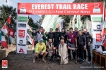
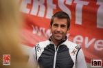
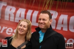
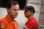
EVEREST TRAIL RACE, Nepal

Twenty years from now you will be more disappointed by the things you didnt do than by the ones you did do. So, throw off the bowlines, sail away from the safe harbour. Catch the trade winds in your sails. Explore. Dream. Discover. – Mark Twain

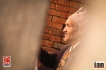
Sir Edmund Hillary and Tenzing Norgay (Sherpa Tenzing) are the stuff of legends; real comic book heroes for this modern era. They had the RIGHT STUFF! You know what I mean, stiff upper lip and the ability to take it on the chin.

Think back, 50+ years ago clad in wool and leather boots they departed Kathmandu on what is now considered one of the most iconic journeys everon the planet. A journey that would take the duo and a British expedition step-by-step, stride-by-stride from Kathmandu to Everest Base Camp; a journey to climb the highest mountain in the world, Everest.

To follow in the footsteps of these pioneers, to follow in the footsteps of Hilary and Tenzing and retrace the ‘53’ journey is beyond running. Its a life affirming and life changing experience and one that the Everest Trail Race provides.

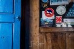
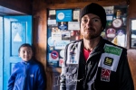
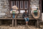
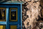
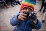
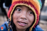
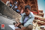
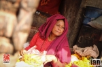
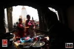
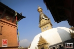
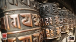
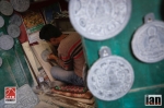
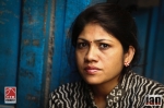
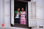
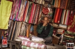
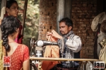
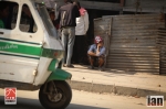
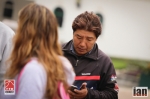
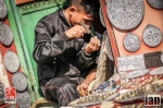
Kathmandu is just the most incredible place. Its a cacophony of noise, colour, people, cars and dust. Nothing can really prepare you for the assault on your senses. A dichotomy for the mind; I embrace the poverty around me and I make it look amazing with stunning photos. Am I a fake? Its a question I often ask. Do I prostitute the locals for my own gain? I think the answer is yes! But with each photograph captured I receive a smile, an acknowledgement that I have made them happy.

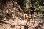
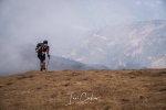
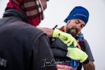
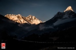
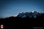
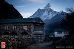
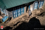
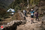
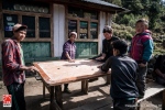
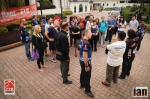
Departing Kathmandu, the road to Jiri is a twisting and gut-wrenching series of bends and miles. At 1905m altitude base camp 1 is warmed by the glow of yellow tents. As the sun lowers behind the surrounding mountains, anticipation of the journey ahead is high. Sherpas and porters prepare dinner and we spend a first night under canvas. Suddenly, the journey ahead feels very real.

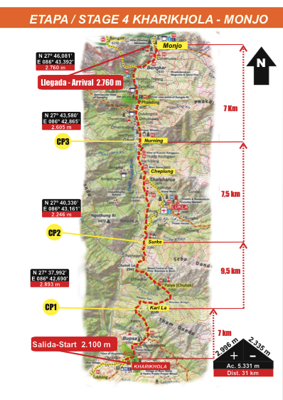
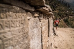
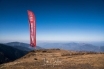
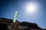
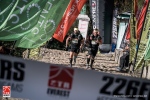
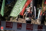
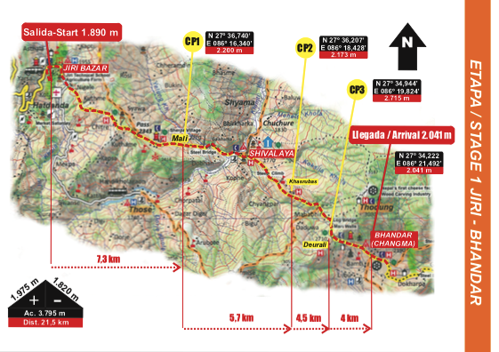
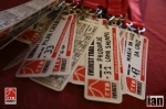
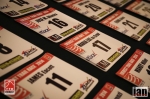
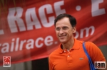
The Everest Trail Race (ETR) follows the route of Hilary and Tenzing from Jiri all the way to Tengboche and then turns around and heads back to Lukla, thus facilitating an easy and manageable exit point to fly back to Kathmandu.

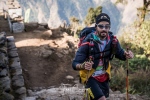
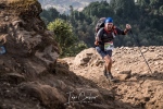
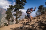
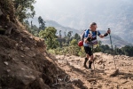
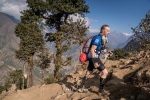
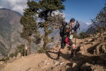
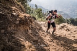
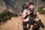
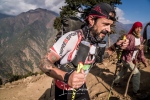
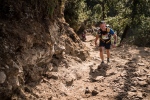
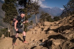
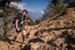
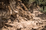
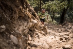
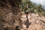
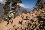
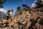
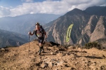
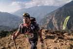
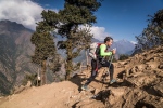
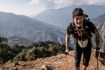
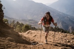
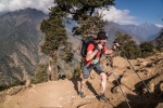
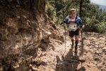
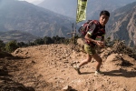
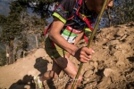
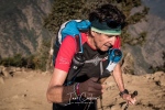
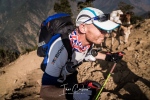
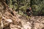
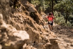
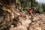
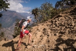
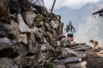
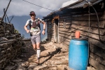
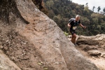
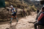
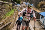
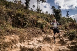
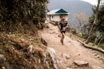
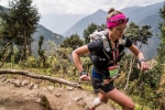
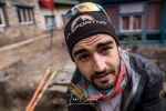
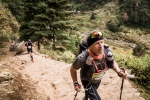
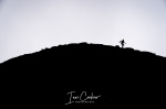
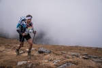
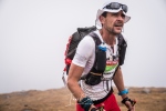
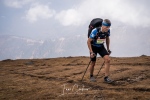
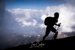
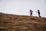
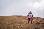
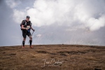
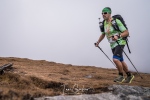
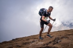
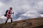
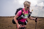
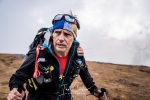
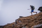
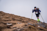
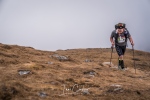
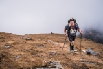
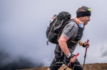
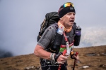
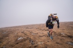
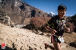
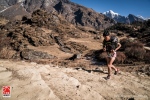
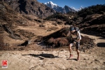
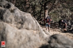
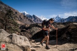
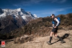
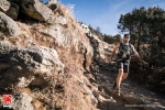
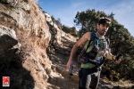
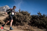
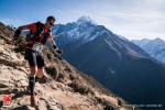
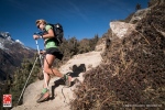
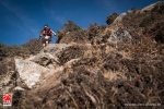
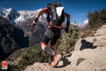
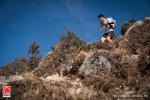
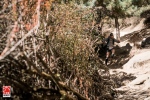
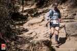
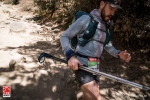
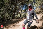
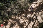
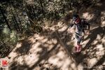
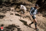
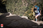
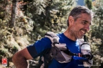
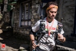
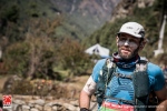
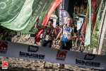
At 100-miles in distance an experienced ultra-runner may well think the race to be easy. Think again. The combination of relentless climbing, long descents, technical terrain and high altitude makes the ETR, mile-for-mile one of the toughest races of its type.

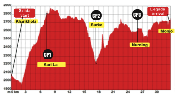
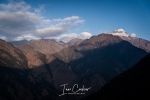
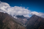
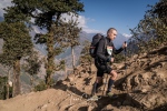
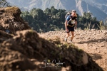
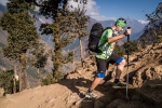
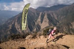
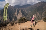
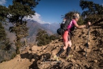
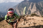
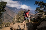
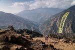
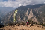
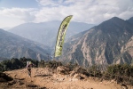
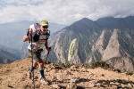
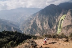
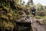
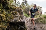
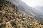
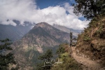
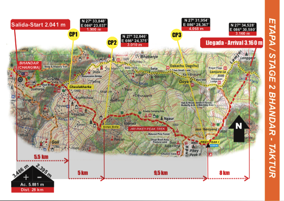
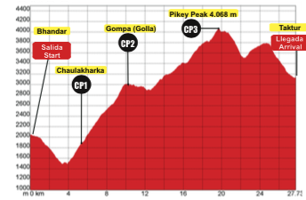
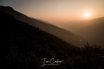
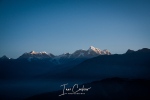
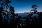
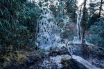
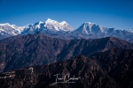
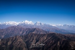
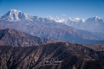
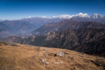
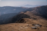
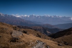
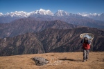
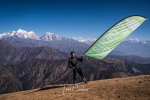
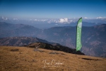
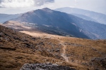
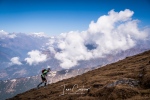
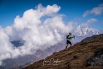
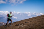
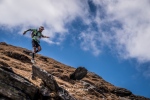
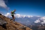
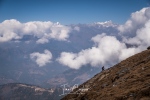
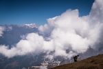
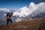
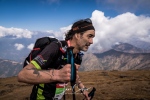
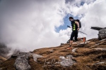
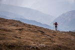
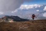
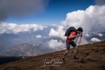
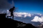
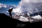
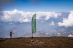
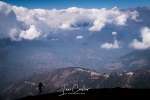
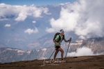
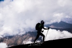
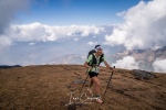
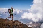
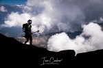
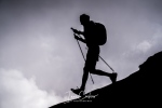
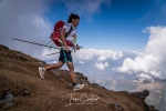
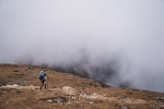
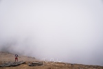
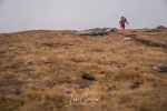
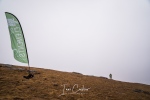
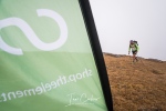
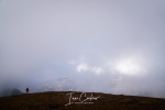
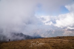
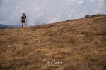
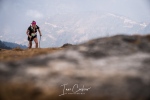
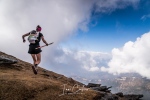
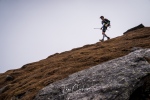
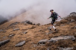
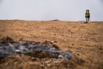
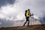
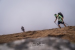
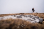
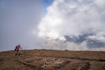
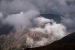
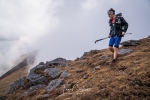
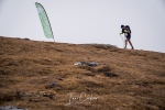
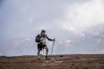
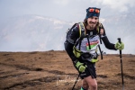
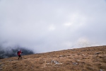
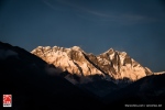
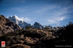
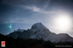
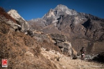
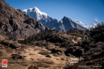
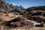
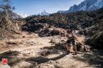
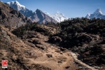
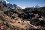
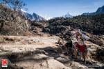
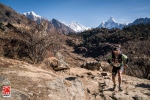
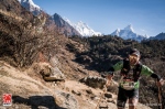
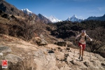
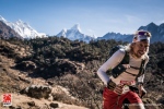
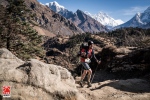
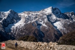
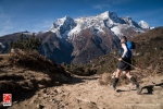
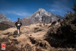
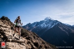
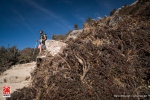
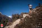
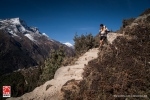
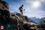
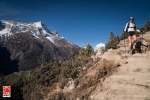
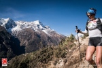
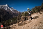
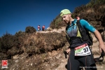
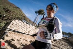
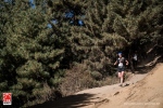
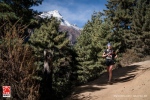
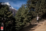
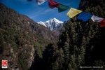
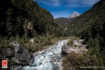
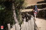
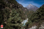
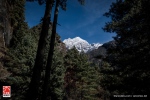
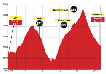
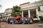
Broken down into manageable chunks, the race is divided into 6-stages with daily distances of approximately 22, 28, 30, 31, 20 and 22km. Altitude gain starts at 3000m and builds to 6000m. The ETR is a journey to widen one’s eyes and lungs. The visual splendor of the Himalayas is beyond words. The mountains, trails and people arguably provide one of the most stunning backdrops to any race on the planet. It’s easy to become stuck in the moment; the moment of relentless forward motion, then something stirs, you look up and as your jaw hits the floor, the visual splendor takes what little breath remains away; you are left gasping, breathless at the beauty.

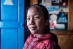
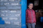
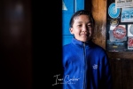
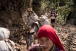
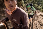
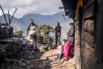
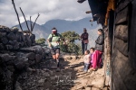
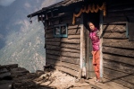
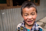
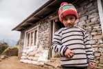
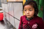
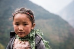
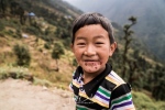
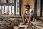
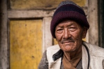
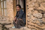
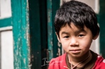
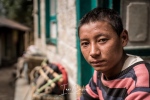
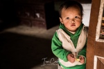
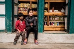
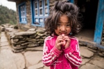
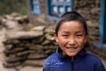
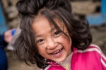
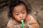
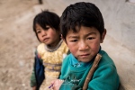
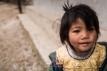
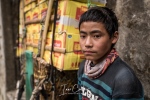
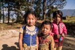
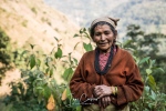
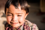
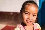
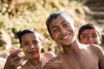
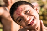
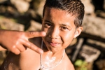
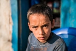
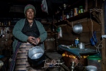
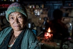
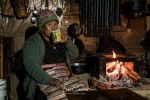
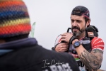
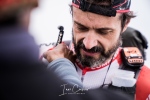
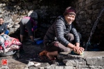
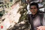
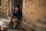
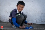
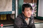
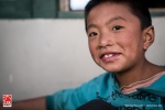
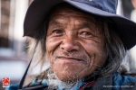
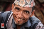
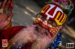
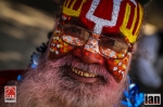
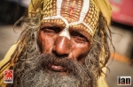
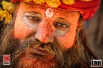
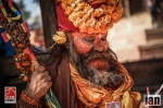
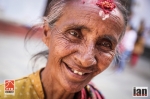
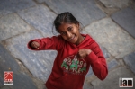
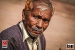
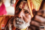
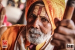
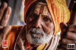
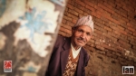
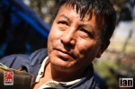
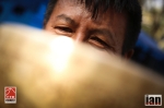
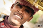
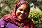
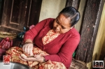
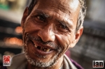
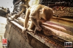
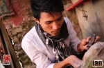
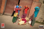
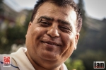
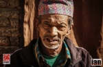
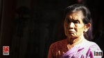
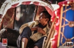
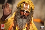
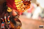
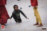
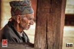
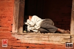
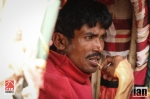
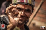
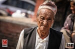
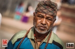
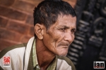
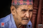
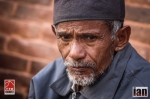
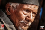
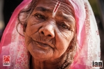
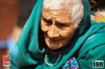
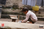
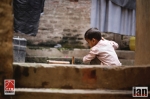
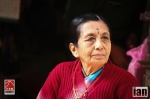
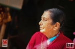
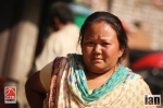
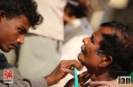
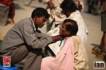
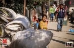
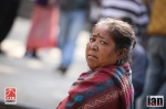
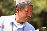
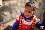
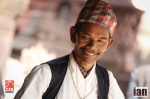
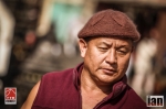
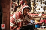
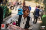
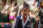
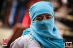
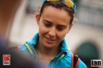
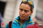
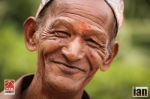
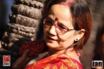
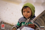
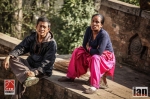
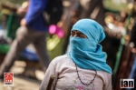
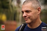
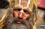
Large eyes, dried dirt, runny noses and wide-open welcoming smiles; the Nepalese people really are the salt of the earth. Living in a harsh, demanding and remote environment they have adapted to the surroundings and have found a peace and humility that we can all learn from.

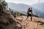
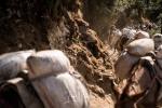
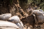
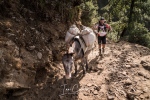
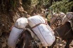
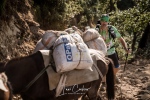
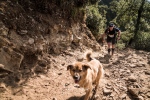
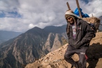
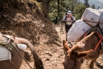
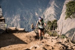
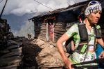
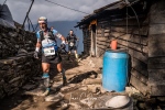
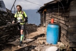
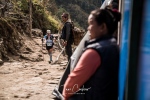
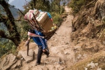
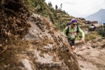
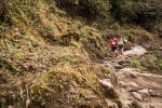
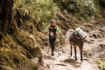
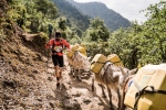
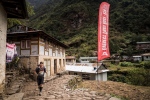
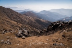
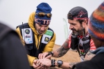
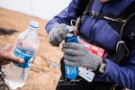
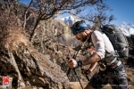
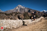
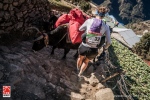
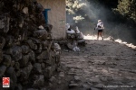
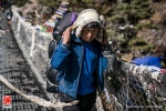
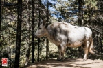
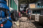
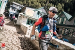
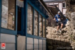
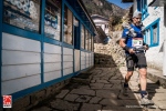
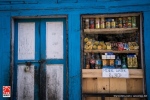
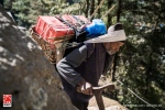
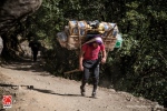
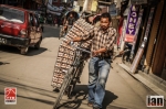
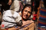
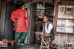
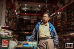
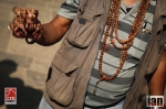
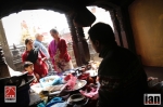
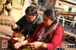
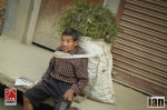
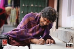
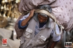
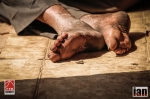
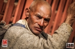
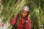
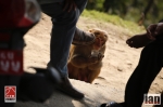
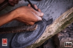
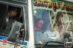
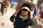
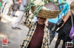
The trekking route, on which we travel, is the motorway of Nepal. We are the tourists, a constant stream of heavy goods vehicles surround us: porters, mules or yaks. Porters transport goods and services up and down this trail motorway daily, an important lifeline to the whole community. For £10 a day they will carry 30kgs on their backs covering high altitude and long distances with the ease of mountain goats. Experienced porters have been known to carry up to 120kg per day. It is beyond belief or comprehension. It is easy to look on from the outside and nod disapprovingly. However, this is normal. No roads exist here, the only method of transporting any goods along the trail are by porter, yak or mule.

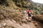
Day 1 to Bhandar eases runners into the race with 3700m+/- of vertical gain and descentand approximately 21km in distance. The mind is released, and the legs and lungs try to follow. The sound of horns from local villagers announce the race is underway.

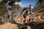
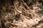
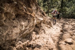
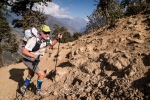
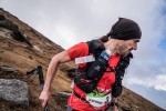
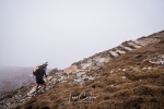
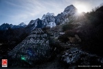
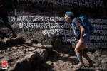
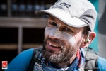
Bhandar to Jase Bhanjyang is a beast and arguably day 2 is considered one of the toughest of the race. It’s a brute! A brute of epic proportions; it leaves every runner questioning the journey ahead and the possibility of completion. Deviating from Hilary and Tenzing’s route, the ETR does not circumnavigate Pikey Peak at just over 4000m but goes over it! As one runner said, ‘It would certainly appear that day 1 really had been just a hors d’oeuvre and the race would miss the entrée and go straight into the main course, ready or not!’

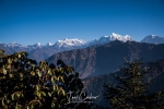
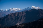
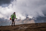
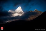
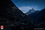
Like any good meal, you can sometimes be a little over faced with the plate in front of you. Pikey Peak was such an indulgence. It was a climbing journey that made a vertical kilometer look like a small hill-rep. Front-runners can anticipate 2-hours plus of relentless climbing, the remainder of the field can spend 4, 5, 6 and maybe longer negotiating the steep slopes of these Himalayan foothills. From the summit; each step of pain is rewarded with a wonderful vista of the Himalayan range. In the distance Everest, Lohtse and Ama Dablam making this 4000m-peak dwarf with their 7000m plus splendor.

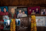
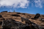
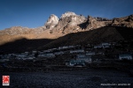
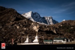
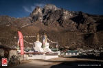
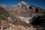
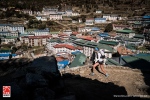
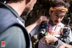
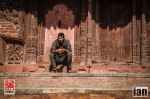
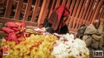
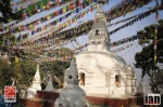
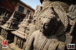
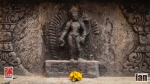
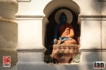
Kharikhola provides an incredible end to day-3. A monastery perched atop a mountain. I have often heard how runners have discussed and explained out of body experiences while running. Its not something one can pinpoint, like a mirage they come and go leaving one to question ones sanity. Kharikhola may well have provided such stimulus. Is that real?one may ask and as the final steps arrive and the ETR finish banner awaits.

Travel is the discovery of truth; an affirmation of the promise that human kind is far more beautiful than it is flawed. With each trip comes a new optimism that where there is despair and hardship, there are ideas and people just waiting to be energized, to be empowered, to make a difference for good.” – Dan Thompson, Following Whispers: Walking on the Rooftop of the World in Nepal’s Himalayas.

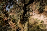
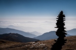
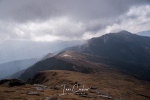
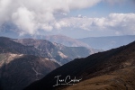
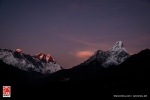
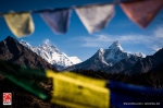
The trail changes and suddenly more trekkers, more porters, more mules and yaks populate the trail to Lukla and beyond. Dropping down and climbing up, the trail switches and twists and as you turn a bend at Kari La, the mountains hit you through the mist. They are no longer distant peaks but massive snow-covered monsters that make you realise how completely insignificant you are.

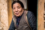
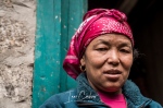
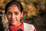
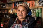
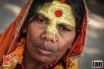
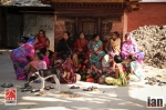
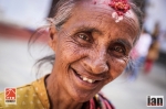
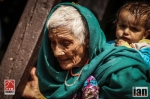
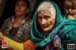
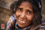
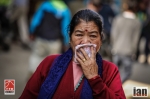
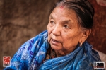
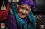
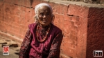
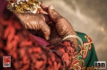
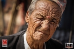
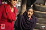
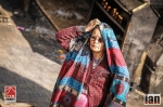
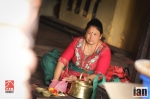
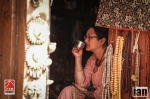
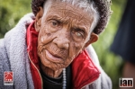
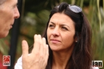
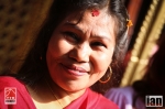
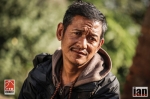
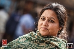
I see a woman carrying wood to her home. I stop her and ask for a photograph. Without hesitation she stops, looks me in the eye and patiently waits while I work my craft. Her face is leathered, full of lines and adorned with gold jewelry. She is beautiful. I cant even remotely pinpoint her age, but her face tells me a multitude of stories. Each line an experience. A story of laughter, a story of childhood and I am sure many stories of hardship.

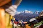
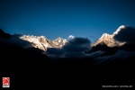
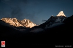
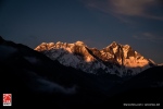
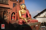
Tengboche, the finish line of day-5 offers a panorama to bring a tear to the eye. Everest, Lohtse and Ama Dablam are close and the finish line of the ETR frames them beautifully like a classic painting. Relief, emotions and an outpouring of tears make the journey worthwhile. So tough the journey, many a runner needs to be reminded to turn around, look, and see what is behind them. The reaction always the same, a huge intake of air, a hand to the face and then a lowering of the head.

Hillary and Tenzing carried on from Tengboche. In the process they created a new world, a world where anything is possible. They climbed to the top and looked down and in doing so they paved the way for all of us to set new horizons, new goals and they have made us all ask the question, what if?

It is not the mountain we conquer but ourselves.

Edmund Hillary

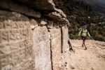
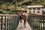
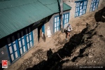
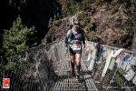
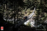
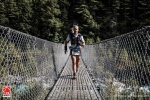
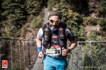
Passing through Sagarmatha National Park, crossing Hilary Bridge, navigating through Namche Bazaar the final calling of Lukla confirms the end of the ETR.

Nepal and the Everest Trail Race provides more than a race experience, they provide a spiritual journey that transcends running. Running may be the vehicle but the trails of Nepal provide the highway, a highway to a new experience, to something magical and to something special.

Words taken from the book RUNNING BEYOND HERE

Follow on:

Instagram – @iancorlessphotography

Twitter – @talkultra

facebook.com/iancorlessphotography

Web – www.iancorless.com

Web – www.iancorlessphotography.com

Image sales –www.iancorless.photoshelter.com

Everest Trail Race by The Elements Pure Coconut Water #ETR2017 – STAGE 6 TENGBOCHE to LUKLA

Day 6 #ETR2017

On paper, today’s stage of the Everest Trail Race was mostly downhill with 3183m of descent in comparison to 2105m of ascent over the 29.5km course. Don’t be fooled though, it’s a tough day.

Leaving Tengboche the race retraces stage-5 to Phakding via a diversion at Sensa to the amazing Kumjung Valley where the runners have an incredible backdrop of Everest, Lohtse and Ama Dablam. Finally, they arrive at Namche Bazaar and re-trace stage 5 and then branch left to climb to Lukla and the finish of the 2017 ETR.

Suman Kulung had it all to fight for today, he lay 2nd behind Luis Alberto Hernando 6-minutes and 53-seconds back. It was tough ask to take this amount of time out of one of the best trail runners in the world, Luis Alberto Hernando. But as we had seen on previous day’s, the Nepali runner can fly when going down-hill! After CP1 he had gained a lead of 4-minutes and Luis Alberto was chasing hard. At Namche Bazaar, the Spaniard lost some time after a wrong turn and tried to chase hard but the writing was on the wall and Luis Alberto knew it. He eventually eased off knowing that Suman had earned a well fought 2017 ETR victory, he placed 4th on the stage. Jordi Gamito moved up from his usual 4th on stage and placed 2nd and as per usual, Sondre Amdahl placed 3rd.

Chhechee Sherpa in reality already had the 2017 ETR sewn up on the start of the final stage, her lead of 12-minutes and 22-seconds was almost impossible to claw back on a stage with so much downhill running, something the Nepali loves! It went like clockwork, she forged away at the front and not only took the stage victory but extended her overall winning time. Ester Alves chased hard all day in the hope of a miracle and once again she placed 2nd ahead of Elisabet Barnes who placed 3rd.

Suman Kulung and Chhechee Sherpa are crowned the 2017 ETR champions but all credit goes to each and every finisher. At 100-miles, this race may not be the longest but it is surely one of the toughest! The combination of tough technical terrain, relentless climbing and descending and of course altitude, all combine to make the ETR a race to do!

Results Stage

  1. Suman Kulung 2:47:59
  2. Jordi Gamito 3:19:48
  3. Sondre Amdahl 3:29:19
  4. Luis Alberto Hernando 3:31:17


  1. Chhechee Sherpa 3:50:26
  2. Ester Alves 4:25:57
  3. Elisabet Barnes 4:46:31


OVERALL RESULTS

  1. Suman Kulung 18:35:54
  2. Luis Alberto Hernando 19:12:49
  3. Sondre Amdahl 20:47:31


  1. Chhechee Sherpa 24:58:46
  2. Ester Alves 27:37:19
  3. Elisabet Barnes 28:09:45


Everest Trail Race #ETR2014 – Kathmandu

©iancorless.com_Nepal2014-8112

An incredible day exploring the sights, sounds, colours and meeting the people of Kathmandu. What an incredible place.

Located at the top of a hill, our day started with a visit to Swayambhunath (affectionately known as the Monkey Temple).

Swayambhunath (Devanagari: स्वयम्भूनाथ स्तुप; sometimes romanized Swoyambhunath) is an ancient religious complex atop a hill in the Kathmandu Valley, west of Kathmandu city. The Tibetan name for the site means ‘Sublime Trees’ (Wylie:Phags.pa Shing.kun), for the many varieties of trees found on the hill. However, Shing.kun may be a corruption of the local Nepal Bhasa name for the complex, Singgu, meaning ‘self-sprung’. For the Buddhist Newars in whose mythological history and origin myth as well as day-to-day religious practice, Swayambhunath occupies a central position, it is probably the most sacred among Buddhist pilgrimage sites. For Tibetans and followers of Tibetan Buddhism, it is second only to Boudhanath.

The Swayambhunath complex consists of a stupa, a variety of shrines and temples, some dating back to the Licchavi period. A Tibetan monastery, museum and library are more recent additions. The stupa has Buddha’s eyes and eyebrows painted on. Between them, the number one (in Devanagari script) is painted in the fashion of a nose. There are also shops, restaurants and hostels. The site has two access points: a long stairway with 365 steps, leading directly to the main platform of the temple, which is from the top of the hill to the east; and a car road around the hill from the south leading to the southwest entrance. The first sight on reaching the top of the stairway is the Vajra. Tsultrim Allione describes the experience:

We were breathless and sweating as we stumbled up the last steep steps and practically fell upon the biggest vajra (thunder-bolt scepter) that I have ever seen. Behind this vajra was the vast, round, white dome of the stupa, like a full solid skirt, at the top of which were two giant Buddha eyes wisely looking out over the peaceful valley which was just beginning to come alive.[2]

Much of Swayambhunath’s iconography comes from the Vajrayana tradition of Newar Buddhism. However, the complex is also an important site for Buddhists of many schools, and is also revered by Hindus.

From Swayambhunath we took a short bus ride and then walked around the vibrant streets of Kathmandu. It’s a cacophany of noise mixed with people, cars and colour. The people are warm, welcoming, happy and friendly despite obvious poverty that is on display no matter where you look.

Kathmandu (Nepali: काठमाडौं [kɑʈʰmɑɳɖu]; Nepal Bhasa: येँ देय्‌) is the capital and largest municipality of Nepal. It is the only city of Nepal with the administrative status of Mahanagarpalika (Metropolitan City), as compared to Up-Mahanagarpalika (Sub-Metropolitan City) or Nagarpalika (Municipality). Kathmandu is the core of Nepal’s largest urban agglomeration located in the Kathmandu valley consisting of Lalitpur, Kirtipur, Madhyapur Thimi, Bhaktapur and a number of smaller communities. Kathmandu is also known informally as “KTM” or the “tri-city”. According to the 2011 census, Kathmandu has a population of close to 1 million people. The municipal area is 50.67 square kilometres (19.56 sq mi)  and has a population density of 3000per km² and 17000 per km square in city.

The city stands at an elevation of approximately 1,400 metres (4,600 ft) in the bowl-shaped Kathmandu Valley of central Nepal.[6] It is surrounded by four major mountains: Shivapuri, Phulchoki, Nagarjun, and Chandragiri. Kathmandu Valley is part of three districts (Kathmandu, Lalitpur, and Bhaktapur), has the highest population density in the country, and is home to about a twelfth of Nepal’s population.

Historically, the Kathmandu Valley and adjoining areas were known as Nepal Mandala. Until the 15th century, Bhaktapur was its capital when two other capitals, Kathmandu and Lalitpur, were established. During the Rana and Shah eras, British historians called the valley itself “Nepal Proper”. Today, Kathmandu is not only the capital of the Federal Democratic Republic of Nepal, but also the headquarters of the Bagmati Zone and the Central Development Region of Nepal.

Kathmandu is the gateway to tourism in Nepal. It is also the hub of the country’s economy. It has the most advanced infrastructure of any urban area in Nepal, and its economy is focused on tourism, which accounted for 3.8% of Nepal’s GDP in 1995–96. Tourism in Kathmandu declined thereafter during a period of political unrest, but since then has improved. In 2013, Kathmandu was ranked third among the top 10 travel destinations on the rise in the world by TripAdvisor, and ranked first in Asia.

The city has a rich history, spanning nearly 2000 years, as inferred from inscriptions found in the valley. Religious and cultural festivities form a major part of the lives of people residing in Kathmandu. Most of Kathmandu’s people follow Hinduism and many others follow Buddhism. There are people of other religious beliefs as well, giving Kathmandu a cosmopolitan culture. Nepali is the most commonly spoken language in the city. English is understood by Kathmandu’s educated residents. Content ©wikipedia

Tomorrow, Tuesday 12th is an early start as we all leave Kathmandu and head to Jiri for an overnight camp and then the race starts Wednesday.

Stage 1 – Preview

ETR Stg1

ETR Stg1 Profile

Km 0. Departure from campsite with initial direction 150o. Follow main pathway that crosses Bhandar. At the end of the village, cross the wooden covered bridge, turn left immediately and followmainpathwayparalleltotheriver (maintaineddescenttillKm3,7).

Km 1,04. Take footpath on the right and go down crossing several times the main pathway. Km 3,7 (1.523 m). Turn right crossing the bridge (maintained ascent till Km 9,8).

Km 9,8. Arrival to the pass that leads to the Golla village (Gompa). Take the footpath on the left that leads to the village exit and to the CP2.

Km 10 CP2 . Come out following the path on the right. Terrain combining flat sections and slight ups and downs till Km 12.

Km 12. Take the detour on the left and follow the marked path. Maintained climbing inside the forest till Km 13,5 where we reach a hill with flags. Follow marked pathway inside the forest.

Km 16,9 (3625 m.). Find a clearing and enter again the forest with direction 170o. Follow marked pathway.

Km17. Anewclearing. Initialdirection150otillenteragaintheforest.

Km17,5(3.772m.).Comeout oftheforest.Followmarkedpathandturnleftafterfewmeters to start climb to the Pike Peak (4.065 m). Follow marked path. We will identify the summit because of the prayer flags.

Km 19,5 CP3. Reach the Pike Peak summit. Go down the marked path till a Many Wall (3.989 m). Take marked path on the left. Go down along a technical zone. CAUTION!.

Km 21,5. (3.950 m). Clearing. Turn left and go on till pass with Mani Wall (3.500 m). Km 23,7 (3.783 m). Pass by a group of 3 chorten and follow pathway. Km26,5(3.265m).Turnleft crossingtheriver.Followmarks.Km 28. Taktur.

STAGE ARRIVAL.

KATHMANDU IMAGES: