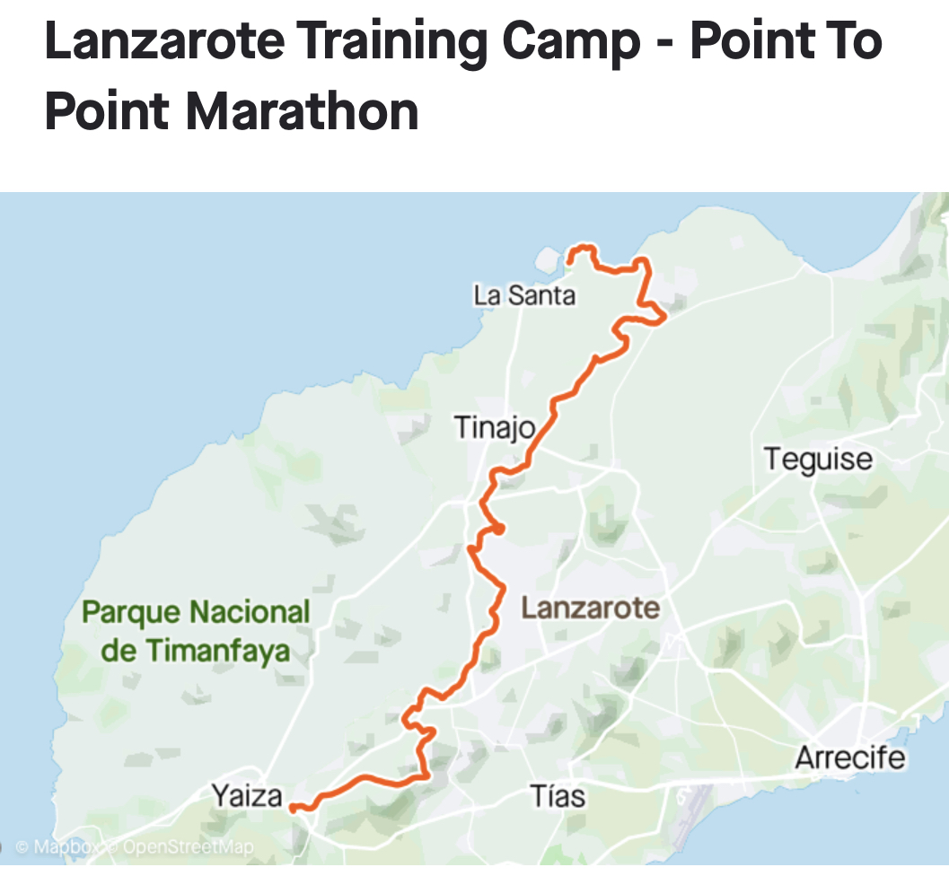
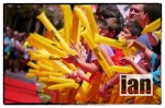
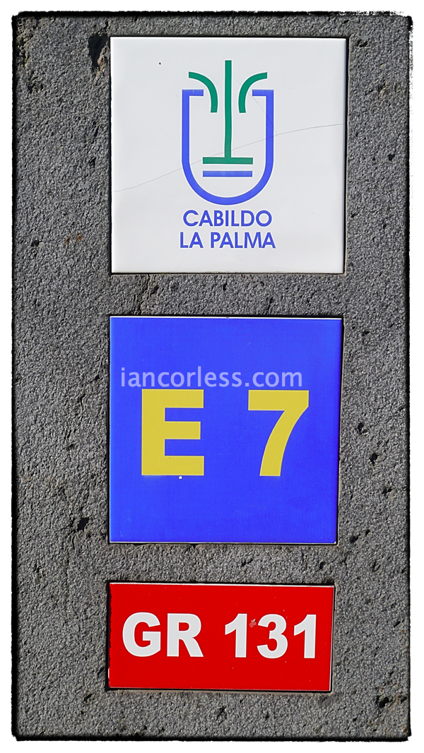
LA PALMA and the TRANSVULCANIA LA PALMA
Mountains, volcanoes, beaches, forests, a tropical rainforest, tiny villages and breathtaking views. La Palma is the jewel in the ‘Canaries’ crown. Many consider it to be the most beautiful idyllic Canary Island, un-spoilt by tourism and ideal for rest, peace and quiet. It is a treasure for the walker, hiker or runner. Considering the islands size (50km x 25km) it has many surprisingly different areas of natural beauty. It has a perfect all year round climate, not too hot in the summer and pleasantly warm in the winter.
La Palma
La Palma lies 200km from the coast of Morocco and is approximately 3500km from the UK. Just north of the ‘Tropic of Cancer’. The island attracts many a stargazer and budding astronomer for the incredible display by the stars at night.
Not dependent on tourism the island attracts a very different client to those you may find on Gran Canaria or Tenerife. You won’t find ‘English Pub’ or ‘English Food served here thank goodness. It is un-spoilt, traditional and a haven for those seeking a true Spanish feel. Natural beauty, dramatic vistas and 100’s of km’s of trails are available to explore via the marked ‘GR’ or ‘LP’ routes. Of course the famous GR route is the 131 that makes up the route for the Transvulcania La Palma… more on that later!
How big is the island? Well, in a nutshell, not very big… at just 50km long and 25km wide. The population is only 86, 528 (dated 2008).
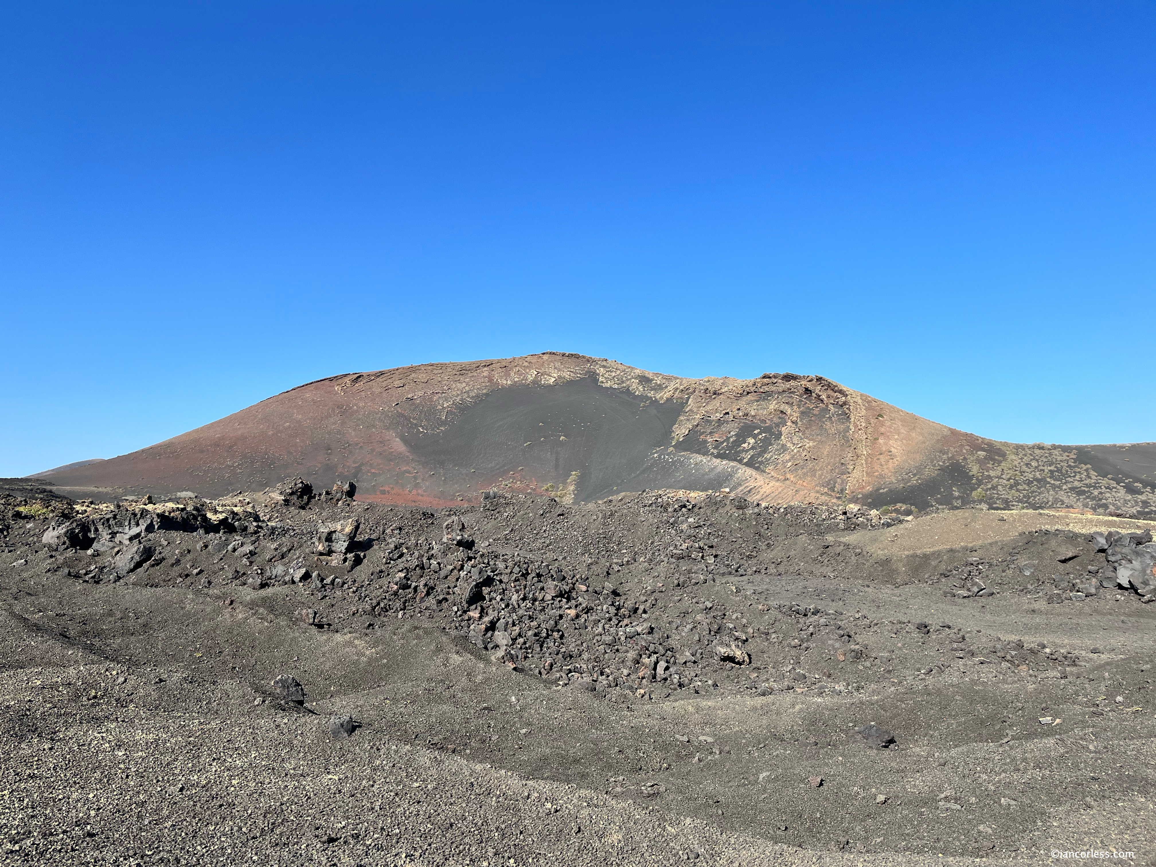
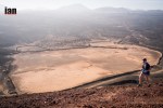
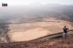
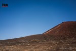
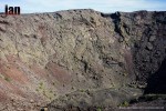
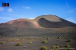
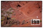
La Palma is dominated by the Caldera, the massive erosion crater often (incorrectly) thought of as a volcano, it has steep sloping sides both inside and out.
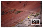
The south-west part of the Caldera has collapsed and been eroded away leaving a ravine that runs deep right down to the sea at Tazacorte and the start point for the Transvulcania La Palma race.

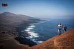
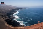
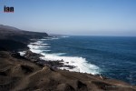
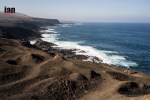
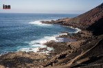
The southeast and north of the island has a coastline that drops steeply down to the sea making access to the coast very difficult. Many areas are only reachable by sea.
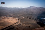
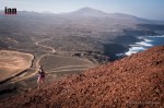
The central ridge (cumbre) makes up the central and southern parts that extend from the Caldera in the north to the southern point of the island and divides the island into two.
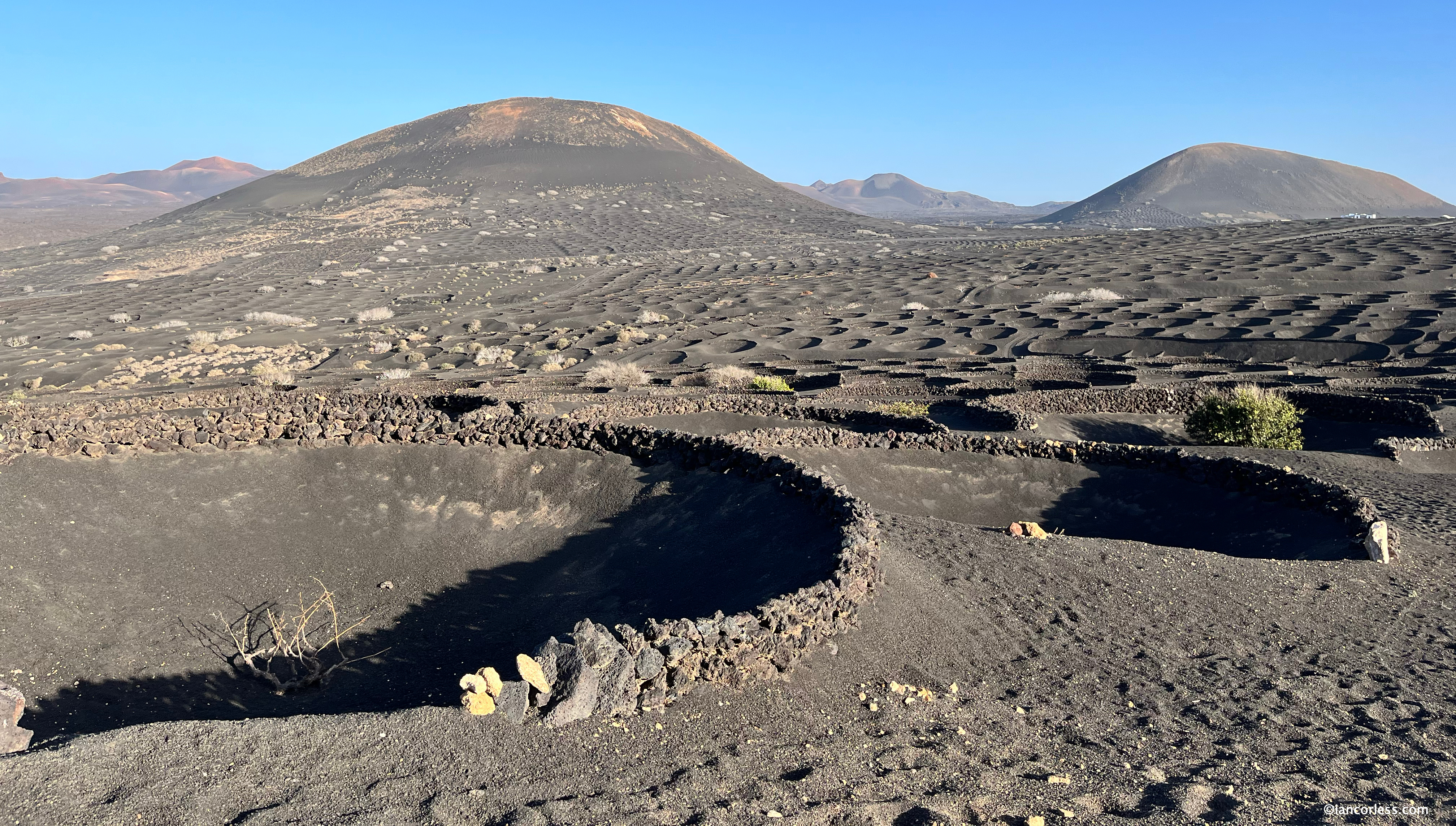
Often called ‘La Isla Bonita’ it is a green island with many trees, including tree heather, the tall Canary Pine and cultivated citrus, avocado, chestnut, almond and banana trees at lower altitudes. Characterized by steep cliffs, volcanic rock, bays, black sand and cactus. Of course one thing you will see everywhere are many, many banana plantations.
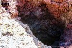
A volcanic island, the last eruption was in 1971 at the Teneguía volcano.
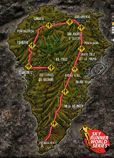
The GR 131
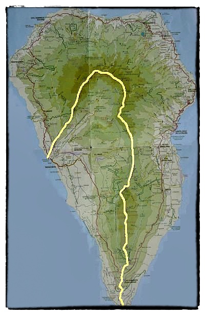
The GR 131 was created from the logical joining of two large mountain routes in La Palma: The Volcano Route and the route of The Crests of the Taburiente Crater.

To make a logical route, the GR131 was extended at both ends to the sea. It is possible to start at sea level from the Fuencaliente lighthouse climb upward and upward to the Caldera Taburiente Crest. Run around the crest to Roque de Los Muchachos and then drop down and then descend to Tazacorte Port. In its origins, this path connected the localities furthest away from each other, as it climbed a radial path to the current GR131 and followed it to the radial downwards path to the destination. It has also been the main path for the herding of goats from the summit to the coast.
Route Description
In providing a route description of the GR131 I am looking at it from the eyes of a runner in relation to the Transvulcania La Palma. Please keep this mind if you are reading this from the perspective of a walker or hiker.
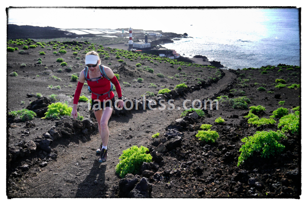
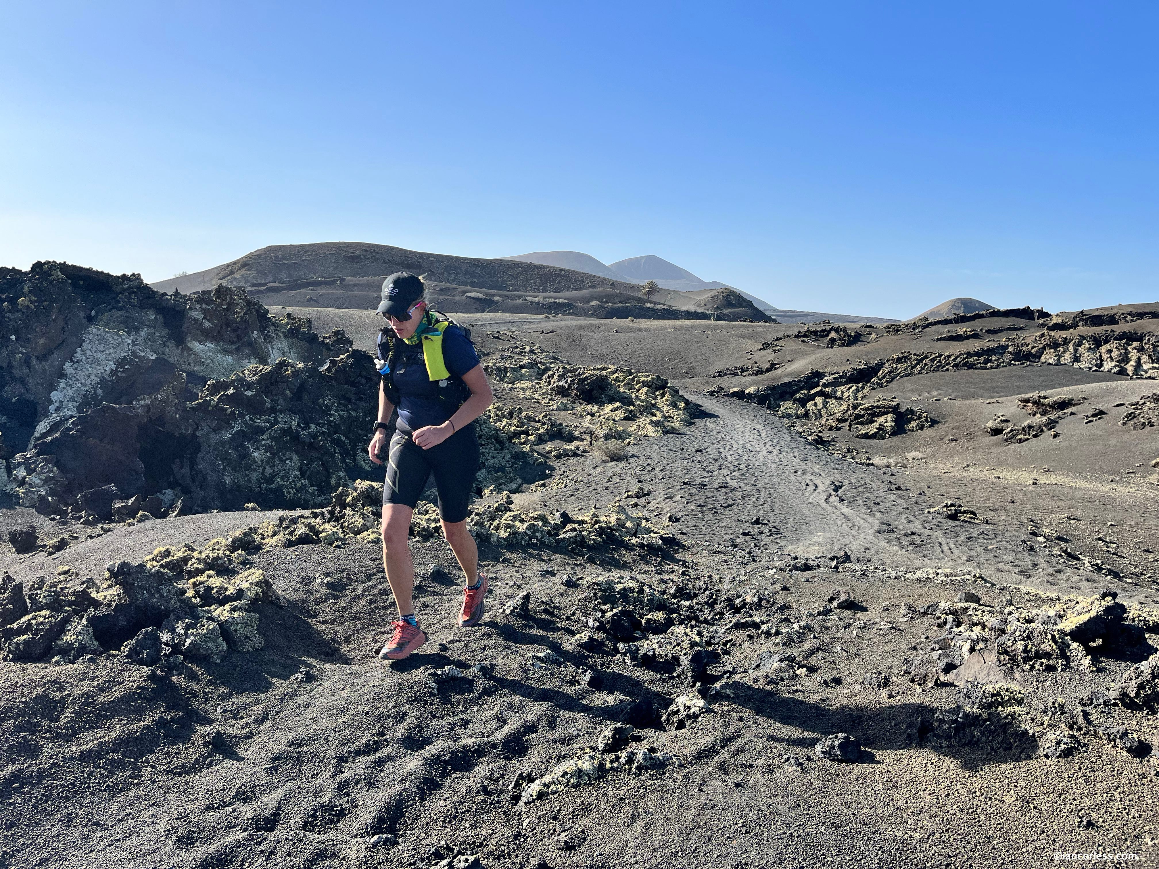
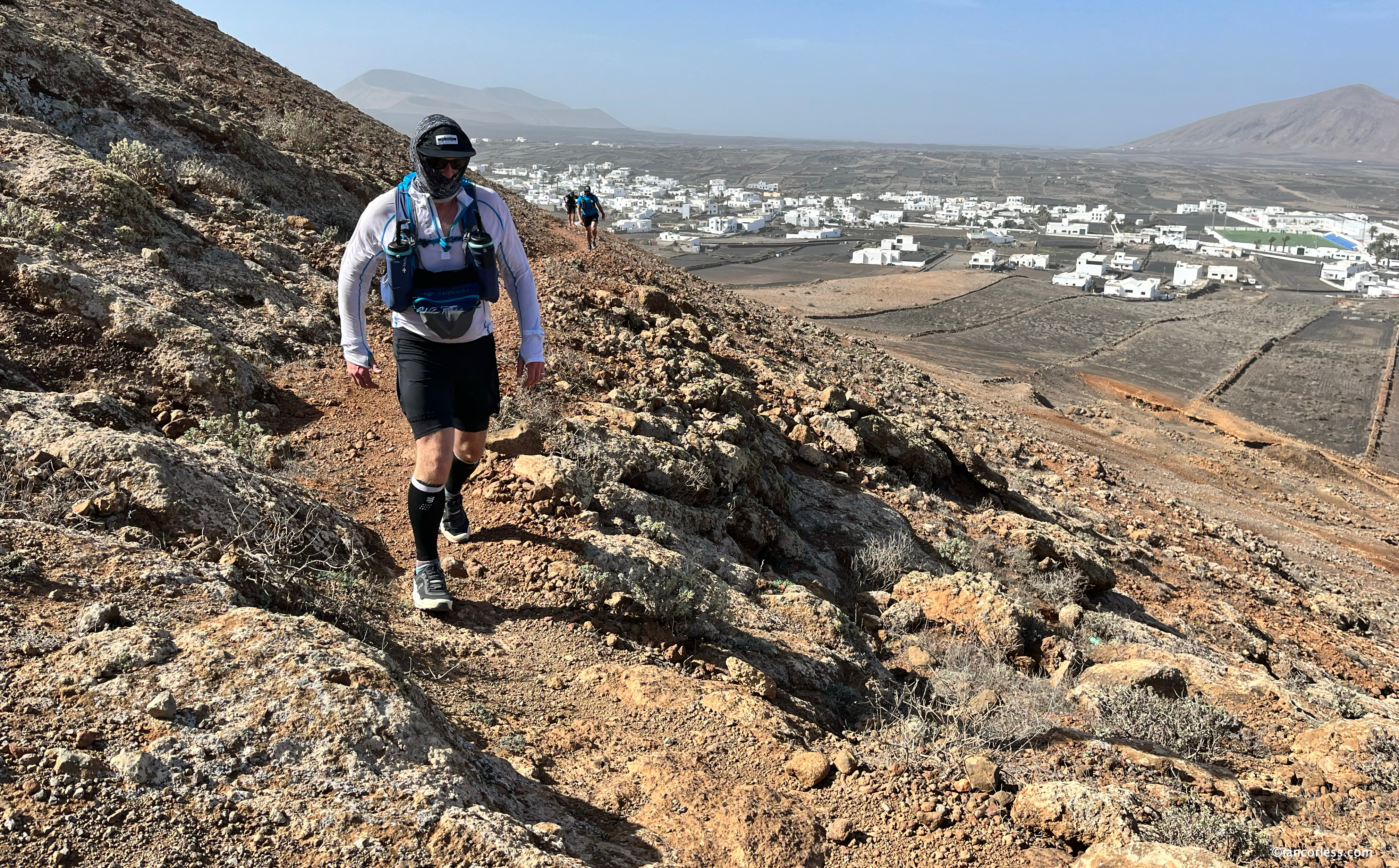
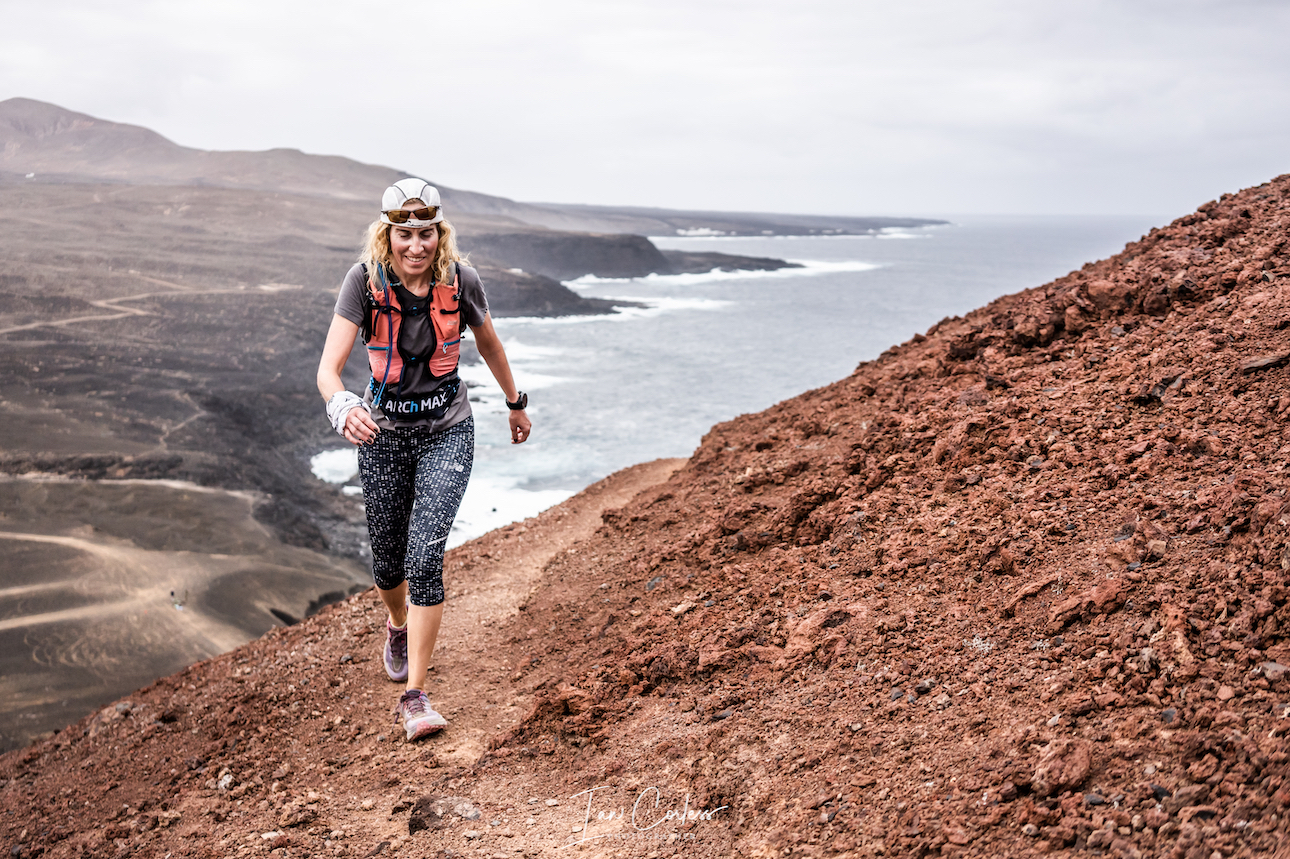
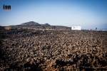
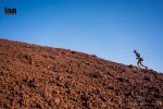
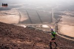
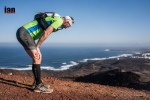
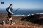
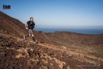
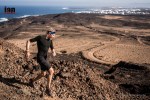
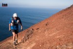
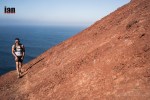
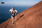
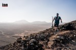
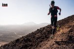
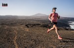
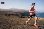
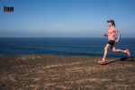
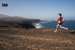
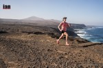
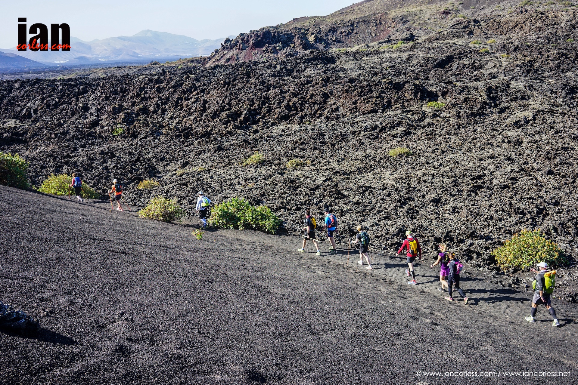
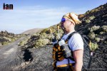
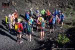
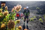
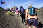
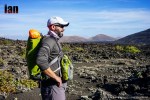
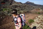
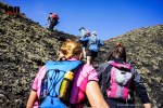
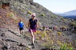
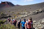
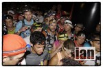
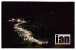
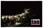
Starting at the Fuencaliente Lighthouse at sea level the first section includes two key volcanoes, San Antonio and Teneguía. As mentioned previously, Teneguía last erupted in 1971. The first miles are tough going and most certainly on race day with some 1500+ runners a struggle. The path is often narrow with loose black sand or rocks. Patience will be required.

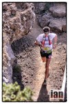
From Los Canarios you enter the dense pine forests which offer a stark contrast to the opening miles. Underfoot terrain now mixes black lava sand, pine needles and rocks. Running is much easier than the opening miles and you will find an opportunity to stretch your legs.
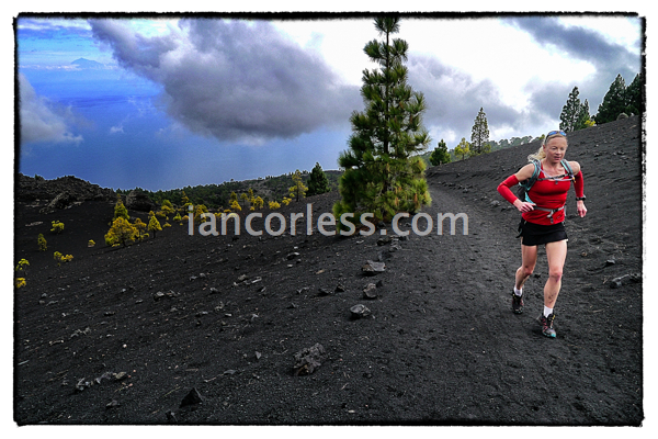
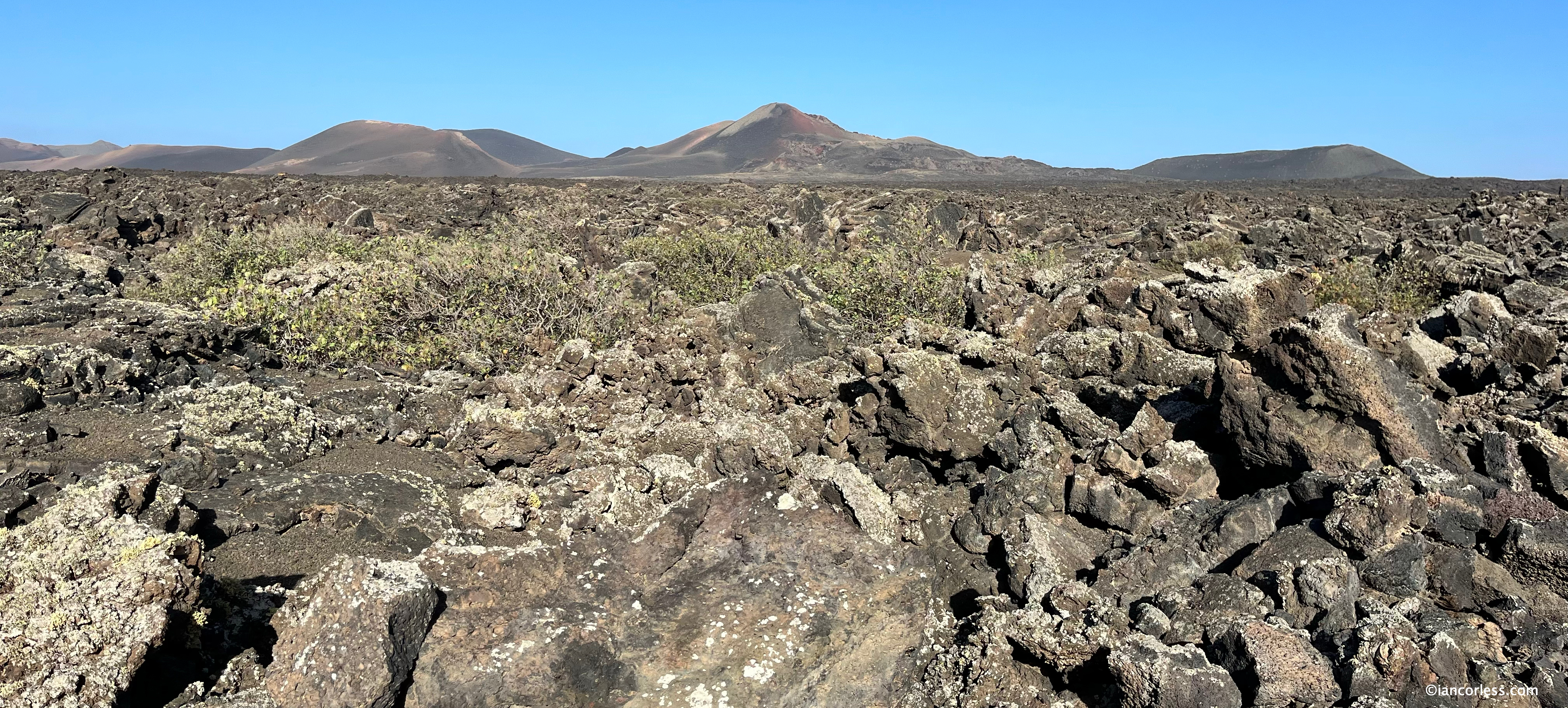
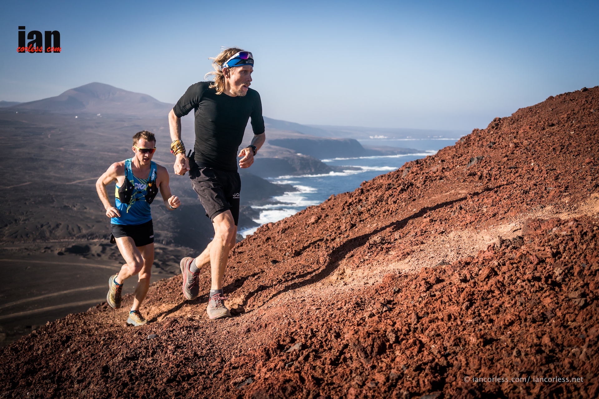
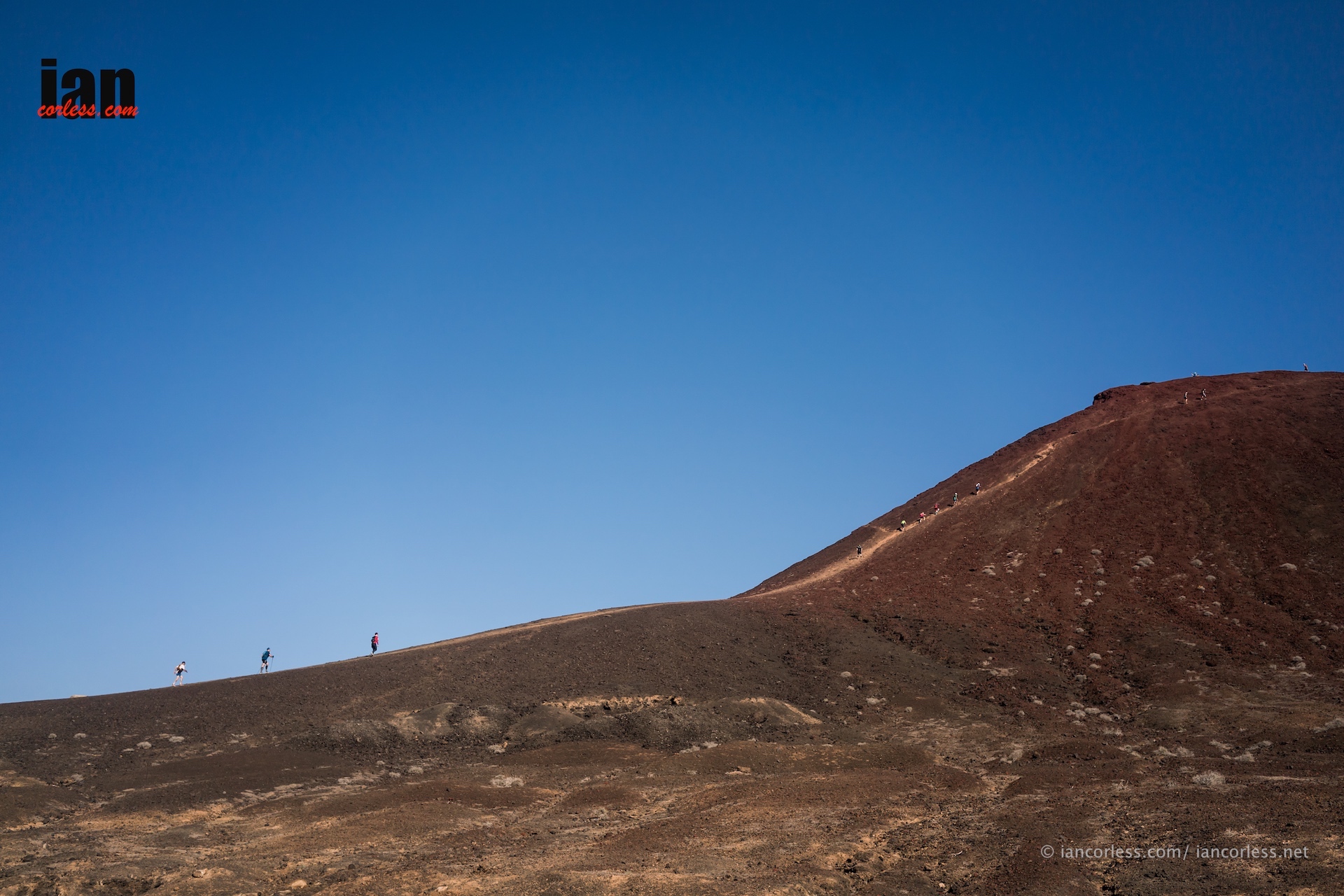
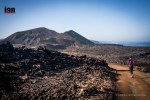
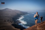
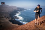
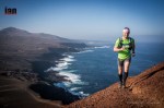
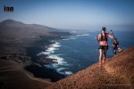
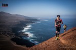
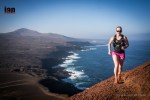
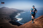
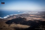
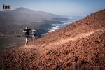
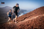
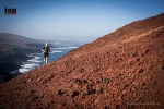
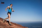
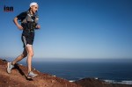
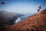
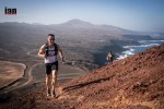
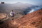
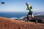
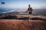
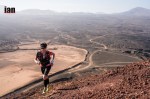
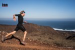
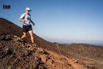
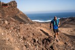
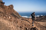
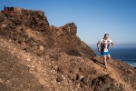
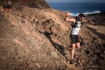
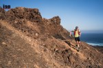
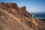
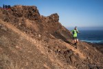
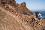
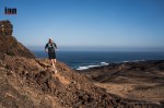
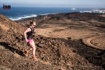
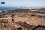
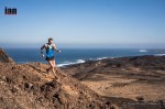
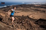
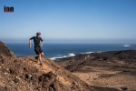
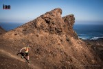
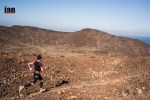
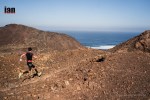
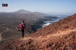
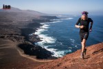
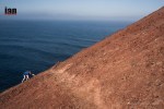
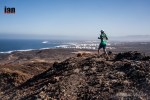
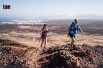
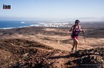
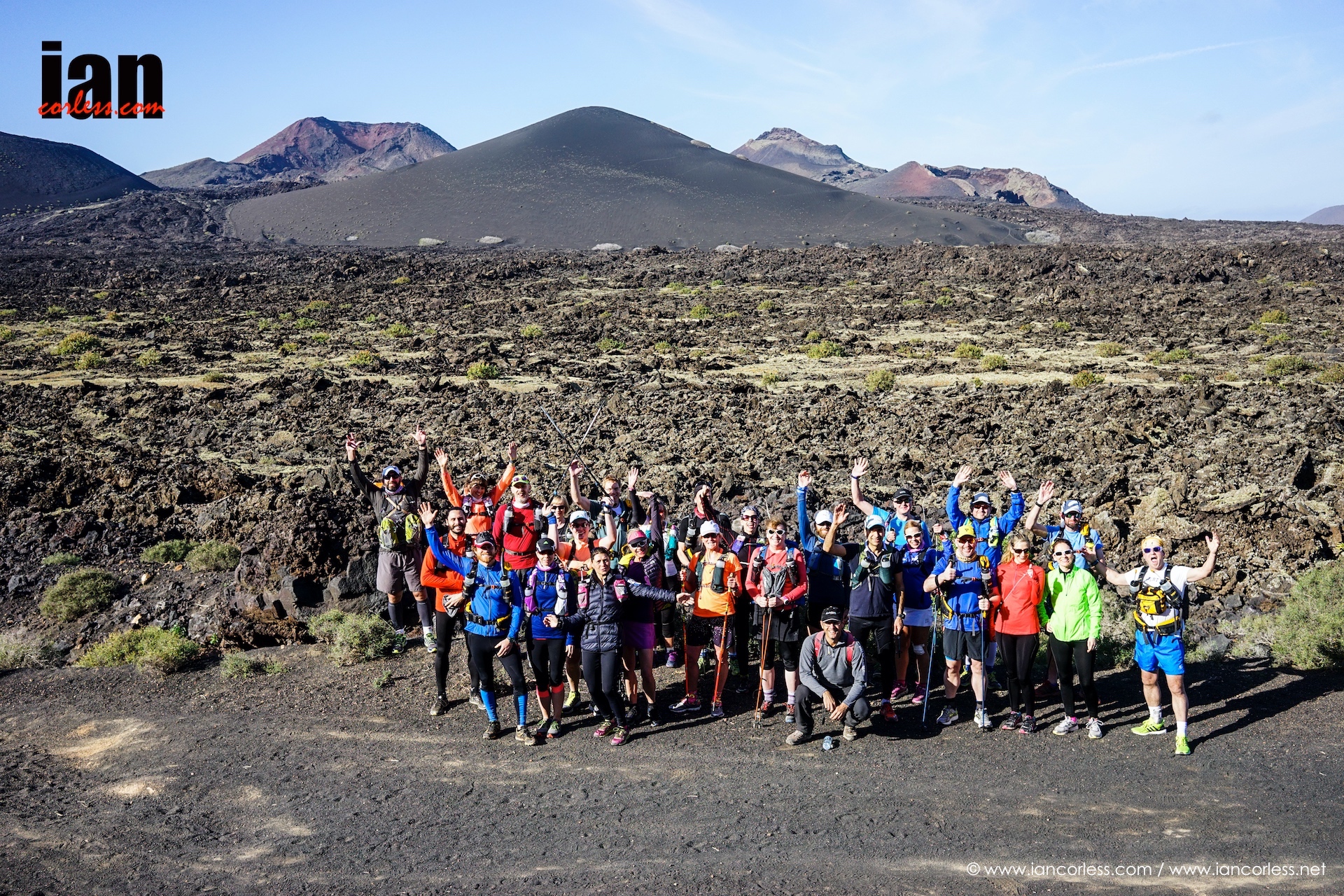
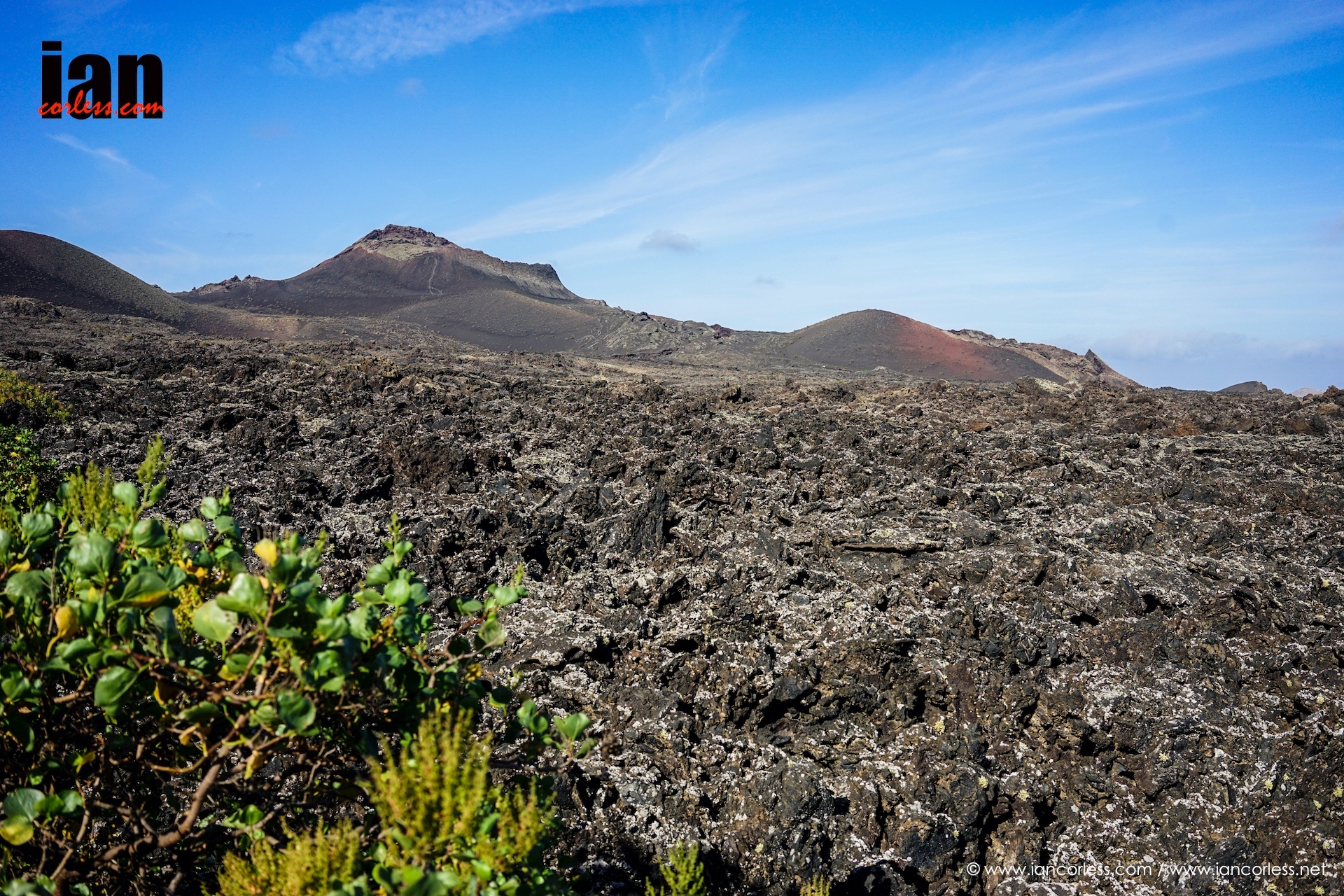
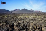
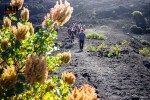
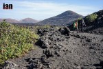
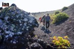
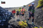
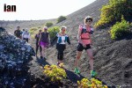
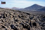
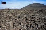
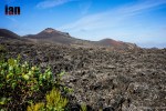
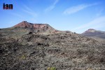
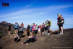
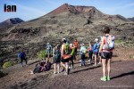
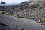
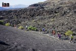
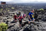
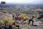
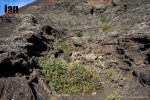
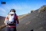
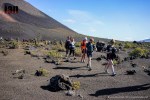
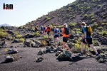
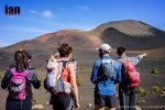
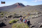
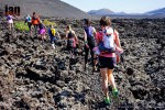
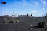
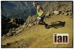
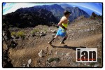
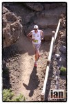
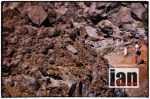
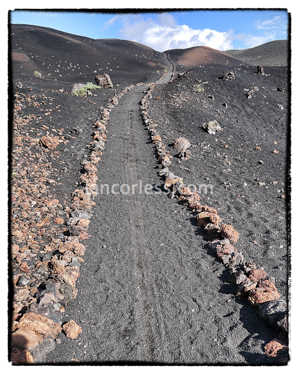
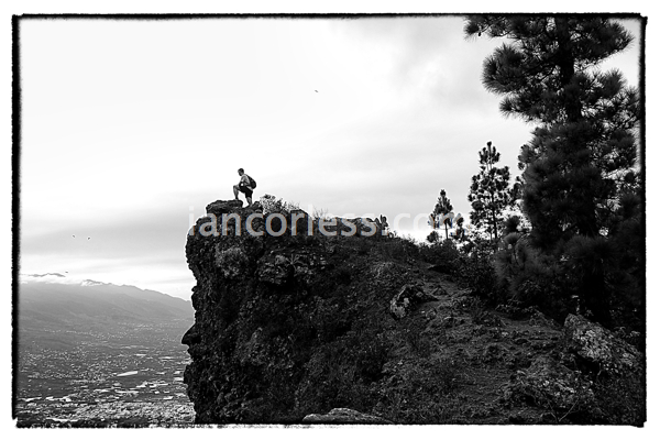
Climbing up the trees eventually start to subside and you emerge in the ‘Route of the Volcanoes’. This path crosses the southern ridge of the island, where most of the volcanoes are lined up (less than 200,000 years old). Among others, the following volcanoes can be seen from the path: Birigoyo Peak, Nambroque Peak, San Juan or Hoyo Negro Volcano (eruption in 1949), Duraznero Volcano, Las Deseadas, El Charco Mountain (active in 1712), Martín Volcano (eruption in 1646), Pelada Mountain, El Fuego Mountain and the Crater of Los Arreboles. It is an incredible route, sometimes very runnable, at other times hard work due to the increasing steepness of the path and loose deep lava sand.

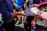
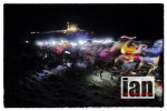
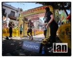
The final sections of the volcano route offer good fast running to El Pilar. In the Transvulcania La Palma this place offers an important marker. An important feed station and also the finish point for the shorter race provided by the race organizers.
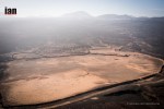
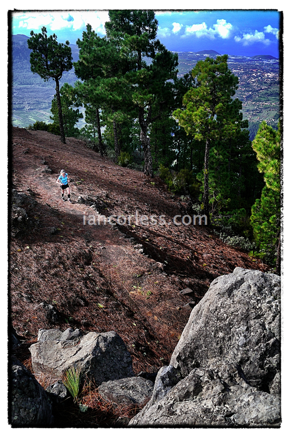
Leaving El Pilar, the race route (GR 131) heads north for the crest of La Cumbre Nueva using a forest trail that goes beyond the port of El Reventón (1350 m). Initially you will find this section providing some of the easiest running you will have had so far… the gradients are easier and underfoot one has less obstacles.
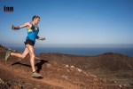
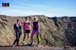
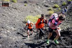
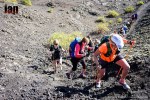
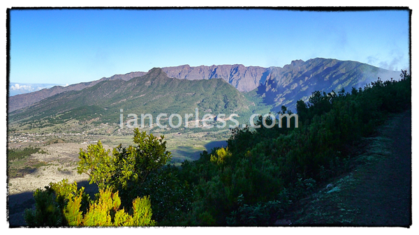
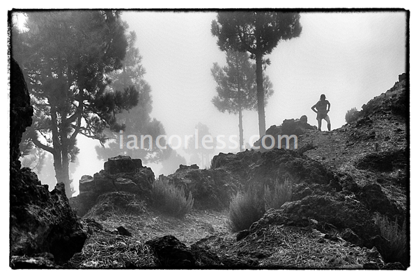
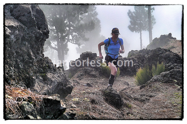
Of course it soon comes to an end, the path climbs the successive and increasingly high peaks, running along the very edge of the Taburiente Crater.
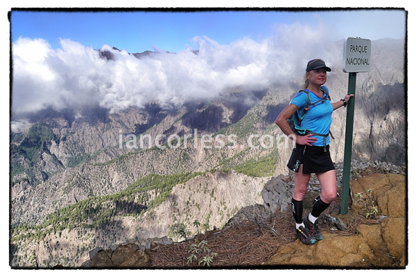
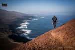
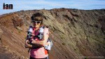
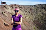
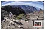
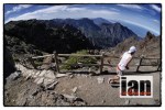
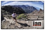
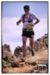
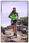
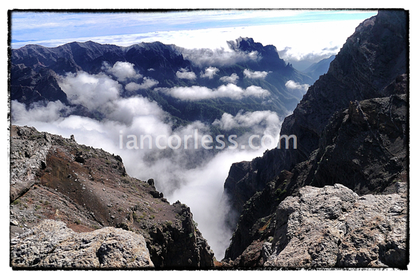
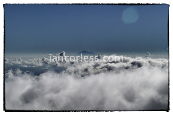
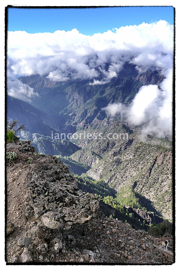
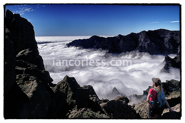
The Taburiente Crater rim is an incredible natural wonder offering technical running terrain, constant changes in elevation and some of the most incredible views you will ever see. Depending on the weather systems you will either have clear blue skies and the ability to look out into the distance for miles or a thick blanket like layer of cloud that will be below you literally making you feel they you are Skyrunning. Incredible. One thing that La Palma is famous for is the micro climate. You will almost certainly while running the race have several different types of weather, particularly if the cloud layer appears. You can be hot with the sun beating down on you and then a little chilly as you run through the cloud. It is what makes it so interesting.
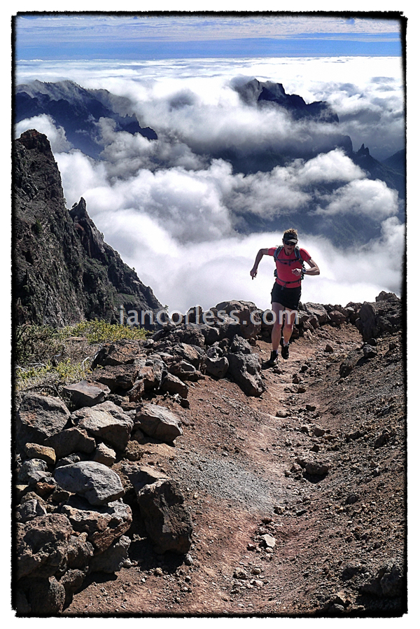
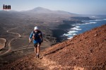
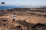
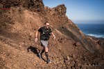
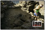
From the Rock of Los Muchachos (2436 m) the highest point of the course, the route drops down to the sea at the Port of Tazacorte. Beware! You may be thinking to yourself as you climb up and up for hours and hours that you have a wonderful long descent to the finish. You do but it is steep, technical and punishes your legs. Easy running sections are followed by tough, technical, rocky and gnarly terrain.
Crossing a main road at El Time you then have a couple of very steep road sections before the final drop down the stunning (and technical) zig-zag path to Tazacorte Port.
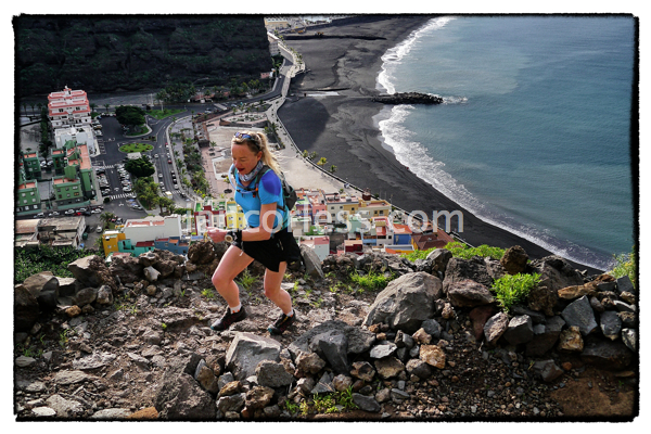
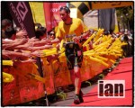
No warm up, from Tazacorte you go up for 18k
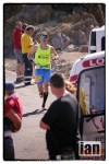
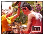
The GR131 stops here but the Transvulcania La Plama organizers have a sting in the tail… the final miles take you back up to the town of Los Llanos De Aridane where a rapturous welcome awaits. Believe me, you will have earned it!
Training Information
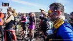
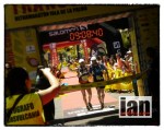
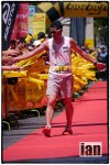
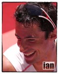
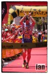
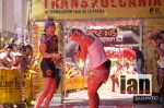
The Transvulcania La Palma is an incredible race on a stunning course. At 83km’s it is a real challenge. Dakota Jones won the 2012 edition of the race in an incredible 6:59:07. Believe me that time is fast… very fast! Take a step back and in real terms look at adding a minimum of 3 hours to Dakota’s time and keep an eye on the cut-off times. Of course I am speaking in general terms here.
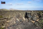
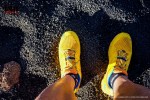
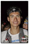
The terrain underfoot falls into one of these categories: black lava sand, rocky lava sand, hard rocky lava, pine forests, tough gnarly rocks and a very small section of road. The terrain eats the grip on your shoes and I therefore would recommend a trail shoe with cushioning and grip. For example; Salomon Speedcross, Salomon Slab Softground, Scott eRide Grip2, Sportiva Raptor or similar… you get the drift! You always have exceptions to rules and for example Kilian Jornet (3rd 2012) and Andy Symonds (2nd 2012) used the lightweight Salomon Sense for the 2012 race. In general terms though, the average runner will need grip and cushioning to the ease the harshness of the terrain.
The ability to handle technical terrain while maintaining a good pace is essential. This will come extremely important on the flatter sections and the long descent from Roque de Los Muchachos. If you can’t make up time here than you are most definitely in for a long day out.
From the start at the lighthouse and until you reach the highest point of the course at 2436m you are arguably always going up. It ultimately all comes down to economy of effort and having a strategy and or ability that will allow you to make the summit with enough left to get to the finish. What should you do?

- Run with a short stride looking ahead constantly
- Practice walking fast, uphill with your hands on your knees
- Incorporate some long day hikes on hilly terrain
- Run/ hike on loose sand uphill for long periods of time (a quarry would be good)
- Run on hard packed trail for your speedier/ faster workouts
- Find some gnarly, rocky terrain and practice running on it. Build up a confidence to move over it as quickly as possible
- Add some strength and core work to your training if this is a weak area for you
In many respects, the Transvulcania La Palma is like any other trail or mountain race but it does have a combination of elements that make this a very tough course. Respect it. Without doubt it is one of the most beautiful I have experienced.
Practical Information
La Palma is a small island. The race starts at the southern most tip and finishes almost half way up the island on the west. Therefore your hotel decision for the race may very well depend on many factors such as:
- Are you with family?
- Are you staying just for the race?
- Do you plan to stay on?
If travelling with family you may very well be better basing yourself at Los Llanos de Aridane as this is a town with shops, cafes and other facilities or at Tazacorte Port.
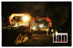
Tazacorte Port has a beach, restaurants and cafes. Of course this will mean as a participant you will need to arrange for transport and/or an overnight stop at the race start for the race day. Please note the race starts very early!
If travelling just for the race weekend I would seriously consider looking at the options provided by the race organization at www.transvulcania.com They will have accommodation and travel packages that will provide you with all that you need.
If you plan to stay in La Palma after the race my recommendation would be to base yourself in or around Los Llanos and then use this as a start point from which you can then travel from.
Hire Car
A hire car is essential and they are very affordable. La Palma is serviced by all the main providers at the airport; Avis, Hertz and Europcar. Cicar is a local hire company available here. Book in advance for the best deal.
Flights
Flights to La Palma can be a little tricky. If in doubt, fly to Tenerife and then book one of the many connections that are available. Again, the race organizers are providing packages and practical information to facilitate this at www.transvulcania.com. Thomson have just started a direct flight from Manchester to La Palma.
Weather
La Palma boasts year round good weather. In May it will be hot but not excessive. Travel light and cool and always ensure that you have a warm layer and/or windproof just in case.
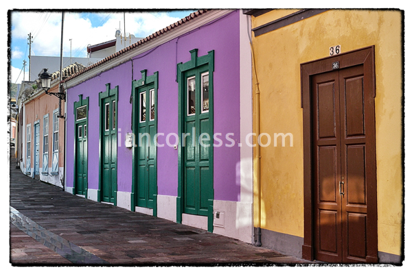
Los Llanos de Aridane
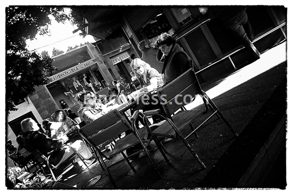
Los Llanos is the largest and busiest town on the west side of La Palma with a population of just over 20,000. There are many modern buildings. It has a traffic-free centre and the surrounding side streets still retain their old character. Plaza de Espana is the hub of the town and a good place to have a cup of coffee and watch the world go by.
You can see images of Los Llanos here: https://iancorless.org/photography/los-llanos-la-palma/
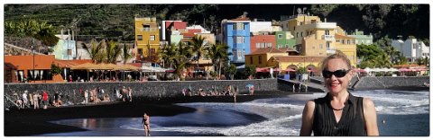
Tazacorte
Tazacorte is situated on the west side of the island and claims to be the warmest place on the island. It is divided into 2 villages.
Puerto de Tazacorte is on the coast and has a long promenade, a fishing harbour, a black sand beach and an area with boulevard, bars and (fish) restaurants. Tazacorte pueblo (village) as about 1km above the coast and is the main center with the town hall, post office, shops and supermarket.

Market day : https://iancorless.org/photography/la-palma-tazacorte-market-day/
Recce, blogs and Images
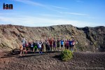
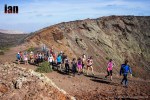
In December 2012 I spent two weeks running, hiking, jogging, walking and crawling over the Transvulcania La Palma course. My blog posts are available on iancorless.org and my images are filed in a logical order, starting at the lighthouse at Fuencaliente, moving through the route of the volcanoes, El Pilar, Cumbre Vueva and then Tazacorte as days here:
Fuencaliente – https://iancorless.org/photography/la-palma-fuencaliente/
Route of the Volcanoes – https://iancorless.org/photography/la-palma-the-route-of-the-volcanoes/
El Pilar – https://iancorless.org/photography/la-palma-el-pilar/
Cumbre Nueva – https://iancorless.org/photography/roque-de-los-muchachos-la-palma/
Tazacorte – https://iancorless.org/photography/la-palma-tazacorte-to-roque-de-los-muchachos/
Blog Posts:
Conclusion
La Palma has been a revelation. I have now had the opportunity to see the island and the Transvulcania la Palma from two perspectives. In May I followed the race as a journalist/ photographer and got to see one of the most competitive races of the year unfold before my eyes.
In December I returned for a holiday, to spend time on the trails in some warm winter sun.
The people, the places, the food, the hospitality and the multitude of trails make La Palma the most perfect location for the enthusiastic runner or hiker. I have focused this post on the GR131 and the Transvulcania La Palma but trails are everywhere. From my base in the Caldera de Taburiente just outside Los Llanos de Aridane I also discovered and explored so many other incredible trails such as this circular route:
December in La Palma offered great weather allowing me to escape the winter grey and gloom of the UK to run in shorts and T-shirts on some of the most incredible terrain with the most stunning views.
I should point out that I did only explore the southwest corner of the island. I have been told, repeatedly, by friends that the island has so much more to offer.
La Palma and its network of trail may very well become a regular slot in my calendar moving forward…
I would like to thank Lourdes Plasencia, Julio Carbera Rocha, Lauri Van Houten, Marino Giacometti, Transvulcania La Palma and Skyrunning for all the help and support.
Finally, many thanks to Niandi for making the trails so enjoyable.